
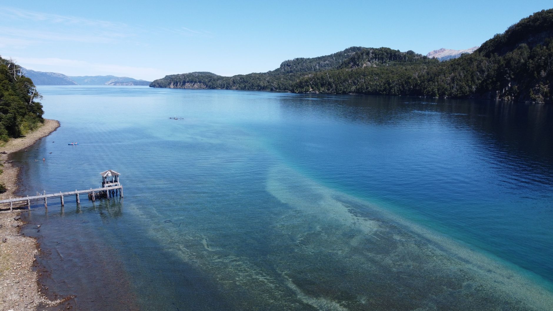

Between the rugged masses of the North Island and the South Island of New Zealand lies one of the most dynamic and geologically complex marine passages on the planet: the Cook Strait. This channel is not merely a geographic accident connecting the Tasman Sea with the southern Pacific Ocean, but a natural laboratory where titanic tectonic forces and extreme hydromechanical regimes converge. The waters flowing through this submerged gorge support hurricane-force tidal currents and a benthic biodiversity that defies traditional paradigms of temperate marine biology.
The uniqueness of this ecosystem lies in its complex bathymetry. A network of deep submarine canyons cuts through the continental shelf, channeling nutrients from the abyssal plains to the surface through an upwelling phenomenon driven by prevailing westerly winds. This incessant flow sustains dense populations of cold-water corals, glass sponges, and a cephalopod community that feeds the elusive colossal squids and migratory cetaceans traversing the region.
Tectonic Genesis and Bathymetry of the Strait
The geological history of the Cook Strait is relatively recent in terrestrial time terms. During the Miocene and Pliocene epochs, the region formed part of a continuous cordillera uniting both landmasses. It was the shearing movement along the active Marlborough fault system that fractured and subsided the central block, creating a tectonic depression progressively invaded by the sea. This geological instability persists today, manifested in frequent submarine earthquakes and a very high sedimentation rate.
Beneath the surface, the relief is as abrupt as that of the New Zealand Alps. The Cook and Narrows Basin canyons plunge steeply to depths exceeding four hundred meters, acting as natural funnels for marine currents. When Pacific tidal fronts collide with Tasman Sea water masses in this narrow corridor, turbulences of such magnitude are generated that they can be clearly observed from Earth orbit via multispectral satellite imagery.
Tidal currents in the Cook Strait are not mere water movements; they constitute a vertical oceanic river that shapes the bedrock and sweeps nutrients along at speeds exceeding five knots during spring tides.
This constant agitation prevents the accumulation of fine sediments in the axial zones of the channels, exposing hard rocky substrates that serve as anchor points for slow-growing sessile organisms. It is a habitat where survival demands exceptional morphological and physiological adaptations to withstand constant hydrodynamic stress.
Hydrodynamic Dynamics and the Nutrient Engine
The tidal regime in the strait is complex, characterized by an unfavorable tidal interference between both ends of the channel. While high tide on the western coast coincides with low tide on the eastern side, the hydrostatic pressure differential drives colossal volumes of water through a geographical funnel barely twenty-two kilometers wide at its narrowest point.
This constant collision of water masses produces massive whirlpools, locally known as tidal bubbles, and vertical upwelling zones. These ascending currents act as a biological pump transporting dissolved nitrates, phosphates, and silicates from the abyssal depths to the photic zone. The result is disproportionately high primary productivity compared to surrounding oceanic waters.
The Biological Pump of Submarine Canyons
The canyons are not mere passive conduits; they act as organic sediment traps. Particulate matter derived from the dense terrestrial forest cover is swept by rivers toward the coast and rapidly channeled into the depths of the strait. There, detritivorous communities process this energy input, sustaining a complex trophic chain that defies the apparent hostility of the environment.
Researchers have documented dense aggregations of krill and copepods concentrating at canyon heads during daylight hours, descending or shifting laterally according to turbulence cycles. This floating biomass constitutes the primary sustenance for resident populations of dusky dolphins, New Zealand fur seals, and threatened seabirds such as Salvin’s albatross.
Benthic Biodiversity and Cold-Water Reefs
Far from tropical coral reefs, the seabed of the Cook Strait harbors benthic ecosystems of muted tones yet incalculable ecological value. At depths where sunlight is nonexistent, tridimensional forests formed by deep-water stony corals, primarily the species Enallopsammia rostrata, and giant gorgonians exceeding one meter in height predominate.
These organisms construct complex calcareous structures providing shelter, spawning grounds, and feeding areas to dozens of commercial and endemic fish species, including the blue grenadier and various deep-water sharks. Glass sponges, with skeletons composed of pure silica, form dense white mantles filtering tons of seawater daily, regulating the clarity and purity of the environment.
The fragile framework of deep-water corals in the Cook Strait represents a historical archive of oceanic thermal fluctuations, recorded in the chemical composition of their calcareous growth rings.
However, this benthic biodiversity faces extreme vulnerability. Historical bottom-trawling practices have severely impacted extensive zones of these abyssal gardens, fragmenting habitats that have taken millennia to consolidate and leaving visible scars on bathymetric profiles.
Cetaceans and Pelagic Megafauna
The geographic position of the strait makes it a critical migratory highway for marine megafauna. During the southern winter months, humpback whales transit the channel on their journey to tropical breeding areas in the South Pacific. The demographic recovery of these populations, following decades of intensive commercial whaling, has transformed the strait into a key hotspot for non-lethal cetological research.
Likewise, sperm whales regularly utilize the depths of the southern canyons to hunt giant and deep-sea squids, taking advantage of ascending currents disorienting their prey. Coastal observers can record the presence of these marine giants a few kilometers from the shoreline, an unusual phenomenon underscoring the extreme proximity of oceanic abysses to the terrestrial surface.
The Ecological Role of Endemic Seabirds
The extreme currents of the strait also attract exceptional avian diversity. Sooty shearwaters, diving petrels, and multiple albatross species use winds channeled by the terrestrial topography to glide with minimal energy expenditure while foraging in tidal convergence zones.
Sheltered islands near the channel, such as Stephens Island, function as strict ecological reserves where relict species survive, demonstrating how climatic and oceanic gradients of the strait have shaped insular evolution over millennia.
Anthroprigenic Threats and Climate Change
The ecological equilibrium of the Cook Strait faces growing anthropogenic pressures. Global ocean warming is altering the intensity and frequency of zonal winds, directly impacting coastal upwelling dynamics and nutrient availability at the surface.
Furthermore, marine acidification—a direct result of anthropogenic carbon dioxide absorption by the ocean—directly threatens organisms with calcium carbonate shells and skeletal structures, jeopardizing the structural integrity of cold-water coral reefs and planktonic mollusk populations.
The Pressure of Navigation and Energy Infrastructure
As the primary maritime communication link between the country’s two main islands, the strait supports constant traffic of high-speed ferries, international cargo ships, and fishing vessels. Underwater noise generated by these fleets interferes with cetacean echolocation systems, altering their migratory routes and social communication patterns.
In parallel, the energy potential of its currents has attracted projects for deploying underwater tidal turbines. Although representing a clean and predictable energy source, their deployment requires rigorous environmental impact assessments to avoid collisions with pelagic fauna and drastic alterations in local sedimentary fluxes.
Conservation Strategies and Marine Protected Areas
Institutional response to environmental degradation has evolved from sector-based management to more comprehensive ecosystem approaches. The establishment of specific marine protected areas in deep canyons seeks to restrict destructive extractive fishing practices, allowing gradual regeneration of coral benthic habitats.
National scientific organizations, in collaboration with indigenous Maori communities holding traditional guardianship rights—kaitiakitanga—over the waters, develop acoustic and satellite monitoring programs to assess marine mammal population health and plan low-impact navigation corridors.
The governance of this marine space demands constant international and transdisciplinary cooperation, given that oceanographic processes governing it are connected with global climate dynamics escaping local administrative boundaries.
Practical guide
How to get there: The main access to the Cook Strait is through Wellington on the North Island or Picton on the South Island. Inter-island ferry services operate multiple daily frequencies crossing the channel in approximately three and a half hours.
When to travel: The southern spring months (from October to December) offer the most stable conditions for observing marine fauna and migratory cetaceans, although the weather in the channel is notoriously fickle year-round.
Visitor requirements: No special authorization is required for regular commercial or tourist maritime transit, but technical diving activities or scientific research in protected areas require formal permits from the New Zealand Department of Conservation.
Logistics and safety: Meteorological conditions can change radically within hours. Consulting navigation bulletins and gale warnings before planning any expedition in small vessels is mandatory.
Accommodation and operation bases: Wellington and the Marlborough Sounds offer hotel infrastructure and scientific support facilities for observers and naturalists interested in the region’s marine ecology.
Ethical observation code: Maintain a prudent and legally established distance regarding cetaceans and seabirds, minimizing internal combustion engine use and avoiding any interference with their feeding and migration routes.
Recommended reading: To deepen knowledge of local geology and oceanography, monographic publications by the National Institute of Water and Atmospheric Research of New Zealand (NIWA) are recommended.
Epilogue: The Hidden Pulse of the Southern Ocean
Contemplating the leaden waters of the Cook Strait from the wind-swept cliffs of the Wellington Peninsula is an experience transcending mere landscape tourism. Beneath that seemingly chaotic and hostile surface beats a thermodynamic and biological mechanism of millimetric precision, a system where tectonic plate collisions and tidal fury have sculpted an unparalleled biodiversity refuge in the southern hemisphere.
At a time when the planet’s oceans suffer unprecedented pressures, understanding and protecting this submerged gorge is not merely a scientific imperative, but an ethical acknowledgment of our responsibility toward Earth’s most remote and essential abysses.


