Origins and Channels: The Genesis of an Amphibious Territory
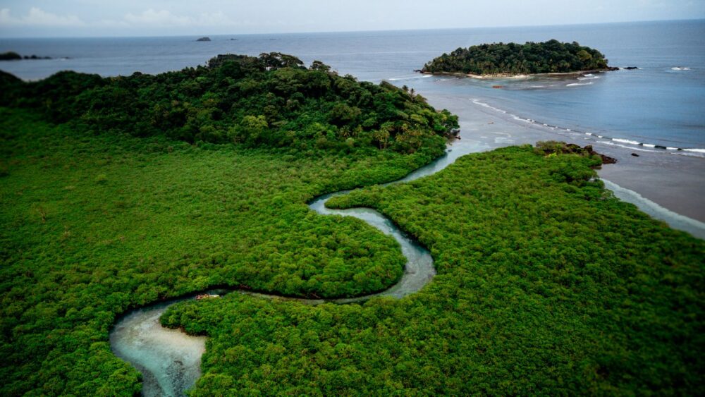
The Ebro Delta represents one of the most distinctive landscapes in the western Mediterranean, an alluvial plain where the fresh water of the Iberian Peninsula’s mightiest river meets the salinity of the sea. For centuries, this marshy frontier remained an elusive territory, inhabited mainly by seasonal fishermen and hunters who navigated its waters in shallow draft log canoes. The radical transformation of this space was no accident, but rather an ambitious engineering enterprise developed in the late nineteenth century and consolidated throughout the twentieth. The construction of the main irrigation canals, known as the Right Main Acequia and the Left Main Acequia, irrevocably altered the physiognomy of the land, turning ancient reed beds into a vast chessboard dedicated to rice cultivation.
This network of canals not only marked a victory over malaria and inhospitable marshlands, but also established an artificial hydrological regime that today sustains the entire ecosystem. Every spring, the coordinated opening of the main floodgates inundates thousands of hectares, creating a temporary artificial lagoon that mimics natural flooding cycles. Farmers and irrigation community technicians operate a millimeter-precise system of iron gates and concrete walls that regulates flow with surgical exactitude. This water management allows the rice fields to fulfill a dual function: maintaining the region’s economic backbone while offering a vital refuge for millions of migratory birds that find in this wetland an indispensable stopover along their routes between Europe and Africa.
The connectivity of this amphibious territory depends entirely on the health of its secondary canals and drainage ditches that empty directly into the bays of Fangar and Alfacs. Unlike other European deltas that have suffered drastic desiccation, the Ebro maintains a constant sheet of water thanks to the regulated inflow from the Mequinenza and Riba-roja reservoirs located upstream. However, this dependence creates structural vulnerability: any alteration in the sediment regime or the ecological flow volume immediately impacts the stability of the littoral sandbars. The traveler traversing these service roads discovers an invisible yet ironclad network of floodgates and siphons that demonstrates how human agency can establish a symbiotic, albeit fragile, dialogue with fluvial dynamics.
The Engineering of Water: Floodgates, Locks, and Service Roads
Walking the banks of the Ebro’s main canals is akin to stepping through an open-air manual of hydraulic architecture. The infrastructure vertebrating the delta combines nineteenth-century masonry with modern automated systems. Regulation floodgates, located at strategic points such as the Amposta weir or the Deltebre bifurcations, act as the cardiac valves of this circulatory system. Using worm gears and metal counterweights, operators adjust water levels to ensure flow reaches both fields farthest from the coast and protected marshlands.
Along the embankments, paved or compacted dirt service roads allow fluid mobility for tractors, bicycles, and walkers. These service paths, initially conceived for canal maintenance, have become the backbone of a sustainable tourism network that bypasses major highways. From these routes elevated above the rice paddies, the landscape perspective changes radically: infinite panoramas unfold where the horizon blurs between the blue sky and the tender green of rice shoots, punctuated by the geometric silhouettes of traditional tool sheds.
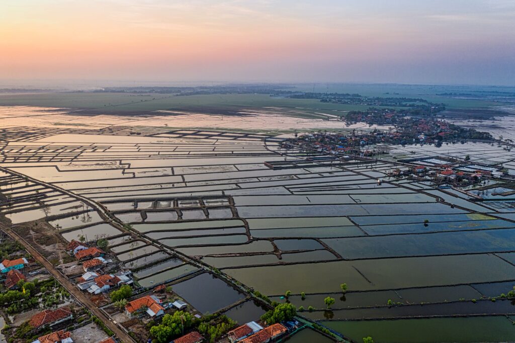
Maintaining this system requires continuous dredging and sludge removal. Mechanical dredges work periodically to prevent the silting up of secondary canals, ensuring water flows unhindered toward drainage points. This constant human intervention is the price paid to preserve a habitat that is paradoxically artificial in origin yet of high ecological value in its current development. The coexistence of industrial agrarian activity with the conservation of protected species such as the squacco heron or the western swamphen illustrates the complexity of managing an anthropized natural space.
The Architecture of Rice: Field Sheds, Piers, and Wooden Bridges
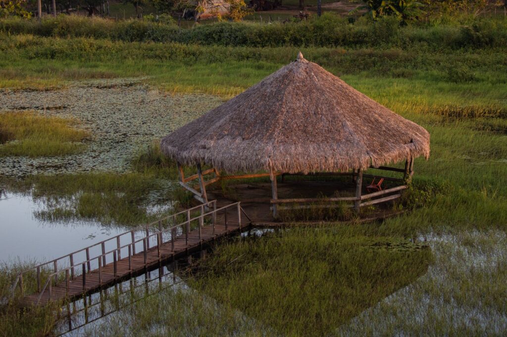
The built heritage of the Ebro Delta possesses a typology as concrete as it is functional, strictly adapted to the demands of a humid terrain subject to seasonal flooding. Traditional delta huts, originally constructed with adobe walls and thatched roofs of reed and cattail, represent the clearest example of vernacular architecture. Although many have been restored as secondary residences or interpretation centers, their presence dotting the embankments recalls the austere life of ancient farmers who spent weeks isolated amidst the fields during harvest campaigns.
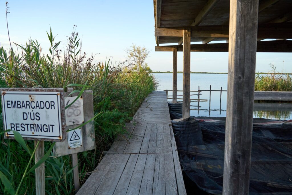
Alongside the huts, small wooden and concrete piers situated near main canals and interior lagoons reveal the historical importance of river and lagoon navigation. Before the mass adoption of motorized road transport, flat-bottomed boats propelled by poles were the only efficient means of moving tools, fertilizers, and harvests between river islands and urban centers like Sant Jaume d’Enveja or Deltebre. Today, these minor docks primarily serve to moor recreational craft or authorized traditional fishing boats, keeping a maritime aesthetic alive in the agrarian heartland.
The bridges crossing the main canals exhibit clear technical evolution, from old stone and wrought-iron crossings to current metal walkways facilitating heavy machinery transit. These crossing points not only connect agricultural plots separated by artificial channels, but also act as privileged viewpoints for observing avifauna. From them, flocks of greater flamingos searching for food in shallow waters or raptors flying over the plots in search of micro-mammals are commonly sighted.
Transition Ecosystems: Between Freshwater Lagoon and Saline Bay
The ecological wealth of the Ebro Delta lies in its condition as a giant ecotone, a transition strip where freshwater ecosystems collide and blend with the marine environments of Fangar and Alfacs bays. Large coastal lagoons, such as Treserve or l’Encanyissada, function as biological thermometers for the park. In these brackish mirrors of water, submerged vegetation and extensive sawgrass beds create an ideal habitat for native fish reproduction and waterfowl nesting.
Connectivity between the rice fields and these lagoons is regulated by a network of drainage gates allowing salinity control and preventing anoxia during peak summer temperatures. Scientists and environmental managers constantly monitor these flows to ensure water quality meets standards required by European conservation directives. This surveillance is indispensable in the context of climate change, where sea-level rise and the scarcity of torrential rain events threaten to irreversibly salinize underground aquifers.
The delta is not a static geography, but a delicate daily pact between sea pressure and channel discipline.
The role of lagoons as natural green filters is fundamental for purifying agricultural runoff waters before final discharge into the sea. Macrophyte plants absorb excess nutrients and nitrates from fertilizers, proving natural and artificial engineering can efficiently complement each other. For the respectful visitor, exploring bird observatories located along the edges of the Treserve lagoon offers a masterclass in Mediterranean ecosystem resilience.
The Slow Mobility Network: Cycling Routes and Riverside Paths
Exploring the Ebro Delta on foot or two wheels constitutes one of southern Europe’s most rewarding slow travel experiences. The absence of steep gradients makes the territory an ideal setting for family and adventure cycle tourism. The Ebro Natural Trail (GR-99), in its final stretch, runs parallel to the river down to its mouth at the northern and southern golas, connecting main riverside municipalities via a safe, well-signposted infrastructure.
These soft mobility routes utilize old towing paths and canal embankments, keeping travelers away from road traffic and immersing them in the silence of the agrarian landscape. Along the route, informational panels detail local flora and fauna, explaining rice cultivation cycles and the history of nineteenth-century agrarian colonization. Mandatory stops include enclaves like the Fangar lighthouse, situated amid a sandy peninsula resembling a miniature desert, and the Tàpia salt flats, where traditional salt industry left an indelible mark on the coastal landscape.
Transportation intermodality is key to enjoying this region without constantly relying on private automobiles. Several local businesses offer electric bike rentals adapted for sandy terrain, as well as combined transport services with small boats crossing the Ebro River between Deltebre and Sant Jaume d’Enveja. This flexible transport network promotes a low-impact tourism model where the pace of travel matches the leisurely cadence of the natural environment itself.
Gastronomic and Cultural Heritage Tied to Water
The material and intangible culture of the Ebro Delta is inextricably linked to its waters’ flagship product: rice. Native varieties like Bomba or Senia absorb broth flavors with unrivaled texture, resulting from the combination of clay soil and the region’s humid climate. Local restaurants, from seaside taverns in fishing ports to rural dining rooms, have elevated rice cuisine to fine arts, crafting emblematic dishes like arroz a banda, rice with Ximos, or fresh bay fish suquets.
Beyond the table, local festivities and popular traditions reflect the harshness and beauty of marshland life. The rice harvest festival, held in late September, brings residents and visitors together to recreate traditional manual harvesting methods with sickles, dressed in traditional attire of ancient reapers. This collective memory exercise is not a mere folkloric claim, but an act of identity affirmation by a community that has preserved traditional knowledge against globalizing homogenization.
Artisanal fishing in the bays completes this cultural map. Local fishermen continue using traditional gear like trammel nets or set traps to catch sea bass, gilthead bream, and coveted Fangar prawns. This subsistence economy and local market guarantees fishing sustainability and supplies markets where product freshness is the undisputed hallmark of deltaic cuisine.
Contemporary Challenges: Subsidence, Climate Change, and Ecological Flow
Despite its apparent serenity, the Ebro Delta faces monumental challenges to guarantee medium- and long-term survival. The phenomenon of subsidence—the progressive sinking of terrain due to natural sediment compaction and lack of solid inputs from upstream reservoirs—combined with sea-level rise driven by climate change, threatens to submerge lower coastal zones.
Environmental organizations and scientific committees insist on the urgent need to revise ecological flow regimes established in the Ebro River Basin Hydrological Plan. Without significant sediment inputs during spring floods, the delta constantly loses landmass, eroding littoral spits and leaving rice fields more exposed to marine water intrusion. The solution requires complex political agreements and continuous investment in adaptive management strategies reconciling agrarian activity with coastline defense.
Saving the delta demands returning part of the river’s primal force, allowing sediment to rebuild the land the sea claims.
Pilot tests of controlled parcel flooding with river sediments demonstrate that gaining ground against sinking is possible, though large-scale application requires considerable financial resources. Meanwhile, the local community and Natural Park managers continue working on dune restoration and coastal cordon protection, conscious that the future of this amphibious paradise depends on collective adaptive capacity.
Practical guide
How to get there: Main access to the Ebro Delta is via road along the AP-7 highway or N-340 national road, taking exits toward l’Aldea, Amposta, or l’Ampolla. The l’Aldea-Amposta railway station connects the region with Barcelona and Valencia via frequent regional services. Reus Airport is situated about 75 kilometers to the north.
When to go: Spring (April to June) offers mild temperatures, the spectacle of rice field flooding, and intense bird nesting activity. Autumn (September and October) coincides with harvest season and migratory bird passage, also serving as an excellent period to avoid crowds.
Internal transport: Bicycles are recommended for exploring service roads and canal routes. For longer trips between municipalities or visits to isolated wetlands, having a private vehicle or utilizing car rental services available in major towns is advisable.

Accommodation: Offerings include charming small hotels, restored traditional rural houses (some former huts), and tourist apartments in towns like Deltebre, Sant Jaume d’Enveja, and coastal nuclei like Riumar and Ampar.
Essential gastronomy: Taste rice of local varieties (Bomba and Senia) in any of its seafood preparations, along with Fangar bay shellfish and deltaic garden produce.
Park rules: Being a protected natural space, respecting signage, not littering, avoiding disturbing avifauna during sensitive periods, and transiting solely along authorized paths is mandatory.
Silhouettes in Twilight: The Ultimate Frontier of Water and Light
As the sun begins to decline over the Ebro Delta horizon, light acquires an almost pictorial quality, gilding the sheets of water covering the rice fields and outlining the solitary silhouette of flamingos against the burning sky. In this moment of absolute stillness, the bustle of agricultural work gives way to a reverential silence enveloping the entire marshland. Irrigation canals, formerly dynamic arteries of work and flow, transform into perfect mirrors reflecting the changing palette of Mediterranean twilights.
Sitting on the bank of a secondary canal, with the distant murmur of floodgates closing for the night, allows one to grasp the profound essence of this landscape built by human effort and sustained by nature’s generosity. Here, in the confines where the river delivers its final breath to the sea, each sunset recalls that the most moving beauty is often born from the fragile harmony between human tenacity and water’s untamed immensity.