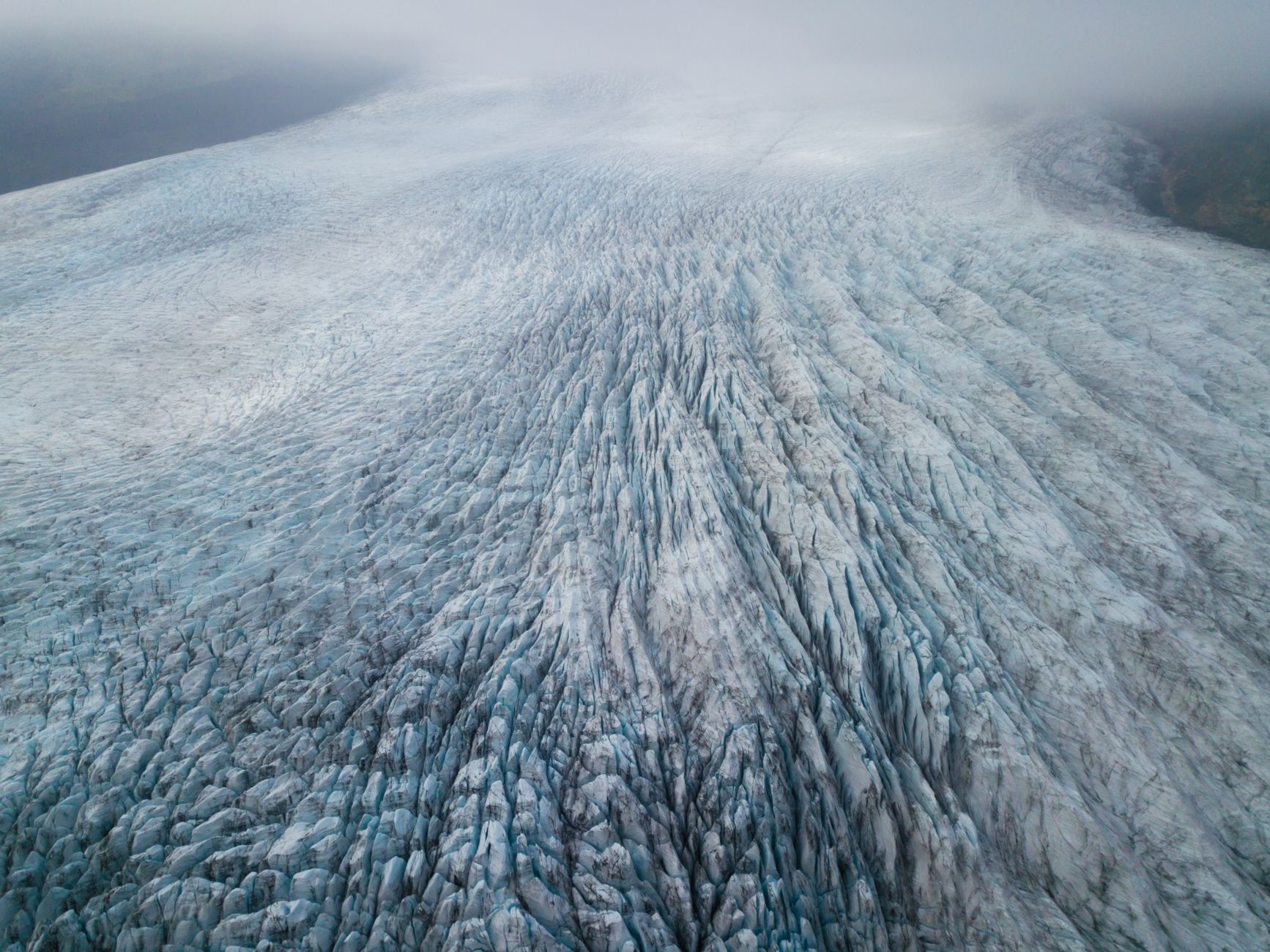

In southeast Iceland, Vatnajökull is not just a glacier: it is a dynamic system where ice, fire, and water write a story that changes every year. Covering over 1,400,000 hectares, Vatnajökull National Park encompasses nearly 14% of the country’s surface and contains ten central volcanoes, eight of them subglacial. Two of these are among Iceland’s most active. Walking along its edges is like peering into a natural archive that records millions of years of geological history.
The key to visiting it lies not in conquering its peaks, but in learning to read the traces the landscape reveals. This report proposes an interpretive journey through the scenarios where the ice retreats and the terrain exposes its memory. Understanding Vatnajökull means accepting that the ground beneath your feet is provisional, shaped by forces that operate on scales far beyond a human lifetime.
A territory shaped by ice and fire
Vatnajökull sits atop the Mid-Atlantic Ridge, the same rift that separates the North American and Eurasian tectonic plates. This active rift, which widens by about 19 millimeters each year, feeds a volcanic system without equal. Beneath the ice, volcanoes erupt and generate jökulhlaups: sudden floods that, upon breaching the glacier’s margin, carry sediment and carve out sandur plains unique in the world.
These plains extend north and south of the ice cap. The rivers that cross them frequently change course, and the canyons they carve evolve at a speed geologists can measure in real time. The result is a landscape that is not contemplated as a static postcard, but as a motion picture. The interaction between the cryosphere, hydrosphere, atmosphere, and lithosphere is constant, which is why researchers consider this park a natural laboratory for studying Earth system processes.
Vatnajökull is not an immobile monument: it is a laboratory where the Earth shows its processes without shame.
The ten volcanoes beneath the ice
The park contains ten central volcanoes, eight of them covered by the ice cap. Two of these subglacial volcanoes are among the four most active in Iceland. The interaction between magma and ice produces phenomena not observed anywhere else on the planet with this frequency and scale. When magma heat melts the ice, water accumulates in subglacial lakes. If pressure increases, the water escapes violently and triggers a jökulhlaup.
These recurring events have shaped the terrain and continue to do so. Scientists study these processes because they offer clues about early Earth and the icy moons of Jupiter and Saturn. The subglacial lakes may replicate conditions found in those distant environments, making Vatnajökull a reference point for astrobiology and planetary geology. The volcanic systems are not isolated: they connect to fissure swarms that extend beyond the ice cap, creating a network of geological activity that spans the entire region.
An open-air geological archive
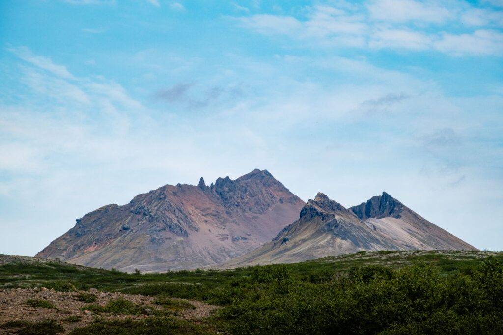
The park contains a diversity of volcanic forms that make it a global reference. Tuyas and tindar—mountains and ridges of brown hyaloclastite—formed in eruptions beneath ice-age glaciers. These structures appear in few places worldwide, and in Vatnajökull, they do so in exceptional numbers.
Beyond the ice, the terrain varies from extensive flat lava flows to mountains and volcanic fissures. The park’s oldest rock dates back some 10 million years, while the most recent is from 2015. That temporal difference coexists in a relatively compact space, making it easier to read the landscape as a succession of geological chapters. The basaltic lava shields, known as Iceland shields, are particularly well exposed and have been used as analogues for similar features on Mars. This comparative value is one of the reasons the park was inscribed on the UNESCO World Heritage List in 2019 under criterion (viii).
The retreat of the ice and its visible consequences
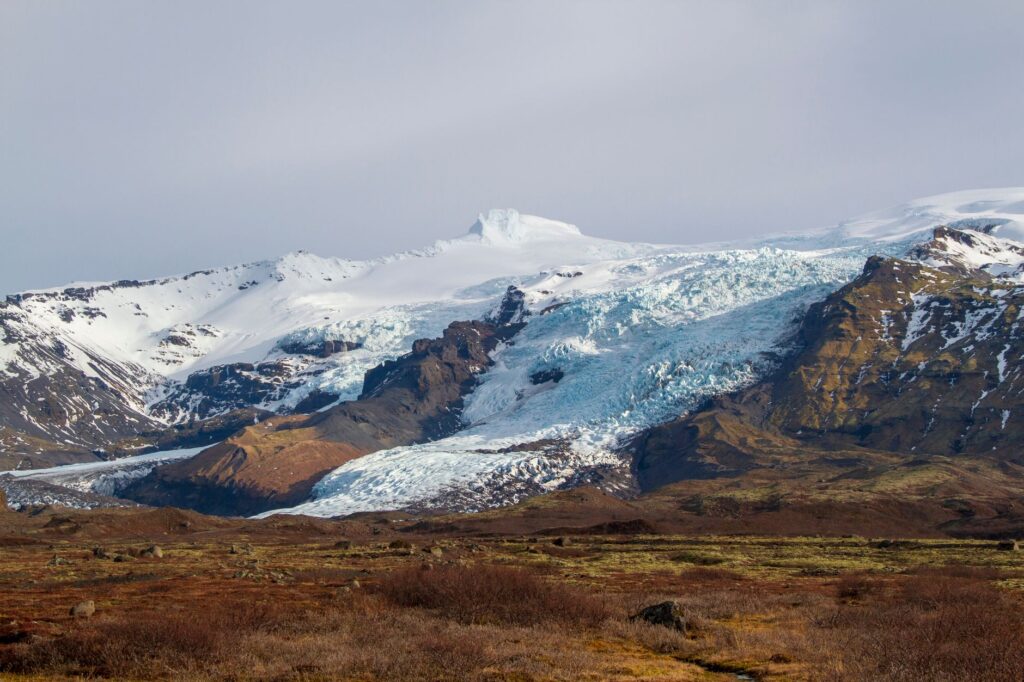
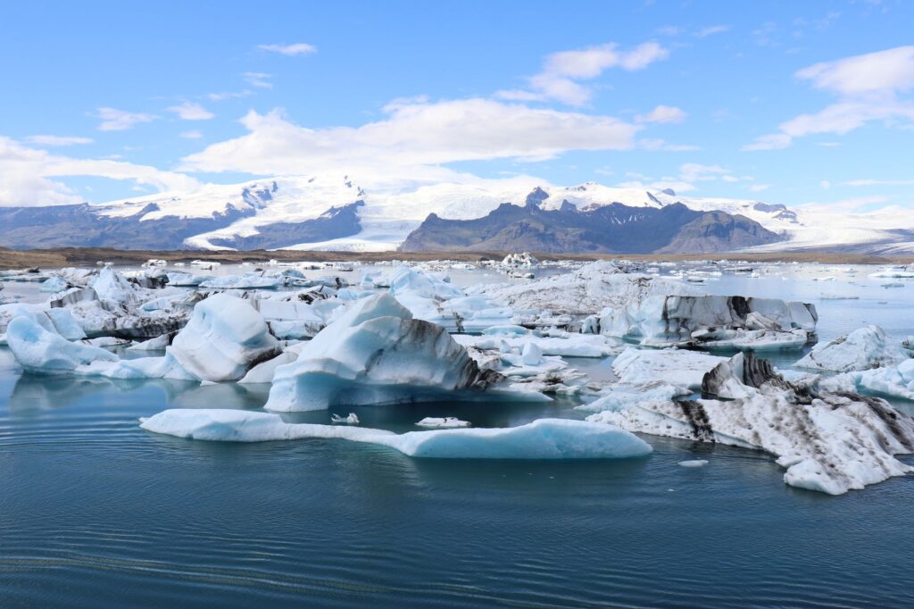
The Vatnajökull ice cap reached its maximum extent in the late 18th century. Since then, it has retreated steadily, and in recent decades that retreat has accelerated. This phenomenon makes the park a prime location for studying the impacts of climate change on glaciers and the landforms left behind.
As the ice retreats, moraines, proglacial lakes, and polished rock surfaces appear. These elements tell the story of a glacier that was once larger and now leaves behind a trail of transformations. Interpreting these traces requires attention to detail and, in many cases, the company of specialized guides. The retreat is not uniform: some outlet glaciers respond faster than others, and the forelands they expose become natural classrooms for understanding how landscapes recover after ice loss. The park’s management strategy includes monitoring these changes, using both ground-based observations and satellite data to track glacial flow and fluctuations.
The Vatnajökull landscape cannot be explained by sight alone: it demands an understanding of the processes that generate it.
Fauna and flora in an extreme environment
Despite harsh conditions, life finds a way in Vatnajökull. In the volcanic zones, an endemic groundwater fauna survives that persisted through the Ice Age. These organisms, adapted to darkness and stable temperatures, represent a little-known chapter of Icelandic biodiversity. In subglacial lakes, single-celled organisms thrive in an environment scientists compare to early Earth conditions.
Outside the ice, lichens and mosses colonize recent lavas, while seabirds and reindeer—introduced to Iceland—roam the lowlands. Life here is not abundant, but it is resilient and singular. The vegetation that establishes itself on new substrates plays a crucial role in soil formation, slowly preparing the ground for more complex communities. This process of ecological succession is slow, and visitors should avoid stepping on fragile moss and lichen, which can take decades to recover from a single footprint.
Landscapes that inspire science and literature
The phrase fire and ice was coined precisely in this territory. The combination of volcanic activity and glaciers has fascinated scientists and writers for generations. Vatnajökull’s landscapes have been used as terrestrial analogues to study similar formations on Mars, underscoring their scientific value.
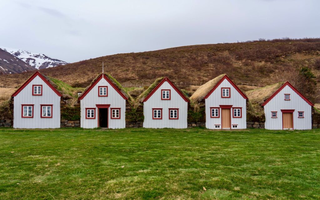
This dual condition, natural and cultural, led to the park’s inscription on the UNESCO World Heritage List in 2019, under criterion (viii), which recognizes its exceptional geological processes. The distinction is not an ornament: it is a reminder that this is a place whose conservation matters on a global scale. The park covers over 25% of Iceland’s central highlands and approximately 12% of the country’s total area, with about 85% classified as wilderness. This intactness is rare in Europe and adds to the site’s universal value.
Technical activities and responsible decisions
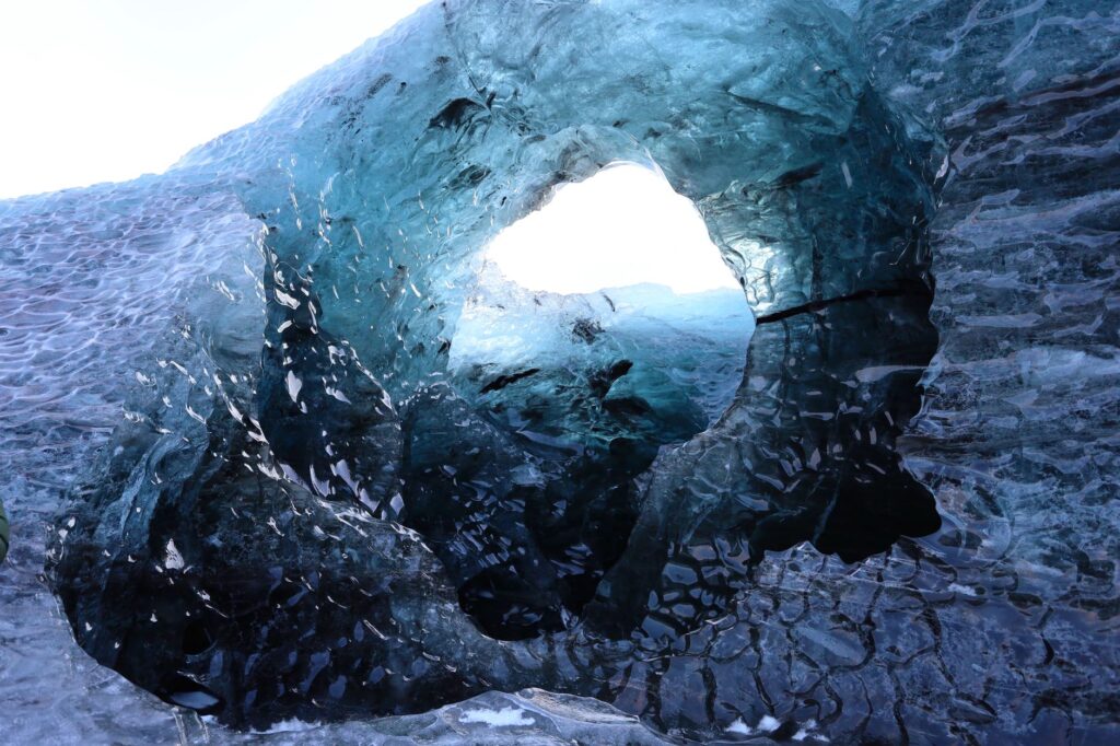
Vatnajökull offers opportunities for adventure, but it also imposes clear limits. Technical activities—glacier walks, ice cave visits, navigation in glacial lagoons—must be carried out with authorized operators who know the terrain and changing conditions. This is not a bureaucratic precaution, but a real necessity: the ice moves, rivers change course, and the weather can shift in minutes.
The responsible visitor plans ahead, checks route conditions, and respects the indications of park rangers. Most of the territory is classified as wilderness, and infrastructure is minimal. That means self-sufficiency and preparation are part of the experience. It is also important to understand that the park is not a theme park: there are no barriers at every hazard, and rescue services may take hours to reach remote areas. Travelers should carry appropriate insurance and inform someone of their itinerary before setting out.
Practical guide
When visiting Vatnajökull National Park, several logistical and safety aspects should be considered. The information below is general in nature and should be verified with park authorities and local operators before traveling.
- Access: The park extends across southeast Iceland. Main entry points are along the Ring Road (Route 1), connecting towns such as Höfn and Kirkjubæjarklaustur.
- Best time: Summer (June to August) offers longer days and milder temperatures, though weather can change rapidly. Winter allows ice cave visits but requires specialized guides and stricter safety conditions.
- Technical activities: Glacier walks, ice caves, and glacial lagoon navigation should be booked with certified operators. Accessing the ice without a guide is not recommended.
- Equipment: Waterproof and warm clothing, footwear suitable for uneven terrain, and wind protection. In winter, crampons and specific gear are required.
- Safety: Check route conditions and weather alerts. Respect signage and do not leave marked trails.
- Accommodation: Options are concentrated in towns near the main road. Camping is only allowed in designated areas.
- Environmental respect: Leave no waste, do not disturb wildlife, and follow park rules to minimize impact.
A closing for memory
At dusk, the light over Vatnajökull acquires a quality found nowhere else. The ice reflects blues and grays, and the hyaloclastite mountains stand against a sky that seems not to darken fully in summer. It is a landscape that invites pause, observation, and the understanding that beauty here is inseparable from fragility.
Vatnajökull is not a destination to conquer, but to interpret. Every crevasse, every sandur plain, every subglacial lake tells a story that transcends the visit. Those who approach with respect and curiosity take away more than photographs: they take away the awareness that the landscape is alive and that our presence also leaves a mark. The park’s future depends on a balance between access and protection, and every visitor plays a role in maintaining that balance.