Introduction to the Frozen Edge of the Baltic
At the heart of the Baltic Sea, strategically positioned between the coasts of Sweden and the continental territory of Finland, lies a geographical mosaic of over six thousand islands and reefs known as the Åland Archipelago. This autonomous, Swedish-speaking region not only stands out for its unique statutory status and rich maritime history, but also for posing one of Northern Europe’s most fascinating transport engineering and logistics challenges. Keeping a community fragmented by thousands of square kilometers of marine water—which partially freezes during the harshest winter months—connected requires a seamless intermodal deployment combining deep-draft ferries, smaller local vessels, and seasonal ice roads.
Åland’s transport system operates under an unrelenting premise: mobility is not a luxury, but the vital umbilical cord guaranteeing the economic, social, and sanitary survival of its inhabitants. Unlike other continental island regions where regional aviation often takes center stage, here the daily pulse is marked by the steel decks of ferries and the expertise of captains who have spent decades reading currents, northern winds, and the silent advance of ice sheets. Analyzing this communication network means delving into a mechanism where timetable precision battles against the capricious meteorology of Northern Europe.

The Maritime Backbone: Major Continental Links
To understand the scale of Åland’s logistics, one must begin with its primary arteries: the routes connecting the archipelago with neighboring nations. The ports of Mariehamn, the island capital, and Långnäs act as the main nodes for passenger and heavy freight exchange. Daily transits through these terminals involve colossal passenger ships operating circular routes between Stockholm, Åland, and the Finnish ports of Turku and Helsinki. These vessels are far more than mere transport; they function as floating hotels and supply centers providing the islands with everything required for daily life.
However, the true logistical challenge begins when descending to the local scale. The outer islands, many inhabited by just a handful of permanent residents, depend on the regional ferry network operated by Ålandstrafiken. This fleet of distinctively colored vessels links the northern and southern islands via labyrinthine routes zigzagging among rocky islets. Each crossing is an exercise in precision where captains must navigate narrow channels, bypass hidden shoals, and dock at piers exposed to harsh weather, where crosswinds can turn a routine maneuver into a high-tension test.
The Geography of Ice and Seasonal Roads
When the Baltic winter reaches its zenith and temperatures plummet well below zero for consecutive weeks, the sea surface undergoes a radical transformation that completely alters the transport map. The waters between smaller islands solidify, creating an ice layer thick enough to challenge traditional laws of mobility. At this point, the so-called ice roads, or isvägar, come into play—temporary marked paths over the frozen sea allowing light vehicle traffic and even small supply trucks.

Opening and maintaining these ice roads requires rigorous and constant technical monitoring. Specialized teams from the local administration daily measure the thickness and structural quality of the ice, verifying the absence of dangerous cracks or saltwater pockets that could compromise safety. When conditions are optimal, these routes drastically reduce travel times between adjacent islands, replacing long and costly ferry detours with a direct drive across the white surface of the Baltic. Nevertheless, this remains an ephemeral and volatile infrastructure; an untimely sudden temperature rise or windstorm can force immediate road closures within hours.
The Crucial Role of Regional Aviation in Mariehamn
Though water and ice dominate Åland’s transport landscape, the aerial link plays an irreplaceable role in urgent connectivity, especially when extreme weather temporarily paralyzes maritime navigation. Mariehamn Airport, located a few kilometers from the urban center, features a paved runway capable of accommodating medium-sized aircraft linking the archipelago with Stockholm and Helsinki on short-duration flights.
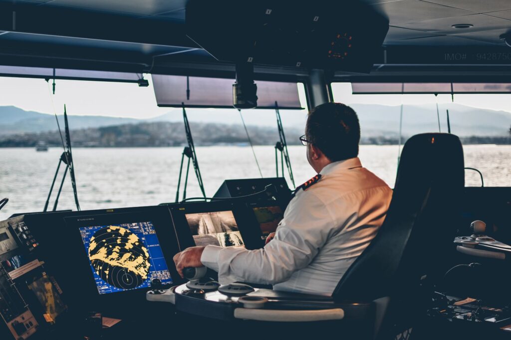
This air connection acts as an insurance policy for medical emergencies and non-delayable professional travel. Regional airlines operating this route frequently contend with low cloud ceilings, dense sea mists, and strong crosswinds, demanding the routine use of advanced instrument approach systems. For Åland residents, watching the morning plane take off for the mainland is confirmation that, despite winter geographical isolation, the region remains connected to Scandinavia’s decision-making hubs.
The Engineering of Interisland Bridges and Embankments
As Åland’s population and economic needs have evolved over recent decades, exclusive reliance on ferries and traditional boats has given way to intensive terrestrial integration through major civil engineering works. The central group’s main islands are now interconnected by a network of paved roads supported by an impressive sequence of suspension bridges, concrete viaducts, and embankments built over marine shoals.

These civil structures are designed to withstand extremely aggressive environmental conditions. Continuous freeze-thaw cycles combined with the corrosive action of saltwater and heavy impacts from floating ice during spring thaws demand strict preventive maintenance programs. Every bridge and embankment has been mathematically calculated to permit not only road traffic flow but also the natural currents of marine waters, thereby preventing ecological disasters in a marine ecosystem as delicate as the Baltic’s.
Sustainability and Energy Transition in the Regional Fleet
In recent years, Åland’s transport system has embarked on a profound transformation toward decarbonization and environmental sustainability. Given that the maritime transport sector is one of the largest consumers of fossil fuels in the autonomous region, local authorities have driven an ambitious plan to modernize the regional ferry fleet, gradually introducing hybrid and electric propulsion systems.
New vessels equipped with large battery banks and advanced biofuel-powered engines already operate on some of the busiest lines, drastically cutting greenhouse gas emissions and almost entirely eliminating underwater noise, directly benefiting local marine wildlife, particularly grey seal populations and waterbirds. This green transition not only responds to international climate commitments adopted by Finland and the European Union, but also to a deeply rooted conviction among the local population: protecting the archipelago’s fragile natural environment is the sole guarantee for ensuring its long-term viability.

Practical guide
Planning a journey and navigating efficiently across the Åland Archipelago requires understanding the inner workings of its intermodal network, where flexibility and advance booking are decisive factors.
- Main Maritime Access: Tallink Silja, Viking Line, and Finnlines operate regular daily connections between Stockholm, Turku, Helsinki, and the ports of Mariehamn or Långnäs. Advance booking is essential when traveling with a personal vehicle.
- Local Ferry Network: Ålandstrafiken manages interisland lines. Foot passenger tickets are generally affordable, but car transport requires prior reservation, especially during the peak summer tourist months.
- Ice Roads: Their opening depends entirely on winter weather, typically between January and March. They must never be used unless officially opened and marked by the Åland transport authorities.
- Cycling Connectivity: The archipelago features an excellent network of well-conditioned cycling routes. Many ferries allow bicycles to be boarded free of charge or at reduced rates, facilitating sustainable tourism.
- Accommodation and Services: Mariehamn concentrates most hotel capacity, but smaller islands offer traditional cabins and guesthouses. Consulting updated public transport timetables is recommended, as they vary significantly between the peak summer season and winter.
Visual Epilogue Over Silent Waters
As evening falls over the Baltic Sea and the navigation lights of the final ferries begin blinking on the gray horizon, the Åland Archipelago recovers that ancient stillness defining its true essence. In this frontier where land and water merge into an infinite horizon, every maritime crossing, every bridge raised over the strait, and every route marked upon the ice represent far more than mere logistical infrastructure. They stand as living testimony to human tenacity, tangible proof that the will to connect communities can overcome any barrier imposed by geography and the most implacable climate.