
Origins and Geography of the Tekke Peninsula
The territory where the waters of the Aegean and the eastern Mediterranean converge has shaped over millennia a geographical corridor of steep cliffs, white pebble coves, and limestone plateaus known as the Tekke Peninsula. In this environment, the Lycian Way winds for over five hundred kilometers along coastal and mountainous contours where the ancient Lycian civilization sculpted its rock-cut necropolises. The topographic complexity of this region does not lie in extreme altitudes—Mount Tahtalı rises to two thousand three hundred and sixty-six meters—but in the constant alternation between vertical drops to sea level and sustained climbs through abrasive rock gorges that demand rigorous technical preparation.
Understanding the dynamics of this relief requires analyzing the plate tectonics that have fractured the limestone block into a succession of capes, peninsulas, and hanging valleys. Unlike traditional alpine routes where snow dictates seasonality, along the Lycian coast the decisive factor is solar radiation and the scarcity of natural water sources on elevated stretches. Hikers venturing into this coastal strip must manage their hydration and equipment weight with millimeter precision, as daily cumulative elevation gains frequently exceed one thousand meters of ascent over loose stone and thorny Mediterranean scrub.
Historical research prior to the start of the trek reveals that every valley conceals vestiges of a federation of city-states that rivaled in autonomy and maritime commerce. The ruins of Patara, Xanthos, Myra, and Simena are not mere tourist attractions, but geographical milestones that the ancient Lycians connected through bridle paths and staircases carved into living rock. Following these original tracks allows contemporary walkers to understand the logic of a layout that prioritized coastal visibility and control of natural ports over the comfort of valley routes.
Logistical Preparation and Water Management in Arid Terrain
Planning an autonomous traverse along the Lycian trail requires a supply protocol radically different from that of wet European mountain ranges. Except for the river valleys of the Xanthos or Kocaçay rivers, permanent streams are scarce during the late spring and practically nonexistent in the summer months. For this reason, the design of each day must incorporate secure refuelling points at traditional cisterns, rural mosques, or small family-run guesthouses maintained by local inhabitants who keep traditional Anatolian hospitality alive.
Camping equipment must be reduced to the absolute minimum, prioritizing lightweight double-walled shelters capable of withstanding gusty winds that descend abruptly from the peaks toward the sea. Technical footwear requires high-traction outsoles with rubber compounds that prevent slipping on polished limestone rock shaped by continuous foot traffic and marine erosion. Likewise, the water filtration system must be capable of processing both traditional well liquid and water from minor streams, combining hollow-fiber filters with backup purification tablets.
The true measure of self-sufficiency on the Lycian coast is not found in distance from urban centers, but in the ability to ration effort and water under an unforgiving sun that dissolves the boundary between physical exertion and landscape contemplation.
Satellite communications and geolocation devices are accessory yet recommended tools on the most remote karstic plateaus, where cellular coverage disappears due to towering rock walls. Local authorities and gendarmerie rescue teams emphasize the need to register detailed route plans with local accommodations before tackling isolated stages, such as the stretch linking the heights of Gelidonya to the pine forests of Adrasan.
Topography and Technical Challenges of Limestone and Scrub
The surface upon which the trekker moves presents an unforgiving geology dominated by lapiaz and karstic formations. These surfaces, eroded by the chemical dissolution of limestone, generate sharp ridges and micro-fissures that severely punish boot soles and backpack flanks. Accumulated ankle fatigue is one of the most frequent risks, making the use of telescopic trekking poles with tungsten tips indispensable for securing every footstep on stony descents.
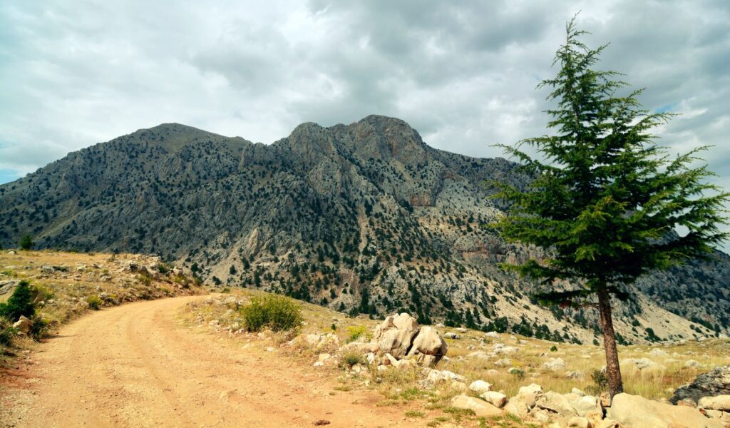
The prevailing vegetation, composed of dense maquis scrub, creeping junipers, and scattered Calabrian pine forests, adds another layer of technical difficulty by limiting resting spaces and generating a microclimate of trapped heat in terrain depressions. During central daylight hours, ambient temperatures in canyons can rise drastically, forcing expeditionary groups to start early to complete exposed sections before noon and reserve peak heat hours for natural shelters or shaded stops.
Advancing along the dry-stone paths flanking marine abysses demands uninterrupted concentration; here, a miscalculation in foot placement is paid with a fall onto thorny brush or a steep descent toward the turquoise waters crashing against the cliffs.
Trail markings, officially blazed with the red and white colors of long-distance hiking routes according to international standards, are generally in good condition, though weather action and occasional vandalism can occasionally disorient hikers at junctions with newly opened forestry or agricultural tracks.
Archaeological Heritage and the Memory of Lycian Civilization
Walking through this Mediterranean corridor is also a continuous exercise in open-air historical reading. Unlike musealized monumental sites, Lycian ruins are organically integrated into the natural landscape. It is common to find sarcophagi with inverted ship-keel roofs, rock-cut tombs sculpted into inaccessible vertical faces, and remnants of classical theaters enveloped by roots of wild fig trees and mastic bushes.
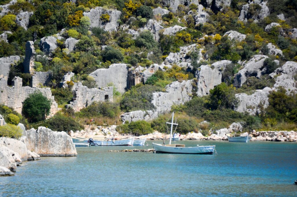
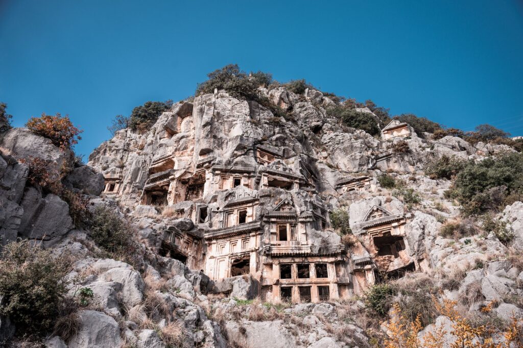
Lycian society, described by ancient historians as history’s first democratic federation—whose system of representation anticipated key elements of modern Western republics—left an architectural imprint oriented toward eternity. The necropolises of Myra, with their imposing temple facades carved into living rock, or the submerged remains of the port city of Kekova, visible beneath the transparent waters of the bay, compel walkers to pause and reflect on the fleeting nature of human constructions against the persistence of the sea and stone.
Historians and archaeologists studying the area note that the current layout largely respects the ancient herding and trade paths that linked these enclaves. Far from being a modern recreational invention, the trail is a heritage recovery effort that explains how the geographical isolation of the coastal mountains protected the Lycians from external invasions for centuries, allowing them to preserve their unique language and traditions until their final assimilation by the Roman Empire.
Socioeconomic Dynamics of Rural Mountain Communities
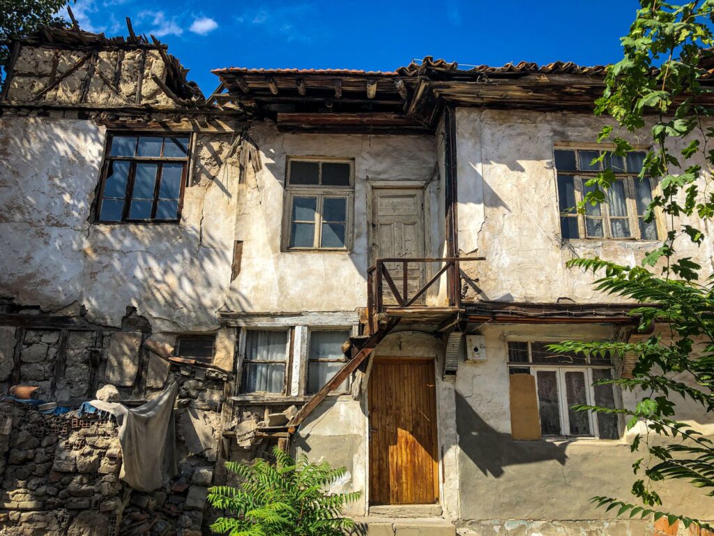
The impact of hiking tourism on the small villages of the Tekke Peninsula has gradually transformed the local economy, traditionally based on goat herding, olive cultivation, and pine honey production. Villages such as Üçağız, Faralya, or Kayaköy—the latter an abandoned Greek ghost town following the population exchange of nineteen twenty-three—depend to varying degrees on hosting walkers seeking an authentic experience far from the mass resort complexes of the Turkish coast.
This sustainable rural development model allows visitors to stay in local family-run guesthouses where they consume regional products such as fresh goat cheese, extra virgin olive oil, and traditional dishes cooked in stone ovens. However, this growth also presents environmental management challenges, particularly regarding solid waste management and pressure on underground aquifers during peak spring visitor months.
Interaction with local shepherds and permanent residents adds a fundamental human dimension to the expedition. Despite language barriers, Anatolian hospitality constantly manifests itself in the form of a glass of black tea offered on a stone house porch or precise indications regarding nearby water sources, demonstrating that the social fabric of these mountains remains as vibrant as it was in the era of trading caravans.
Practical guide
How to get there: Dalaman International Airport is the main entry gateway for the western sector of the trail, while Antalya Airport serves the eastern sector directly. From both terminals, local scheduled buses connect with the coastal towns of Fethiye, Kaş, and Kumluca.
Best time to visit: The spring months (March to May) and autumn (September to November) offer optimal temperatures for trekking, ranging between fifteen and twenty-five degrees Celsius. The summer period should be strictly avoided due to extreme heatwaves.
Permits and regulations: Access to the trail is open and free of charge. No special permits are required for walking, though wild camping must be conducted with absolute respect for the environment, strictly avoiding open fires in forested areas due to extreme wildfire risks.
Recommended equipment: High-traction trekking boots, telescopic poles, water purification system, quick-drying technical clothing, broad-spectrum sun protection, lightweight windbreaker, and a detailed map or offline navigation application.
Accommodation and provisioning: It is possible to combine autonomous camping with stays in local rural guesthouses every two to three days, significantly reducing backpack weight regarding food and cooking gas.
The Eternal Echo of Mediterranean Capes and Lighthouses
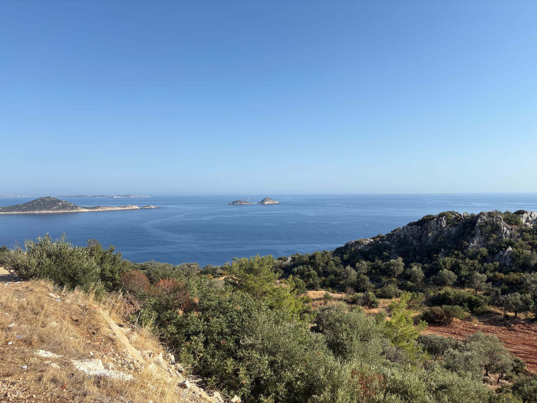
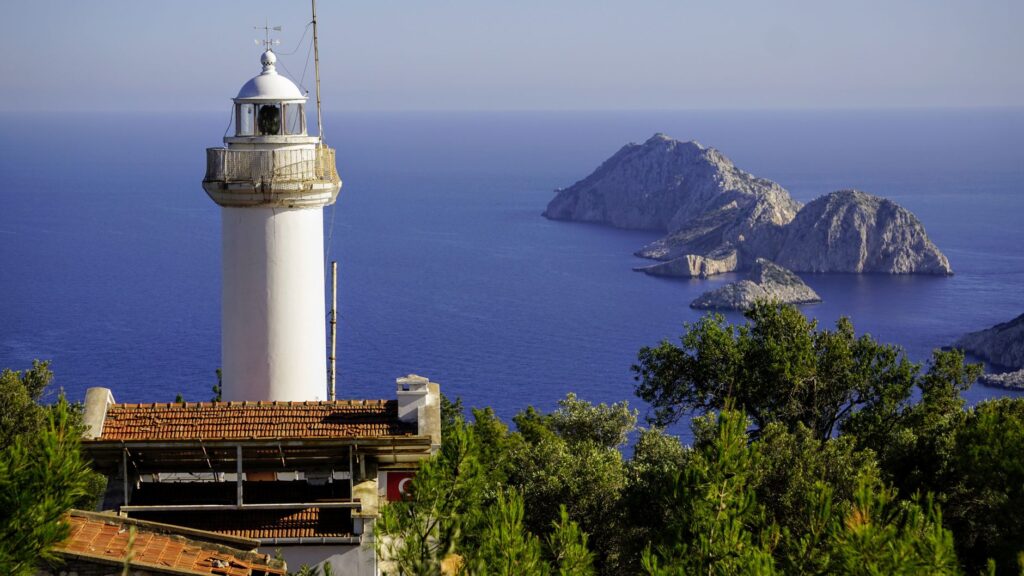
When the route reaches its endpoint at Cape Gelidonya, where the old lighthouse stands upon a wind-whipped rocky promontory dotted with islets, the physical effort accumulated over weeks transforms into profound mental clarity. From this vantage point, contemplating the infinite horizon where the blue of the sky merges with the currents of the Gulf of Antalya, the trekker understands that the true essence of this traverse lies not in conquering a distant summit, but in constant attunement with a landscape where ancient history and wild nature converse in perpetual silence sculpted by wind and time.