
An Aquatic Territory in Southeast London
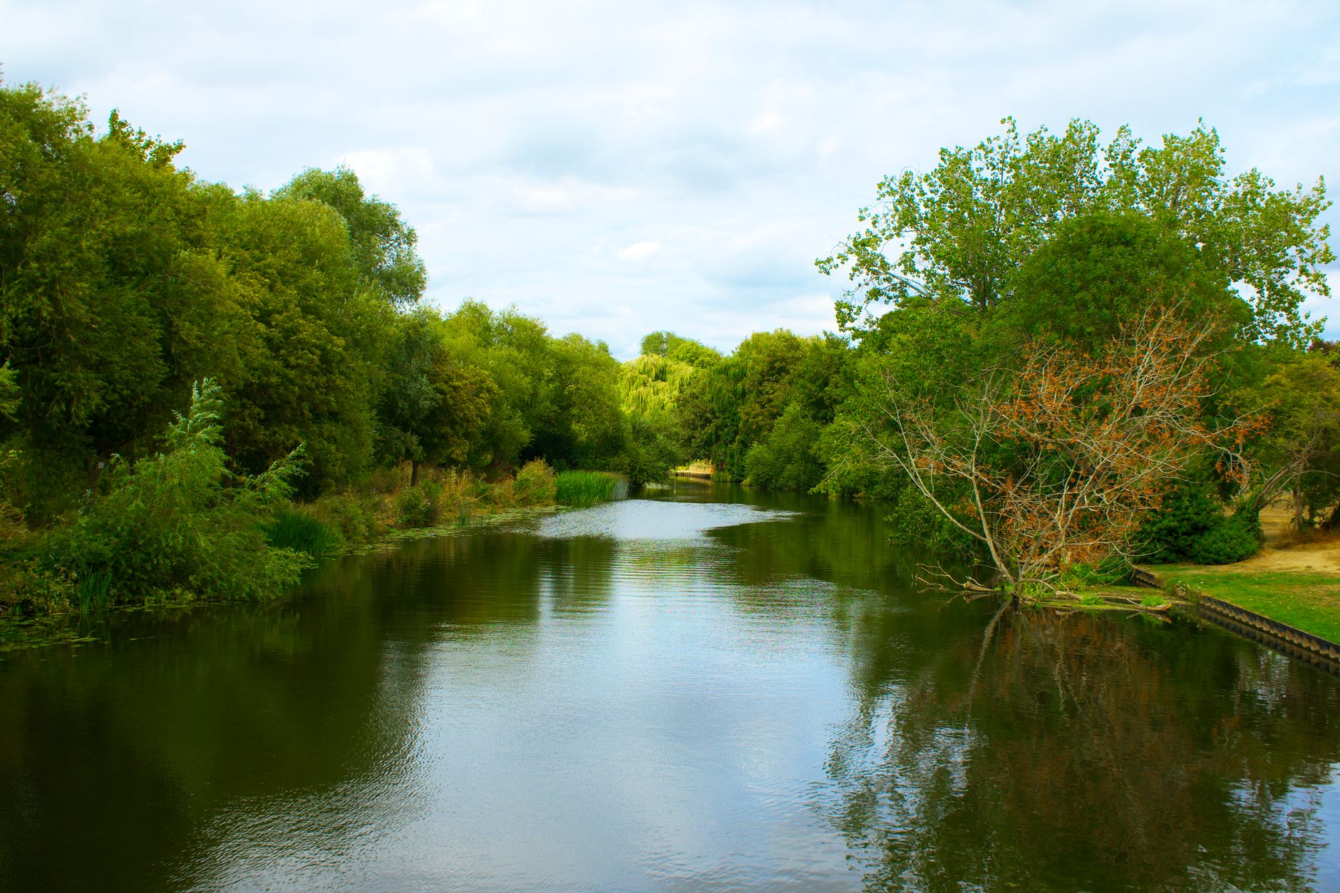
The district of Bexley, located in the southeast of the United Kingdom within the Greater London metropolitan area, features a landscape where freshwater streams and alluvial plains deeply shape the terrain. At an average elevation of sixteen metres above sea level, this municipality borders the River Thames, establishing a complex ecological dynamic among interior wetlands, local creeks, and strong estuarine influences. The watercourses descending northward have carved fertile valleys and damp zones that historically served as refuges for native flora and fauna, resisting the pressures of modern urbanization.
The geography of the area is defined by a network of small channels and tributaries flowing into the Thames estuary. These ecological corridors act as vital arteries for local biodiversity, enabling aquatic birds, amphibians, and small mammals to move through a densely populated setting. The interplay between Thames tides and freshwater discharges creates unique brackish and marshy habitats, characterized by resilient riparian vegetation adapted to periodic fluctuations in water levels and salinity.
Furthermore, the hydrological network serves as a natural drainage system for the entire borough, helping to regulate surface water flows during heavy rainfall events. Maintaining these open drainage paths is essential for mitigating urban flood risks, a priority that has gained increasing prominence in municipal spatial planning. The preservation of these waterways prevents excessive runoff acceleration and contributes significantly to the overall resilience of the regional watershed.
Historical Memory and Land Use in the River Basin
The relationship between human communities and water in Bexley dates back centuries, when early settlers took advantage of alluvial soil fertility and water availability for agriculture and mills. As the region evolved from rural communities and trading villages into a settled peripheral area of Greater London, the landscape underwent radical transformations. Nevertheless, numerous vestiges of this hydraulic and agricultural history still endure in local parks, nature reserves, and the boundaries of former manorial estates.
Contemporary land management seeks to balance urban growth with the preservation of remaining natural spaces. Local spatial planning policies have evolved to recognize the importance of maintaining ecological buffer zones along watercourses. This prevents flooding and ensures that natural filtration and aquifer recharge functions are not entirely lost beneath pavement and real estate development.
Historical records and old maps reveal how many of the smaller tributaries were once utilized to power local grain and fulling mills, marking the beginning of industrial activity along the streams. Although these traditional operations have long since vanished, their footprints remain visible in the topography of local valleys and linear parks. Today, safeguarding these historical traces alongside natural habitats provides a comprehensive perspective on how human presence has shaped and adapted to the aquatic environment over successive generations.
Riparian Flora and Adaptations of Local Vegetation
The predominant vegetation in Bexley’s riverbanks and wetlands includes species adapted to damp and periodically flooded soils. Willows, alders, and ashes compose the gallery forests bordering main streams, providing essential shade to keep water temperatures low and ensure adequate dissolved oxygen levels for fish and other aquatic organisms.
Beneath the tree canopy, the understory hosts a rich variety of herbaceous plants and ferns thriving in constant moisture. Species such as reeds, bulrushes, and yellow water irises colonize muddy banks, forming dense natural barriers that stabilize slopes against erosion caused by currents and seasonal swells. These plant formations are crucial for intercepting nutrients and sediments before they reach primary water channels, improving overall ecosystem health.
In addition to these native species, certain invasive plants have established themselves in some sectors, posing ongoing challenges for conservation managers. Coordinated eradication campaigns focus on removing non-native species that outcompete local flora for light and space. Restoring native plant communities ensures that the ecological functions of filtration and bank stabilization continue uninterrupted, supporting a balanced and self-sustaining riparian habitat.
Aquatic Fauna and Birds Inhabiting the Wetlands
Bexley’s wetlands and rivers support stable populations of resident and migratory waterbirds. Grey herons, mallards, great crested grebes, and various passerine species find refuge, food, and protected nesting areas in these habitats. The presence of these birds serves as a clear indicator of the ecological health of the water bodies, as they depend directly on abundant aquatic insects, small fish, and amphibians.
In the cleaner stretches of local streams, native fish like brown trout and chub find suitable spawning grounds despite physical barriers introduced by urban infrastructure over the years. Ecological restoration efforts focus on removing these artificial obstructions and improving river connectivity, allowing aquatic fauna to move freely between different sections of the watershed and maintain genetically healthy populations.
Beyond fish and birds, the damp meadows and slow-moving channels provide vital microhabitats for dragonflies, damselflies, and numerous amphibian species such as frogs and newts. These creatures complete complex life cycles that link aquatic and terrestrial food webs. Protecting these diverse animal populations requires continuous monitoring of water quality and the preservation of undisturbed margins where wildlife can forage and breed safely away from intense human disturbance.
Environmental Challenges Facing Demographic Pressure
With an estimated population exceeding two hundred thousand residents, Bexley faces the constant challenge of mitigating human impacts on its aquatic ecosystems. Diffuse pollution from urban runoff—carrying heavy metals, hydrocarbons, and plastic waste from paved streets into streams—represents one of the primary threats to water quality.
Likewise, increasingly frequent extreme weather events driven by global climate disruption test the resilience capacity of the district’s green infrastructure. Intense precipitation overloads drainage systems and triggers sudden overflows that erode riverbanks and disrupt aquatic habitats. To counter this, authorities and community organizations promote nature-based solutions, such as creating artificial retention wetlands and de-culverting channelized stream sections to restore their original meandering courses.
Addressing these complex pressures also requires strict regulatory enforcement regarding industrial discharges and domestic connections. Public awareness campaigns complement these measures by encouraging residents to adopt habits that reduce water consumption and minimize pollution at the source. Through a combination of structural engineering improvements and ecological restoration, the municipality strives to safeguard its aquatic resources for the future.
Community Initiatives and Environmental Volunteering
The role of the local community in conserving Bexley’s natural spaces is essential. Various volunteer groups and local associations work closely with municipal authorities on stream cleanups, biodiversity monitoring, and planting native species in degraded areas. These initiatives not only improve the physical state of the natural environment but also foster a strong sense of ownership and environmental responsibility among residents.
Educational activities organized in local reserves and visitor centers help younger generations understand the value of urban aquatic ecosystems. Through hands-on workshops and guided walks, citizens learn to identify local flora and fauna, recognizing that nature conservation is not exclusively a matter for remote areas, but an everyday task beginning right in one’s own neighborhood.
Participation in citizen science projects, such as recording waterbird sightings or measuring river clarity, empowers individuals to contribute directly to ecological research. These grassroots efforts bridge the gap between scientific understanding and public action, creating a collaborative network dedicated to the long-term stewardship of local natural heritage.
The health of an urban river is measured not solely by the clarity of its waters, but by the community’s capacity to recognize its value and protect it against encroaching concrete.
Practical guide
How to get there: Bexley is excellently connected to central London via National Rail commuter services and various metropolitan bus routes. Bexley station offers frequent arrivals from London Bridge and Charing Cross.
When to visit: Spring months (April to June) and early autumn (September to October) offer optimal weather conditions and heightened local wildlife activity, featuring the blooming of riparian vegetation and the passage of migratory birds.
Visitor rules and low impact: To preserve fragile wetland ecosystems, staying on marked trails, avoiding littering, and keeping pets on leashes at all times are mandatory to prevent disturbing wildlife or damaging riparian vegetation.
Accommodation and services: The district offers a varied selection of local guesthouses, bed and breakfasts, and small hotels, alongside all necessary urban services for the responsible traveler, including environmental information centers and bicycle rental points.
Additional tips for explorers: Bringing a pair of binoculars for birdwatching and wearing waterproof footwear are highly recommended when exploring the more secluded paths along local streams and marshy reserves.
Visual Reflection and Commitment to the Environment
Observing the steady flow of water in Bexley invites travelers to pause and examine the small details sustaining life in balance with the city. Every riparian nook, every restored wetland, and every citizen effort to keep watercourses clean demonstrates that coexistence between humans and nature is possible when respect and conscious planning prevail. Upon departing these aquatic landscapes, one leaves with the certainty that the future of local biodiversity depends equally upon public policy and the individual sensitivity of every visitor who chooses to walk slowly and observe attentively.
Ultimately, experiencing these urban waterways offers a profound reminder of the resilience inherent in natural systems. When communities actively engage in protecting their local rivers and wetlands, they not only restore ecological integrity but also create healthier and more harmonious living spaces for everyone involved in the urban environment.