Amsterdam does not end at the canal ring. The city stretches west, east and south in a constellation of neighbourhoods where daily life revolves around stations, markets, parks and quays. For visitors, the difference between a superficial visit and a well-planned stay often comes down to movement: which line to take, where to change and how much time to allow for each leg.
In the Netherlands, mobility is not simply getting from one sight to another. It is the infrastructure that holds the day together: taking children to school, commuting, shopping or heading home at dusk. Understanding that logic helps travellers plan better and read the city with different eyes. It also changes what you notice: not only the postcard view of a canal, but the ordinary choreography of a neighbourhood waking up, a tram filling and emptying, a ferry sliding across grey water with commuters who barely look up from their phones.
A city you read in layers
The historic centre of Amsterdam, with its canals and narrow streets, invites walking. But the real city, the one that runs seven days a week, is built around a public transport network combining tram, metro, bus and ferry. Each mode has its own rhythm and its own territory.
The tram is the most visible option for visitors. Its lines cross residential areas, shopping streets and cultural districts, allowing direct journeys without complicated changes. The metro, by contrast, covers longer distances with fewer stops and links the centre with more distant areas and the central station.
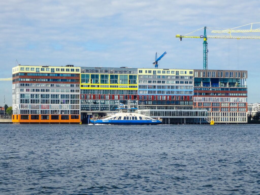
The ferry across the IJ is a singular part of the system. It is not a tourist service but a daily link between the central bank and the northern neighbourhoods. For travellers, it offers a different perspective on the city skyline and an easy way to extend a route without relying on taxis.
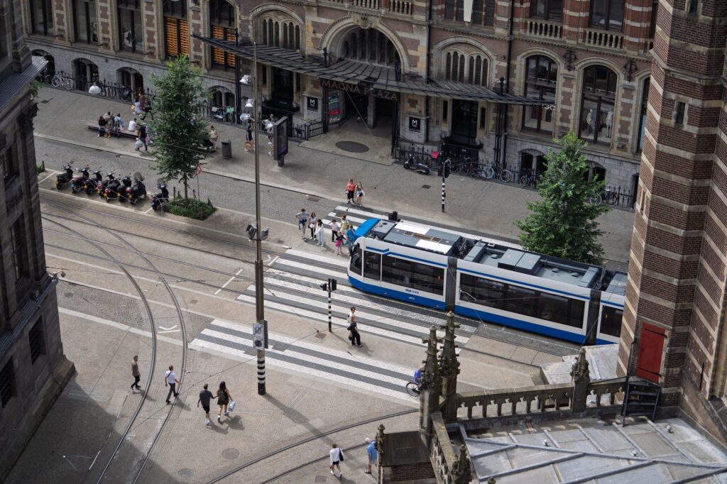
Buses complete the picture, filling gaps where rails do not reach and connecting residential edges with transport hubs. Seen together, these modes form a grid that is easy to underestimate at first glance but quickly becomes legible once you start using it.
Neighbourhoods with their own character
Each part of Amsterdam has a recognisable identity that shapes the visitor’s experience. Oud-Zuid, in the south, combines museums, wide avenues and quiet residential streets. It is comfortable for walking, with parks and local shops that keep predictable hours.
The eastern side, around Oost, mixes markets, shopping streets and a growing food scene. It is a good example of how the Dutch urban landscape alternates historic buildings with recent architecture, and how neighbourhood life organises around squares and stations.
The west, with Westerpark as a reference, offers a slower version of the city, with green spaces, former industrial areas turned into cultural venues and a tram network that makes getting around easy. The north, connected by the IJ ferry, has gained weight as an area of museums, workshops and cultural projects.
Beyond these broad zones, smaller districts each carry their own daily rituals. Some revolve around a weekly market; others around a station square where commuters buy coffee before the first tram. Recognising these micro-centres is one of the most practical skills a visitor can develop, because it turns a large city into a series of walkable, connected pockets.

In Amsterdam, moving well is not about going faster but about choosing the right mode for each leg and accepting that the city reveals itself in layers.
The bicycle as a system, not a souvenir
The bicycle dominates transport in the Netherlands, and Amsterdam is no exception. For visitors, however, it is not always the easiest option: it requires knowing the rules, respecting the lanes and adapting to the local pace. Renting a bike can work well for short trips and quiet areas, but it does not replace public transport over longer distances.
Shared bicycles and park-and-ride facilities are part of the everyday landscape. Seeing them in use alongside trams and buses helps explain that Dutch mobility is an integrated system, not a sum of isolated alternatives.
It is worth observing how bicycles interact with other traffic: at intersections, cyclists often have their own signals and priority rules, and pedestrians who wander into a bike lane are gently but firmly corrected. Understanding this hierarchy is part of understanding the city, even if you never rent a bike yourself.
Water as a planning axis
Amsterdam was built on water and still organises itself around it. The canals, the IJ and the port areas are not just a backdrop: they shape routes, bridges and the location of stations. Walking beside the water is a way to understand the city’s geography and anticipate travel times.
The IJ ferry, in particular, crosses from one bank to the other with a frequency designed for residents. For travellers, it is a way to see how landscape and daily life intertwine: the same crossing that serves commuters can become one of the most useful views of the city.

Water also imposes patience. Bridges open, quays flood after heavy rain, and some routes simply take longer than a map suggests. Accepting this is part of planning realistically, and it often leads to slower, more rewarding walks along the water’s edge.
Planning without rigidity
Planning in Amsterdam works best when organised by area rather than by endless lists of sights. Grouping visits by neighbourhood reduces travel and makes better use of the day. A morning in the south, an afternoon in the east and a sunset by the IJ can form a coherent day without crossing the city repeatedly.
Tickets and travel passes suit different visitor profiles, but conditions should be checked before buying. Official information and transport apps help calculate routes and alternatives in real time, which is especially useful when combining tram, metro and ferry.
A useful habit is to identify one or two anchor points per day and let the rest of the route grow around them. This leaves room for detours, unexpected cafés and the kind of unplanned pause that often becomes the highlight of a trip. Rigid schedules, by contrast, tend to collapse the moment a tram is delayed or a museum runs long.
Eating, shopping and resting like a local
Amsterdam’s daily life shows in its markets, bakeries, cafés and neighbourhood restaurants. Many keep hours designed for residents, which means peak times and closing days can surprise visitors. Checking ahead avoids unnecessary journeys.

Dutch food culture combines traditional dishes with cuisines from around the world, reflecting a diverse city. Trying local specialities in a neighbourhood setting is often more rewarding than concentrating every meal in tourist areas. The urban landscape, with its narrow streets and canal-side terraces, is part of the experience.
Markets deserve particular attention. They are not only places to eat or buy produce; they are social infrastructure where the rhythm of a district becomes visible. Arriving early, when stalls are still being set up, offers a quieter and more authentic view than the crowded midday hours.
What to look for beyond the canals
Beyond the central ring, Amsterdam shows varied architecture: former factories turned into cultural spaces, well-kept social housing, public libraries and train stations that work like small cities. Observing these places helps explain how life is organised in the Netherlands and what role transport plays in it.
Parks such as Vondelpark or Westerpark are meeting points where residents and visitors mix. Walking through them at the end of the day offers a calmer version of the city and shows how green space is part of everyday infrastructure, not just leisure.
Libraries, community centres and station halls are also worth noticing. They are the quiet, functional buildings that support daily routines, and they often reveal more about a neighbourhood than its most photographed streets. For a traveller interested in how a city actually works, these are essential stops.
Weather, seasons and the shape of a day
Dutch weather is changeable, and it influences how the city is used. Rain can empty a square in minutes and fill a tram; a clear afternoon brings terraces and parks to life. Planning with flexibility, and keeping indoor alternatives in mind, is not pessimism but practical local knowledge.
Seasons also change the feel of movement. Summer evenings stretch late, making walks along the water pleasant after dinner. Autumn brings shorter days and a faster return indoors, while winter encourages shorter, more purposeful trips between warm places. Adjusting expectations to the season makes any itinerary more realistic.
Practical guide
- Choose the area before the list: group visits by neighbourhood to cut travel and make the most of the day.
- Combine modes: the tram works for urban trips; the metro for longer distances; the ferry to cross the IJ.
- Check current conditions: fares, timetables and passes change; verify official information before buying.
- Respect bike lanes: if you rent a bicycle, learn the rules and avoid main routes at peak times.
- Allow time to walk: the centre and many neighbourhoods are best enjoyed on foot, without rushing.
- Prepare alternatives: Dutch weather can change plans; keep indoor options in mind.
- Travel light and early: mornings are calmer on public transport and in markets, and they leave room for the unexpected.
- Watch the locals: how residents queue, board and cross tells you more about the city’s rhythm than any timetable.
A city understood by moving through it
Amsterdam rewards those who take time to understand how it works. It is not about seeing everything but about choosing routes well, accepting local rhythms and leaving room for the unexpected. A tram crossing a neighbourhood, a ferry over the IJ or a quiet street beside a canal can become the most memorable part of a trip.
At the end of the day, when lights reflect on the water and residents head home, the city shows its most everyday side. That simple, repeated image explains better than any guide why Amsterdam remains one of Europe’s most walkable and best-connected cities.