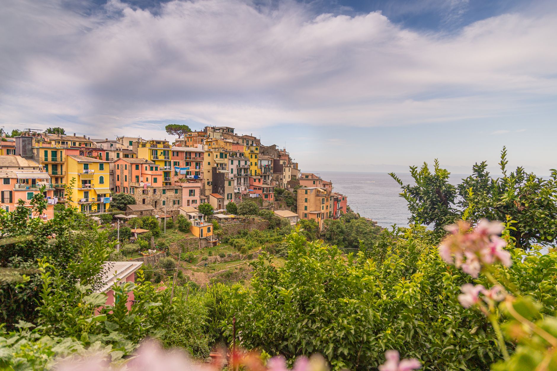

On Liguria’s eastern coast, between Levanto and La Spezia, the landscape is not a backdrop: it is living infrastructure. The dry-stone terraces that climb slopes up to 400 metres above sea level would not exist without generations of farmers who built them and continue to repair them. Cinque Terre, in Italy, is far more than five picturesque villages: it is a way of life that has survived a thousand years of history, rural depopulation and the pressures of global tourism.
UNESCO inscribed this territory — which includes Portovenere and the islands of Palmaria, Tino and Tinetto — as a cultural landscape in 1997. It did not do so for the beauty of its cliffs, but for something deeper: the way small communities have transformed steep, uneven terrain into a sustainable agricultural mosaic. That recognition, however, does not guarantee the survival of the model. The question running through these villages is not how to attract more visitors, but how to keep alive the work that makes the landscape possible.
A landscape built by hand over a thousand years
The terraces of Cinque Terre were mostly built from the 12th century onwards, when Saracen raids from the sea came to an end. Farmers made use of every patch of hillside to plant vineyards and olive groves, supported by dry-stone walls of sandstone blocks bonded together with pebbles removed from the ground. According to the UNESCO nomination file, some terraces stretch as much as two kilometres in length and extend from a few metres above sea level to 400 metres, the highest altitude suitable for cultivation.
What impresses is not only the scale but the collective logic. Building and maintaining these walls required communal agreements that are hard to imagine today. Without neighbourly cooperation, terrace farming would have been unviable. Each owner tended their plot, but the entire system depended on everyone doing their part. That ethic of shared care is, according to the site’s managers, an essential attribute of its outstanding universal value.
The Cinque Terre landscape is not preserved by decree: it is preserved because someone still climbs up each season to repair what rain and time knock down.
Five villages, five ways of inhabiting the cliff
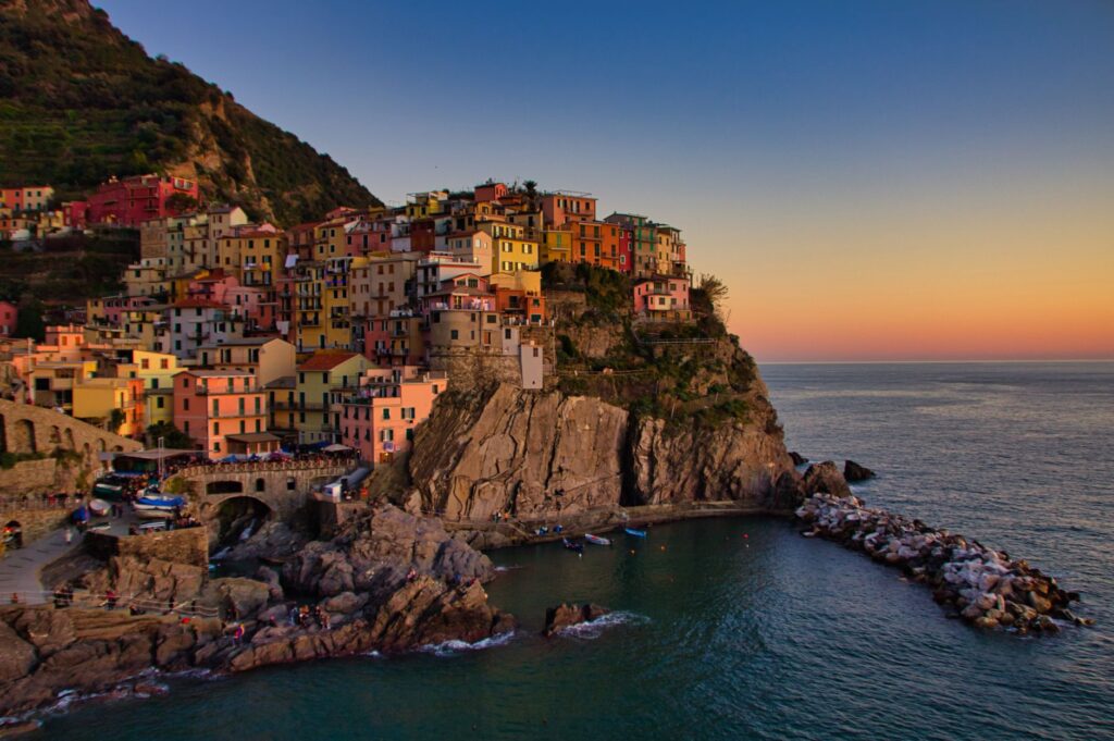
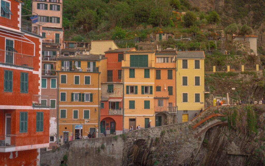
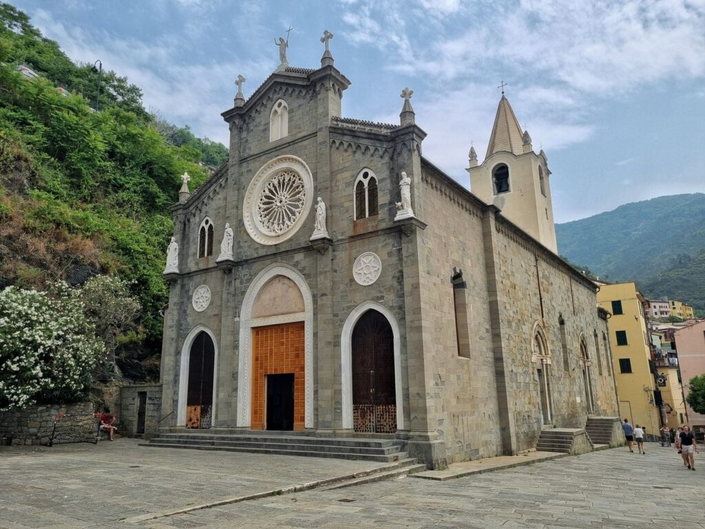
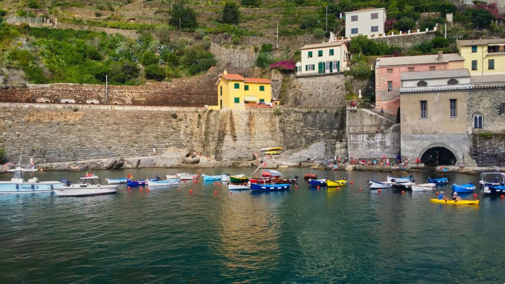
Monterosso al Mare, Vernazza, Corniglia, Manarola and Riomaggiore share the same sea and the same rock, but each responds to a different geography. Monterosso, the westernmost, stretches along two short valleys and faces one of the few beaches in the area. Vernazza is organised around the Vernazzola stream, protected by a rocky spur that shields it from the sea. Corniglia is the only one that does not touch the water: it sits on a high promontory reached by a long staircase.
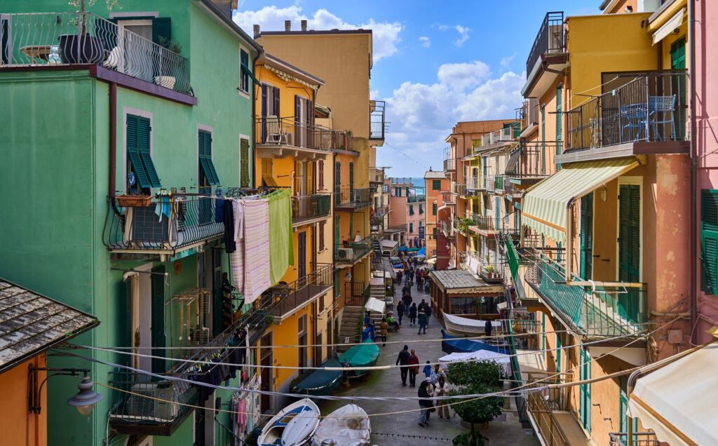
Manarola descends towards the sea in two directions, partly on a rocky spur and partly along the Grappa stream. Riomaggiore, the easternmost, lines its houses along the narrow valley of the Rio Maggiore, now covered and used as the main street. In all of them, the use of local stone for roofs and facades creates a visual unity that is no accident: it is the result of centuries of adaptation to available materials.
The settlements cluster around religious buildings or medieval castles, and on the hillsides there are small hamlets — Volastra, Groppo, Drignana, San Bernardino, Campiglia — that served as agricultural support. Scattered among the terraces are countless tiny stone huts, isolated or grouped together, used for temporary shelter during the harvest. This pattern of compact settlement on the coast and dispersed settlement in the hills reflects an intelligent strategy: concentrate housing where the terrain allows it and reserve every cultivable slope for agriculture.
The work that holds up the walls
The integrity of the landscape depends on an ungrateful and constant task: repairing the walls. At the time of inscription on the World Heritage List, it was estimated that 130 metres of wall per hectare of vineyard and between 30 and 300 metres per hectare of olive grove were in need of urgent reconstruction. Since then, mechanisms linking tourism activity with landscape maintenance have been activated, and tens of hectares have been recovered for vines and olives.
The underlying problem is demographic and economic. Abandoned terraces are vulnerable to landslides, and spontaneous reforestation threatens to erase the agricultural structure. Maintaining the walls is the responsibility of each landowner, and many cannot bear the cost. Support programmes exist, but they operate on a voluntary basis. The sustainability of the site, paradoxically, does not depend on grand projects, but on there being enough people willing to do slow, physical, low-visibility work.
A national park with communities inside
Cinque Terre is not an open-air museum. It is a national park with residents, schools, shops and everyday problems. Its protected status — National Park since 1999, after years as a regional park — imposes strict controls on any intervention in the territory. Any work requires authorisation from heritage and landscape authorities, and municipal plans must incorporate landscape quality criteria.
That tangle of regulations protects the site, but it also generates tensions. Residents live with restrictions affecting everything from renovating a home to opening a business. At the same time, mass tourism has transformed the local economy: many residents have moved from agriculture to services, and housing prices have risen. The balance between conservation and daily life is fragile and negotiated every day.
The question is not whether Cinque Terre is beautiful, but whether it remains habitable for those who care for it.
Portovenere and the islands: the other end of the site
The inscribed property is not limited to the five villages. It includes Portovenere, a compact historic centre with houses aligned along the coastline and dominated by the Doria Castle, and the islands of Palmaria, Tino and Tinetto. These islands are noteworthy not only for their natural beauty but also for the remains of early monastic establishments they contain. Portovenere was a commercial and cultural centre dating back to Roman times, and its current layout preserves medieval and modern strata that make it an urban palimpsest.
Managing the site is complex: two parks are involved — the Cinque Terre National Park and the Portovenere Regional Park — along with several municipalities, the provinces and the Liguria Region. A protocol signed in 2016 established a coordination committee, a permanent technical group and an office dedicated to the UNESCO site. The stated aim is for all these instruments to respect the outstanding universal value and act in harmony. In practice, coordination between administrations remains a challenge.
What visitors can do without upsetting the balance
Tourism is an indispensable source of income for maintaining the landscape, but also a threat when it concentrates in a few months and spaces. The high season, from May to September, saturates the trails and the streets of the villages. Those who visit Cinque Terre aware of what sustains the landscape can contribute to its conservation through simple decisions.
- Travel outside the high season: early spring and autumn offer mild temperatures, fewer crowds and light that brings out the terraces.
- Stay in the villages or in the hill hamlets: spending stays in the community and reduces pressure on the coastal centres.
- Buy local products: Cinque Terre wine and olive oil come from the terraces you want to preserve. Purchasing them directly supports their maintenance.
- Respect marked trails: walking off authorised routes accelerates erosion and damages the walls.
- Think before photographing: the houses are homes, not sets. Residents’ privacy matters.
The trail network connecting the villages is itself a conservation infrastructure. Many historic paths are maintained precisely because visitors walk them, and some routes cross working vineyards. Walking them is a way of understanding the scale of the work that sustains the landscape: every bend, every wall, every terrace demands an effort that cannot be seen from the sea.
The future is decided on the slopes
The site’s management plans include measures to support terrace maintenance and agricultural activities, but their application is voluntary and depends on the initiative of landowners and farmers. Spontaneous reforestation, landslides and the ageing of the rural population are recognised risks. Floods that have affected some villages and the watercourses descending the slopes have highlighted the territory’s vulnerability to extreme events.
The authenticity of the site, according to UNESCO criteria, depends on maintaining traditional farming systems and integrated settlements. It is not about freezing the landscape, but about preserving the relationship between community and environment that produced it. That relationship is not sustained by subsidies or speeches, but by people who live there, work the land and find a viable future in it.
Cinque Terre is, in that sense, a human-scale experiment in how to inhabit a fragile territory without destroying it. Its value lies not only in the postcards, but in the obstinacy of those who keep repairing walls that the next rain will damage again. That repeated, almost invisible gesture is what holds the landscape up.
Practical guide
Cinque Terre is best explored on foot and by train. The railway line connecting Levanto with La Spezia links the five villages and is the fastest and most sustainable way to move between them. Cars have restricted access in most of the centres, and parking is difficult and expensive. The regional train allows frequent connections, and trails link the villages on foot for those with time and fitness.
The best time to visit is from April to June and from September to October. In summer, heat and crowds can make the experience uncomfortable and put pressure on local services. Wearing suitable footwear for walking on stone trails is essential. Water and sun protection are necessary even in spring and autumn.
For eating, look for local products: Cinque Terre white wine, olive oil, Monterosso anchovies and focaccia. Markets and small shops in the villages offer options that support the local economy. Restaurants in the hill hamlets tend to be quieter and cheaper than those in the harbour.
Respect for park rules is mandatory: you cannot leave marked trails, swimming is not allowed in unauthorised areas and leaving waste is prohibited. Fines for non-compliance are high. Official information on routes, timetables and restrictions is available at park offices and tourist information points in each village.
For those who want to understand the landscape beyond the visit, there are guided routes explaining the terrace system and agricultural work. Participating in them is a way of contributing to the conservation economy and understanding why this place is not just a destination, but an inhabited territory that needs continuous care.