
Introduction to the Geothermal Heart of Iceland
The Laugavegur trail, stretching for approximately fifty-five kilometers between Landmannalaugar and Þórsmörk in the highlands of southern Iceland, represents one of the most geologically dynamic hiking itineraries on the planet. This route is not a simple walking path, but a traverse through an active laboratory of tectonic and cryogenic forces where the Earth’s crust exhibits its ceaseless transformation. Planning an expedition in this subarctic corner demands absolute respect for meteorological unpredictability and a deep understanding of insular high-mountain logistics, where self-sufficiency marks the difference between success and rescue.
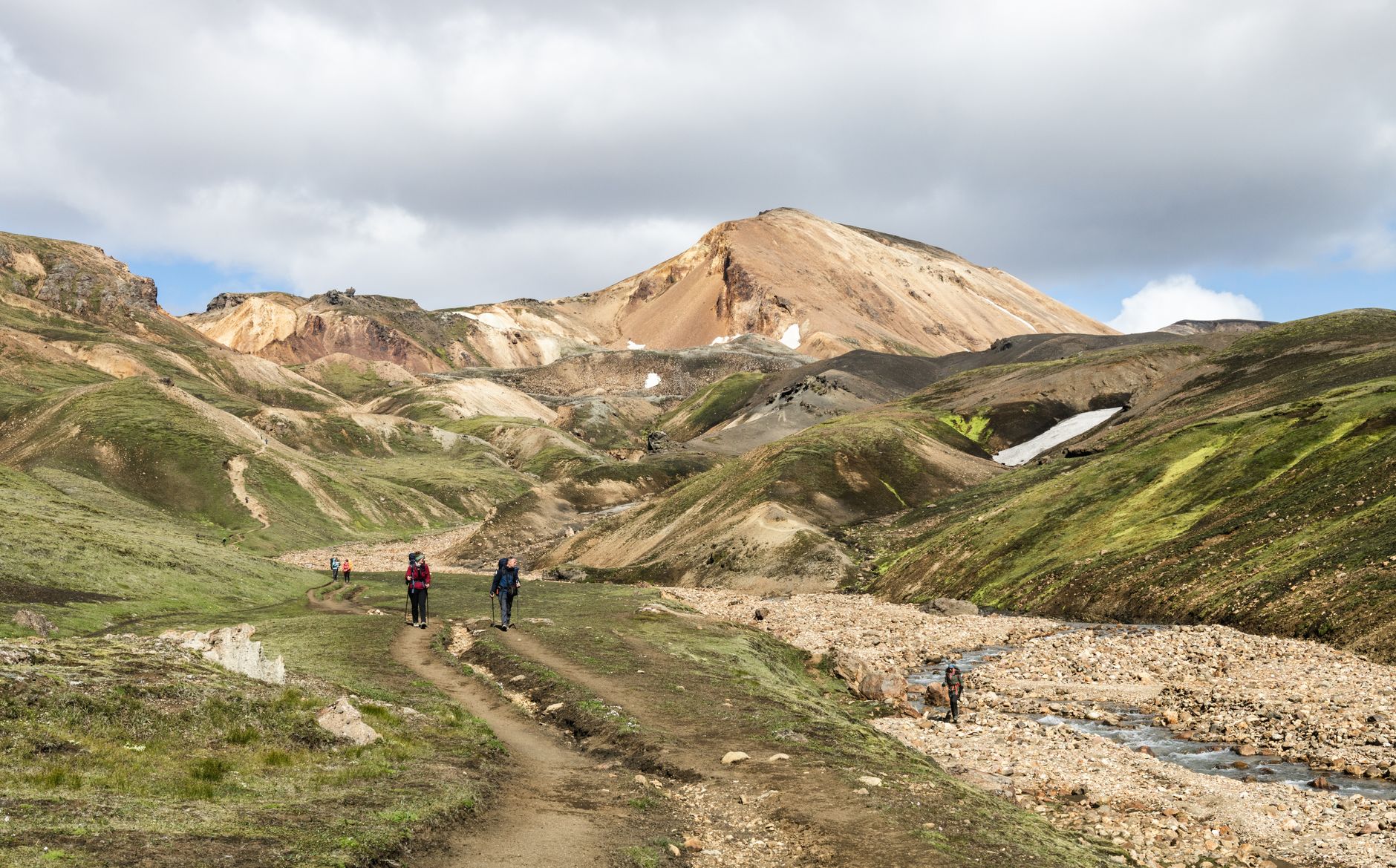
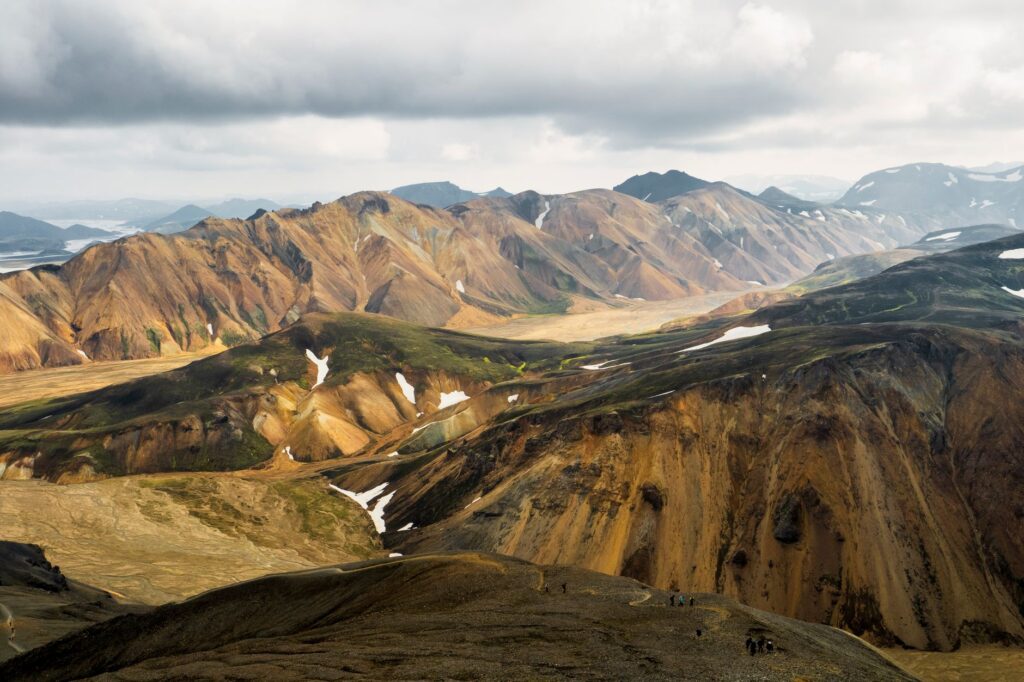
Over the course of four standard days of trekking, expedition members ascend from thermal valleys to black obsidian plateaus, negotiating wind-whipped catabatic cols and wading through glacial meltwater channels. The singularity of the Icelandic landscape lies in its extreme chromatic palette: rhyolite mountains flashing in ocher, phosphorescent green, and intense red hues, contrasting immediately with the pristine white of the Eyjafjallajökull and Mýrdalsjökull glaciers. This report offers a technical and narrative immersion into the preparations, challenges, and geographical secrets necessary to face the Laugavegur with professional rigor.
Geography and Tectonics: The Stage of Fire and Ice
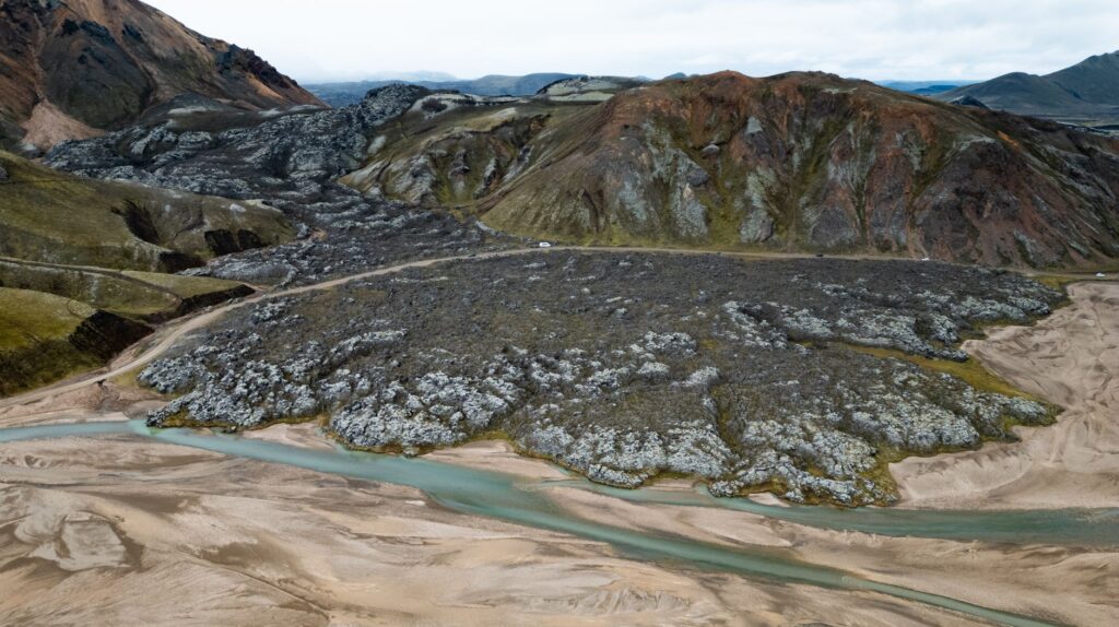
Understanding the geography of the Icelandic highlands requires grasping that the territory sits astride the Mid-Atlantic Ridge, a divergent boundary where the North American and Eurasian tectonic plates slowly pull apart. The initial stretch of the route at Landmannalaugar is dominated by recent lava fields and smoking geothermal springs that emit sulfurous steam twenty-four hours a day. This geothermal activity is not static; springs change in temperature and flow from one season to the next, forcing cartographers and local guides to constantly update progression maps.
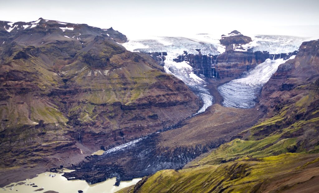
As the route advances southward, the substrate changes dramatically. Rhyolite mountains, formed by the extrusion of silica-rich lava, give way to black deserts of basalt and volcanic ash at Hrafntinnusker and Álftavatn. These desolate expanses, battered by mist and horizontal rain, test the navigational skills of hikers when visibility drops to a few meters. The geomorphology of the area is the direct result of historical subglacial eruptions that have carved deep canyons and lunar plateaus of austere, haunting beauty.
Temporal Planning and Subarctic Seasonality
The operational window to safely traverse the Laugavegur is extraordinarily brief, generally limited to the boreal summer months from late June to early September. Beyond this period, paths remain blocked by deep snow, road accesses via F-roads are closed by government decree, and mountain refuges are completely shut down and devoid of services. Even in July or August, a sudden drop in temperature can unleash snowstorms capable of disorienting the most experienced trekker.
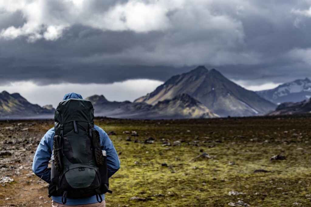
Daily march timing must be planned considering daylight hours, which are nearly perpetual at the height of the summer solstice but diminish rapidly toward late August. Mountaineers must calculate their stages not only based on linear distances, but on cumulative elevation gain and, above all, morning weather conditions, which in Iceland tend to be more stable than afternoon ones. Flexibility in the itinerary is a fundamental survival skill: pushing through a ridge during a hurricane-force gale is tantamount to assuming unnecessary risks.
Refuge and National Park Campground Logistics
The system of refuges along the Laugavegur—managed primarily by the Ferðafélag Íslands (FFÍ) touring association—constitutes the backbone of the support infrastructure. Facilities at Landmannalaugar, Hrafntinnusker, Álftavatn, Emstrur, and Þórsmörk offer dormitory bunks, running water, restrooms, and in some cases, showers. However, demand far exceeds available capacity, meaning reservations must be processed many months in advance through the organization’s official digital platforms.
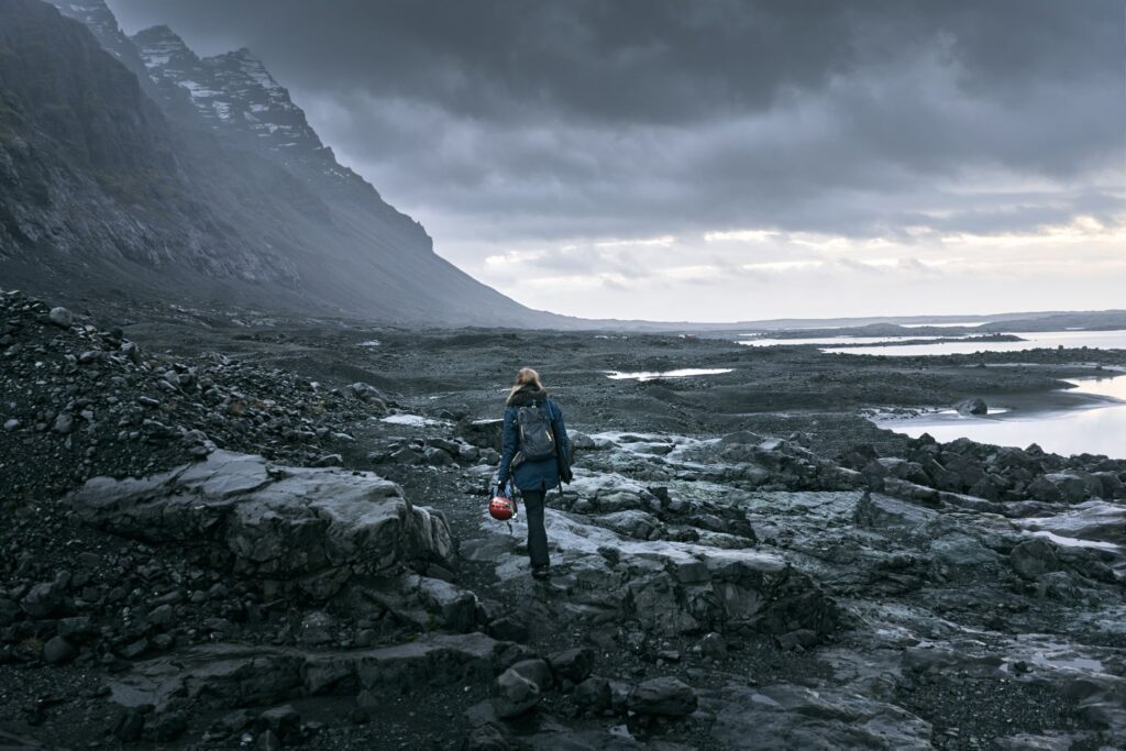
The Icelandic mountain does not negotiate with improvisation; its overwhelming beauty is directly proportional to the severity of its meteorological elements.
For those opting for total self-sufficiency in tents, protected area regulations are strict and restrictive. Camping is only permitted in specifically delimited zones surrounding each refuge, and pitching tents in the wild is strictly prohibited to protect the fragile flora of mosses and lichens that takes decades to regenerate. Tent stakes must be robust and capable of withstanding gale-force winds, as loose volcanic terrain complicates conventional, firm, and secure anchoring.
Technical Management of River Crossings and Footwear
One of the greatest technical and psychological challenges of the Laugavegur is wading across bridge-less glacial rivers, especially the vigorous torrent located between Álftavatn and Emstrur, known as Bláfjallakvísl, and multiple minor streams crossing the area. These currents carry ice-cold water sourced directly from melting ice, featuring rapid flows and a bed composed of slippery stones and unstable boulders. A poorly executed crossing can induce severe hypothermia or sweep the hiker away with all their gear.
The safety protocol for wading requires unbuckling backpack hip belts to immediately ditch the pack in case of a fall, using trekking poles to form a tripod supporting against the current, and crossing diagonally downstream or forming a human chain with fellow expedition members if levels are high. Carrying specific water footwear, such as neoprene booties or closed sandals protecting feet from submerged sharp basalt fragments, is indispensable while dry boots remain stowed in the pack’s waterproof compartment.
Clothing and Equipment for Extreme Conditions
Layering is the sole effective defense against notoriously unstable Icelandic weather, where experiencing blazing sun, hail, horizontal rain, and freezing wind within a single hour is entirely possible. Cotton must be completely banished due to its capacity to retain moisture and rapidly chill the body, prioritizing merino wool for base layers and highly breathable synthetic garments for intermediate insulation.
The waterproof, windproof outer shell must meet professional standards, utilizing high-end technical membranes with heat-sealed seams and wrap-around hood designs that do not limit peripheral vision. Likewise, sleep systems must include a sleeping bag with a comfort rating appropriate for temperatures near freezing and a high R-value insulating sleeping pad. Satellite communication devices and high-capacity power banks are mandatory, as mobile phone coverage is nonexistent across much of the interior valleys.
Practical guide
- Getting There: The starting point at Landmannalaugar and the terminus at Þórsmörk are accessible exclusively via specialized all-terrain buses (known as super jeeps or mountain buses) operating from Reykjavík during summer months. Conventional passenger cars are prohibited from transiting F-roads due to the hazards posed by river crossings.
- Permits and Reservations: FFÍ refuge slots typically sell out within minutes of the annual winter booking window opening. Camping fees in designated areas are paid directly at each refuge’s ranger station and include access to basic hygiene facilities.
- Safety and Rescue: Submitting a detailed route plan on the official Icelandic SafeTravel.is platform is mandatory before setting out. In case of a genuine emergency, the unified rescue telephone number is 112, though response times for helicopter teams may be delayed if weather conditions ground aircraft.
- Environmental Impact: The principle of Leave No Trace is strictly enforced. All generated waste, including organic food scraps, must be packed out in backpacks until reaching designated disposal bins at stage endings. Altering mineral formations or collecting geological samples is prohibited.
Emotional Epilogue in the Birch Forest of Þórsmörk
After navigating the volcanic aridity and ash deserts characterizing the central traverse, arriving at Þórsmörk unfolds as an almost dreamlike sensory revelation. This sheltered valley, whose name evokes the Norse god Thor, startles the trekker with a dense, lush forest of arctic birch, ferns, and an overwhelming diversity of wildflowers thriving under the shelter of surrounding glacial walls. It is a green oasis that movingly contrasts with the dark, ash-monochrome of preceding days.
Sitting upon damp moss at dusk, watching the final fire-gold rays of sun cast their glow upon the snowy peaks of Mount Tindfjallajökull, provides a long-sought catharsis for those who choose to walk through Iceland’s entrails. The forest silence, interrupted only by the distant murmur of glacial rivers descending toward the sea, seals a transformative physical and mental experience. The Laugavegur is not simply a long-distance hiking trail; it is an ancient reminder of life’s persistence and our planet’s fragile beauty.