The backbone of rock and sea in the Tramuntana
The Serra de Tramuntana, declared a UNESCO World Heritage site under the Cultural Landscape category, conceals a network of historical pathways winding between limestone cliffs, ancient agricultural terraces, and Mediterranean forests. The long-distance hiking trail GR 221, popularly known as the Dry-Stone Route, acts as the backbone for this rugged territory, running from the municipality of Andratx to Pollença. This is not merely a conventional trekking route, but rather an architectural journey through traditional Mallorcan engineering, where every meter of the trail has been sculpted over centuries using the technique of paret seca (dry stone), an ancient art intended to reclaim arable land from the steepest hillsides.
Embarking on this traverse requires an understanding of the geographical duality of a mountain range that drops abruptly toward the Mediterranean Sea. Throughout its main stages, the hiker faces considerable cumulative elevation gains, karstic ground composed of highly eroded limestone, and a shifting climate where sea breezes and solar radiation dictate the pace of the march. Planning an expedition through this natural corridor demands precise knowledge of water sources, the availability of spaces within the public refuge network, and the technical capacity to manage exposed sections where vertigo and fatigue become the primary traveling companions.

Geography, history, and layout of the GR 221
The origin of the paths comprising the GR 221 dates back to the Islamic era, a period when the first terraced farming systems and irrigation channels were established to harness the scarce water resources of the sierra. Later, during the 17th and 18th centuries, these communication routes were expanded to facilitate the transport of charcoal, the harvesting of snow in high-altitude mountain wells, and the maritime trade of citrus fruits and olives. Connecting the municipalities of the northern slopes with the coastal ports required tracing packhorse trails meticulously calculated to withstand the passage of mule trains carrying heavy loads.
Today, the officially homologated route allows hikers to traverse this landscape mosaic by combining stages of moderate and high difficulty. The main itinerary links deeply rooted cultural towns such as Estellencs, Banyalbufar, Valldemossa, Deià, Sóller, and Lluc. Each of these enclaves provides a unique perspective on the relationship between human activity and a natural environment that is as hostile as it is extraordinarily fertile. Dry stone is not merely an aesthetic element; it functions as a natural drainage system that prevents massive soil erosion during torrential autumn rainfalls—a critical factor that every expeditionary must consider when studying terrain stability.
Logistical planning and seasonality in the sierra
Choosing the right moment to begin the traverse absolutely conditions the success of the experience. Although Mallorca enjoys a benign climate for much of the year, the core summer months (July and August) are strongly discouraged for long-distance hiking due to high temperatures, an elevated risk of forest fires, and a critical scarcity of water along high-altitude sections. The optimal period spans from late October to early May, with special emphasis on the spring months (March and and April), when the fields burst into bloom and mountain streams recover a moderate flow.

The logistics of provisioning and overnight stays rely fundamentally on the network of refuges managed by the Consell de Mallorca, among which Can Boi in Deià, Muleta in Sóller, and Tossals Verds stand out—the latter situated in a strategic location surrounded by emblematic peaks such as Puig de Massanella. Securing reservations months in advance through the official platform is an absolute requirement, as capacity is limited and international demand is extremely high. Furthermore, carrying a water purification system is essential, as natural springs along the karstic stages are neither guaranteed nor subject to official sanitary controls.
Landscape architecture: The mastery of dry stone
Walking the GR 221 is, above all, a continuous exercise in observing vernacular architecture. The marges (terraces) support tons of fertile soil on slopes that frequently exceed forty degrees of inclination. The paredadors, artisans specialized in dry-stone construction, used exclusively local rocks fitted together without any mortar, achieving flexible structures capable of absorbing seismic movements and the pressure of accumulated water. This ethnographic heritage was recognized by UNESCO as Intangible Cultural Heritage of Humanity, highlighting the sustainability of a technique that fosters local biodiversity.
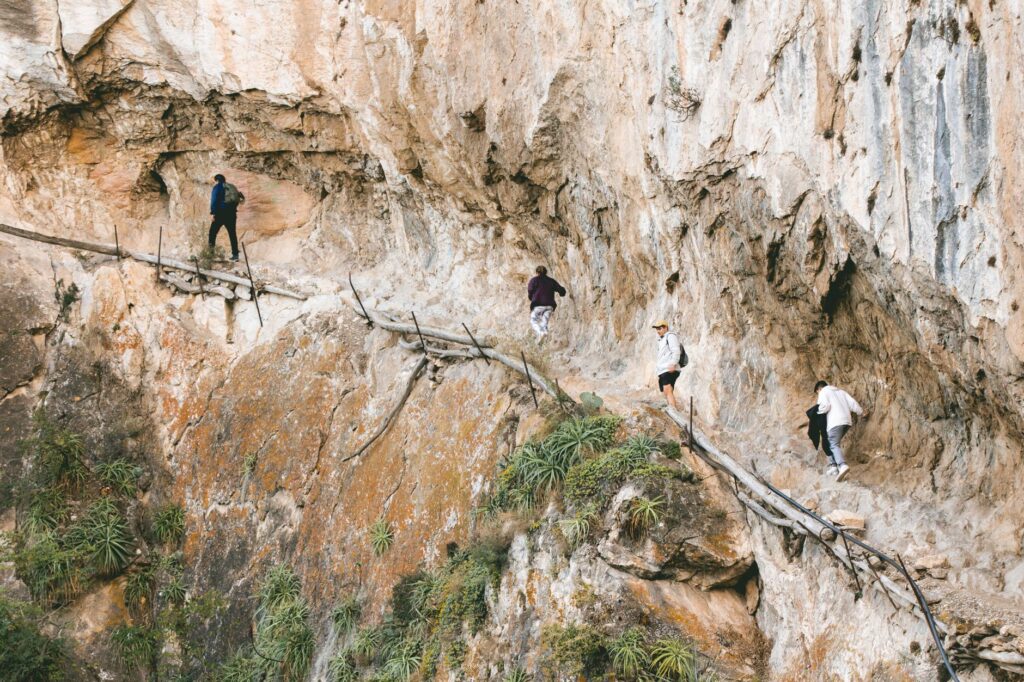
Alongside the terraces, the route reveals elements as unique as the cases de neu (snow houses), circular-domed stone constructions designed to store winter snow that was subsequently distributed to Palma in summer in the form of ice. Hikers also cross lime kilns, watermills, and cobblestone paths flanked by centuries-old holm oak woods (*Quercus ilex*). Every structure tells a story of survival and economic adaptation in an isolated island territory, turning each day of marching into a living lesson in human geography and heritage conservation.
The trail is not a line drawn upon a map, but an ancient dialogue between the gravity of limestone rock and the patience of the hands that shaped it.
Safety, orientation, and physical demands in karstic terrain
tackling the GR 221 does not entail extreme alpine technical difficulties, yet it demands absolute respect for Mediterranean orography. Karstic terrain is characterized by sharp rocks, lapiaz, and small sinkholes hidden beneath shrubby vegetation. A misstep in areas like the Pas de Lloria or near Puig Major can lead to severe injuries due to isolation and irregular mobile phone coverage. Therefore, using telescopic poles with tungsten tips and high-cut hiking boots with high-grip soles is a mandatory standard for any serious trekker.
Trail marking, signaled by red and white long-distance blazes and directional posts from the Consell de Mallorca, is generally excellent along the main sections; however, sudden sea fogs can reduce visibility to zero within minutes in summit zones. Carrying a GPS device with official tracks downloaded and a backup analog compass is essential. Furthermore, regulations within the Serra de Tramuntana Natural Area strictly prohibit wild camping, mandating overnight stays exclusively in authorized refuges or designated camping zones such as Sa Coma d’en Vidal.
Botanical heritage and endemic fauna of the Tramuntana
The ecological richness of the sierra lies in its insular isolation, which has fostered the evolution of numerous plant and animal endisms. Among the most representative botanical species is the pinzell (*Teucrium subspinosum*) and various wild orchid varieties emerging among heather and myrtle brush. In the highest and windiest zones, the xabec (shrubby savin juniper) adopts twisted shapes sculpted by the persistent force of northern winds, demonstrating admirable botanical resilience in the face of deep soil scarcity.
Regarding fauna, the undisputed king of Mallorcan skies is the cinereous vulture (*Aegypius monachus*), one of the largest raptors in the world, which found its last European stronghold of survival in the cliffs of Tramuntana thanks to rigorous reintroduction programs. Observing its majestic flight as it glides over rocky ridges constitutes one of the most intense natural moments of the traverse. Additionally, sightings of wild goats (*Capra hircus*), descendants of feral domestic specimens, are frequent, their constant grazing exerting a direct impact on the dynamics of native vegetation.

Practical guide
- How to get there: Palma de Mallorca Airport (PMI) connects directly with major European capitals. To start the route in Andratx, take urban bus line A1 to Palma’s Intermodal Station and connect there with line 101.
- Best time to visit: From October to May, avoiding summer months due to extreme heat and fire risks.
- Accommodation: Public refuge network managed by the Consell de Mallorca (Can Boi, Muleta, Tossals Verds, Lluc). Mandatory advance booking months ahead on their official website.
- Recommended gear: High-cut trekking boots, telescopic poles, 2-liter hydration system, waterproof rain jacket and windbreaker, first-aid kit, and GPS device with downloaded mapping.
- Permits and restrictions: Wild camping is strictly prohibited. Lighting fires is permitted solely in enabled recreational areas during low-fire-risk periods.
- Drinking water: Not all natural springs are treated or guaranteed. Carrying purification tablets or a portable membrane filter is essential.
- Connectivity: Intermittent mobile coverage in deep ravines; optimal reception points at mountain cols and clear summits.
The silent heartbeat of the Balearic horizon
When the fatigue accumulated from days of marching dissolves into the contemplation of sunset from the Coll de sa Bataia or before the blue immensity of Cap de Formentor, the traverse of the GR 221 reveals its true nature. It is not merely a matter of summiting cols or accumulating kilometers on a map, but of tuning one’s inner rhythm to the ancient heartbeat of a land that has withstood the passage of empires, storms, and extreme droughts. In every stone placed without mortar above the abysses of Tramuntana, the memory persists of those who understood that the beauty of a landscape is not an accident, but the patient fruit of human effort and absolute respect for nature.
The true traveler is not the one who accumulates destinations in memory, but the one who learns to read in silence the scars of the territory they tread.