
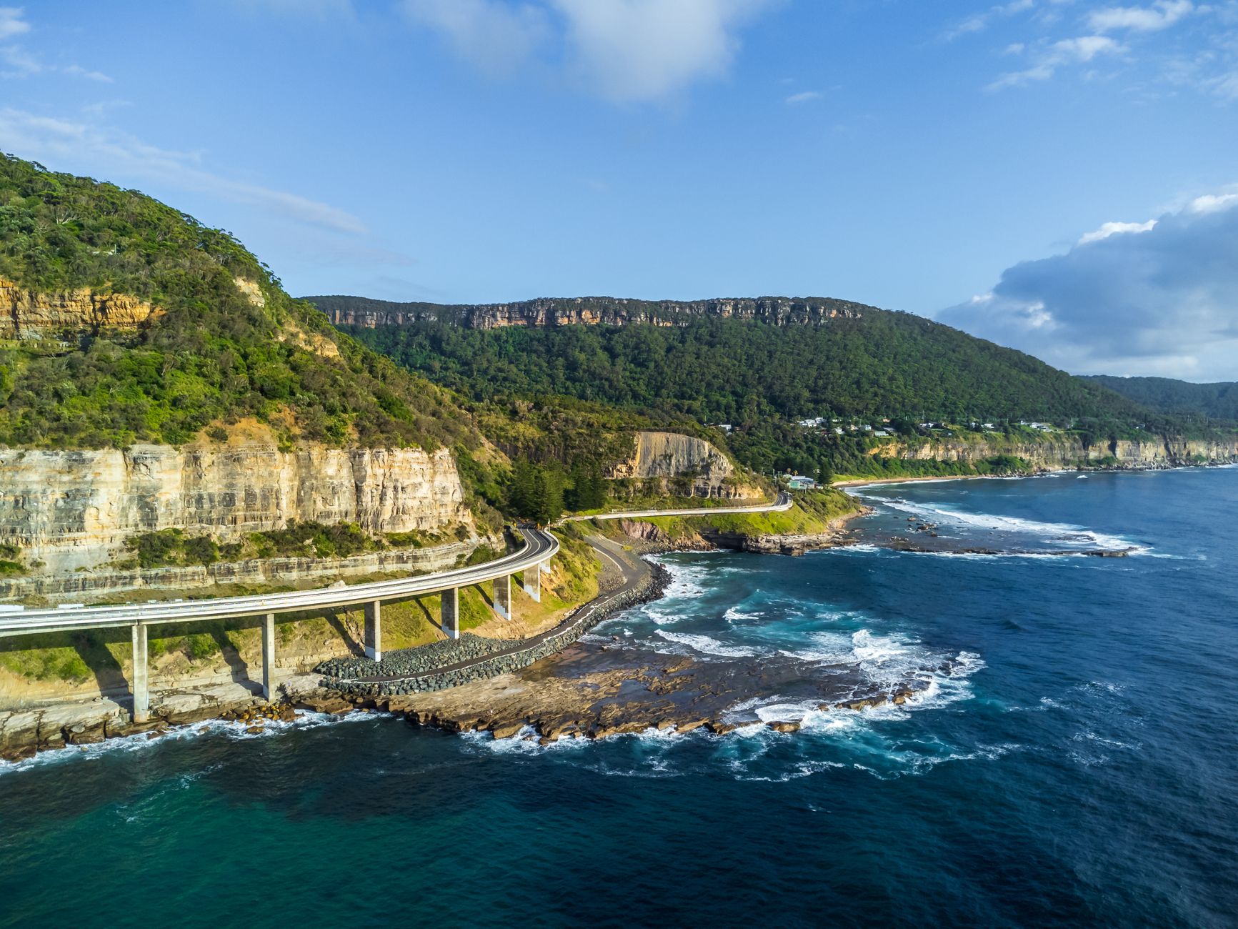

The Great Ocean Road is far more than just one of the world’s most famous scenic drives; it is a feat of civil engineering and a testament to human resilience that snakes along 243 kilometers of Australia’s southeastern coast. Officially registered as the B100 highway, this route connects the Victorian towns of Torquay and Allansford, cutting through limestone cliffs, temperate rainforests, and coastal hamlets that depend entirely on this asphalt umbilical cord. However, its true magnitude lies in its origin: it is the largest war memorial on the planet, built by hand by soldiers returning from the trenches of World War I.
From a technical perspective, the route represents a permanent logistical challenge for the Victoria Department of Transport. The very geography that makes it spectacular—its extreme proximity to the edge of the continent—is also its greatest weakness. Managing this corridor requires constant vigilance against coastal erosion, landslides, and the pressure of a tourist flow exceeding eight million visitors annually. Understanding the Great Ocean Road involves breaking down its infrastructure, its history of sacrifice, and the sophisticated transport network that allows life and commerce to flow in one of Oceania’s wildest corners.
The Genesis of an Asphalt Monument
Construction of the Great Ocean Road began in 1919, driven by the need to provide employment for soldiers returning from the Great War and to connect the isolated communities of the Victorian coast, which until then were only accessible by sea or precarious bush tracks. Under the direction of the Country Roads Board, some 3,000 men worked for thirteen years in extreme conditions. Lacking modern heavy machinery, the road was won from the cliffs using picks, shovels, and explosives, with materials transported by horse-drawn carts on slopes that defied gravity.

This effort was not merely a public work, but a process of national healing. Many of the workers suffered from what we now know as post-traumatic stress disorder, and physical labor in the fresh air, facing the vastness of the Bass Strait, was considered a form of occupational therapy. The original layout was narrow and dangerous, designed for the traffic of the era, but it laid the foundations for an infrastructure that would transform the region’s economy. The official opening in 1932 marked the end of an era of isolation and the birth of an icon that is now an Australian National Heritage site.
«The Great Ocean Road was not merely designed to connect towns, but to heal the spirit of a nation after the Great War.»
Today, the Memorial Arch at Eastern View serves as a physical reminder of this sacrifice. Every time a vehicle passes under its timber structure, it does so on an engineering base that was literally carved into the rock by veteran hands. The logistics of supply during construction were so complex that self-sufficient camps were established along the route, creating small temporary towns that today serve as the foundation for established tourist destinations.
Defying Geology: The Technical Challenge of the Cliffs
From the standpoint of modern engineering, the stretch between Lorne and Apollo Bay is the most critical. Here, the road clings to steep hillsides where volcanic rock and limestone meet the ocean. Ground stability is a constant concern. The Department of Transport utilizes state-of-the-art geotechnical sensors to monitor slope movement. In recent decades, millions have been invested in reinforcing retaining walls and improving drainage to prevent torrential rains from turning the asphalt into a river of mud.

The Twelve Apostles section, near Port Campbell, presents a different challenge: base erosion. The famous limestone stacks are the result of a geological process that never stops. The road must be managed with a long-term vision, understanding that the retreat of the coastline is inevitable. In some spots, the possibility of moving the alignment inland has been raised to ensure connectivity—a decision that would balance logistical safety with the loss of the scenic value that draws travelers.
Mobility Logistics: From V/Line to Private Transport
Connectivity on the Great Ocean Road does not rely exclusively on private vehicles. An intermodal public transport system managed by V/Line, Victoria’s regional transport authority, exists. Trains connect Melbourne with Geelong and Warrnambool, and from these stations, a network of long-distance coaches travels the main highway. This logistics is vital not only for tourism but for residents who need access to health and education services in larger urban centers.
- Rail Connection: The Warrnambool line is the main axis flanking the western end of the route.
- Coach Services: Daily buses operate between Geelong and Apollo Bay, coordinated with train timetables.
- School and Freight Transport: Specific routes ensure the supply of basic goods to communities like Wye River.
- Cycling Infrastructure: Segregated lanes are being developed in specific sections to encourage safe cycle tourism.
Traffic flow management is particularly complex during the peak summer season and events like the Cadel Evans Great Ocean Road Race. The use of Intelligent Transport Systems (ITS) allows drivers to be informed in real-time about travel times and potential closures due to weather incidents. Digital signage and parking management at critical points, such as the Twelve Apostles visitor center, are essential to prevent the road from collapsing under the weight of traffic.
Risk Management: Landslides and Extreme Weather
The Southern Ocean climate is unpredictable and fierce. The Great Ocean Road is exposed to gale-force winds and storm surges that can hurl debris and salt water directly onto the asphalt. Preventive maintenance engineering includes regular culvert clearing and aerial drone inspections to identify loose rocks on the upper cliffs. Following major bushfires, such as the 2015 Wye River fire, the road’s vulnerability increased due to the loss of vegetation that stabilized the slopes.
To mitigate these risks, high-strength steel mesh barriers have been implemented in the most dangerous sections. These structures are designed to absorb the impact of rockfalls without interrupting traffic. Furthermore, emergency protocols between Victoria Police and road services allow for rapid preventive closures when meteorological models predict extreme risk conditions, ensuring that a pleasure route does not become a trap.
Socio-economic Impact on the Victoria Region
The road is the undisputed economic engine of southwest Victoria. Without this infrastructure, industries such as dairy, fishing, and, of course, tourism would struggle to access global markets. Export logistics from the Heytesbury farms rely on the B100 highway and its feeder routes being in perfect condition for heavy truck transit. The balance between commercial and recreational use is one of the central themes in the region’s land-use planning.
«The asphalt here is a fragile border between human ambition and the relentless erosion of the Southern Ocean.»
Local communities, from bohemian Lorne to the fishing hub of Apollo Bay, have evolved around the road. Urban development is strictly regulated to preserve the visual character of the corridor. However, the pressure to improve connectivity often clashes with the need to conserve the natural environment of the Great Otway National Park, which the road traverses. Waste management and water supply for millions of visitors are logistical challenges managed in parallel with road maintenance.
The Future of the Route: Sustainability and EVs
Looking ahead, the Great Ocean Road is adapting to the energy transition. The Victorian government has begun installing a network of fast-charging stations for electric vehicles (EVs) along the route, ensuring that the coastal journey is viable for the next generation of cars. This initiative is part of a broader plan to turn the corridor into a sustainable tourism destination, minimizing the carbon footprint of travel.
Additionally, more durable and eco-friendly paving materials are being explored, including the use of recycled plastics in the asphalt mix. Resilience to climate change is the top priority; sea-level rise models are forcing engineers to rethink bridges and the lowest sections of the road. The 21st-century Great Ocean Road must not only be beautiful but also smart and capable of withstanding an increasingly hostile environment.
Practical guide
To navigate the Great Ocean Road with logistical efficiency, planning according to the season is essential. The recommended direction of travel is east to west (from Torquay toward Allansford), as this places the vehicle in the lane closest to the ocean, making it easier to pull into lookouts without crossing oncoming traffic. It is recommended to dedicate at least three days to cover the full route, allowing for technical stops in Lorne, Apollo Bay, and Port Campbell.

If opting for public transport, the V/Line service requires advance booking for the long-distance coach sections. Tickets can be managed via the Myki card (for trains to Geelong) and paper tickets for the more remote regional sections. It is essential to carry technical clothing for sudden temperature changes, even in summer, due to the influence of Antarctic winds. For drivers, remember that gas stations are scarce in the stretches between small towns; always keep the tank above a quarter capacity.
Regarding safety, the road is winding and requires maximum concentration. Numerous rest areas are designed to combat driver fatigue. It is mandatory to respect speed limits, which vary frequently based on the danger of the section and the presence of wildlife, especially kangaroos and koalas, which often cross the road at dawn and dusk.
Visual closing: The watchman’s solitude
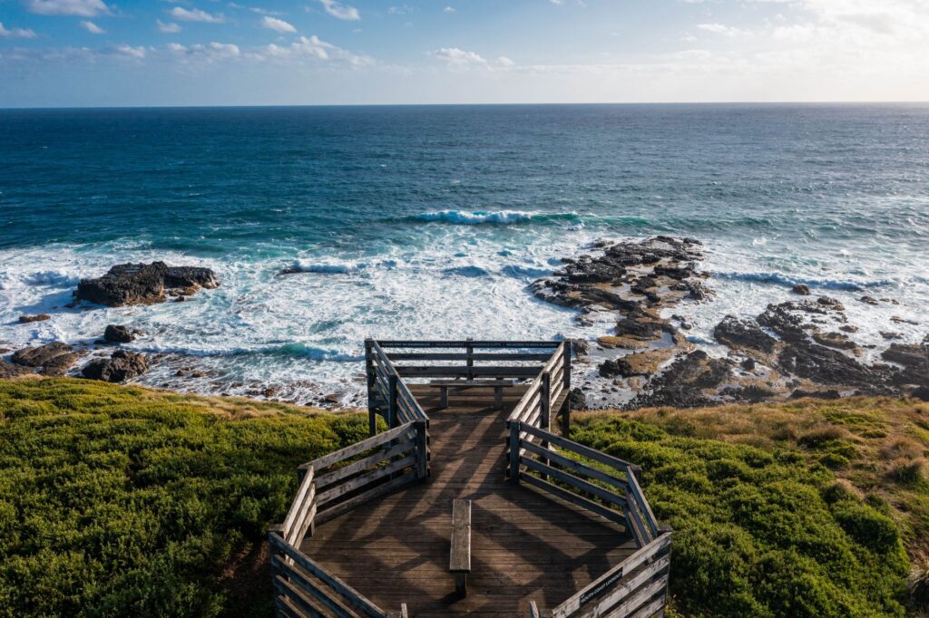
At the end of the journey, near Warrnambool, the landscape softens, and the road moves away from the dramatic cliffs into green meadows. It is here that the traveler understands the Great Ocean Road is more than a destination; it is a process. A photograph of a lonely bench facing the sea at the Bay of Islands captures the emotional essence of the route: a space for contemplation where human engineering yields to the magnitude of the oceanic horizon.


