

Walking across Jordan is not merely completing a hiking route; it is a geological and human reading of a territory that has served as a bridge between civilizations for millennia. The Jordan Trail, a 675-kilometer path winding from the northern ruins of Um Qais to the warm waters of the Red Sea in Aqaba, has established itself as one of the most challenging and rewarding long-distance expeditions in the world. Unlike highly marked European trails, this traverse demands rigorous technical preparation, precise navigation skills, and a deep respect for the desert’s thermal rhythms.
The journey offers a study in contrasts that challenges common preconceptions of the Jordanian landscape. The hiker begins among Roman ruins and green hills reminiscent of the classical Mediterranean, then descends below sea level into the Dead Sea canyons, and finally emerges into the granite and sandstone cathedrals of Wadi Rum. It is a route that requires approximately 35 to 45 days of continuous trekking, divided into eight distinct geographical regions, each with its own microclimate and logistical hurdles. In this report, we analyze the complexity of this route, from critical water management to immersion in the Bedouin culture that serves as the true backbone of the country’s infrastructure.
The Vertical Axis of the Levant: Geography of an Ancient Path
The spine of the Jordan Trail follows the edge of the Jordan Rift Valley, a geological feature that defines the country’s dramatic topography. This location provides a variety of ecosystems that few hikers expect to find in the Middle East. In the north, the Um Qais and Ajloun region features a landscape of ancient olive groves, oak forests, and wheat fields. Here, the terrain is rolling and water supply is relatively straightforward, with frequent villages to replenish provisions. However, as the route moves south, the geography becomes more aggressive and isolation increases exponentially.

Upon entering the Jordan Valley and the central plateaus, the hiker faces the first great wadis (valleys or dry riverbeds). These canyons, cutting through the plateau from east to west toward the Dead Sea, force vertical descents and ascents of hundreds of meters in a single day. Navigation becomes technical, and physical effort multiplies. It is here that the thesis of the traverse shifts: it is no longer just about walking, but about managing energy against a terrain that offers no respite. The transition from the white limestone of the north to the red sandstone of the south marks the beginning of the most iconic and demanding section of the trail.
«The Jordan Trail is not a line on a map; it is a constant conversation between the endurance of your boots and the memory of stones that have seen armies, prophets, and spice caravans pass by.»
Water Logistics: The Critical Challenge of the Desert
In a 675-kilometer traverse through one of the world’s most water-stressed nations, water management is the determining factor between success and medical evacuation. While springs and villages are common in the north, from the Dana Biosphere Reserve onwards, water becomes a strategic resource. Hikers must plan their stages strictly based on water points verified by the Jordan Trail Association. In many sections, it is necessary to carry 6 to 8 liters of water to cover days of extreme heat without intermediate sources.
The use of filtration systems is mandatory, as available sources are often livestock troughs or small Bedouin wells. In addition to filtering, chemical disinfection is recommended to avoid gastrointestinal issues that could compromise the expedition in remote areas. Logistics become complicated in the Wadi Mujib sections and the Wadi Rum desert, where the total absence of natural sources forces hikers to hire logistical support services to place water caches at specific points in the desert before starting the march. This prior planning is what separates a recreational hiker from a long-distance expeditionary.

From Northern Forests to the Dead Sea Canyons
The stretch connecting Ajloun with Fuheis and Salt is an immersion into rural Jordan. Here, the route passes through agricultural communities where hospitality is overwhelming. However, the true technical test begins after leaving the Salt region. The descent into Wadi Zarqa Ma’in offers some of the most spectacular views of the Rift Valley but also introduces the hiker to a much drier and hotter climate. Temperatures can fluctuate by as much as 15 degrees Celsius between the plateau and the valley floor.
The Mujib Canyon section is, for many, the most physically demanding. The terrain is unstable, with shepherd paths that often disappear into brush or loose rock. Solar exposure is constant, and shade is a luxury found only under the occasional acacia tree. It is fundamental to understand that the Jordan Trail is not fully waymarked; the use of GPS tracks and a compass is indispensable. Blindly trusting in finding paint marks can lead to dangerous navigation errors in an environment where a wrong turn can mean hours of unnecessary climbing under the sun.
Petra via the Backdoor: A Triumphant Entry to the Rose City
One of the greatest milestones of the route is the arrival at Petra. While most tourists enter through the main Siq, the Jordan Trail leads the hiker through the mountains of Little Petra (Siq al-Barid) toward the Monastery (Ad-Deir). This approach allows for an unparalleled visual and emotional transition. After days of solitude in nature, seeing the rock-carved facade of the Monastery emerge from the clifftops is one of the most powerful experiences in world hiking.
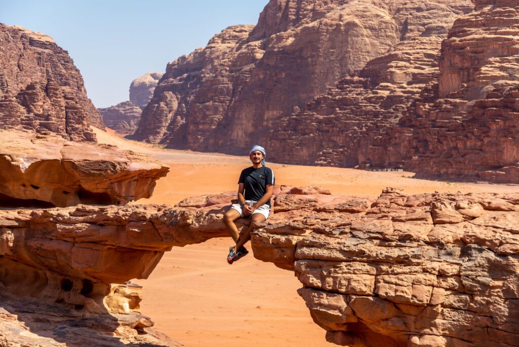
This segment, which crosses from the Dana Reserve toward Petra, has been repeatedly voted one of the best trails in the world by specialized publications. The geology shifts from limestone to granite and then to the famous multicolored sandstone. Permit management is vital here; hikers must possess the Jordan Pass or a valid entry for Petra, as the archaeological site is accessed through a controlled area. It is a reminder that this route not only traverses wild nature but also one of humanity’s most important cultural heritages.
«Crossing the desert is not about conquering space, but about allowing silence and immensity to reconfigure your own priorities.»
The Sandstone Labyrinth of Wadi Rum: Navigating the Void
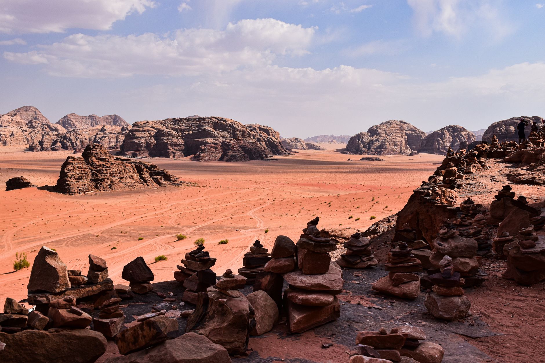
If the north is green and the center is rugged, southern Jordan is pure geological abstraction. Upon entering Wadi Rum, the Jordan Trail plunges into a lunar landscape of red sands and sandstone massifs that seem to melt under the sun. Here, navigation becomes an art. The trail disappears into the sand, and visual references are monumental mountains like Jebel Rum or Jebel Um Ishrin. The heat is relentless, and sun protection, combined with breathable technical clothing, is the only defense.
In this stage, contact with the Bedouins of the Howeitat tribe is essential. Many hikers choose to stay in Bedouin camps or under the stars (cowboy camping). Supply logistics become critical as there are no villages for several days of walking. The sand adds extra physical difficulty; walking on dunes with a 15-kilogram backpack requires a short, steady stride technique to avoid premature muscle exhaustion. It is the segment where self-sufficiency is definitively put to the test.

The Human Factor: Bedouin Hospitality as Infrastructure
Despite the harshness of the environment, the Jordan Trail is a deeply human route. The concept of Karam (hospitality) is rooted in the local culture. It is not uncommon for a hiker to be invited for tea, freshly baked bread, or even to spend the night in a goat herder’s tent. These interactions are not transactional; they are part of a desert code of honor that has protected travelers for centuries.
However, the modern hiker must balance accepting this generosity with the responsibility of not being a burden to communities that often have limited resources. It is advisable to hire local guides in the most remote sections, not only for safety but to support the economy of the villages the route passes through. The Jordan Trail has been designed as a sustainable tourism project that seeks to distribute tourism income beyond hotspots like Petra or the Dead Sea, reaching rural areas that were previously off the tourist map.
Technical Gear and Preparation for Extreme Climates
Gear selection for the Jordan Trail leaves no room for error. Due to the variability of the terrain, mid-cut hiking boots with an excellent grip sole (such as Vibram) are recommended for the loose rock sections. However, lightness is key. Many experienced thru-hikers opt for reinforced trail running shoes to allow the foot to breathe in the desert heat, though this requires more prepared ankle musculature.

The layering system must account for temperatures that can drop below freezing on winter or spring nights in the highlands and exceed 35 degrees during the day in the wadis. A lightweight insulating garment (down or synthetic) for nights and long-sleeved clothing with UV protection for the day are indispensable. One must not forget a specialized first-aid kit, with particular emphasis on blister treatment, oral rehydration salts, and dressings for sunburn. Safety is completed with a satellite communication device (like Garmin inReach), as mobile coverage is non-existent in deep canyons and the heart of Wadi Rum.
Practical guide
- Best Time to Go: The ideal windows are spring (March to May), when wildflowers cover the north, and autumn (September to November). Winter can be extremely cold and rainy (with flash flood risks), while summer is dangerously hot.
- Documentation and Permits: The Jordan Pass is the best investment; it includes the entry visa and access to over 40 tourist sites, including Petra and Wadi Rum.
- Transportation: To reach the start in Um Qais, you can take a bus from Amman or a private taxi. Upon finishing in Aqaba, there are frequent connections back to the capital or international flights.
- Navigation: It is mandatory to download offline maps and GPX files from the official Jordan Trail website. Do not rely on physical waymarking, which is scarce or non-existent in many sections.
- Water and Food: Plan your resupply points every 3 to 4 days. In the south, coordinate water caches in advance if you plan to go fully autonomous.
- Safety: Always inform someone of your daily itinerary. Stay alert to weather forecasts; light rain miles away can cause a deadly flash flood at the bottom of a wadi.
The Echo of the Red Sea: An Emotional Closing
After weeks of dust, rock, and infinite horizons, the first sighting of the Gulf of Aqaba from the southern granite mountains triggers an inevitable catharsis. The final descent toward the Red Sea is a rite of passage. The air becomes denser and saltier, and the deep blue of the water contrasts violently with the ochre of the desert that has been the hiker’s home for hundreds of kilometers. Upon reaching the shore, tradition dictates submersing oneself with the same boots that have traversed the country—a symbolic gesture of purification and closure.
The Jordan Trail leaves a deep mark not only on the footwear but on the traveler’s psyche. It is a traverse that teaches humility before the scale of geological time and the importance of human connection in the most inhospitable places. In the end, what the hiker takes away is not just the satisfaction of having crossed a country on foot, but the understanding that, in the desert, survival depends as much on modern technology as on the ancestral wisdom of those who have always called these sands home. It is, without a doubt, the ultimate adventure in the heart of the Hashemite Kingdom.


