
Origins and Geography of an Ancient Green Corridor
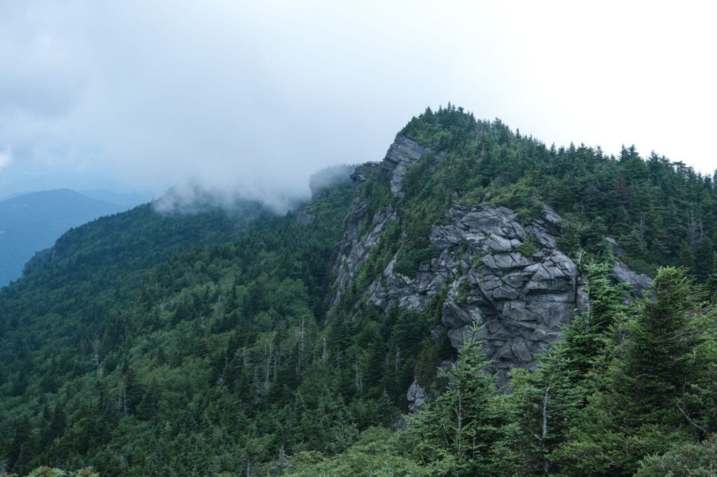
The Appalachian Trail represents one of the most extensive and significant pedestrian corridors on the planet. Spanning approximately three thousand five hundred kilometers, this route winds from the summit of Springer Mountain in Georgia to Mount Katahdin in Maine, crossing fourteen states along the eastern United States. The mountain range crossed by this itinerary is not distinguished by perpetual snow or sharp alpine peaks, but by its extraordinary geological antiquity. The Appalachians are mountains worn down by time, shaped over hundreds of millions of years by relentless erosion, which imparts a dense, forested, and deeply intimate character to the landscape.
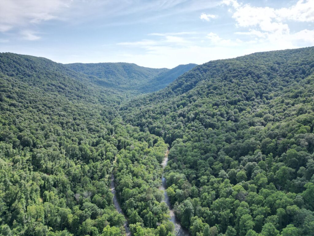
Throughout this corridor, hikers immerse themselves in temperate deciduous forests dominated by oaks, maples, and balsam firs, depending on latitude and altitude. The topography is characterized by constant and abrupt ups and downs, popularly known among the hiking community as the rollercoaster profile. Each day involves accumulating notable positive and negative elevation gains, frequently exceeding one thousand meters of ascent across terrain where exposed rock, damp roots, and perpetual mud demand constant attention. Farther removed from the open expanse of western North American cordilleras, the Appalachians offer a continuous green tunnel where distant horizons are revealed only on rare cleared summits or forest fire towers.
The history of this trail is inextricably linked to the visionary effort of Benton MacKaye, who in nineteen twenty-one proposed the creation of a pathway connecting eastern highlands for recreation and conservation. Formally inaugurated in nineteen thirty-seven, the trail is jointly managed today by the National Park Service, the USDA Forest Service, the Appalachian Trail Conservancy, and numerous local volunteer organizations. This collaborative management model ensures that the path remains open, blazed with white paint marks, and protected from the uncontrolled urbanization threatening the peripheral forests of the eastern United States.
Logistical Planning and Seasonality of the Route
Undertaking the complete traverse of the Appalachians, known in hiking jargon as a thru-hike, requires meticulous planning ranging from weather window selection to precise calculation of food supplies and equipment. The vast majority of expeditioners opt for a south-to-north direction, departing from Georgia between March and April. This temporal window seeks to harness the arrival of spring in the south while avoiding extreme winter cold, while simultaneously allowing for the final summit in Maine before autumn snows close access to Mount Katahdin, typically by mid-October.
Backpack weight management constitutes a decisive factor for expedition success. Given that the trail regularly intersects rural roads and small towns, the resupply strategy is divided into segments lasting three to five days. Hikers can mail resupply packages via post offices and affiliated mountain shops, or purchase provisions directly in supermarkets located within a few kilometers of the path. Reducing base equipment weight below ten kilograms is fundamental to preventing chronic injuries in knees and ankles, joints subjected to severe stress due to the constant inclination of the terrain and the hardness of the stony soil.
The climate in the Appalachians is notoriously variable and unpredictable. In southern states like North Carolina and Tennessee, high elevations such as the Great Smoky Mountains can register sub-freezing temperatures and snowstorms even in mid-spring. As the route progresses northward toward New England and Maine, hikers must face humid, hot summers plagued by insects, followed by an early autumn characterized by persistent rains, freezing winds, and a drastic reduction in daylight hours. Mental flexibility to accept consecutive days of rain and mud is just as vital as high-end waterproof gear.
The Shelter Network and Hut Culture Along the Path
One of the most distinctive elements of the Appalachian Trail is its shelter infrastructure, widely known simply as shelters. Scattered throughout the entire route at intervals ranging from ten to twenty-five kilometers, these three-sided wooden or concrete-floored structures provide free protection against adverse weather conditions. The shelter network acts as the social heart of the route, a meeting point where hikers share stories, repair equipment, evaluate upcoming stretches, and forge bonds of camaraderie that frequently endure long beyond the journey.
Adjacent to each shelter, visitors typically find a natural spring water source, a composting or dry-pit privy, and a designated tent camping area if the shelter reaches maximum capacity. The unwritten code of the shelters prioritizes solidarity and mutual respect: nighttime silence, proper waste management, and the prohibition of saving space for absent companions are fundamental principles ensuring harmonious coexistence in confined spaces. Furthermore, logbooks are routinely kept near shelters—notebooks where expeditioners record their passing, words of encouragement, and brief chronicles of trail conditions.
The community support culture known as trail magic represents another deeply endearing facet of the Appalachian experience. Local residents, veteran hikers known as trail angels, and route supporters spontaneously deploy at road crossings to offer fresh food, beverages, mechanical assistance, or words of encouragement to hikers. This altruistic phenomenon reinforces the connection between rural eastern towns and the global hiking community, turning the traverse into a constant exercise of human exchange and selfless generosity amidst the wilderness.
Water Management and Wildlife Safety Protocols
Water supplies along the Appalachian Trail are abundant compared to western arid routes, but their microbiological purity must never be taken for granted. Springs, streams, and rivers crossing the itinerary can be contaminated by pathogenic microorganisms, notably giardia and cryptosporidium, stemming from livestock presence in adjacent agricultural zones or local wildlife. For this reason, the systematic use of purification methods—whether hollow-fiber membrane filters, chemical treatments with chlorine dioxide, or ultraviolet light sterilization systems—remains a mandatory and non-negotiable protocol on every single day.

Regarding wildlife, the American black bear constitutes the largest mammal present in the Appalachian forests. Although these animals are generally elusive and avoid human contact, their attraction to food forces hikers to exercise extreme caution. Secure food storage is a legal requirement in numerous trail sections, demanding the use of certified rigid containers or hanging provisions bags from high branches using ropes and pulleys, away from both tree trunks and the ground. Likewise, hikers must carry bear spray and understand basic techniques to deter an individual in the event of an accidental encounter.
The presence of disease-vector insects, such as ticks transmitting Lyme disease, represents a silent yet persistent health hazard across the entire eastern strip of the United States. Prevention requires prior treatment of clothing and gear with permethrin, daily application of DEET or picaridin repellents, and thorough bodily checks at the end of each day. Understanding initial symptoms of tick-borne infections and carrying a well-stocked first-aid kit helps mitigate risks associated with prolonged exposure in damp, dense forested environments.
The Technical Terrain of New England and the White Mountains Challenge
As the route pushes into the New England states, the character of the trail shifts radically. In Massachusetts, Vermont, and especially New Hampshire, the Appalachians leave behind the gentle southern undulations to transform into a vertical labyrinth of granitic rock, extreme elevation changes, and weather conditions typical of high alpine environments. The White Mountains of New Hampshire harbor legendary stretches for their technical difficulty, where hikers must literally scramble up slippery rock walls and negotiate chaos of massive boulders known as boulder fields, where a single misstep can lead to serious injuries.
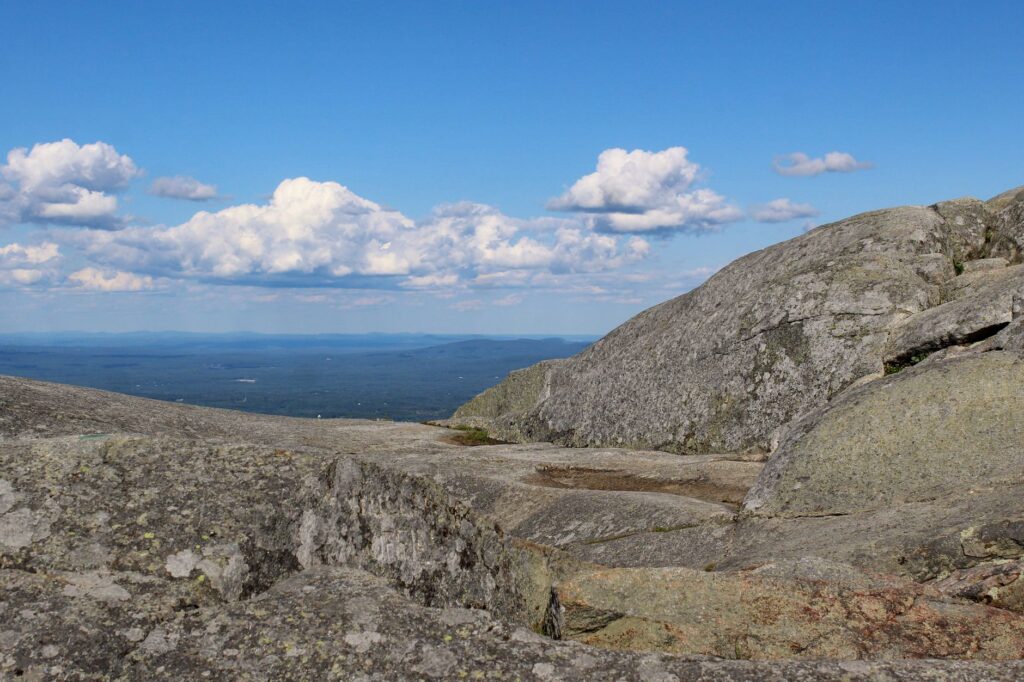
At these elevated latitudes, above treeline, alpine vegetation is extremely fragile and vulnerable to erosion caused by human trampling. Local regulations mandate camping exclusively on designated wooden platforms or near high-mountain huts managed by the Appalachian Mountain Club, and staying strictly on rocks marked with stone cairns. Summer thunderstorms form rapidly on these exposed summits, compelling expeditioners to start early every morning to clear alpine sections before midday and avoid extreme vulnerability to lightning strikes.
The physical and mental effort accumulated after thousands of kilometers finds its ultimate test in New Hampshire. The steep slope of Mount Washington, famous for recording some of the highest wind speeds ever measured on Earth’s surface, tests the psychological fortitude of any hiker. Overcoming this stretch demands not only optimal physical conditioning, but also exceptional resilience to overcome chronic fatigue, persistent humidity, and the relentless hardness of terrain that grants no quarter until reaching the border with Maine.
The Final Stretch and the Apotheosis of Mount Katahdin
The final leg of the Appalachian Trail traverses the remote and wild forests of Maine, a territory where civilization recedes and nature reclaims absolute dominance. This section includes the crossing of the Hundred-Mile Wilderness, an area completely devoid of roads, stores, or urban infrastructure, where expeditioners must carry enough food in their backpacks for total self-sufficiency of at least one week, alongside confronting major river crossings that can become impassable following heavy rainfall episodes.
The geographical and emotional culmination of the traverse materializes in the ascent of Mount Katahdin, located within Baxter State Park. Katahdin’s summit, known as Baxter Peak, marks the northern terminus of the trail. The final climb via the classic Knife’s Edge route constitutes a true test of balance and cool-headedness: a sharp rock ridge with significant drops on both sides, where hikers must use both hands and feet to advance over stone swept by North Atlantic winds. It is a fitting finale for an expedition demanding months of constant effort and absolute dedication.

Upon reaching the iconic wooden sign crowning the mountain, emotions blend between the euphoria of athletic achievement and melancholy over the end of a nomadic, simplified lifestyle. Hikers completing the entire journey join an exclusive community that has learned to read the landscape letter by letter, step by step, across one of the oldest ridges on Earth. Returning to daily life is approached with a renewed perspective, shaped by the simplicity of walking with belongings on one’s back, the generosity of strangers, and the intimate realization that human endurance finds its furthest limits in deep communion with primeval forests.
Practical guide
- Best Season for Full Traverse: Late March to mid-October for a south-to-north (NOBO) direction, aiming to avoid extreme winter in Georgia and early snows in Maine.
- Permits and Regulations: Registration with the Appalachian Trail Conservancy is mandatory, along with strict adherence to camping regulations in state parks such as Baxter in Maine and Great Smoky Mountains in Tennessee.
- Recommended Basic Gear: Fifty to seventy-liter backpack, sleep system with water-resistant treated down sleeping bag, lightweight tent or public shelter utilization, and membrane water filtration system.
- Resupply and Logistics: Plan postal resupply packages every five to seven days, utilizing rural post offices and affiliated outfitters located along the route.
- Safety and Health: Systematic use of permethrin-treated repellents to prevent tick-borne diseases, carrying certified bear-resistant food storage containers, and maintaining an advanced first-aid kit for blister and joint injury care.
The green silence of the Appalachians transcends the mere accumulation of kilometers or the completion of a continental sporting challenge. In an era dominated by digital immediacy and constant noise, immersing oneself in this vegetable tunnel for months offers an irreplaceable space for introspection. Each sunrise among ancient oaks and each shared sunset on the wooden floor of a remote shelter remind us of the exact scale of human beings facing the patient immensity of nature. At the end of the road, when worn-out boots rest at the foot of Mount Katahdin, the true treasure is not the symbolic medal or the photograph beside the wooden sign, but the intimate certainty of having recovered, step by step, the capacity to listen to the deep heartbeat of the Earth.