
Introduction to the Northern Outpost and Its Insular Geography
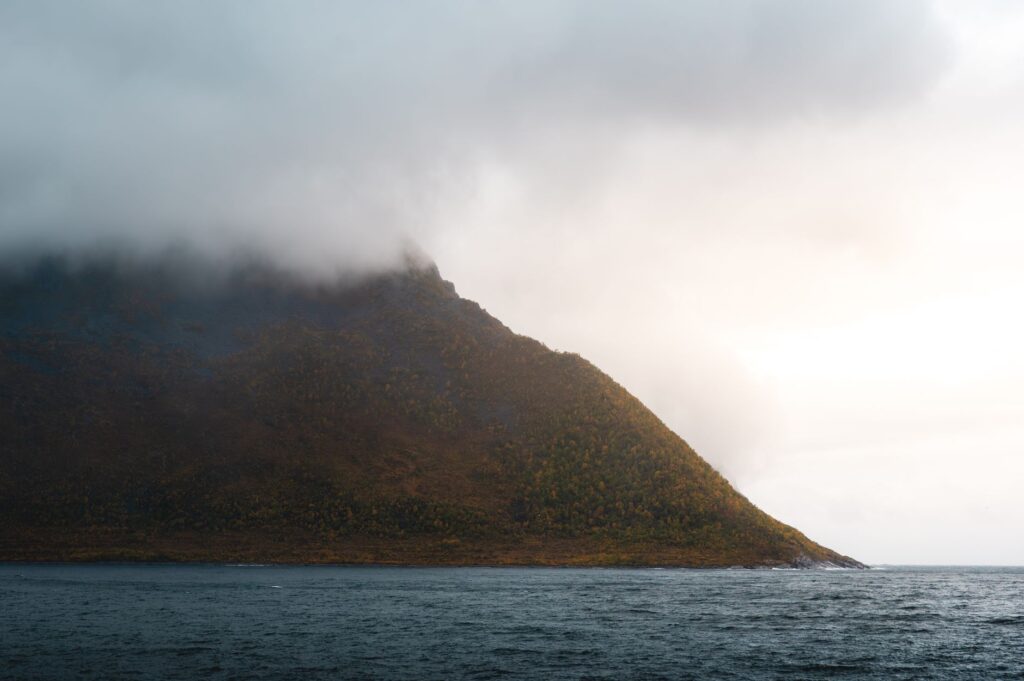
The Faroe Islands archipelago, situated in the North Atlantic between Iceland, Norway, and Scotland, represents one of the most fascinating engineering and mobility challenges in Europe. Eighteen major islands, sculpted by glacial erosion and battered by gale-force winds for much of the year, are home to a community that has transformed the hostility of its environment into a constant exercise in logistical adaptation. With an abrupt topography where basalt cliffs plunge vertically into a mist-darkened sea, the economic and social survival of this territory depends strictly on an intermodal transport network as sophisticated as it is fragile.
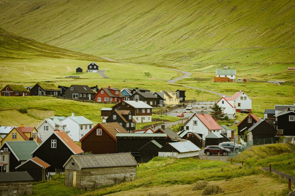
For centuries, isolation was the norm, and communication between coastal settlements, known as bygdir, relied on rowing boats and mountain paths that became nearly impassable in winter. Today, modernity has arrived in the form of neon-lit subsea tunnels, ferries challenging unpredictable currents, and a public helicopter network acting as a medical and postal lifeline when weather grounds all other transport. This report examines the intricate machinery holding these islands together and analyzes the challenges of a transport model subjected to climatic pressure and the steady growth of international tourism.
The Subsea Tunnel Revolution and Asphalt Beneath the Sea
The most radical transformation of Faroese mobility over the past two decades stems from subterranean engineering. Connecting islands separated by deep fjords and open sea channels required abandoning costly traditional ferries in favor of state-of-the-art subsea tunnels. Pharaonic projects such as the Vágatunnilin and, more recently, the impressive Eysturoyartunnilin crossing—famous for housing the world’s first subsea roundabout with an artistic light installation—have completely redesigned the travel time map across the archipelago.
These tubes of concrete and basalt rock descend hundreds of meters below the seabed for much of the year, reaching gradients of up to nine percent. The investment, driven by both public capital and electronic toll systems, has brought the periphery closer to the capital, Tórshavn. However, this reliance on underground asphalt raises questions about safety in the event of serious accidents miles from the surface, vulnerability to saltwater leaks, and power supply cuts affecting ventilation and emergency evacuation systems.

Faroese engineering does not seek to tame nature, but rather to negotiate permanently with its geological violence through galleries of living rock and reinforced concrete.
Despite these advances, maintaining these infrastructures absorbs a substantial share of the autonomous budget. Fractured rock formations demand constant monitoring, and marine corrosion severely tests metal anchors. For local residents, the tunnel has meant the end of winter isolation, but it has also altered the commercial fabric of smaller villages, where road traffic diverts travelers toward major urban centers without stopping in rural communities.
The Ferry Fleet: The Maritime Pulse Between Fierce Tides
While tunnels solved connections between central islands, maritime transport remains the sole access route for peripheral islands and heavy cargo supplying the salmon farming and livestock industries. The state-owned company Strandfaraskip Landsins operates a fleet of robust ferries specifically designed to withstand the rough seas of the North Atlantic and dock at exposed piers where tides can fluctuate several meters within hours.
Navigating routes such as the crossing from Gamlarætt to Sandoy or the journey to the remote island of Suðuroy requires millimetric precision from captains. Tidal currents, known locally as fjøru and flóð, generate whirlpools capable of deflecting large vessels if departure windows are not calculated with scientific exactness. On board, passengers experience the constant rolling of a sea that rarely stays calm, while vehicles are lashed down with steel chains to prevent shifting in the cargo holds.
The ferry is not merely a tourist transport, but the floating umbilical cord carrying everything from fuel and machinery to the last postcard destined for the most isolated enclaves.
The future of this maritime fleet faces an unavoidable ecological transition. The push to reduce carbon emissions has led local authorities to project hybrid and electric vessels, a major challenge due to long distances and the power required to operate in extreme weather conditions. Modernizing docks and installing high-capacity charging points in exposed ports represent a considerable technical and financial hurdle for a small population administration.
Atlantic Airways Helicopters: The Cliffside Aerial Lifeline
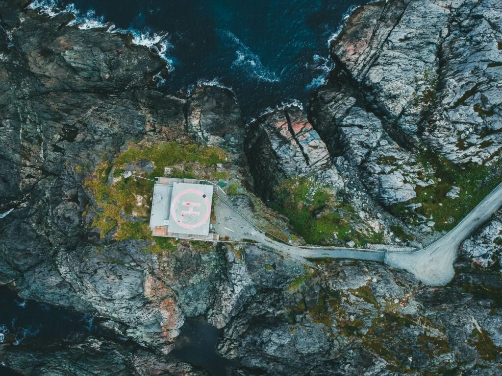
When winds blow with hurricane force or snow blocks mountain roads, the Faroe Islands resort to their most emblematic service: the helicopter fleet operated by Atlantic Airways. Subsidized by the government as an essential public service, these aircraft are not a tourist luxury, but a vital transport tool for residents of islands like Mykines or Koltur, where there are no road connections or safe ferry docks during winter storms.
The reservation system systematically prioritizes local residents’ needs—transporting medicines, on-call doctors, and commuting for work or education—over traveler demand. Pilots operate in frequently zero-visibility conditions, guided by advanced instrumentation and deep knowledge of local topography, where downdrafts around cliffs can destabilize aircraft within seconds.
Heliports are, in most cases, circular concrete pads wedged between hills or at the edge of marine abysses. The logistics of maintaining these bases in locations accessible only by air or sea underscore the complexity of a system where light aviation fulfills an irreplaceable social function. For travelers fortunate enough to secure a seat, the flight offers a top-down perspective of the fjords, revealing the true scale of a territory dominated by verticality and water.
Exterior Road Infrastructure: Cornice Roads and Suspension Bridges
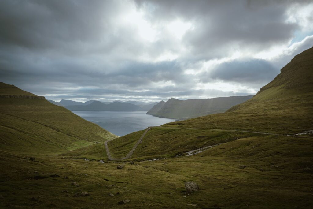
Outside the tunnels, the Faroese road network is a masterclass in civil engineering adapted to mountain cornices. Narrow single-lane stretches with passing bays every few meters meander alongside precipices where crash barriers are often dry-stone walls. Driving these routes demands constant attention to falling basalt blocks loosened by freeze-thaw cycles or the sudden presence of sheep grazing in the middle of the asphalt.
Bridges connecting minor islands, such as the crossing between Streymoy and Eysturoy or the viaduct toward Borðoy, are metal structures designed to withstand extreme crosswinds. Speed limits are frequently strict, and heavy vehicle traffic is restricted when gusts exceed structural safety thresholds. Highly reflective road signage adapted to winter twilight serves as the sole guide on nights when darkness and dense fog reduce visibility to under two meters.
Maintaining these roadways involves the constant use of snowplows and salt trucks during cold months, although in many exposed areas, snow is simply allowed to compact into an ice layer navigated with mandatory studded tires. Integrating the road network with urban centers has enabled a notable increase in daily freight flow, ensuring fresh fish reaches packaging and export hubs within hours of capture.
The Impact of Mass Tourism and Transport Node Congestion
Over the past decade, the archipelago has experienced an exponential rise in visitors drawn to its pristine nature and romantic isolation. This boom has tested the carrying capacity of transport infrastructure originally designed for a small, stable population. During summer months, main ferries operate at full capacity, forcing tour operators and local residents to book spaces months in advance.
Roads leading to iconic enclaves such as Lake Sørvágsvatn or the village of Gásadalur suffer unusual congestion, and the scarce available parking overflows, causing trail erosion and tensions with local communities. The autonomous government has begun debating specific tourist taxes intended to fund road wear and subsidize collective public transport modernization.
Similarly, Vágar Airport, the archipelago’s sole international air gateway, has expanded its runway and facilities to accommodate larger aircraft from Copenhagen, Reykjavik, Edinburgh, and Paris. However, its location on a plateau exposed to strong crosswinds continues to cause frequent cancellations and diversions, reminding travelers that nature imposes its own rules on global connectivity.
Practical guide
Planning a journey and moving through the intermodal labyrinth of the Faroe Islands requires logistical rigor, weather flexibility, and deep respect for local safety rules.
How to get there: Air access is exclusively through Vágar Airport (FAE), operated primarily by Atlantic Airways and partner airlines. By sea, Smyril Line connects Tórshavn with Denmark and Iceland via the Norröna ferry, ideal for travelers bringing their own vehicles.
Internal transport: Car rentals must be booked months in advance, choosing models with adequate traction for steep inclines. Using tolled subsea tunnels incurs an automatic charge usually billed by rental companies at contract end; check if the electronic toll tag is included.
Local navigation and flights: Schedules for ferries (managed by Strandfaraskip Landsins) and helicopters (Atlantic Airways) are subject to constant weather modifications. Always check official apps on the day of travel and keep at least a 24-hour buffer before international return flights.
Driving rules and safety: Strictly obey speed limits and yield at single-lane tunnel passing bays (mótsøla). Headlights are mandatory 24 hours a day, and stopping on unapproved road shoulders for photography is prohibited.
Emotional Epilogue Facing the Atlantic Immensity
Clinging to the edge of a pier on Borðoy island, with the muffled sound of crashing waves striking concrete pilings and the sky merging into an indistinguishable grey with the marine horizon, one realizes traveling through the Faroe Islands is, above all, an exercise in humility. Here, speed is not a conquest over space, but a truce negotiated with the fury of the elements. Every tunnel excavated in basalt darkness, every ferry crossing defying tidal currents, and every helicopter rotor slicing through fog represent the unbreakable determination of a community bound to its roots.
In this northern outpost, transport ceases to be a mere functional service and becomes the living narrative of human endurance. The threads of steel and asphalt connecting these eighteen islands not only carry goods and passengers, but sustain the fragile identity of a people who have made isolation their home and mobility their greatest act of faith.