Introduction to Orkney’s Northern Labyrinth
At the northernmost tip of Great Britain, where the waters of the North Sea merge with the relentless fury of the Atlantic Ocean, the Orkney archipelago stands as a fragmented territory where human mobility has never been a trivial matter. Far from the idyllic image of southern archipelagos, this collection of islands demands uncompromising precision engineering to unite communities that, for centuries, have relied on the skill of their mariners and the solidity of their road infrastructure. Scapa Flow, the vast marine basin sheltered by rings of islands, serves not only as a landmark of modern naval history but also as the geographical axis governing the daily flow of people, goods, and energy in this remote Scottish outpost.
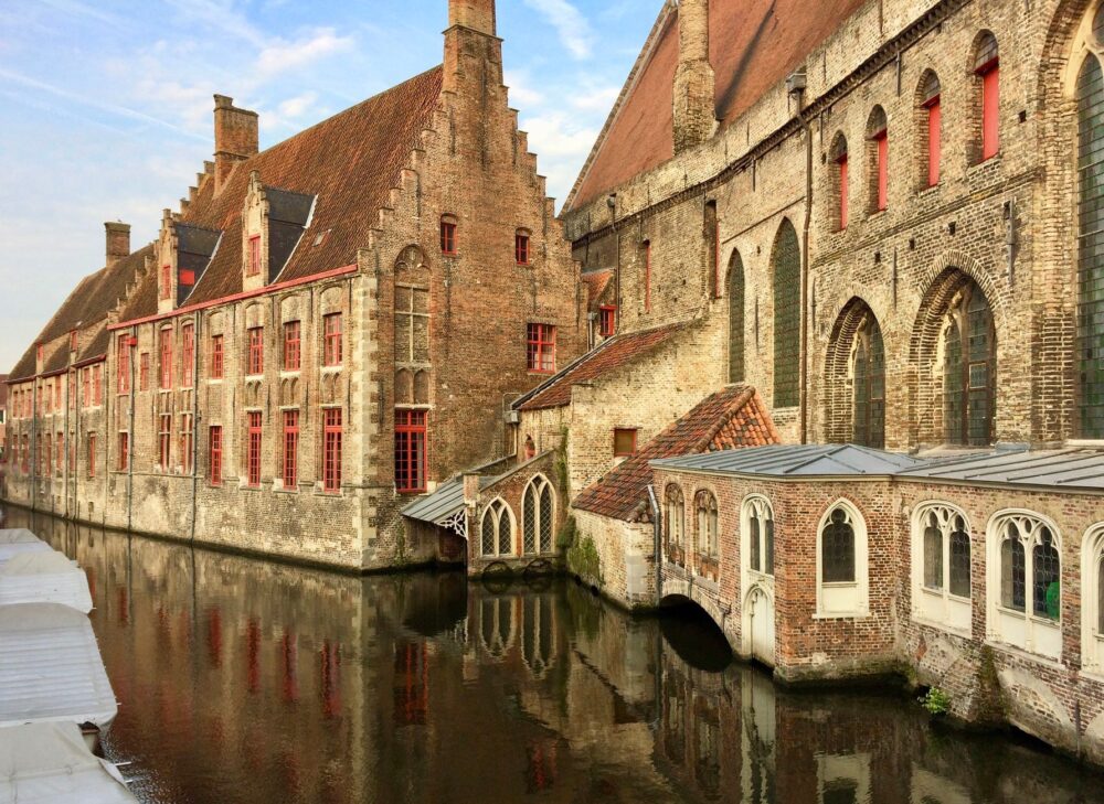
Modern connectivity in Orkney represents the culmination of a millennial dialogue between insular isolation and the imperative need for communication. From early Neolithic settlements crossing these channels in skin-covered boats to the modern tilting ramps of contemporary ferries, community survival has been tied to mastering the tides. This report examines how the network of artificial causeways known as the Churchill Barriers and the fleet of inter-island ferries shape one of the most unique and demanding transportation geographies in northern Europe.
The Military Genesis of the Churchill Barriers
The most decisive infrastructural milestone in shaping the territorial layout of southern Orkney is rooted in the Second World War. Following the torpedoing of the battleship HMS Royal Oak in October 1939 by a German U-47 submarine inside Scapa Flow, the British Admiralty realized that the eastern approaches had to be blocked permanently. The solution adopted was not merely naval, but large-scale civil engineering: the construction of four submerged causeways connecting Mainland to the islands of Burray and South Ronaldsay, utilizing millions of tons of quarried rock and concrete blocks.
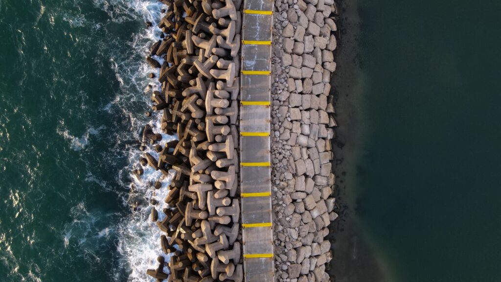
The construction of these structures, partly entrusted to Italian prisoners of war who subsequently erected the celebrated Italian Chapel on Lamb Holm, completely transformed the hydrography and mobility of the archipelago. What began as a purely defensive measure evolved over the decades into the terrestrial umbilical cord that today enables smooth vehicular transit without relying solely on navigation through stormy straits. The causeways not only halted tidal currents but permanently rewrote the socioeconomic map of South Ronaldsay, integrating it into the daily pulse of Kirkwall.
The stone causeways did more than seal the strategic approaches of Scapa Flow; they fused forever the geographic destiny of several islands once separated by roaring Atlantic currents.

Road Engineering Against the North Sea Gales
Maintaining a road that simultaneously acts as a breakwater against monumental oceanic storms requires continuous and specialized maintenance. The Churchill Barriers are permanently exposed to salinity, the impact of waves exceeding ten meters in height during winter gales, and the relentless corrosion of marine elements. The engineers of the Orkney Islands Council operate under a continuous monitoring protocol, ensuring that every displaced armor block and asphalt fissure is repaired before the Scottish winter compromises the stability of the alignment.
The original design, based on a core of quarried rubble covered by massive rock-armor slabs, has demonstrated remarkable flexibility against the kinetic energy of wave action. However, the insular road network extends far beyond these major historical arteries. Secondary roads winding across Mainland and cutting toward Rousay or Westray exhibit a sinuous profile adapted to the topography of heather moors and red sandstone cliffs known as Old Red Sandstone, where lateral drainage is the key to preventing frequent rainfall from destroying the asphalt subbase.
The Cabotage Fleet and Tidal Ferries
Despite the efficiency of the land causeways, the Orkney archipelago remains utterly dependent on its ferry fleet, operated primarily by Orkney Ferries. These vessels, engineered with robust hulls and azimuthing propulsion systems, connect the outer islands—such as Eday, Stronsay, Sanday, and North Ronaldsay—with the central port of Stromness and the Hatston pier in Kirkwall. The scheduling of these routes does not respond to rigid continental timetables, but rather to a complex choreography dictated by tidal currents that reach notable speeds in local narrows.

The captains of these ferries must daily contend with adverse weather conditions, gale-force northern winds, and visibility frequently reduced by sea fog banks known locally as haar. The port infrastructure supporting this service includes adjustable hydraulic ramps that compensate for tidal variations of up to four meters, ensuring the safe loading of livestock, fuel supply trucks, and passengers. This domestic maritime transport system constitutes the true lifeline preventing the demographic isolation of smaller communities.
The Energy Transition in Insular Transport
In recent years, the challenge of connectivity in Orkney has evolved toward sustainability and the decarbonization of transport. Due to its privileged geographical location regarding wind and tidal energy resources, the archipelago has become an advanced testing ground for hybrid and electric maritime mobility. The Iona project and local initiatives seek to gradually electrify the short ferry fleet, utilizing locally generated power from tidal turbines installed in the hazardous Fall Warness strait.
This transition is not without severe technical hurdles. The energy demands of a ferry operating in turbulent waters require high-density batteries and ultra-fast charging points at docking piers, infrastructures demanding significant investment in local electrical grids. Concurrently, private electric vehicles driving across the islands face the reality of reduced range during winter months due to intensive cabin heating, forcing the island council to deploy public charging points even in the most remote enclaves of Rousay and Hoy.

Submerged Industrial Heritage and Transport Archaeology
The landscape of mobility in Orkney is steeped in historical layers that transcend current operations. Beneath the waters of Scapa Flow lie the wrecks of the German High Seas Fleet scuttled in 1919, a naval graveyard that now attracts technical divers worldwide, generating a specialized tourism economy entirely dependent on dive support vessels based in Stromness. These recreational and research craft utilize the same historical piers that once served Royal Navy minesweepers.
Likewise, the vestiges of old peat piers in coastal zones and the remains of short-lived industrial tramways evidence that transport in the archipelago has always been conditioned by a scarcity of forest resources and the necessity of extracting fuel from interior bogs. Every abandoned dry-stone pier in a deserted cove tells the story of a community attempting to overcome insular constraints through the brute force of manual labor and the exploitation of local resources.

Socioeconomic Impact of the Road Network on Local Communities
The consolidation of transport infrastructure has redefined the social and economic fabric of the archipelago. In the past, each island functioned as a self-sufficient microcosm highly vulnerable to crop failures or external supply shortages. Today, physical interconnection allows educational, medical, and commercial services to be efficiently centralized in Kirkwall without residents of smaller islands losing their permanent residency status.
However, this constant flow also introduces demographic dilemmas. Ease of travel has accelerated population centralization on Mainland, gradually depopulating minor islets and forcing local authorities to heavily subsidize transport services to prevent the definitive demographic collapse of historic communities. Contemporary island economy thus debates between the advantages of modern logistics and the preservation of the unique cultural identity generated by historical isolation.
Practical guide
- Getting There: Access to Orkney is primarily via NorthLink Ferries services connecting Scrabster (Thurso) to Stromness, or Aberdeen to Kirkwall, crossings operating year-round but subject to weather cancellations.
- Inter-Island Transport: Orkney Ferries operates regular passenger and vehicle services to the northern and southern islands; vehicle reservations are mandatory in advance, especially during the summer season.
- Driving the Causeways: When crossing the Churchill Barriers and secondary roads, exercise extreme caution regarding strong crosswinds and adhere to speed limits due to occasional loose livestock.
- Weather and Planning: Always consult the local meteorological service and road status alerts before embarking on long journeys across exposed coastal areas.
The Silence of Tides at Stromness Piers
When evening falls over the historic port of Stromness, the hustle and bustle of scheduled ferries subsides, yielding to profound silence broken only by the rhythmic splashing of water against basalt stone pilings. In this outpost where mainland earth seems to surrender before the vastness of the Atlantic, connectivity is not a simple matter of asphalt and engines, but a daily pact between human frailty and the indomitable energy of the sea. The causeways and piers stand as monuments to tenacity, reminding us that uniting islands has never meant building roads against the sea, but learning to live alongside its tide.