
Introduction to the Insular Labyrinth of the Deep South
The Chiloé archipelago, situated at the northern fringe of Chilean Patagonia, stands as a territory where geography has historically dictated the rules of human survival. Separated from the mainland by the Chacao Channel, this main island and its dozens of smaller satellites form a transitional ecosystem where temperate rainstorms merge with marine channels subject to violent currents and unpredictable tides. For centuries, connectivity across this region relied not on paved highways or major civil engineering works, but on the ancestral mastery of sailing, rowing, and the construction of native hardwood watercraft.
Today, the logistical challenge of integrating Chiloé into national and international transport networks intersects with the imperative to preserve a unique cultural heritage, recognized in several expressions as a UNESCO World Heritage site. This report examines how ferry systems, minor cabotage routes, gravel rural roads, and larch-shingle architecture sustain the daily life of communities that continue to interpret their territory through the relentless rhythm of the sea.
The Northern Gateway: The Chacao Channel and Crossing Engineering
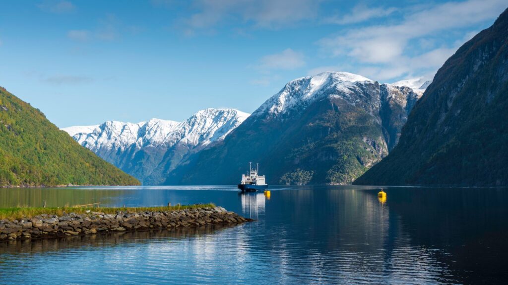
The umbilical cord connecting the main island of Chiloé to the American mainland is the Chacao Channel, a roughly two-kilometer-wide stretch of water where the Pacific Ocean meets the Reloncaví Sound. Currents in this passage can exceed nine knots, generating whirlpools and navigational hazards that have tested mariners and engineers for generations. Traditionally served by passenger launches and shingle-built rowing boats, the crossing evolved into a mechanized system of double-ended roll-on/roll-off ferries capable of transporting heavy vehicles, tour buses, and commercial freight on continuous twenty-five-minute transits.
Port infrastructure at both terminals—Pargua on the mainland and Chacao on the island—has undergone constant modernization to absorb exponential traffic growth driven by the region’s aquaculture, forestry, and tourism sectors. Hydraulic docking ramps allow continuous operation despite tidal ranges exceeding six vertical meters, testifying to the technical precision required to keep Chiloé’s primary supply artery open. Simultaneously, debates surrounding the construction of a suspension bridge across the same channel have polarized local communities, dividing opinions between those viewing the project as a definitive solution to isolation and those fearing the irreversible alteration of insular character and the traditional economy of local boatmen and merchants.
The persistence of maritime transport in high-sea channels is not merely an issue of industrial logistics, but the last redoubt of an amphibious culture where human time synchronizes with the lunar cycle of the tides.
A few kilometers south of the Chacao disembarkation point, Route 5 of the Pan-American Highway winds through rolling hills blanketed in scrub and pasture, forming the terrestrial spine descending to the heart of the main island. This highway axis, paved along its primary stretch yet vulnerable to winter landslides, connects historic urban centers such as Ancud and Castro, enabling dairy production, artisanal fishing, and local agricultural goods to reach markets in Puerto Montt and central Chile. However, the true complexity of the Chilota transport network reveals itself upon leaving the asphalted road to venture onto secondary gravel tracks leading to the rugged western coast and interior archipelagos such as Quinchao, Lemuy, and the smaller offshore islands.
Floating Architecture: Palafitos and Urban Adaptation to Water
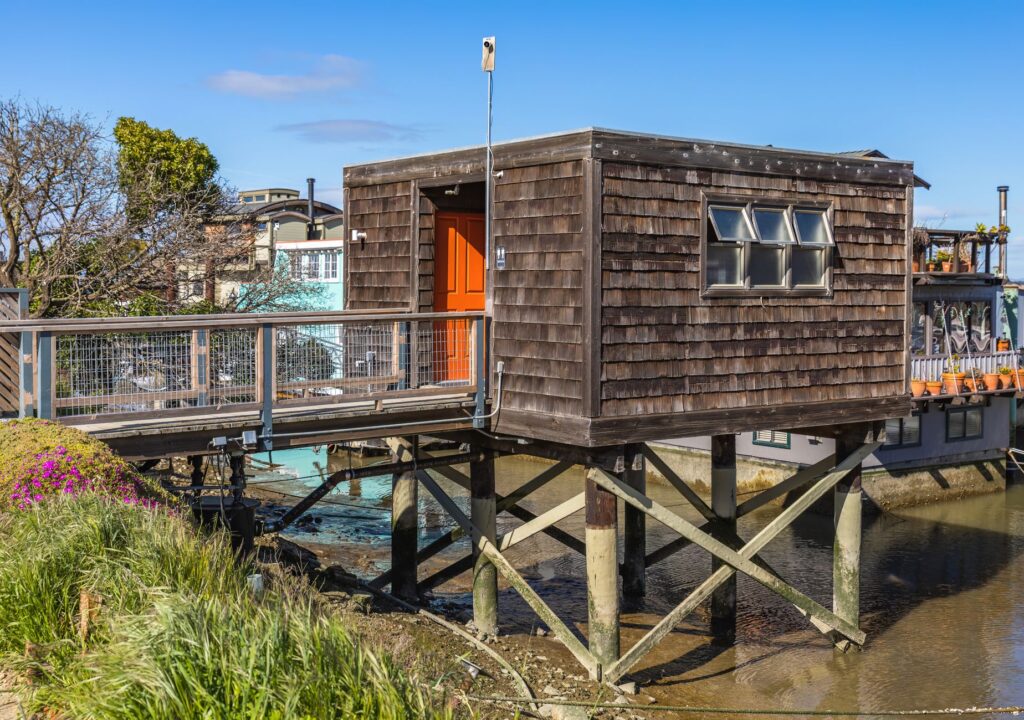
The relationship between human habitation and the aquatic realm finds its maximum visual and functional expression in the stilt-house districts (*palafitos*) defining coastal cities like Castro and Chonchi. Built upon pilings of luma or cypress wood driven directly into the seabed or intertidal zone, these settlements emerged in the late nineteenth and early twentieth centuries in response to a scarcity of flat land along coastal cliffs and the pressing need of fishermen and merchants for immediate access to their working boats. The dwellings, constructed with larch shingles capable of withstanding the extreme humidity of the Patagonian climate, align in rows over the water, forming pedestrian boardwalks that serve as community streets where domestic life, shellfish landing, and general commerce converge.
From a vernacular engineering perspective, these stilt settlements represent highly resilient housing solutions against seismic activity and high tides. The structural flexibility of native timber allows buildings to absorb earthquake energy without structural collapse, while the height of the pilings protects living quarters from extraordinary sea surges. Nevertheless, the sustainability of these neighborhoods has faced severe urban and sanitary pressures over recent decades. The historical lack of centralized sewage systems in intertidal zones compelled local governments and neighborhood organizations to implement sanitation and urban renewal projects aimed at protecting the marine ecosystem without displacing traditional families who have inhabited the shoreline for generations.
Minor Cabotage: Sailboats, Chilota Launches, and Interior Connectivity
While Route 5 and the main ferries channel heavy freight traffic, the true capillary network uniting the smaller islands of the archipelago depends on minor cabotage. Smaller wooden vessels, popularly known as *lanchas chilotas* or coastal boats, operate from sheltered ports and coves such as Achao, Dalcahue, and Quilen. These craft fulfill an irreplaceable social function: transporting passengers, mail, construction materials, liquefied gas, and farm animals to islands where major port infrastructure is economically and environmentally unviable.
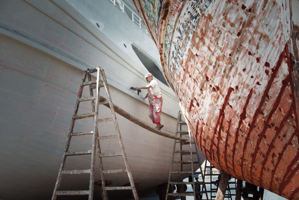
Traditional boatbuilding in Chiloé, centered in artisanal shipyards where master rib carpenters pass down their knowledge across generations, constitutes a living heritage of immeasurable value. Using hand tools and timbers selected for density and resistance to marine rot—such as mañío, tepú, andalerce—these master shipwrights continue assembling hulls capable of withstanding the constant torsional stress of Patagonian swells. The scarcity of certified native timber and competition from industrial materials like fiberglass have transformed the trade, compelling local guilds to pursue designations of origin and state support to safeguard nautical knowledge defining the identity of the inner sea.

- Artisanal rib shipyards along the eastern coast of Quinchao.
- Sailing and motor navigation routes connecting Achao, Caguach, and Linlín.
- Artisanal ramp systems for tidal loading on minor islands.
- Transport of fractional cargo and small livestock aboard cabotage launches.
Sacred Heritage as a Landmark for Territorial Orientation
The famous wooden churches of Chiloé, recognized by UNESCO, do not merely represent pinnacles of religious carpentry and Jesuit-Franciscan evangelization; they historically functioned as visual reference points for coastal navigation. Strategically located on promontories facing the sea or at the heads of protected inlets, the towers and main bodies of these sanctuaries served—and in many cases still serve—as daytime navigational marks for mariners traversing interior channels under overcast skies and dense fogs. The architecture of these churches dispenses with iron nails, utilizing wooden dowel joinery and modular frames mimicking naval construction techniques applied to terrestrial architecture.
The conservation of these religious buildings has required coordinated efforts among the Chilean state, local dioceses, and heritage foundations. The geographical isolation of sanctuaries located on islands such as Achao, Aldachildo, or Nercón means restoration work requires the barge transport of specialized materials, scaffolding, and heritage carpentry equipment. This process underscores how cultural preservation in Chiloé is inextricably linked to transport infrastructure: without an efficient cabotage network and passable rural roads, maintaining these masterpieces of insular carpentry would be practically impossible.
The Economy of the Tide: Aquaculture, Fishing, and Port Logistics
Chiloé’s integration into the contemporary global economy rests upon a diversified port infrastructure combining industrial terminals dedicated to salmon and mussel farming with artisanal fishing coves. Cities such as Quellón, at the southern extremity of the main island, function as high-intensity logistical terminals supporting fleets of service vessels servicing salmon and mussel farming sites, generating a continuous flow of freight trucks returning to the mainland via the Chacao Channel. This economic dynamism has transformed insular demographics, attracting continental labor and generating tensions surrounding the carrying capacity of secondary roads and municipal utilities.
Conversely, artisanal fishing and shore gathering—seaweed, bull kelp, and various mollusk species—continue operating according to biological cycles and tides. Coastal communities depend on artisanal piers and landing aprons where public infrastructure often contends with the precariousness of local facilities. Connectivity in this sector entails not only moving commodities, but ensuring highly perishable seafood reaches national and international consumer markets under optimal conditions of freshness and traceability, defying geographical distances and the climatic seasonality of Patagonia.
Practical guide
How to get there: The primary access to Chiloé is by road from Puerto Montt via Route 5 to Pargua, where car ferries cross to Chacao (continuous operation 24 hours a day, with no advance reservation required for private vehicles). Regular flights also operate from Santiago to Mocopulli airfield, located near Dalcahue.
When to visit: The southern summer months (December through March) offer optimal weather conditions with lower rainfall and extended daylight hours. However, the archipelago retains its cultural appeal year-round, with winter months ideal for observing stilt-house architecture and traditional religious celebrations with lower tourist density.

Internal transport: Exploring the main island and smaller satellites (Quinchao, Lemuy) by rental or private car provides maximum flexibility for accessing secondary gravel roads. Interurban bus lines efficiently connect major towns (Ancud, Castro, Quellón), while minor ferries to interior islands operate on schedules subject to tidal conditions.
Accommodation and dining: Advance booking is recommended during peak season, particularly for restored heritage lodgings or cabins embedded in rural settings. Gastronomic offerings include traditional dishes like *curanto en hoyo*, *chochoca*, and a wide variety of local fish and shellfish that should be consumed at health-certified markets.
Final Reflection on the Insular Horizon
At the threshold where the American continent dissolves into an archipelago of labyrinthine channels and misty forests, Chiloé clings to its amphibious identity as a bastion of cultural resistance. Modernity has introduced high-speed ferries, asphalt, and digital connectivity, yet the true pulse of the island continues beating to the slow rhythm of the tides and the creaking of native timber beneath the hands of rib carpenters. Far from a static territory trapped in nostalgic postcards, Chiloé demonstrates that true human connectivity resides not merely in highway speeds, but in a community’s capacity to engage in dialogue with its natural environment, transforming geographical isolation into an inexhaustible source of cultural sovereignty and territorial dignity.