
Conquering Verticality in the Central Andes
The Central Railway of Peru stands as one of the most daring milestones of nineteenth-century civil engineering. Conceived to connect the Pacific coast with the rich mineral deposits of the Andes, this railway route relentlessly defies the laws of gravity and topographic physics. Departing from the docks of Callao, the iron track initiates a steady ascent that, within just a few hours, leaves the marine mist behind to penetrate arid valleys and, subsequently, the snow-capped summits of the Western Cordillera. The journey is not merely a physical displacement, but a direct immersion into the complex geography that structures Peruvian territory.
The necessity to integrate the center of the country prompted governments of the era to project a route overcoming geological barriers previously deemed impassable. The magnitude of the challenge demanded unprecedented technical solutions, transforming the railway into an open-air laboratory where engineers from diverse nationalities tested the limits of available railway technology. Today, examining this steel corridor entails understanding how high-mountain logistics shaped settlements, regional economies, and commercial routes that still define the connectivity of the South American nation today.
The Switchback Design and Overcoming the Abyss
One of the most remarkable features of the Central Railway is its ingenious system of marching inversions, popularly known as switchbacks or zigzags. Confronted with vertical slopes where a continuous track proved technically impossible, builders engineered alternating platforms allowing the convoy to advance and reverse successively to gain elevation in a stepped manner. This mechanism bypassed the need for excessively long tunnels given the technological resources of the nineteenth century, prioritizing mechanical traction on live rock slopes and sheer abysses.

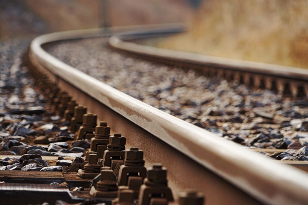
The route meanders along the Rímac River canyon, a narrow gorge where space is a severely scarce commodity. Every kilometer of track won from the mountain required the manual removal of tons of rock and the construction of stone retaining walls capable of withstanding the constant erosion of summer rains. The precision required in designing curves and sidings evidences an absolute mastery of geometry applied to rugged terrain, serving as a tangible testimony of human effort under truly hostile climatic and oxygen conditions.
The railway track is not merely an artifact of iron upon stone; it is a deliberate scar that opened the mineral belly of the Andes to connect it with global commerce.
As the train overcomes initial elevation changes, the shrubby coastal vegetation yields to the aridity of the lower puna. Iron bridges, prefabricated in Europe and transported on muleback or carts via bridle paths, succeed one another over vertiginous chasms. These metallic structures, true filigrees of engineering, supported the constant passage of steam locomotives first and powerful diesel units later, demonstrating exceptional structural durability in a geologically active and earthquake-prone environment.

High-Altitude Logistics and the Challenge of Thin Air
Operating a railway line reaching 4,781 meters above sea level at the emblematic Ticlio station entails extraordinary logistical challenges. At that altitude, atmospheric pressure drops drastically, reducing the power output of internal combustion engines and demanding strict protocols for personnel management and rolling stock maintenance. The lack of oxygen impacts not only the technical functioning of machinery but also human endurance, turning every journey into a test of acclimatization and operational efficiency.
Fuel management, water supply for historical steam locomotives, and parts repair in isolated environments necessitated the creation of a network of workshops and warehouses along the entire route. Stations like Chosica, Matucana, and San Mateo historically functioned as vital logistical nodes where maintenance crews repaired damages caused by mudslides and frequent landslides during the rainy season. This infrastructure of human support proved just as crucial as the rails themselves in guaranteeing the continuity of rail traffic.
- Deployment of specialized emergency crews for debris removal and slope stabilization.
- Preventive maintenance of braking systems for prolonged gradients exceeding 4%.
- Medical monitoring and emergency oxygen supply for crews and passengers in the high-mountain section.
- Centralized traffic management through telecommunications adapted to the complex Andean orography.

Tunnels, Summits, and the Ticlio Milestone
The culminating point of the route is found at the Ticlio pass, where the track crosses the Anticona abra via the Galera tunnel. Drilling this subterranean gallery at nearly five thousand meters of altitude constituted a titanic feat performed under extreme conditions of cold and isolation. Workers had to contend with freezing water leaks and oxygen scarcity, utilizing rudimentary tools and dynamite in a coordinated effort that cost numerous lives, reflecting the heavy human toll of Andean modernization.
Upon emerging from the tunnel, the landscape shifts radically toward the high-andean plateaus, where the horizon widens and the first glacial lagoons appear. The presence of surrounding snowy peaks marks the transition toward the eastern slope of the cordillera, ultimately leading the journey toward the Mantaro Valley. This direct connection between the coast and the central sierra transformed the country’s economic dynamics, facilitating the outflow of copper, silver, and zinc to international markets and integrating isolated rural communities into a larger-scale monetary economy.
Industrial Heritage and Railway Memory
The material legacy of the Central Railway transcends its original economic function; today it constitutes a monument to Latin American industrial heritage. Victorian-style stations, locomotive sheds, and mechanical workshops preserve machinery from various eras recounting the technological evolution of heavy transport. This heritage faces the challenge of preservation amid the partial abandonment of certain facilities and the predominance of road motor transport, although the track continues to operate intermittently for mineral freight.

Historians and industrial heritage experts agree that valuing this corridor requires an integrated approach combining architectural conservation with sustainable tourism development. Unlike other purely recreational routes, the Central Railway maintains its industrial vocation intact, adding a layer of complex authenticity to its study. The locomotives crossing metal bridges continue to converse with a landscape unaltered by centuries, reminding the contemporary observer of the sheer scale of technical effort invested in its construction.
Practical guide
How to get there: The traditional starting point of the infrastructure is located in the port of Callao, adjacent to Lima. Although regular passenger service operates very sporadically—typically on organized tourist trips run by Ferrocarril Central Andino on specific dates of the year—it is possible to travel the parallel road route (Central Highway / PE-22) to observe historical stations, bridges, and switchbacks.
When to travel: The dry season, spanning from May to September, is the safest and most recommended period to tour the high-mountain zone, as the risks of landslides and mudslides are drastically reduced. Clear skies also offer the best visual conditions to appreciate the scale of the engineering feat.
Acclimatization tips: Because the route ascends rapidly to exceed 4,700 meters of altitude within a few hours, it is strongly recommended to spend at least two or three days in Lima or mid-altitude towns like Chosica or Matucana before attempting to cross the Ticlio pass, in order to prevent severe symptoms of altitude sickness (soroche).
Epilogue on the Mantaro Plateau
When the steel alignment finally descends along the eastern slopes toward the vast and fertile basin of Huancayo, the tension of altitude and abyss dissolves into a landscape of cultivated fields and century-old eucalyptus trees. Arrival at the terminal station does not represent the end of the journey, but the culmination of a mechanical ritual that has defied the continent’s most complex geography for over a century and a half. At this final point, where the cold of the puna yields to the human warmth of the central Andes, the railway remains an unyielding monument to human determination against the imposing and solemn verticality of the cordillera.