
Introduction to the Labyrinth of Stone and Memory
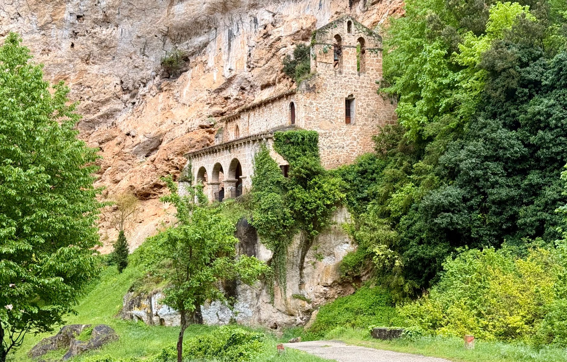
The territory of Liébana, nestled in the eastern flank of the Picos de Europa, cannot be fully understood merely by looking up at the snow-capped peaks piercing the Cantabrian sky. Its true geological, anthropological, and exploratory identity beats beneath the surface, within a kilometer-long network of karstic cavities that for millennia served as a refuge, canvas, and communication route for the inhabitants of this northern peninsular corner. Far from being mere geographical accidents, the caves of this region act as a subterranean circulatory system where limestone rock has shaped both the exterior landscape and the lifestyles of its valleys.
Approaching the rupestrian connectivity of Liébana means venturing into a vertical landscape where gorges carved by swift rivers act as natural walkways connecting seemingly isolated worlds. This report examines how extreme topography has historically conditioned human transit and how today’s contemporary traveler can traverse this network of prehistoric shelters, rock-cut hermitages, and cliff-hanging villages through a rigorous, respectful approach deeply conscious of the fragile ecological balance sustaining this ancient heritage.
Karstic Geography as a Communication Artery
To understand the role of cavities in Liébana, it is essential to analyze the geomorphological process that gave rise to this relief. The dissolution of limestone rock through the continuous action of water has sculpted a subterranean labyrinth composed of chasms, horizontal galleries, and rising rivers that emerge from the bowels of the earth after traversing kilometers in absolute darkness. These formations have not remained static in the face of human evolution; on the contrary, they have functioned since the Paleolithic period as transit routes and seasonal settlements, taking advantage of the thermal stability and natural protection offered against the harsh climatic rigors of the Cantabrian winter.
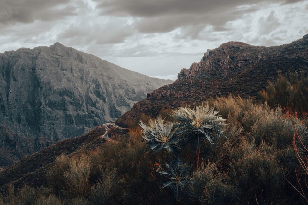
The gorges that delimit the region, led by the imposing Hermida Gorge, act as the great highway arteries of the area. For centuries, traveling through these ravines where the rock seems to close in upon the traveler was an exercise in survival. Today, the N-621 national road serpents parallel to the Deva River, cutting through a trench carved in stone connecting the coast with the mountainous heartland. On both sides of this main route, secondary paths, packhorse trails, and ancient pastoral tracks provide access to caves of great archaeological value, demonstrating that connectivity in Liébana is a constant dialogue between major transport infrastructure and the millenary pedestrian path.
Parietal Art as Spiritual Cartography
Beyond its geological value, the caves of this region treasure exceptional graphic heritage that defies the passage of time. Paintings and rock engravings found in enclaves such as Cuesta del Infierno or minor shelters scattered throughout the Liébana valleys configure a primitive spiritual spirituality. These iron oxide and charcoal strokes are not merely isolated aesthetic expressions, but visual testimonies of how Upper Paleolithic hunter-gatherer communities interpreted their environment, mentally mapping the depths of the earth in relation to natural external cycles.
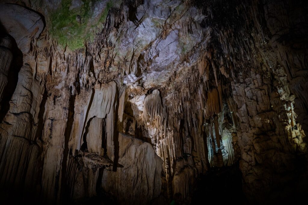
Accessing and studying these subterranean sanctuaries requires complex logistics balancing scientific research with preventive conservation. Unlike the heavily commercialized European rock art enclaves, Liébana’s cavities maintain a more intimate, rugged character where the visitor experiences the exact same gloom and reverent silence felt by their creators over twenty thousand years ago. This sensory experience transforms tourist visits into rigorous archaeological immersions, where every stalactite and flashlight shadow acquires contrasted historical significance.
The subsoil of Liébana is not a cemetery of dead rocks, but an active archive where humidity and stone have preserved intact the breath of the earliest human communities daring to challenge the verticality of the Picos de Europa.
The preservation of this rupestrian legacy depends heavily on coordinated management among local authorities, speleological teams, and cultural heritage experts. Limiting entry quotas, monitoring carbon dioxide levels, and avoiding any alteration of internal microclimates are non-negotiable rules ensuring future generations can continue reading the enigmas of our shared past on limestone walls. Sustainable tourism in this sphere is neither an aesthetic option nor a luxury, but an unavoidable technical and ethical requirement.
The Architecture of Hanging Valleys and Dry Stone
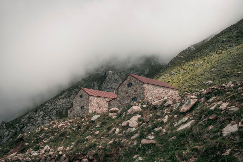
If the subsoil impresses with its karstic complexity, the exterior landscape of the Liébana valleys dazzles through the perfect symbiosis between geology and vernacular architecture. Villages settling on slopes—such as Mogrovejo, Tresviso, or Potes—employ the exact same limestone extracted from the surrounding environment to build their homesteads, barns, and storehouses. This material continuity turns inhabited nuclei into natural extensions of the rocky formations guarding them, generating a cultural landscape where drawing an exact dividing line between nature’s work and human hands is exceedingly difficult.
Dry stone construction techniques, internationally recognized for their heritage value, play a fundamental role in slope retention and the delimitation of mowing meadows. Walls winding across slopes not only organize agricultural territory but act as containment dams against torrential erosion caused by intense seasonal rains. Walking along these traditional paths allows visitors to understand the titanic effort required by pasiega and lebaniega communities to reclaim land from verticality, weaving a pedestrian communication network constituting one of the greatest attractions for specialized hikers.
The Fluvial Pulse: Streams, Mills, and Water Energy
Water is the invisible sculptor shaping every corner of Liébana. The Deva, Quiviesa, and Buyón rivers descend forcefully from the heights, carrying sediments and nourishing a valley where humidity fosters lush forests of beech, oak, and chestnut trees. This ceaseless flow not only feeds botanical richness but has historically been harnessed through a network of diversion channels, traditional dams, and flour hydraulic mills dotting river courses.
Walking along riverbanks via enabled paths reveals the industrial archaeology of water. Many historic mills have been ethnographically restored, showing travelers how the current’s kinetic energy transformed into basic sustenance for valley inhabitants. This minor hydraulic infrastructure represents a key link in understanding the territory: a system of channels and races complementing terrestrial road networks, facilitating self-sufficiency in villages historically cut off by winter snows and rockfalls.

The Historical Trail Network and Foot Connectivity
In a region where motor vehicles face severe physical limitations due to narrow gorges and winding mountain passes, the historical trail network stands out as the true backbone of sustainable mobility. Routes such as the Camino Lebaniego—linking the Cantabrian coast with the Monastery of Santo Toribio de Liébana—are not mere religious pilgrimage itineraries, but ancient cultural corridors structuring the territory from north to south.
These paths recover ancient commercial and livestock routes, allowing contemporary travelers to move between villages without depending exclusively on asphalt. Homologated signage, rest areas respectful of the environment, and integration with regional public transport—such as shuttle buses operating during peak seasons toward high-traffic points—form an integrative mobility model. Walkers traversing these trails not only reduce their carbon footprint but recover the human pace of travel, experiencing shifts in altitude, vegetation, and microclimate at a measured walking rhythm.
Contemporary Challenges: Depopulation and Rupestrian Conservation
The future of Liébana and its exceptional rupestrian and scenic network is debated today between the need for economic revitalization and the urgency of protecting a fragile rural ecosystem. Progressive depopulation in high-mountain villages threatens the irreversible loss of traditional knowledge, artisanal crafts, and active land management that has historically prevented forest fires and the collapse of traditional pathways.
Facing this challenge, local initiatives based on responsible cultural tourism, valorization of native products—such as Picón Bejes-Tresviso cheese or Liébana wine—and rigorous archaeological research offer a ray of hope. Scientists and local managers insist that any development strategy must prioritize quality over quantity, betting on informed visitors valuing environmental authenticity over quick mass-tourism consumption. Subterranean and surface heritage conservation remains, ultimately, a testament of respect toward coming generations.

Practical guide
How to get there: Main access to Liébana is by road via the N-621, crossing the spectacular Hermida Gorge from Unquera (on the Cantabrian coast), or crossing the San Glorio mountain pass from León. There is no direct rail service within the region; the nearest railway station with regional connections is located in Unquera.
Internal transport: Due to orography, renting or using private vehicles is the most flexible way to move between valleys and villages. During summer months and peak periods, regional bus services and specific shuttle buses operate toward Picos de Europa National Park accesses and major historical points of interest.
When to visit: Spring (May to June) and autumn (September to November) offer the most stable climatic conditions and exceptional chromatic displays in forests. Winter can drastically limit access to high zones due to snow and ice on mountain roads.
Accommodation and gastronomy: Lodging concentrates in small rural inns, restored mountain manors, and family-run hotels primarily in Potes and surroundings. Local gastronomy features hearty dishes like cocido lebaniego, artisanal high-mountain cheeses, and pomace spirits produced in traditional alembics.
Visit tips: Accessing cavities with rock art requires prior authorization from the Culture Department of the Government of Cantabria and specialized guiding. Appropriate mountain footwear, waterproof warm clothing—as interior and exterior humidity is constant—and strict adherence to zero-waste and non-disturbance regulations are essential.
Epilogue: The Eternal Murmur of Limestone
At the end of the journey, when the evening light sets the calcareous peaks of the Picos de Europa ablaze and dyes Potes’ slate roofs ochre, the certainty remains that Liébana is far more than a mountain postcard destination. It is a living organism where stone, water, and human memory intertwine in a silent pact resisting the passage of centuries. Hearing the distant murmur of a subterranean stream or contemplating the silhouette of a medieval bridge clinging to the gorge connects us with the purest essence of a territory demanding to be traversed with all five senses, a firm step, and profound gratitude toward anonymous hands that, from the depths of time, bequeathed us this refuge in the rock.