
Regarded for over a century as the «finest walk in the world,» the Milford Track is far more than a mere hiking route; it is a profound immersion into the geological prehistory of Gondwana. Located in the heart of New Zealand’s Fiordland National Park on the South Island, this 53-kilometer journey traverses glacial valleys carved by ice, temperate rainforests of almost impenetrable density, and alpine passes where the weather is governed by the laws of the Roaring Forties. The expedition demands a technical planning that transcends the physical, pitting the hiker against one of the highest rainfall regimes on the planet and strictly regulated access logistics.
Approaching the Milford Track requires understanding that here, nature is not a backdrop but an active force. From the moment you cross Lake Te Anau to disembark at Glade Wharf, contact with civilization dissolves. There are no intermediate exits or mobile coverage; there is only the commitment to move forward through an ecosystem that has remained virtually unchanged since the first European explorers, such as Quintin McKinnon, blazed the trail in the late 19th century. This guide analyzes the fundamental pillars for completing the traverse successfully, from hydrological risk management to the biological interpretation of an environment where flightless birds and ancient moss dictate the pace of the journey.
The Legacy of the Finest Walk in the World
The history of the Milford Track is inextricably linked to New Zealand’s exploratory identity. While the Māori had long used parts of the valley for gathering pounamu (greenstone), it was the opening of the Mackinnon Pass in 1888 that definitively connected the interior of Lake Te Anau with the coast of Piopiotahi (Milford Sound). The central thesis of this route is the connectivity between ecosystems: the transition from a river valley to a high-mountain environment and, finally, to the mouth of a colossal fjord.
Unlike other trans-Pyrenean or Andean routes, the Milford is characterized by a dramatic verticality. The granite walls of the Clinton and Arthur valleys rise nearly a thousand meters above the valley floor, creating a majestic sense of enclosure. This geological configuration is the result of successive glaciations that, upon retreating, left behind U-shaped valleys and some of the highest waterfalls in the Southern Hemisphere, such as the Sutherland Falls. The hiker must be prepared for a visual scale that challenges conventional perceptions of distance.
«In Fiordland, the landscape is not observed; it is endured and celebrated with equal intensity, under a rain that does not merely wet, but baptizes the explorer’s spirit.»
The international prestige of the route has led the Department of Conservation (DOC) to implement an extremely strict quota system. Only 40 independent hikers are permitted to start the track each day during the Great Walks season. This limitation not only protects the integrity of the soil and fauna but also guarantees an experience of solitude and silence that is increasingly difficult to find on major international circuits. Managing this permit is, for many, the first major technical hurdle of the expedition.
Logistics and the Booking System: The Access Challenge
Planning for the Milford Track begins months, sometimes a year, in advance. The DOC booking system typically sells out within minutes of its annual opening. It is crucial to understand that the route is unidirectional (south to north) and must be completed over four days and three nights. Camping is not permitted; overnight stays are mandatory in the three designated huts: Clinton, Mintaro, and Dumpling. This rigid structure forces a consistent pace, regardless of weather conditions.
Logistical access involves two critical water crossings. The first departs from Te Anau Downs via a ferry that navigates the northern arm of Lake Te Anau to Glade Wharf. The second, at the end of the track, transfers expeditionaries from Sandfly Point to Milford Sound. The coordination of these transports is the axis upon which the entire safety of the traverse pivots. If a hiker misses the final connection, they find themselves at a geographical point with no land access, surrounded by impassable cliffs.
In terms of gear, self-sufficiency is total. Although the huts provide bunks, gas for cooking, and running water, the hiker must carry their own sleeping bag, cooking utensils, technical clothing for subantarctic conditions, and all their food. Managing pack weight is vital, especially considering that the second and third days include significant cumulative elevation gains and technical terrain where balance is essential under persistent rain.
Water Management: Navigating the Wettest Region on Earth
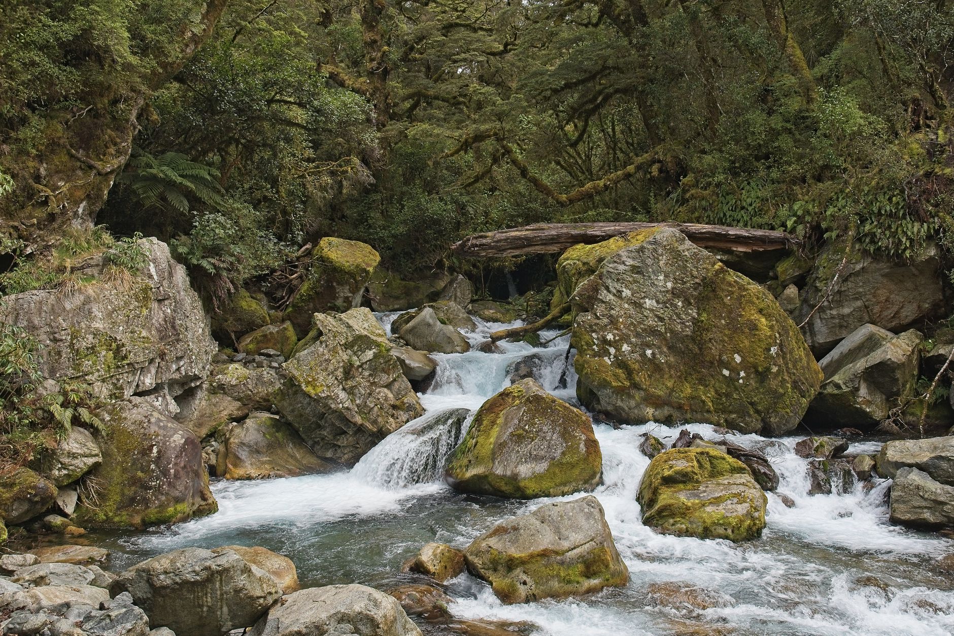
With an average of 7,000 mm of rain per year, Fiordland is one of the wettest places on Earth. On the Milford Track, rain is not an eventuality but a statistical certainty. This transforms the dynamics of the trail in minutes. Rivers that were once crystal-clear streams can become raging torrents that flood sections of the path. The DOC constantly monitors water levels and, on occasion, uses helicopters to evacuate hikers if the valleys become impassable.
Waterproofing and Thermal Safety
- Layering System: It is imperative to use merino wool as a base layer for its ability to retain heat even when wet, combined with a high-end three-layer technical jacket (Gore-Tex or similar).
- Gear Protection: A pack cover is not enough; all contents must be inside dry bags or a heavy-duty polyethylene pack liner.
- Fording Management: During heavy rain, water can reach knee-depth on flat sections. Keeping feet warm (even if wet) is the priority to avoid hypothermia.
The presence of water also provides one of the most impressive natural spectacles in the world: temporary waterfalls. During a storm, the granite walls of the Clinton Valley are covered in hundreds of silver threads falling from vertiginous heights. It is an overwhelming sensory experience where the sound of water hitting rock becomes the constant white noise of the expedition.
Endemic Biodiversity: From the Kea to the Beech Forest
New Zealand’s geographical isolation has created a unique evolutionary laboratory, and the Milford Track is its primary showcase. The flora is dominated by silver beech forest (Nothofagus menziesii), whose trunks are covered in a layer of mosses and epiphytes that retain moisture like giant sponges. This forest is home to bird species that exist nowhere else, many of which have lost the ability to fly due to the historical absence of mammalian predators.
The most iconic encounter is with the Kea, the world’s only alpine parrot. Known for its superior intelligence and destructive curiosity, the Kea often frequents the Mackinnon Pass and the huts. While their presence is fascinating, hikers must be cautious with their gear, as these birds are capable of tearing apart backpacks or boots in search of food or simple amusement. Interaction with wildlife must be strictly observational; feeding a Kea is condemning it to lose its survival instincts.
In the lowlands, the Weka (a ground bird similar to a hen but much craftier) patrols the hut surroundings. The song of the Tui and the Bellbird provides the forest’s soundtrack, while in the mountain rivers, it is possible to spot the Whio (blue duck), an endangered species that requires extremely clean and oxygenated water to live. The traverse is, therefore, an exercise in respect for a fragile ecosystem struggling to maintain itself against invasive species introduced by humans.
The Ascent of Mackinnon Pass: The Technical Climax
The third day of the traverse is the most demanding and, simultaneously, the most rewarding. The ascent from Mintaro Hut to Mackinnon Pass (1,154 meters) is achieved through a series of zig-zags that gain elevation rapidly. This is the only true high-mountain section of the route. Upon reaching the summit, marked by a memorial to Quintin McKinnon, a 360-degree panorama opens up, encompassing the Clinton and Arthur valleys.
The meteorology at the pass is volatile. Gale-force winds and zero visibility are common, but on clear days, the view of the hanging glaciers and the jagged peaks of the Southern Alps is incomparable. From here, the trail descends steeply via a series of wooden boardwalks and rock steps into the Arthur Valley. This descent tests the knees and quadriceps endurance, dropping nearly a thousand meters in a few hours.
«The Mackinnon Pass does not just divide two valleys; it divides the hiker’s perception between the effort of the climb and the surrender to the immensity of the void.»
Midway through the descent, a detour to Sutherland Falls is mandatory. With a 580-meter drop in three tiers, they are one of the country’s natural wonders. The impact of the water as it falls generates an air current and a mist that soaks anyone who comes within a hundred meters of the base. It is a reminder of the kinetic energy contained within Fiordland’s relief.
Huts and Self-Sufficiency in the Subantarctic Environment
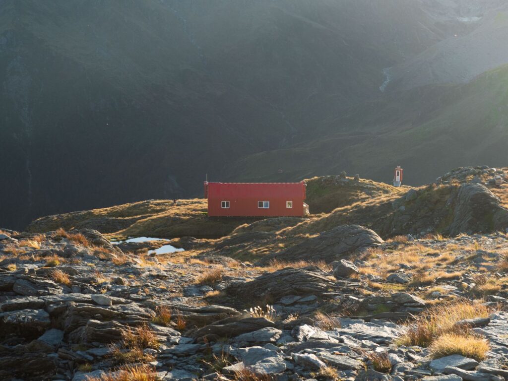
DOC huts on the Milford Track are models for management in remote environments. They operate on solar power for lighting and feature waste treatment systems that minimize environmental impact. However, comfort is spartan. Bunks are shared in large communal rooms, and there are no showers. The expeditionary’s routine is reduced to the essentials: walking, eating, drying clothes, and sleeping.
Hut life is an integral part of the experience. Hikers from all over the world share stories of the day around wooden tables, creating a camaraderie born of shared effort. Waste management is an individual responsibility: everything brought into the park must be taken out. There are no trash cans on the trail or in the huts, reinforcing the ‘Leave No Trace’ ethics that prevail throughout New Zealand.

A logistical factor often underestimated is the presence of sandflies. These small biting insects are omnipresent in the lowlands and near water. Their bite is annoying and can cause allergic reactions. Using potent repellents and clothing that covers limbs is the only effective defense, especially at Sandfly Point, the trail’s terminus named for the legendary density of these insects.
Practical Guide
For those deciding to undertake this expedition, preparation must be meticulous. The Milford Track does not forgive improvisation or inadequate gear. Below are the key aspects for logistical and technical planning:
- Bookings: Spots generally open in May or June for the following season (October-April). It is necessary to register on the DOC website in advance and be logged in at the exact second of opening.
- Transport: Book the Te Anau Downs ferry and the return transport from Milford Sound simultaneously with the track permit. Private companies offer vehicle relocation services from the start to the end point.
- Critical Gear: High-cut hiking boots with good soles (Vibram or similar), as the terrain is slippery. Merino wool socks (minimum 3 pairs). A lightweight stove and sufficient fuel for 4 days.
- Food: Dehydrated food to reduce weight. Nuts, chocolate, and energy bars for consumption during the march. Stream water is generally drinkable, but treatment is recommended if in doubt.
- Safety: Carrying a PLB (Personal Locator Beacon) is highly recommended, as there is no cell signal throughout the route.
- Physical Condition: A medium-high fitness level is required. Although daily distances (13-18 km) seem moderate, the technical terrain and pack weight increase cumulative fatigue.
The Echo of Silence at Sandfly Point
The end of the Milford Track at Sandfly Point is a moment of deep introspection. After four days of immersion in a wild and primal nature, the return to civilization feels strange. Looking back toward the Arthur Valley, one understands that the true traverse has not been merely physical, but a lesson in humility before the elements. The silence of Fiordland, broken only by the roar of waterfalls and the cry of the Kea, remains etched in memory as a reminder of what the world was before us.
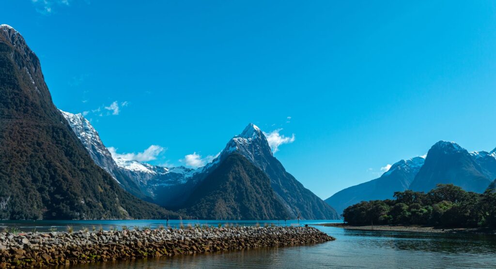
Arriving at the Milford Sound fjord, with the iconic silhouette of Mitre Peak dominating the horizon, is the perfect visual closure. Here, the dark waters of the Tasman Sea meet the mountains, creating one of the most dramatic landscapes on Earth. The expeditionary who completes the Milford Track takes away not just photographs, but the certainty of having traveled through one of the last wilderness sanctuaries, a place where time is measured in geological eras and man is but a fleeting visitor under the eternal rain.