
Introduction to the Arctic Labyrinth of Stone and Tide
The Lofoten Archipelago, situated well above the Arctic Circle in Nordland county, represents one of the most demanding and visually breathtaking sea kayaking environments on the planet. Here, sharp granite peaks plunge vertically straight into the dark waters of the Norwegian Sea, creating a labyrinth of narrow fjords, treacherous channels, and small fishing enclaves that have tested navigators for centuries. Unlike temperate waters, the Arctic environment imposes an iron discipline where every route decision is dictated by unpredictable weather, spring tides, and the glacial temperature of the sea.
Tackling this territory through an autonomous kayak expedition demands absolute mastery of self-rescue techniques, a precise understanding of local nautical charts, and a deep grasp of the oceanographic phenomena that shake the famous Moskenstraumen channel. This report breaks down the anatomy of a coast-to-coast traverse, offering experienced expeditioners the technical and logistical keys required to safely tackle one of Northern Europe’s most beautiful and complex marine itineraries.
The Geography of Vestfjorden and Outer Channel Dynamics
The grand backdrop for any route through Lofoten is the Vestfjorden, the wide body of water separating the archipelago from the continental Scandinavian peninsula. This gulf acts as a giant resonance chamber for winds blowing from the North Atlantic, generating a persistent groundswell that crashes violently against the outer island barriers of Mosken and Flakstad. Kayakers must understand that the apparent calm of interior shelters can vanish within minutes when rounding an exposed cape, where the combined force of wind and surface current multiplies the technical difficulty of the stroke.
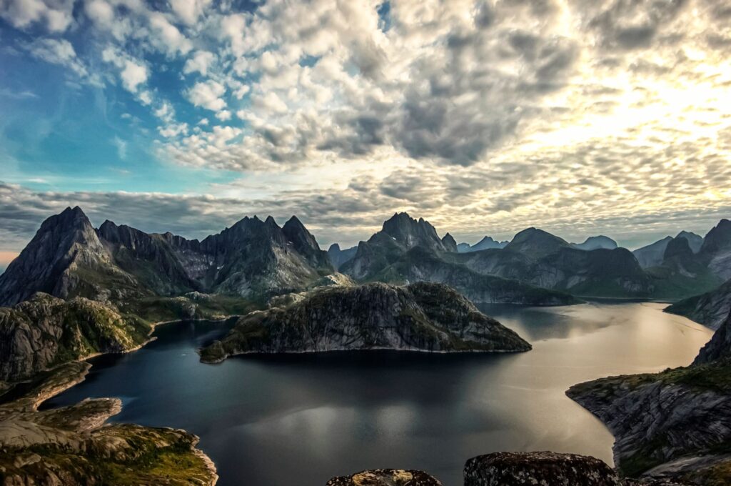
Navigation in these channels requires maintaining precise headings and utilizing coastal counter-currents generated by submarine topography. Submerged reefs and rocky shoals, known locally as skjer, act as hidden traps producing unexpected breaking waves even on days of apparent meteorological calm. Studying bathymetric charts before each leg is not a mere recommendation, but an inescapable survival protocol to avoid dangerous situations in areas difficult for rescue teams to reach.
The Relentless Physics of the Moskenstraumen and Tidal Streams
No navigation analysis in Lofoten would be complete without examining the phenomenon of the Moskenstraumen, one of the most powerful and celebrated tidal current and whirlpool systems in the world, immortalized by Edgar Allan Poe in his classic marine horror tale. Located between the islands of Mosken and Værøy, this massive water flow is driven by the rapid filling and emptying of the Vestfjorden through narrow gaps, colliding with the underwater drops of the continental shelf.
For the sea kayaker, approaching these zones during peak tides is suicidal recklessness. Temporal planning based on official tide tables is the only valid tool for calculating so-called ‘slack windows’—the brief moments of relative calm between incoming and outgoing flows. Crossing these straits requires a steady pace of progression, impeccable group leadership, and the ability to read the water’s surface for boilings (vertical upwellings) and friction lines warning of downward currents.
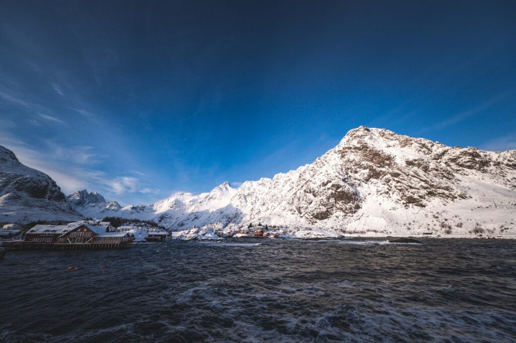
The fury of the Norwegian Sea tolerates no improvisation; a reverent respect for Arctic tides separates the prudent explorer from rescue statistics.
Self-Sufficiency Logistics and Expedition Gear Selection
Logistical autonomy is the fundamental pillar of a successful traverse through Lofoten. With no network of organized refuges for kayakers along the wilder coasts, all drinking water, dehydrated food, and expedition stove fuel must be transported watertight in the boat’s hatches. Freshwater sources abound in valleys, but filtering the flow properly is imperative due to the occasional presence of livestock in lower alpine pastures.
Regarding floating equipment, 5.2 to 5.5-meter expedition sea kayaks made of fiberglass or high-density polyethylene are recommended, mandatorily equipped with double watertight bulkheads, perimeter lifeline, and an adjustable skeg or rudder to maintain heading in crosswinds. The use of breathable membrane drysuits is mandatory year-round, given that immersion hypothermia in waters between 4 and 10 degrees Celsius can incapacitate an adult in less than ten minutes.
Arctic Meteorology: The Tyranny of Katabatic Winds
Lofoten’s alpine relief, where peaks like Hermannsdalstinden exceed one thousand meters in altitude just meters from the sea, generates highly aggressive local microclimates. Katabatic winds—masses of cold, dense air rushing down from upper plateaus by gravity through enclosed valleys—can strike the water’s surface with hurricane-force gusts without warning, easily exceeding predicted knots in general Norwegian coastal weather bulletins.
Constantly monitoring high-resolution numerical prediction services like Yr.no or Windy is an obligatory routine at every nightly basecamp. If models indicate closed pressure gradients over the archipelago, the correct decision is to break camp early or stay ashore until conditions permit clean navigation, avoiding at all costs getting trapped on pebble beaches exposed to direct Atlantic surf attacks.
Coastal Campsites and the Leave No Trace Principle
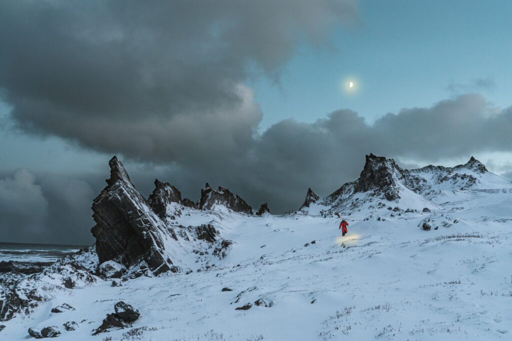
Finding a suitable tent site in Lofoten can turn into a tactical puzzle. The white sand beaches that beautify tourist postcards are usually oriented toward the northwest, taking the direct impact of swells, making them dangerous overnight spots if camped too high or too close to the high-tide line. Elevated grassy areas above cliffs or small river terraces protected by rock formations offer much safer, wind-sheltered alternatives.
Norwegian legal framework, known as Allemannsretten (the right of public access to nature), enshrines the right to camp freely on uncultivated land, but demands strict environmental responsibility. All organic and inorganic waste must be carried back to urban centers, and portable stoves completely replace campfires on soil to protect fragile arctic moss and lichen ecosystems that take decades to recover from a single accidental burn.
Human Heritage and Maritime Architecture Across the Islands
Among the wildest stretches of the route, the traveler encounters silent witnesses to the archipelago’s economic history: rorbuer, ancient fishermen’s cabins built on wooden pilings directly over the water. These traditional shelters, originally built to house fishing crews during the great cod (skrei) season between January and April, today provide visual refuge and occasionally a roof to escape severe storms in small enclaves like Reine, Nusfjord, or Henningsvær.
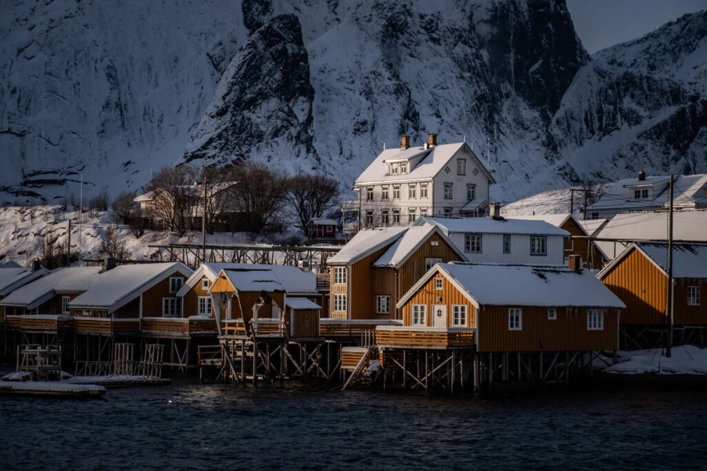
Stopping at an abandoned rorbu is hearing the echo of generations who tamed an unforgiving sea through sheer muscle and patience.
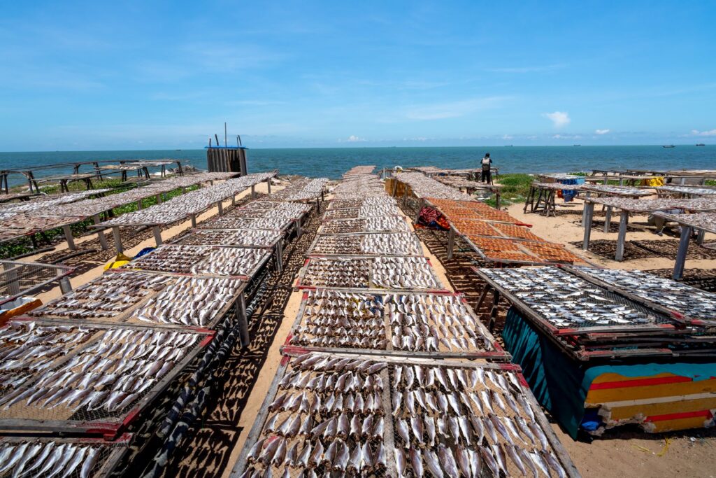
Lofoten’s maritime culture is intrinsically tied to air-drying cod on characteristic wooden racks called hjell. These massive structures, visible on almost every coastal hill, harness the cold yet dry climate of Norwegian winter and spring to cure fish without salt or additives. Observing this scene from the low perspective of the kayak seat connects the modern expeditionary with a millennial subsistence chain that has kept these isolated communities alive against the constant onslaught of wild nature.
Practical guide
How to get there: Main access to the archipelago is via Leknes or Svolvær airport through connecting flights from Oslo via Bodø. Another classic alternative is taking the scheduled ferry linking the mainland city of Bodø with Moskenes, allowing the transport of kayaks and heavy gear without strict airline weight limits.
Best time for expedition: Months between June and August offer the most daylight hours (featuring the midnight sun phenomenon) and milder air temperatures, though early spring (May) provides more stable waters and lower recreational nautical traffic.
Permits and regulations: No special permit is required for sea kayaking along Norway’s coastal waters, but respecting seabird protection zones (sjøfuglfredningsområder) during nesting periods between April and July is mandatory, maintaining a safe distance from islets inhabited by puffins and cormorants.
Mandatory safety equipment: Approved buoyancy life vest (PFD with whistle and rescue harness), spare paddle secured to deck, manual bilge pump, 15-meter floating tow line, hand flares, watertight marine VHF, and a satellite communication system (such as Garmin InReach) for weather and emergency alerts.
The Final Pulse of Arctic Light
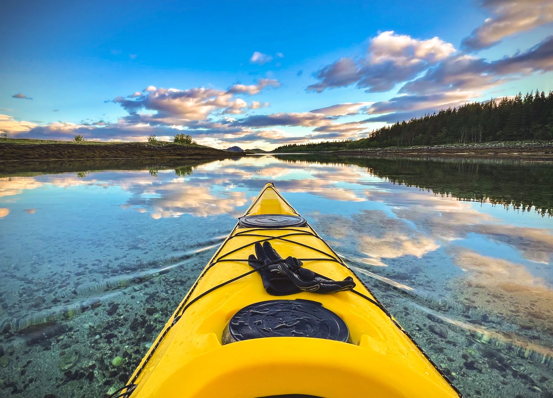
When the sun slowly descends toward the northern horizon in peak summer weeks, never quite submerging completely, the Lofoten landscape is painted in an unmatched palette dominated by mauves, golds, and intense cobalt blue. In absolute silence, broken only by the rhythmic dripping of the paddle entering the water and the distant blow of a porpoise, the kayak traverse reaches its deepest and most contemplative dimension. The dark granite walls cease to be physical obstacles and become silent guardians of an experience challenging the limits of human comfort, reminding us of the fragility of our presence in the planet’s great pristine theaters.