
Origins and Geography of a Transformative River
The Segura River is not merely a geographical feature in the southeast of the Iberian Peninsula; it constitutes the backbone of a civilization shaped by scarcity and ingenuity. From its source in the Sierra de Segura to its mouth in Guardamar del Segura, this watercourse traverses arid territories where every single drop of water has historically been contested and managed with surgical precision. In the stretch crossing the Murcia region, the river assumes a vital role, turning thirsty plains into valleys of high agricultural productivity known secularly as the Huerta de Murcia.
The orography of the basin is characterized by a sharp contrast between the surrounding mountain elevations and the gently sloping alluvial valleys. This configuration meant that early inhabitants could not rely exclusively on the natural precipitation regime, which is notoriously irregular and seasonal. Consequently, the Murcian territory developed from medieval times a complex network of channels, ditches, and diversion dams that redirect the Segura’s flow to irrigate thousands of hectares cultivated with citrus, vegetables, and stone fruits.
Over the centuries, this system evolved from rudimentary diversion methods into a sophisticated civil engineering infrastructure that today integrates regulatory dams, master canals, and telecontrol systems. The Segura river basin represents one of the most remarkable examples of integrated water management in Europe, where structural scarcity has forced extreme optimization of available resources, combining fluvial flow with external inputs and reclaimed wastewater.
The Hydraulic Heritage of Al-Andalus and the Ditch System
The true foundation of Murcian agricultural prosperity dates back to the Andalusian period, when Umayyad and later engineers introduced advanced water management methods that still endure today. The system is structured hierarchically from a network of diversion dams—such as the Azud de la Aljucer or Contraparada—that elevate the water level to distribute it by gravity through major irrigation channels, known locally as brazales and sequiones, until reaching individual plots.
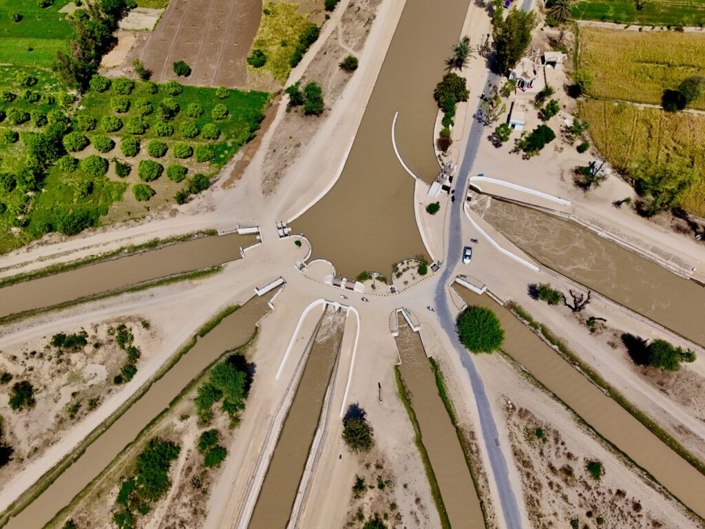
This network is not only a functional engineering work, but a rigorously regulated social organism. Historical institutions such as the Council of Wise Men of the Plain of Murcia (Tribunal de los Hombres Buenos), recognized by UNESCO as Intangible Cultural Heritage of Humanity, continue to resolve irrigation disputes through public verbal trials at the Door of the Apostles of the Cathedral. This model of customary justice demonstrates how hydraulic infrastructure and community cohesion have been inextricably linked for over a thousand years.
Medieval chronicles already highlighted the exceptional fertility of this artificial oasis, surrounded by defensive walls and fortifications that protected agricultural production. Terracing techniques, crop rotation, and the integral utilization of every water branch sustained population densities far exceeding those typical of equivalent semi-arid zones, laying the economic foundations of the city of Murcia and its surrounding region.
Monumental Waterwheels: When Water Defies Gravity
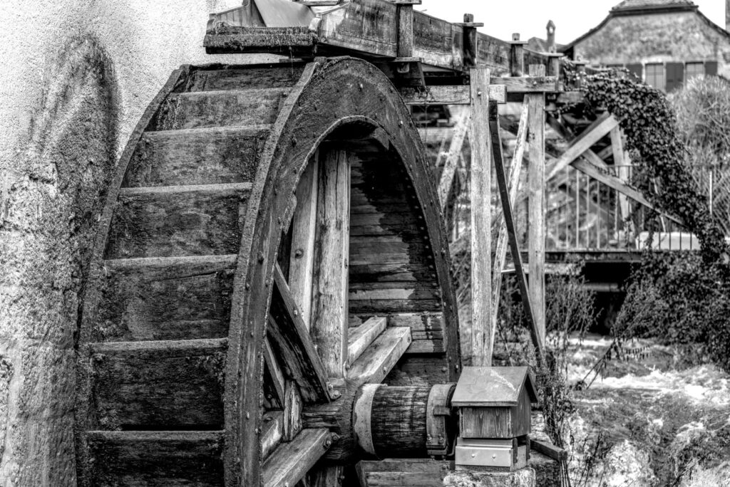
When topography prevented water from flowing by simple gradient toward higher lands situated on the edges of the valley, engineers resorted to mechanical power. Fluvial waterwheels (norias) constitute the most emblematic elements of the region’s industrial and ethnographic heritage, highlighting colossal pieces such as the Waterwheel of Alcantarilla and those of La Ñora and La Albatalía in the traditional orchard.
The Alcantarilla Waterwheel, originally built of wood and later modernized with a metallic structure and ceramic or iron buckets, is capable of elevating water flow several meters high using exclusively the kinetic energy of the Segura River current. These devices not only fulfilled an irreplaceable practical function before the arrival of electrification, but represented true technological milestones that amazed European travelers during the 18th and 19th centuries on their journeys through eastern Spain.
Today, the conservation of these structures demands meticulous artisanal maintenance combining traditional river carpentry with period metallurgy. Municipalities in the orchard and various cultural associations promote their enhancement, integrating them into industrial heritage tourist routes that help visitors understand the physical and technical effort required to tame a fickle river in a dry Mediterranean climate environment.
Agricultural Modernization and Precision Technology in the Riverbed
The 20th century and the first decades of the 21st have radically transformed the water landscape in Murcia. The construction of large headwater regulatory reservoirs—such as the Talave and Cenajo swamps—and the arrival of resources through the Tajo-Segura Aqueduct profoundly altered exclusive dependence on indigenous flow, helping stabilize supplies against recurring structural droughts plaguing the southeastern peninsula.
Concurrently, traditional orchard land has coexisted with the expansion of technologically advanced intensive agriculture in the Campo de Cartagena and neighboring districts. In these areas, drip irrigation and computer-controlled fertigation systems have replaced traditional flood irrigation, achieving exceptional water efficiency ratios. Soil moisture sensors, automated meteorological stations, and advanced reuse of tertiary treated wastewater configure a highly competitive and sustainable agricultural management model.

Nevertheless, this modernization coexists with the need to preserve the ecological and landscape values of the Segura riverbed itself. Environmental restoration of riverside forests, the creation of urban green corridors as it passes through the capital, and rigorous control of industrial discharges have restored biodiversity to stretches that decades ago suffered severe pollution and acute water stress.
The Network of Riverside Paths and Soft Mobility
The Segura waterway network is historically accompanied by service roads and fishermen’s paths that are experiencing a second youth thanks to the rise of active tourism and sustainable mobility. The project to improve and condition the riverbanks has given rise to continuous cycling and pedestrian itineraries connecting municipalities, historic orchards, and protected natural areas without needing to use the conventional road network.
These routes allow travelers to delve into the intimacy of the Murcian agricultural landscape, observing closely the operation of floodgates, secondary ditches, and restored flour mills that bear witness to the valley’s pre-industrial past. The integration of these riverside paths with Renfe commuter train stations and interurban bus lines facilitates an eco-friendly multimodal approach, reducing the carbon footprint associated with tourist travel in the region.
Furthermore, leisurely transit along these paths fosters direct interaction with local communities, farmers still working traditional plots, and artisans keeping alive trades linked to land and water, consolidating a tourism product based on authenticity and territorial rigor.
Gastronomic and Cultural Heritage Linked to the Orchard
The symbiotic relationship between the Segura River and its environment manifests prominently in local gastronomy, considered one of the purest expressions of inland Mediterranean diet. Horticultural products grown through the millennial ditch system—such as Murcia paprika, citrus fruits, artichokes, and a wide variety of leafy greens—form the basis of traditional dishes as deeply rooted as meat pie (pastel de carne), rice with vegetables, michirones (broad beans), and zarangollo.
Popular festivals, deeply influenced by this agricultural cycle, find their maximum expression in events such as the Bando de la Huerta, where thousands of citizens wear traditional attire and recreate farming chores in the capital’s streets. The culture of water also impregnates folklore, popular romances, and the vernacular architecture of orchard manor houses and traditional paprika drying sheds, now converted into small ethnological museums.
Water in the Murcia orchard is not a passive resource that is consumed and discarded; it is living heritage that is inherited, contested, and venerated as the true pulse of the community.
This rich intangible heritage gives depth to any journey through the region, reminding visitors that behind every green and orderly landscape lies a millennial history of collective effort, climate adaptation, and respect for the territory’s natural limits.

Practical guide
Planning a trip focused on the waterway and agricultural heritage of the Murcia region requires keeping in mind several practical recommendations to optimize the experience:
- How to get there: The regional capital features high-speed rail connections (AVE) from Madrid and the Mediterranean corridor, alongside Medium Distance and Commuter trains linking with Alicante and Almería. The Murcia Region International Airport operates regular flights with several European hubs.
- Best time to visit: Spring months (March to May) and autumn (September to November) offer mild temperatures ideal for walking or cycling along riverside paths, avoiding extreme summer heat.
- Internal transport: To explore orchard municipalities (Alcantarilla, Archena, Cieza, Ulea), it is highly recommended to use the conditioned bike lanes along the Segura River or combine public transport with cycling.
- Essential sights: La Contraparada diversion dam, the Alcantarilla Waterwheel and its Ethnological Museum, the historic thermal spa resorts of Archena and Fortuna linked to mineral springs, and Murcia’s historic quarter featuring its famous Council of Wise Men.
- Gastronomy and shopping: Be sure to visit traditional food markets (such as Plaza de Verónicas) to acquire local products with designation of origin, and book a table at restaurants specializing in traditional orchard cuisine.
Final Reflection on Landscape and Fluvial Memory
The journey along the middle course of the Segura reveals an undeniable truth: landscape is not an aesthetic accident, but the accumulated result of human intelligence applied to survival. Through centennial canals, monumental waterwheels, and fields cultivated with millimeter precision, the Murcia region has built an unbreakable identity against climatic adversity.
Observing the leisurely flow of water beneath the arches of an ancient diversion dam or listening to the creaking of wood in an operating waterwheel invites us to rethink our contemporary relationship with natural resources. In a global context marked by climatic uncertainty, the historical model of the Segura stands not only as an archaeological testimony of great value, but as a manual of water resilience worthy of study, preservation, and deep admiration.