Introduction to the Labyrinth of Iron and Water
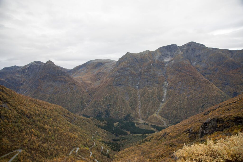
The geography of western Norway is defined by a violent collision between solid land and the Atlantic Ocean, where glacial valleys descend vertically into the dark waters of the fjords. In this territory of impossible gorges and thundering waterfalls, nineteenth and early twentieth-century civil engineering had to redefine the limits of possibility to vertebrate a region isolated by nature. The Flåm Railway, or Flåmsbana, is not merely a masterpiece of European railway infrastructure; it constitutes a vital logistical corridor that radically transformed the mobility of entire communities, connecting the mountainous heights of the Hardangervidda plateau with the branch of the Aurlandsfjord.
Along its twenty-odd kilometers of route, this standard-gauge track overcomes a dizzying elevation drop approaching nine hundred meters until reaching the station at Myrdal, where it connects with the main Bergen line. This report examines with rigorous technical perspective and territorial insight how the audacity of Norwegian engineers succeeded in taming a hostile topography through the manual excavation of spiral tunnels, the construction of bridges over abysses, and the design of specific traction systems for extreme gradients. Beyond its undeniable heritage appeal, the line represents a fundamental milestone in the history of Scandinavian transport and an enduring testimony to human resilience in the face of the natural environment.
The Genesis of an Impossible Route: Planning and Orographic Design
The idea of connecting the Sognefjord with the main railway network linking Oslo and Bergen began to take shape in technical offices during the late nineteenth century. The primary difficulty lay not in a lack of political will, but in the brutal topography of the Flåmsdalen valley. Engineers faced a critical dilemma: how to overcome an average gradient of fifty-five per thousand in terrain dominated by fractured metamorphic rock, constant snow avalanches, and roaring rivers. Following decades of parliamentary debate and preliminary topographical surveys, the Norwegian parliament approved construction in nineteen twenty-four, initiating works that would stretch for over two decades due to extreme weather conditions and subsequent interruptions stemming from international conflicts.

The final design demanded civil engineering solutions unprecedented in the Scandinavian region. Of the twenty tunnels comprising the current layout, eighteen were hand-excavated using picks, dynamite, and a workforce of hundreds of laborers who endured arctic winters under conditions of severe isolation. Each tunnel required meticulous calculations to prevent collapses and ensure long-term structural stability. The complexity of the route forced engineers to devise a system of zigzag tracks and helical tunnels enabling locomotives to gain elevation within the mountain mass without exceeding the physical adhesion limits of steel wheels upon rails.
The Engineering of Spiral Tunnels and Bridges Over Abysses
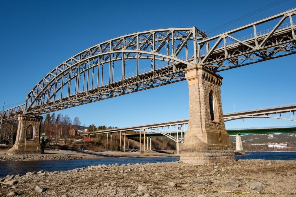
The technical heart of the Flåm Railway lies in its ability to coil within the mountain. The most eloquent example of this construction prowess is the Vatnahalsen tunnel and the loop system enabling the train to ascend in a spiral, crossing the same gorge multiple times at varying heights. This layout not only responded to a geometric necessity to overcome the elevation drop, but also demanded the construction of monumental stone and masonry viaducts capable of withstanding lateral wind loads and the weight of heavy railway formations. Bridge piers were anchored directly to the solid rock of the ravines, utilizing pioneering sub-surface and dry-foundation techniques that still astonish infrastructure specialists today.
blockquote>The construction of the line was not merely an exercise in track laying, but an endeavor of geological patience where every meter of advancement required stabilizing rock faces prone to thermal fracturing during spring thaws.
In addition to geological challenges, the hydrological management of the route required diverting entire watercourses through stone channels and building cyclopean retaining walls to protect the track from recurring avalanches. Engineers designed snow-protection galleries in the most exposed sections—structures of timber and reinforced concrete allowing avalanches to pass over the railway platform without interrupting operational flow. This obsessive attention to structural detail ensured that the line maintained operational viability during the harshest winter months, becoming the umbilical cord of the valley’s rural settlements.
Energy Transition and the Evolution of Rolling Stock
Originally conceived to operate with steam locomotives adapted to steep gradients, the railway system underwent a radical transformation with the advent of electrification in nineteen forty-four. The choice of fifteen-kilovolt single-phase alternating current at sixteen and two-thirds hertz reflected the cutting-edge technological standards of European railroading at the time. This modernization not only increased the operational energy efficiency, but also eliminated the dangerous problem of smoke and toxic gas accumulation inside narrow rock-excavated tunnels, substantially improving working conditions for drivers and general line safety.
Over subsequent decades, rolling stock evolved from classic wooden carriages to robust electric units equipped with multiple braking systems, including regenerative brakes and independent electromagnetic retention systems. These technologies are indispensable for controlling descent speed on the steepest sections, preventing overheating of brake shoes. The catenary infrastructure and electrical substations located along the route have undergone successive modernizations to guarantee a stable power supply, even on winter days when storms lash the peaks of the Norwegian plateau.
Socioeconomic Impact on Valley Settlements
The establishment of the railway line irreversibly altered the socioeconomic dynamics of the Flåmsdalen valley and the riverside communities of the Sognefjord. Before the official inauguration of the route, geographical isolation forced local inhabitants to rely exclusively on complicated fjord navigation routes and mountain paths impassable for much of the year. The train provided a fast and secure communication link for transporting goods, mail, and passengers, facilitating the commercialization of local agricultural and dairy products while opening the region to trade with Bergen and the rest of the country.

With the gradual decline of traditional freight transport, the infrastructure successfully reinvented itself toward passenger mobility and sustainable territorial development. Today, the line functions as an essential multimodal connectivity axis integrating cruise ship traffic, regional ferry services, and the long-distance train network. This steady influx of visitors has transformed the local economy, generating specialized employment in infrastructure maintenance, heritage management, and hospitality services respectful of the protected natural environment of the western fjords.
Industrial Heritage Conservation and Contemporary Challenges
Maintaining a century-old railway infrastructure in such an extreme natural environment represents a constant logistical and financial challenge for the managing enterprise Bane NOR. Structural tunnel inspections, the scaling of unstable rocks on slopes, and the periodic replacement of sleepers and rails subjected to extreme mechanical stresses require rigorous safety protocols and the deployment of cutting-edge technology, such as three-dimensional laser scanners and real-time geotechnical monitoring sensors.
blockquote>Preserving the architectural authenticity of historic stations such as Hareina or Berekvam without compromising modern railway safety standards constitutes the delicate balance guiding current management of this alpine corridor.
The effects of climate change, manifested in increased frequency of intense precipitation and more unpredictable freeze-thaw cycles, require rethinking natural hazard mitigation strategies. Early warning systems against landslides have been reinforced, and significant resources have been invested in renovating subterranean drainage to channel excessive runoff from nearby waterfalls, ensuring the permanence of this moving historical monument.
Practical guide
How to get there: Main access to the line is achieved from Myrdal station, directly connected to the Bergen Line (Bergensbanen), linking Oslo and Bergen daily. Alternatively, the journey can be initiated from sea level at the Flåm terminal, situated at the innermost point of the Aurlandsfjord.
Ticketing planning: Tickets must be secured in advance through official Norwegian rail operator channels or authorized agencies, especially during the peak summer season when international demand reaches its zenith.

Best time to visit: May through September offers stable weather conditions and extended daylight, allowing full appreciation of the scale of glacial landscapes. Winter months provide a dramatic and snowy perspective, though subject to potential operational schedule adjustments due to adverse weather.
Multimodal connectivity: It is possible to combine the train journey with marked hiking trails in the valley, such as the famous Rallarvegen path, or connect with electric ferries navigating the Nærøyfjord, a UNESCO World Heritage site.
Visual Epilogue in the Quiet of the Fjord
When the final service of the day descends slowly toward the water’s edge, the metallic echo of wheels upon rails gradually fades among the constant murmur of the Kjosfossen waterfall and the cold breeze descending from snow-capped peaks. The warm lights of historic stations reflect upon the mirror-like surface of the fjord, painting a scene of profound stillness where human endeavor and geological brutality converge in perfect harmony. At that crepuscular moment, the railway ceases to be a mere means of transportation and becomes a silent bridge between Norway’s industrial history and the majestic timelessness of its most breathtaking landscapes.