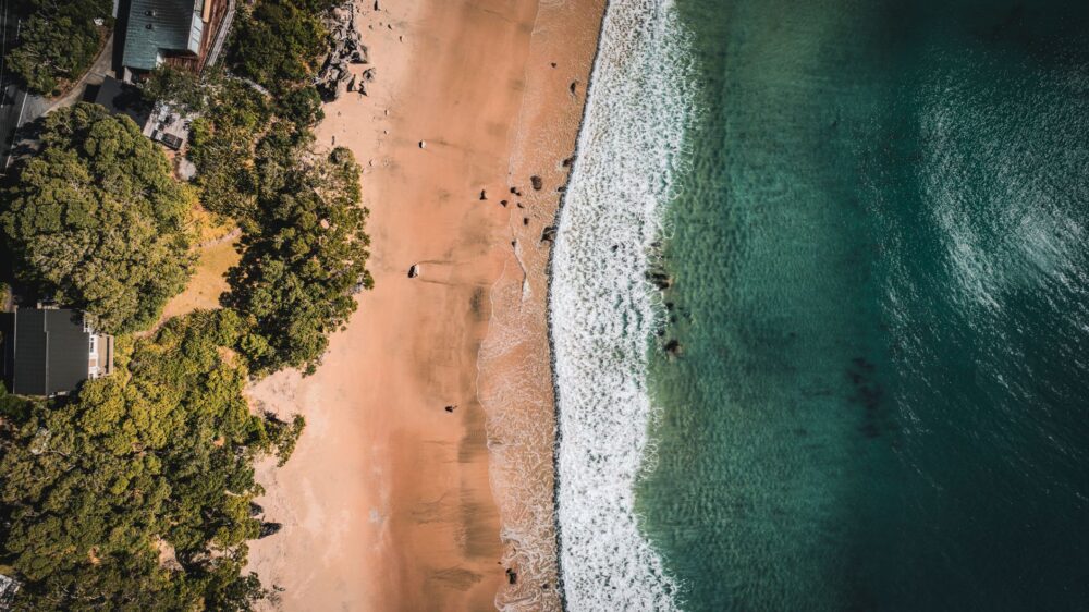
The Wadden Sea, designated as a UNESCO World Heritage Site, represents one of the most complex environments for coastal navigation and tidal exploration on the European continent. This vast system of mudflats, sandbanks, and shallow channels stretches along the southern coast of the North Sea, spanning territories in the Netherlands, Germany, and Denmark. Far from constituting a simple tranquil coastal strip, this marine labyrinth imposes relentless physical rules governed by the constant rhythm of the tides. Every twelve hours, thousands of square kilometers of the seabed are completely exposed, transforming the navigable surface into an impassable muddy terrain before flooding it once again with a speed that tests the skill of any mariner.
Planning a voyage or maritime expedition in this environment demands absolute mastery of specialized nautical cartography and an understanding of tidal currents. Unlike open ocean navigation, where calculation errors afford a wide margin of correction, the Wadden Sea punishes improvisation harshly. Light watercraft, retractable-keel sailboats, and sea kayaks venturing into its secondary channels must calculate sounding windows with millimetric precision. A delay of barely thirty minutes when diverting into a minor channel can result in irreversible grounding on sandbanks, leaving the crew exposed to the unrelenting force of the wind and the rapid rise of cold waters.

The Dynamic Geography of the Frisian Shoals
The morphology of the Wadden Sea is not a static element, but a living geological structure shaped by wind, waves, and tidal currents. The Frisian Islands, which act as a natural barrier between the North Sea and the inner Wadden Sea, experience continuous erosion and sedimentation. This means that nautical charts printed more than two seasons ago lose reliability in key tidal inlets and channels. Channel patterns shift position after every major winter storm, forcing local maritime authorities to constantly update floating buoys and bathymetric data.
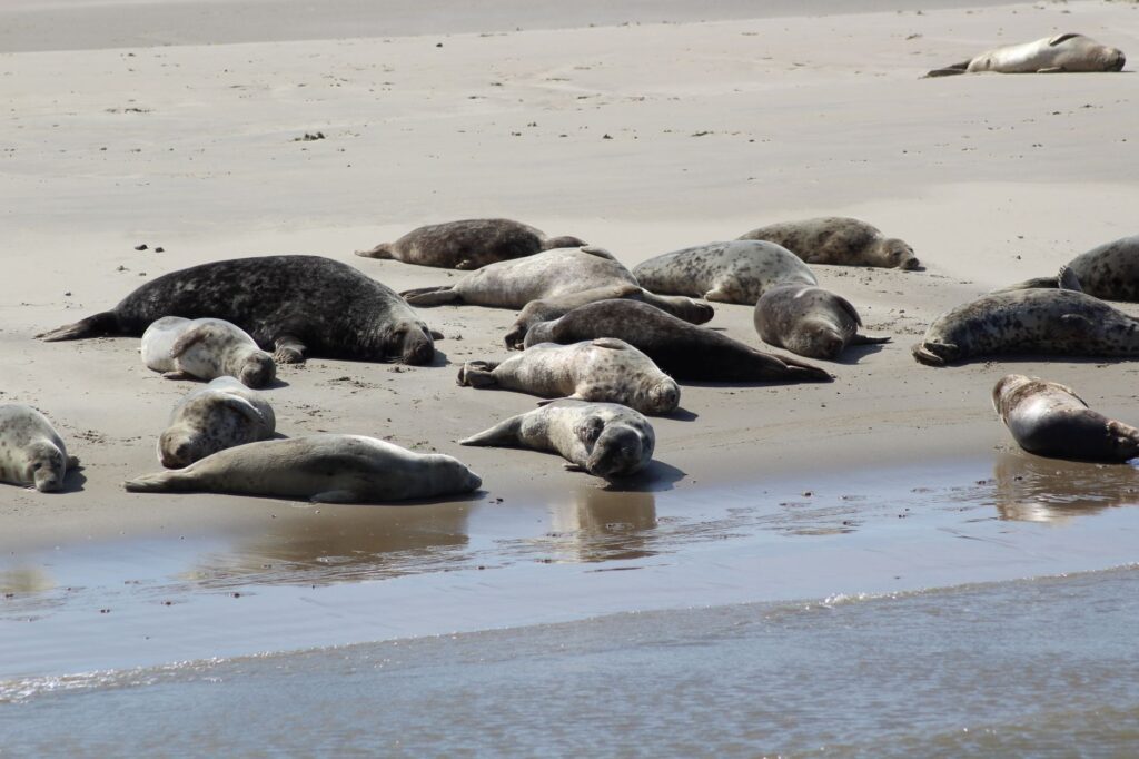
For the modern navigator, understanding this fluvial and marine dynamic requires the combined use of updated global positioning systems and empirical observation of the environment. Sandbanks, locally known as platen, emerge during low tide to form lunar landscapes where the only sign of life comes from colonies of harbor seals and grey seals resting in the sun. Navigation in these areas demands continuous vigilance over depth sounders and sea states, as the combination of strong westerly winds and an exceptional low tide can drain the channels far beyond theoretical tide table forecasts.
Intertidal Meteorology: The Relentless Pulse of the North Sea
The climate in the Wadden Sea basin is dominated by rapidly moving low-pressure systems originating in the North Atlantic. This geographical location exposes the area to sudden meteorological shifts. A peaceful day of sailing under clear skies can transform within hours into a scenario of gusty winds exceeding force 7 on the Beaufort scale, accompanied by intense squalls that reduce horizontal visibility to a mere few metres.

Local weather forecasts must be consulted continuously, paying special attention to storm surge warnings and barometric pressure differences. When strong winds blow from the northwest during a high tide, a storm surge occurs, raising water levels several meters above the usual astronomical high tide and flooding coastal containment dikes. Expedition members must have pre-identified safe shelters or elevated grounding points along each stage of the route to avoid becoming trapped in intertidal zones without escape routes.
Nautical Logistics and Vessel Selection
Choosing the appropriate watercraft is the decisive factor for the success of any voyage through the Wadden Sea. Traditional flat-bottomed sailboats, known in the Netherlands as platbodems, have proven for centuries to be the ideal design for these waters. Their ability to rest safely on sandbanks during low tide, thanks to their leeboards, allows the crew to wait for the rising tide without suffering heel or structural damage to the hull.
On the other hand, sea kayaking practitioners and explorers in rigid inflatable boats must exercise extreme caution regarding weight and survival equipment. Carrying long-range VHF communication systems, isothermal dry suits due to low water temperatures throughout most of the year, and redundant navigation systems that do not rely solely on the onboard electrical grid is mandatory. Autonomy is another critical factor, as fueling and provisioning infrastructure are separated by great distances along protected channel routes.
Marshland Ecology: Responsible Navigation and Conservation
Navigating the Wadden Sea means venturing into one of the world’s most important ecological sanctuaries for migratory birds. Millions of waterbirds use these wetlands as staging, feeding, and breeding grounds along their migration routes between northern Europe and the African continent. This biological fragility imposes strict regulations on recreational and commercial navigation, prohibiting access to designated protected areas during nesting and molting periods.

Crews have both a legal and moral obligation to maintain a safe distance from sandbanks where marine mammal populations rest. Approaching too closely with motorized watercraft induces panic in seal colonies, separating pups from their mothers and compromising their survival. Waste management onboard must be rigorous, applying the principle of zero impact in an environment where the accumulation of plastics and pollutants directly threatens the trophic chain of the intertidal ecosystem.
The Art of Reading Local Charts and Soundings
In the era of automated electronic navigation, mastering traditional cartography remains the ultimate life-saving skill in the Wadden Sea. GPS equipment can fail due to atmospheric interference or electrical power issues, but a bulkhead magnetic compas and well-corrected paper charts will never abandon the navigator. Channel reading requires interpreting water shadows, surface ripples caused by submerged sandbanks, and the changing color of the sea, which shifts from deep blue in deep waters to clear emerald green over the shoals.
Experienced skippers use freeboard techniques and observation of spar buoys to deduce the actual speed of the tidal current. In many straits between the islands, currents can exceed four knots, making progress against the tide an impossible task for low-power engines or human-powered watercraft. Planning the start of each daily leg to coincide with the turn of the tide or leveraging incoming tidal currents is the key to maximizing efficiency and ensuring safe, reliable navigation.

Practical guide
Planning a nautical or coastal expedition through the Wadden Sea requires precise technical knowledge of regulations, seasons, and support resources available across the three riparian countries.
- Best time for navigation: From May to September, when weather conditions are most stable and daylight hours maximize daily travel windows.
- Permits and regulations: Consulting access regulations for national park protected areas in Germany, the Netherlands, and Denmark is mandatory. Certain areas are entirely closed to navigation between April and August.
- Mandatory equipment: Isothermal dry suits, approved VHF radio, updated paper nautical charts, operational depth sounder, and a sea anchor for emergency situations in shallow waters.
- Tide tables: Use exclusively official national hydrographic service tide yearbooks (such as the BSH in Germany or Rijkswaterstaat in the Netherlands), adjusting calculations to local time and daylight saving hours.
- Recommended ports of call: Den Helder and Harlingen in the Netherlands; Cuxhaven and Wilhelmshaven in Germany; Esbjerg in Denmark. All feature full repair and storm-shelter facilities.
- Emergency communications: VHF Channel 16 for general distress calls and permanent contact with local maritime rescue services (KNRM in the Netherlands, DGzRS in Germany).
- Water and food self-sufficiency: Carry drinking water reserves for at least five days, as supply points in remote island shelters are sparse or nonexistent during the off-season.
The infinite horizon of the Wadden Sea, where the sky merges with damp sandbanks under the changing light of northern Europe, offers an unparalleled experience of disconnection and physical challenge. Setting sail from the sheltered ports of the mainland and venturing into the vastness of its tidal channels, the traveler realizes that true adventure does not lie in conquering nature, but in learning to read its subtle signs, adapting with humility to the millenary rhythm of the tides governing this borderland between land and sea.