The Stone Gateway to the Atlantic Abyss
The western fringe of Europe finds in the Aran Islands—Inis Mór, Inis Meáin, and Inis Oírr—a limestone bastion that defies the relentless fury of the Atlantic Ocean. Situated at the mouth of Galway Bay, these three insular formations represent not only a geological milestone of karstic terraces sculpted over millennia, but also the final link in a vital maritime connectivity. For the communities inhabiting these wind-lashed rocks, the sea has never been a barrier of separation, but rather the only possible highway toward the mainland. Understanding the reality of the Aran Islands requires delving into the meticulous logistics of their ferry routes, an essential transport system that sustains daily life, the local economy, and the preservation of a unique linguistic identity.
For centuries, the isolation of the islands was an unyielding condition. The inhabitants depended on traditional sailing and rowing boats known as currachs, built from wooden frames covered in animal skins or tarred canvas, capable of navigating wild swells with surprising lightness yet extreme peril. The arrival of regular steamship services in the late 19th century and, subsequently, the modernization of the ferry fleet in the 20th century radically transformed the islanders’ relationship with the mainland. Today, the crossing from the ports of Rossaveel in County Galway and Doolin in County Clare constitutes an indispensable transit ritual that combines contemporary naval engineering with traditional seafaring expertise.
Engineering and Logistics of the Ferries
Operating a regular maritime transport line in the North Atlantic demands vessels with highly specific technical characteristics. The fleets operating the route to the Aran Islands are primarily composed of high-speed catamarans and passenger-cargo roll-on/roll-off ferries designed to withstand weather conditions that are frequently adverse off the western Irish coast. These vessels must contend with complex tides, strong currents, and gale-force winds battering the Irish western seaboard during the autumn and winter months. The structural stability of these catamarans, equipped with reinforced aluminum hulls and powerful marine diesel engines, guarantees passenger safety and punctuality in the delivery of essential supplies.
The logistical planning of the shipping lines operating out of Rossaveel and Doolin is an exercise in surgical precision. Unlike land transport, insular maritime transit is absolutely subordinate to the tyranny of the weather. Ferry captains must constantly consult oceanographic models and weather forecasts from Ireland’s Meteorological Office (Met Éireann) before authorizing departure. A sudden shift in wind direction or the formation of large swells—high-energy background waves—at the mouth of the bay forces operations to be suspended preventatively. This intrinsic vulnerability makes the crew a fundamental human link, whose accumulated decades of experience frequently surpass the precision of the most advanced digital navigation instruments.
Rossaveel and Doolin: The Two Continental Lungs
Maritime access to the Aran Islands is channeled primarily through two main hubs on the mainland, each with its own distinct geographical and operational personality. Rossaveel (Ros an Mhíl), located in the heart of the Connemara region, functions as the year-round primary port. Its location in a sheltered bay with adequate draft permits the operation of larger ferries even in unfavorable weather conditions. The arrival at Rossaveel from Galway city via the R336 road serves as a scenic introduction to the deep west, traversing salt marshes, dark peat bogs, and communities where the Irish Gaelic language remains the primary vehicle of daily communication.
Conversely, the pier at Doolin, in County Clare, offers the shortest route to the archipelago, particularly to Inis Oírr, the smallest and closest island. Operational mainly from April to October due to the severity of the winter sea, Doolin is renowned for its proximity to the spectacular Cliffs of Moher, offering travelers a unique nautical perspective of these sedimentary formations. However, Doolin’s port infrastructure is more modest and subject to strict tidal constraints, demanding meticulous coordination between the arrival of tourist buses and the docking maneuvers of the rigid and semi-rigid ferries operating from this pier.
The sea separating Galway from the Aran Islands is not an abyss that isolates, but rather the saltwater artery through which the survival of a millenary culture flows.
Inis Mór: The Monumental Scale of the Archipelago
Following a crossing of approximately forty-five minutes from Rossaveel, the ferry docks at Kilronan (Cill Rónáin), the main port of Inis Mór. Covering a surface area of slightly over thirty-one square kilometers, this island is the largest of the group and concentrates most visitor reception infrastructure. The port is a hub of coordinated activity: while passengers disembark toward rental bicycle fleets and local minibuses, the pier cranes unload containers of foodstuffs, construction materials, and fuel, serving as a reminder that insularity demands strict self-sufficiency in logistics.
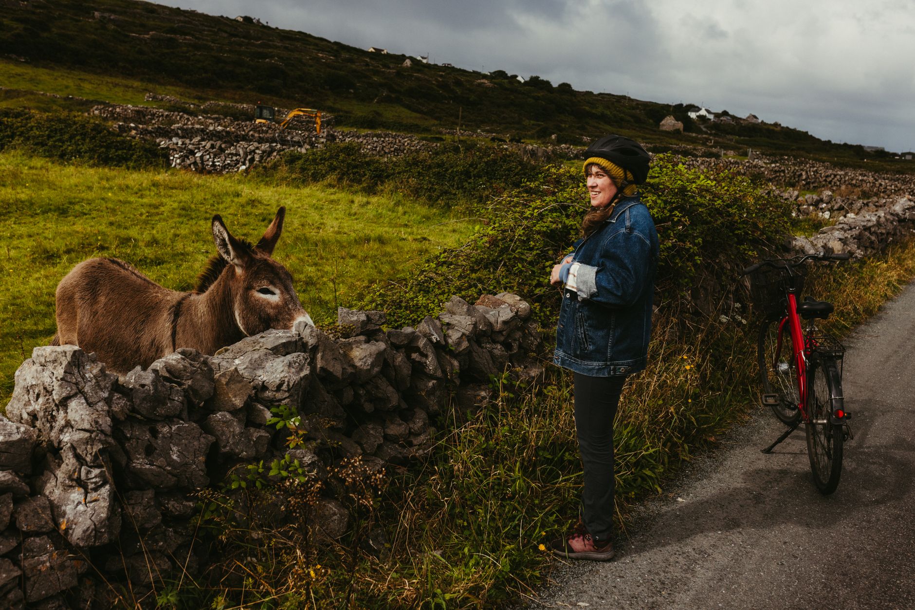
The landscape of Inis Mór is defined by an endless network of dry-stone walls dividing the limestone plateau into thousands of geometric plots. This stone, stacked without mortar by generations of farmers, serves a dual purpose: protecting scarce crops from the erosion of the Atlantic wind and clearing the rocky terrain. At the westernmost tip of the island stands the prehistoric fort of Dún Aonghasa (Dun Aengus), an Iron Age defensive structure perched on the edge of a vertical cliff dropping one hundred meters straight into the ocean. Visiting this monument is not merely an archaeological exercise, but a direct confrontation with the vastness of the marine horizon, where the next stop in a straight line is the American continent.
Inis Meáin and the Geometry of Silence
Nestled between its two sister islands, Inis Meáin (Inis Meadhóin) represents the absolute reverse of mass tourism. With a population barely exceeding one hundred and fifty permanent residents, this island has maintained a low profile along commercial routes, preserving a rural lifestyle deeply rooted in agricultural and fishing traditions. The pier at Inis Meáin, battered by heavy swells and equipped with simpler port facilities, receives a very limited number of daily ferries, primarily mid-sized vessels combining passenger transport with basic provisions.
The geography of Inis Meáin is a labyrinth of stone terraces and meager fields where the soil is so scarce that historical inhabitants had to create arable land by mixing beach sand with rotting seaweed, an ancestral agricultural technique known as wrack composting. This island served as the adoptive home of celebrated Irish playwright John Millington Synge in the early 20th century, who found in its isolation and the language of its people the inspiration for his masterworks on the peasant soul. Traversing Inis Meáin on foot or by bicycle along paths flanked by wild fuchsia thickets is an immersion into a territory where time appears to have slowed its pace, governed solely by the rhythm of the tides and the whistling of the wind.
Inis Oírr: The Atlantic Lighthouse and the Wreck of the Plassey
Inis Oírr, the easternmost and tiniest of the Aran Islands, surprises the traveler with its concentrated landscape and immediate accessibility from the pier. Upon disembarking, the sight of the white sand beach contrasts with the limestone aridity of the interior. The island is dominated by the ruins of the medieval O’Brien Castle, crowning a central hill overlooking the entire coast of County Clare. On the northern shore, half-buried in the littoral rocks, lies the famous wreck of the Plassey, a cargo ship that ran aground during a storm in 1960 and whose metallic remains have become a visual icon of resistance against marine elements.
Transport management on Inis Oírr reflects the human scale of the territory. Private motor vehicles are practically nonexistent here, replaced by modified tractors with passenger trailers, horse-drawn carriages, and bicycles. This sustainable mobility is not a response to modern ecological directives, but rather the simple physical impossibility of introducing a conventional road network into such a fragmented territory. The ferries connecting Inis Oírr to Doolin and Rossaveel operate with a pronounced seasonal cadence, intensifying frequencies during the summer months to absorb the flow of day-trippers seeking a single-day insular experience, although the true essence of the island is only revealed when the last afternoon boat departs for the mainland and day visitors leave the port.
The Survival of the Gaelic Language on the High Seas
Beyond its geological value and the complexity of its transport infrastructure, the Aran Islands constitute one of Ireland’s most vital Gaeltachtaí, regions where the Gaelic language (Gaeilge) remains the mother tongue of the community and the medium of daily communication. This linguistic survival is not a matter of chance, but the direct consequence of historical geographical isolation that protected the population from the assimilationist pressures of the British colonial era. The ferry routes, by guaranteeing regular communication with the mainland, have allowed young islanders to study at continental universities or work in Galway without permanently severing the umbilical cord with their home community.
The Gaelic language echoing across the Aran piers is the invisible map of a cultural resistance sustained by generations of seafaring men and women.
The educational system and cultural centers on the islands, such as Ionad Cultúrtha an Pheadair Mhóir on Inis Mór, continually welcome students from around the world participating in linguistic immersion programs. The arrival of the transeforrs thus functions as a bidirectional bridge: exporting the islanders’ cultural wealth outward while introducing the economic flows necessary to maintain local schools, health centers, and public services. Without efficient maritime connectivity properly subsidized by public administrations, the demographic viability of these insular communities would be unsustainable in the twenty-first century.
Practical Guide for the Atlantic Crossing
Planning a trip to the Aran Islands requires logistical rigor and absolute mental flexibility due to the meteorological instability of the Atlantic. Below are the essential operational keys to organize a successful visit:
- Departure Ports: Rossaveel operates year-round with multiple daily departures and connects to Galway city via a regular bus service coordinated with ferry schedules. Doolin operates seasonally (April to October) and is the most direct option from the south.
- Ticket Booking: Acquiring tickets in advance through the official websites of major shipping lines (such as Aran Island Ferries or Doolin Ferry Co.) is mandatory. During peak season, spaces sell out weeks in advance.
- Weather Flexibility: Always verify service status on the very morning of travel. In case of gales, cancellations are frequent and take precedence over any planned tourist itinerary.
- Internal Mobility: There are no tourist car rental services for visitors on the islands. The primary mode of transport is the bicycle, available at multiple points near the port, complemented by local minibus services and horse-drawn carriages.
- Recommended Gear: Regardless of sunny forecasts, quality windproof and waterproof clothing, suitable footwear for walking on irregular limestone rock, and sun protection are essential, as marine radiation on the cliffs is exceptionally intense.
The Return: The Wake in the Mirror of the Sea
When the ferry undertakes the return journey toward Rossaveel or Doolin, leaving behind the limestone piers and the silhouetted outlines of ancient circular forts, the white wake drawn by the vessel across the dark waters of the Atlantic encapsulates the paradox of modern insularity. The Aran Islands remain a stronghold of natural and cultural resistance, a place where time is measured by the relentless rhythm of the tides and the constant whistling of the western wind. Naval engineering and ferry routes have only served to reinforce that fragile equilibrium, casting an invisible yet indestructible bridge between oceanic exposure and the security of the European continent.