

The Liquid Nexus of an Island Nation
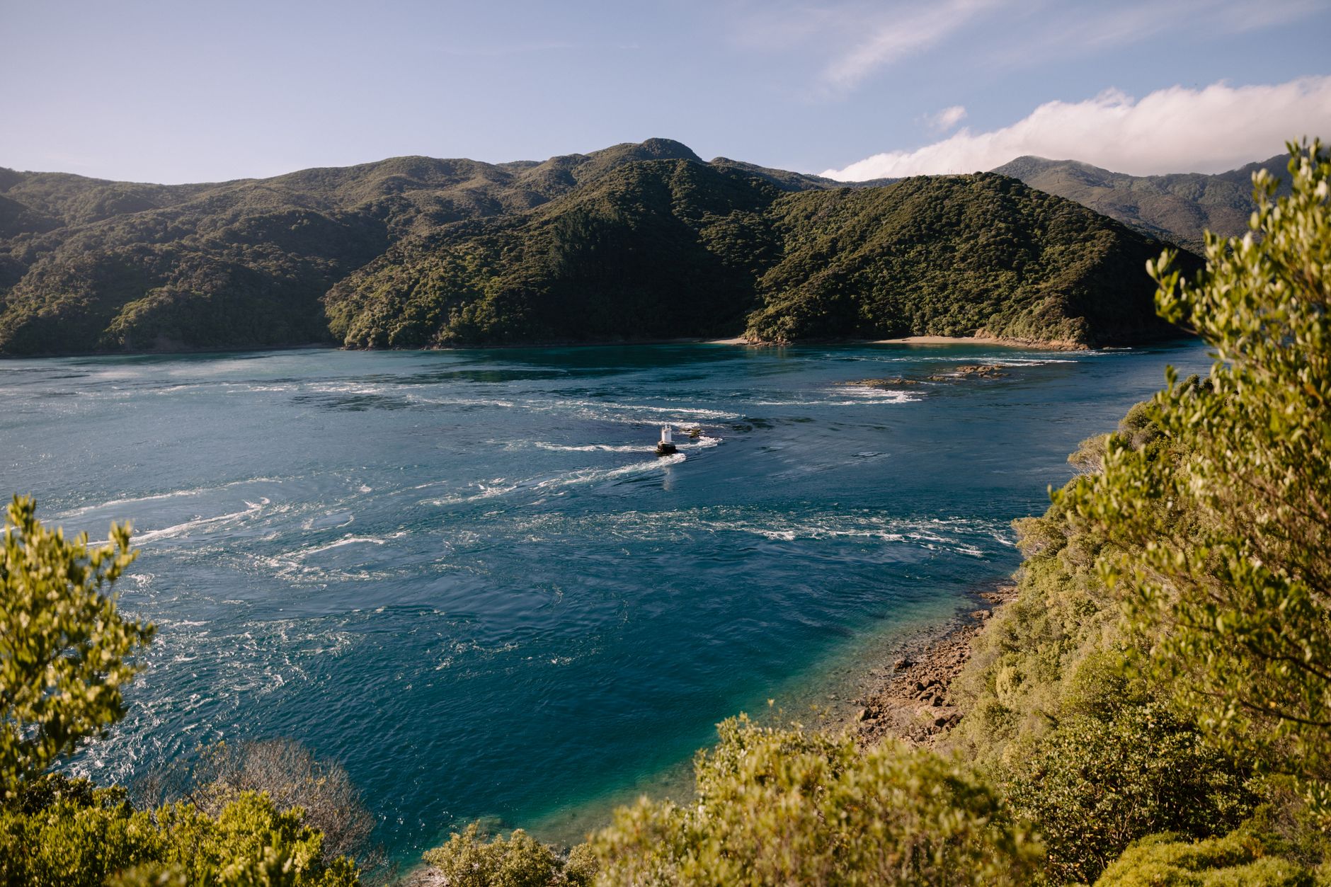
New Zealand is a nation fragmented by the ocean. Its two primary landmasses, the North Island and the South Island, host vastly different demographic, economic, and geographic dynamics that require a constant channel of communication. At the center of this physical divide lies the Cook Strait, one of the most turbulent, unpredictable, and strategically vital bodies of water on the planet. Spanning just 22 kilometers at its narrowest point, this maritime passage is not merely a geographic obstacle, but the very backbone of national connectivity.
For the contemporary traveler and the global supply chain, the Cook Strait functions as a floating extension of State Highway 1 (SH1) and the national rail network operated by KiwiRail. The crossing, which connects the political capital, Wellington, at the southern tip of the North Island, with the picturesque port of Picton in the South Island, represents a marvel of modern logistics. Daily, tons of freight, thousands of passengers, and hundreds of vehicles are transported across this corridor, defying the currents of the Tasman Sea and the Pacific Ocean in a display of naval engineering and port coordination unprecedented in Oceania.
The Unforgiving Geography of the Strait
To understand the technical complexity of this transport system, one must analyze the unique nature of the Cook Strait. Geologically, the strait acts as a gigantic funnel connecting the Tasman Sea to the west with the South Pacific Ocean to the east. This configuration creates a unique hydrodynamic phenomenon: tides at either end of the strait are out of phase, meaning that when it is high tide in the Pacific, it is low tide in the Tasman Sea, and vice versa.
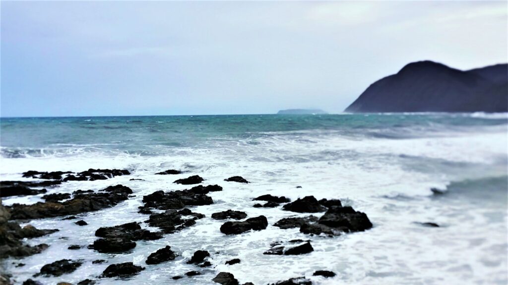
The result of this disparity is the generation of colossal marine currents that can reach speeds of up to eight knots. Compounding this is the wind tunnel effect. Located in the latitude of the Roaring Forties, the strait channels westerly and southerly winds through the flanking mountain valleys, transforming moderate breezes into gale-force winds in a matter of minutes. The resulting waves can easily exceed ten meters in height in the open sections of the passage, requiring vessels operating the route to possess extraordinary stability and power specifications.
«Navigating the Cook Strait is no ordinary coastal run; it is a daily confrontation with the raw hydrodynamics of an ocean that refuses to be tamed.»
Naval Engineering Against the Roaring Forties
The ferries operating this route must be capable of eating up sea miles under extreme conditions while maintaining passenger comfort and the integrity of roll-on/roll-off cargo. The design of modern vessels crossing the strait is the result of decades of technological evolution and lessons learned from the region’s harsh maritime history, marked by the tragic sinking of the ferry Wahine in 1968.
Today’s vessels from the two main operators, Interislander (state-owned) and Bluebridge (operated by StraitFerries), are giants of naval engineering. These ships are equipped with advanced active stabilization systems that use computer-controlled retractable fins to counteract the lateral roll caused by the strait’s heavy swells. Furthermore, their hulls are designed with reinforced bows and high freeboards to withstand the direct impact of the towering waves characteristic of the Karori Rip, a shallow water sector where currents clash violently.
The Inter-Island Fleet: Floating Bridges of Steel
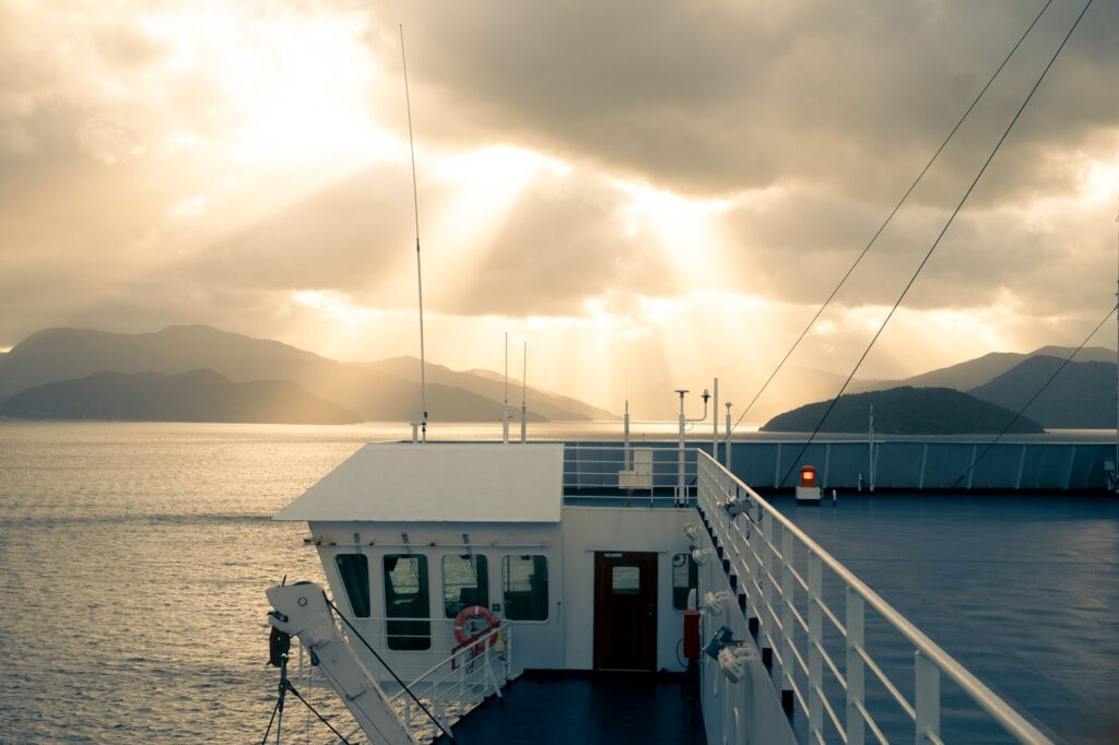
The fleet plying these waters is divided into passenger and general cargo vessels, and specialized rail-enabled ships. The flagship of the Interislander fleet, the Kaitaki, is an outstanding example of operational versatility. With the capacity to carry up to 1,600 passengers and hundreds of vehicles, this green and white giant acts as a true mobile bridge. Alongside it, vessels like the Aratere perform an even more complex technical role: they are rail ferries equipped with internal tracks that align millimetrically with the national rail network at the docks of Wellington and Picton.
This capability to load entire freight trains directly into the belly of the ship eliminates the need for costly cargo transshipment maneuvers at the ports. Containers travel uninterrupted from the farms and industrial hubs of the South Island to the export and distribution centers of the North, optimizing logistical timelines and significantly reducing the carbon footprint of overland transport.
Port Logistics in Wellington and Picton
The efficiency of the Cook Strait route relies not only on the performance of the vessels at sea, but on the surgical precision of landside operations. The port terminals of Wellington and Picton operate under a rapid turnaround model. As soon as a ship berths, a synchronized process begins where heavy freight, rail wagons, commercial trucks, and tourist vehicles must be discharged and loaded within time windows that rarely exceed ninety minutes.
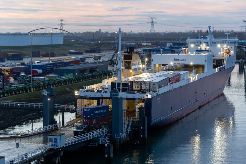
At the Port of Wellington, located in a deep but north-wind-exposed natural harbor, automated mooring systems and double-tier ramps allow for the simultaneous loading of upper and lower decks. In Picton, situated at the head of the winding Queen Charlotte Sound fjord, logistics must adapt to a much more confined geographic environment. Here, the port integrates organically with the small urban fabric and the rail terminal, requiring highly precise traffic management to prevent gridlock on local access roads.
«The true masterpiece of this route is not seen on the water; it is witnessed at the dock, where thousands of tons of rolling cargo change transport modes in under ninety minutes.»
The Passenger Experience: Navigating Fjords and Oceans
For the global traveler, crossing the Cook Strait is one of the most spectacular journeys in the world, a 92-kilometer, three-and-a-half-hour voyage that combines the vastness of the open ocean with the serenity of New Zealand’s fjords. The crossing is clearly divided into three distinct geographical phases.
The first phase begins with departure from Wellington Harbour, navigating through the wide bay and passing the narrow, rocky Wellington Heads, where the Wahine memorial stands as a reminder of nature’s power. Once clear of the harbor’s shelter, the vessel enters the second phase: the crossing of the strait itself. During this ninety-minute open ocean segment, the ship battles the swells, offering dramatic views of the South Island coastline rising slowly on the horizon like a wall of rugged mountains.

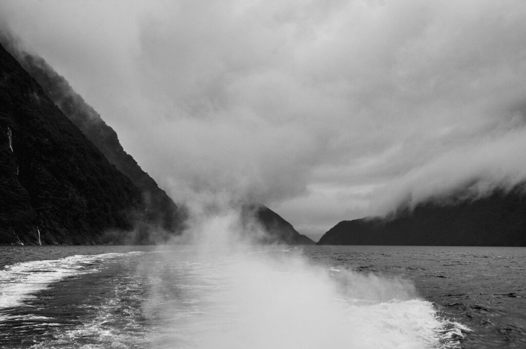
The third phase is undoubtedly the most memorable. The ferry enters the Tory Channel (Tory Channel / Kura Te Au), a narrow, deep inlet flanked by hills covered in dense native forest and green pastures. The contrast between the open ocean’s movement and the almost mystical stillness of the Marlborough Sounds is immediate. The vessel’s speed drops dramatically as it navigates the calm waters of Queen Charlotte Sound, weaving past small islands and secluded bays before finally docking at the port of Picton.
Economic Impact and Freight Transport
Beyond its undeniable tourist appeal, the Cook Strait is the economic engine that unifies New Zealand. It is estimated that more than one million passengers and nearly 300,000 vehicles cross the strait each year, alongside millions of tons of freight representing billions of dollars in trade value. For key sectors such as agriculture, viticulture (particularly the world-famous Marlborough wines), and forestry, the ferry is the only viable link to northern export markets.
The transport of fresh produce, such as seafood from the cold southern waters and seasonal fruits, requires an uninterrupted cold chain. Modern ferries provide electrical hookups for refrigerated trucks and temperature-controlled rail cars during the crossing, ensuring that product quality is never compromised. Any disruption to the strait’s service, whether due to extreme weather or mechanical failures in the aging fleet, has an immediate financial impact felt on supermarket shelves nationwide.
Sustainability and the Future of Decarbonization in the Strait
The future of connectivity across the Cook Strait stands at a technological crossroads defined by the urgency of the green transition. The global maritime sector faces growing pressure to reduce greenhouse gas emissions, and the New Zealand government has set ambitious net-zero carbon targets for mid-century. This requires a comprehensive overhaul of the fleets operating in the strait.
Plans for the medium-term future include the introduction of large-scale hybrid and electric propulsion vessels. These new ships will not only dramatically reduce fossil fuel consumption but will also feature quieter propulsion systems to minimize acoustic impact on local marine wildlife, particularly the populations of Hector’s dolphins and humpback whales migrating through the strait. Furthermore, significant investments are planned for port infrastructure in Wellington and Picton to install high-capacity shoreside charging stations powered by 100% renewable energy, cementing the strait as a global green transport corridor.
Practical Guide for Crossing the Strait
Planning a journey across the Cook Strait requires a clear understanding of logistics and the flexibility needed to cope with New New Zealand’s fast-changing weather. Below are the key aspects to organize your crossing successfully:
- Operator and Service Selection: Interislander and Bluebridge offer multiple daily sailings. While Interislander features larger vessels and a wider range of onboard amenities (ideal for families and travelers seeking comfort), Bluebridge is often the preferred choice for commercial drivers and budget-conscious travelers due to competitive pricing and overnight schedules.
- Vehicle Bookings: If traveling with a motorhome or rental car, booking months in advance is essential, especially during the peak summer season (December to March). Many car rental companies do not allow vehicles to cross between islands, requiring you to drop off your vehicle at one terminal and pick up another at your destination; check your rental terms before booking your ferry ticket.
- Luggage Management: For foot passengers, the process is similar to an airport. Checked luggage is dropped off at the departure terminal and collected from carousels at the destination. The standard weight limit is usually 23 kg per bag.
- Seasickness Prevention: Even on seemingly clear days, swells in the middle of the strait can be pronounced. It is highly recommended to take seasickness preventatives (such as motion sickness tablets or acupressure bands) at least an hour before departure. While the vessels have spacious, climate-controlled indoor lounges, standing on the outer decks and focusing on the horizon often helps mitigate symptoms.
- Ground Transport Connections: In Wellington, the passenger terminal is connected to the central railway station via regular shuttle buses. In Picton, the ferry terminal is within walking distance of the Coastal Pacific train station (connecting to Christchurch) and main long-distance bus stops, facilitating a smooth transition to the rest of the South Island.

