
Introduction to the Labyrinth of Peaks and Tides
The Lofoten Archipelago, sculpted by the relentless advance and retreat of glaciers over millennia, projects into the waters of the Norwegian Sea like a wall of dark granite that defies the laws of terrestrial geometry. Unlike other coastal formations where the transition between mainland and ocean blurs into salt marshes or gently sloping beaches, here alpine summits rise vertically and abruptly from submarine abysses, creating a landscape of sharp ridges and deep fjords that takes the breath away. This territory, situated well above the Arctic Circle, is not merely a geographical accident of singular beauty; it constitutes a human ecosystem where survival has historically depended on the ability to read marine currents, sudden shifts in light, and the unpredictable behavior of the boreal climate.
Arrival in these latitudes imposes a radical shift in the perception of time and space. During the winter months, the polar night wraps the islands in a bluish twilight where northern lights trace greenish arcs across the sky, while summer commands an incessant midnight sun that bathes the rocks in golden tones. It is in this setting that vernacular architecture, centuries-old fishing methods, and coastal navigation routes weave a fascinating network of interdependence. Far from contemporary tourist aestheticization, the communities of Lofoten have preserved an identity forged in isolation, a reverent respect for the marine environment, and the sustainable exploitation of one of the richest fishing grounds on the planet.
Vertical Geography and Glacial Genesis
To understand the layout of human settlements in Lofoten, it is imperative to examine its geological substrate. The rocks composing these islands belong mostly to the Caledonian orogeny, with gneiss and granite formations dating back over two billion years. The erosive action of ice during Quaternary glaciations carved U-shaped valleys so deep that, following subsequent sea-level rise, they became the current fjords and channels separating major islands such as Moskenesøya, Flakstadøya, Vestvågøya, and Austvågøya.
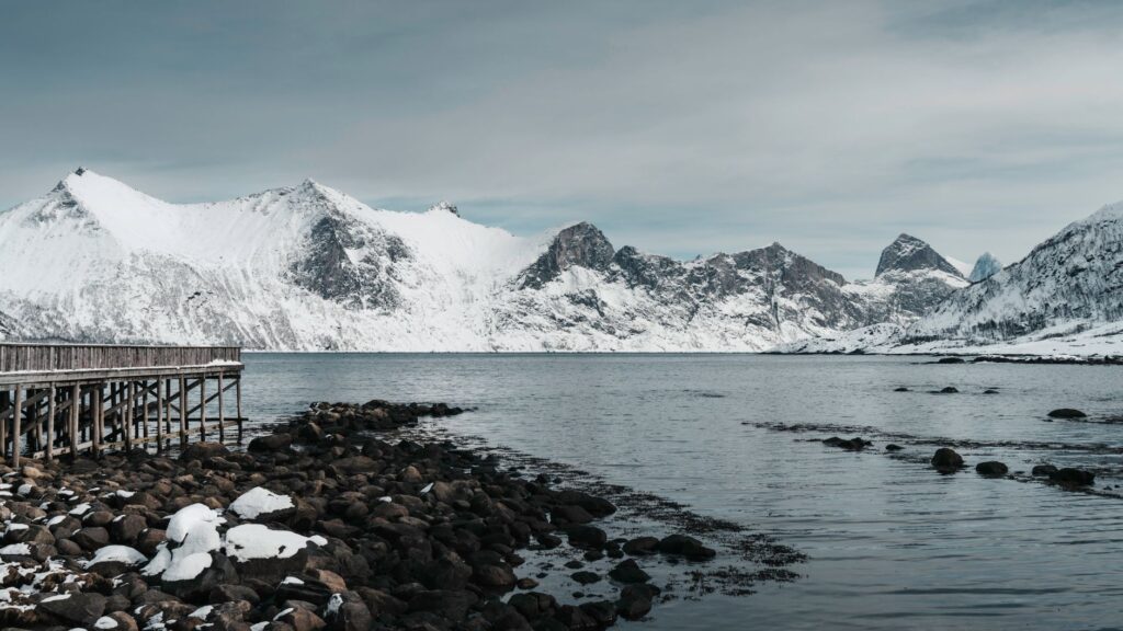
This topographic fragmentation determined that the terrestrial interior remained practically impassable for centuries. The mountains, exceeding one thousand meters in height with near-vertical faces, act as impassable barriers that forced settlers to look exclusively toward the sea. The only viable communication route has historically been the coastal strip and the sheltered waters of the straits. Thus, the network of channels represents not only the physical support for transport, but the vital artery through which economic resources, raw materials, and cultural exchange flow among the various fishing villages wedged between mountain and tide.
The Architecture of the Sea: Rorbuer and Hjeller
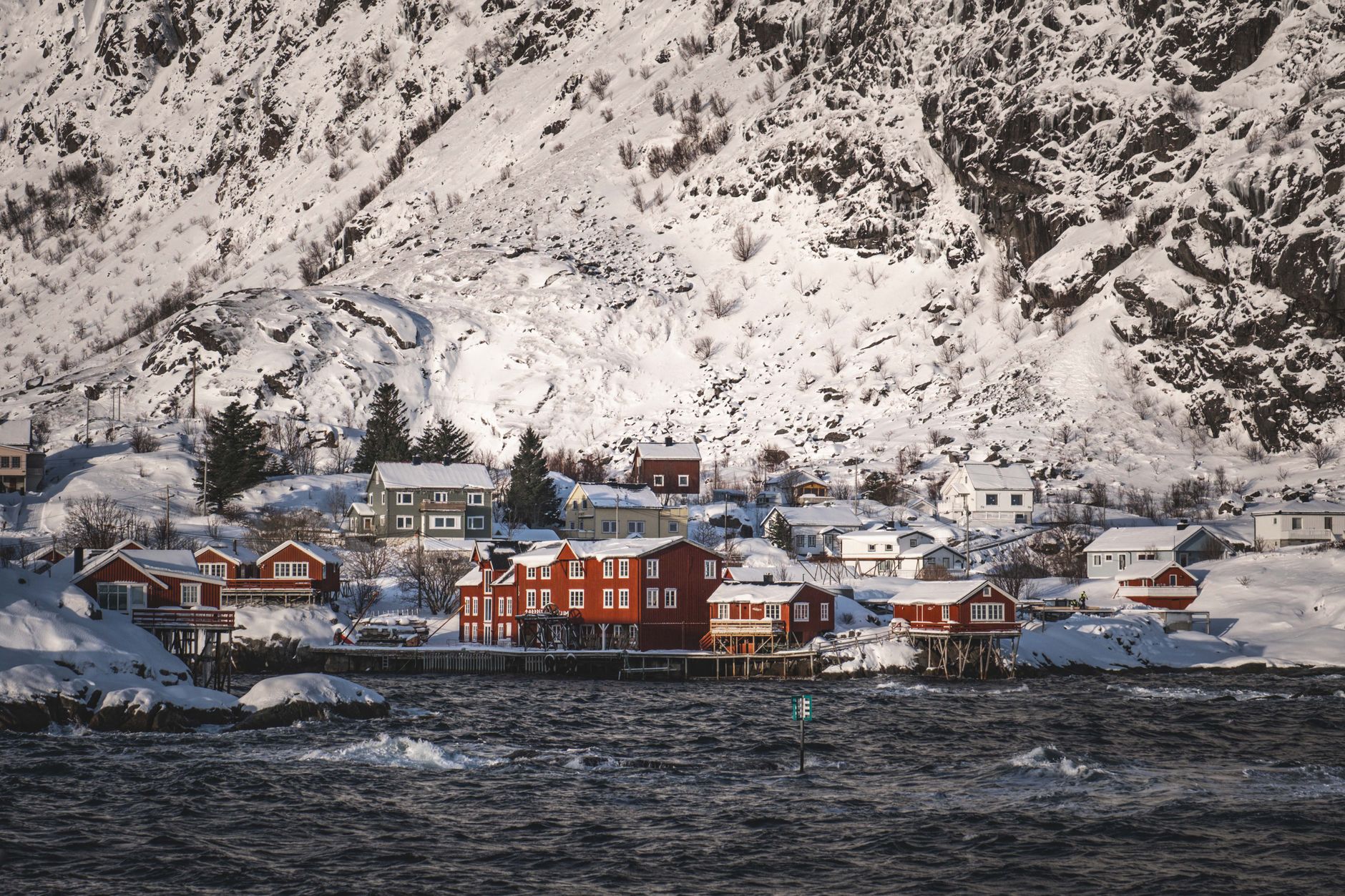
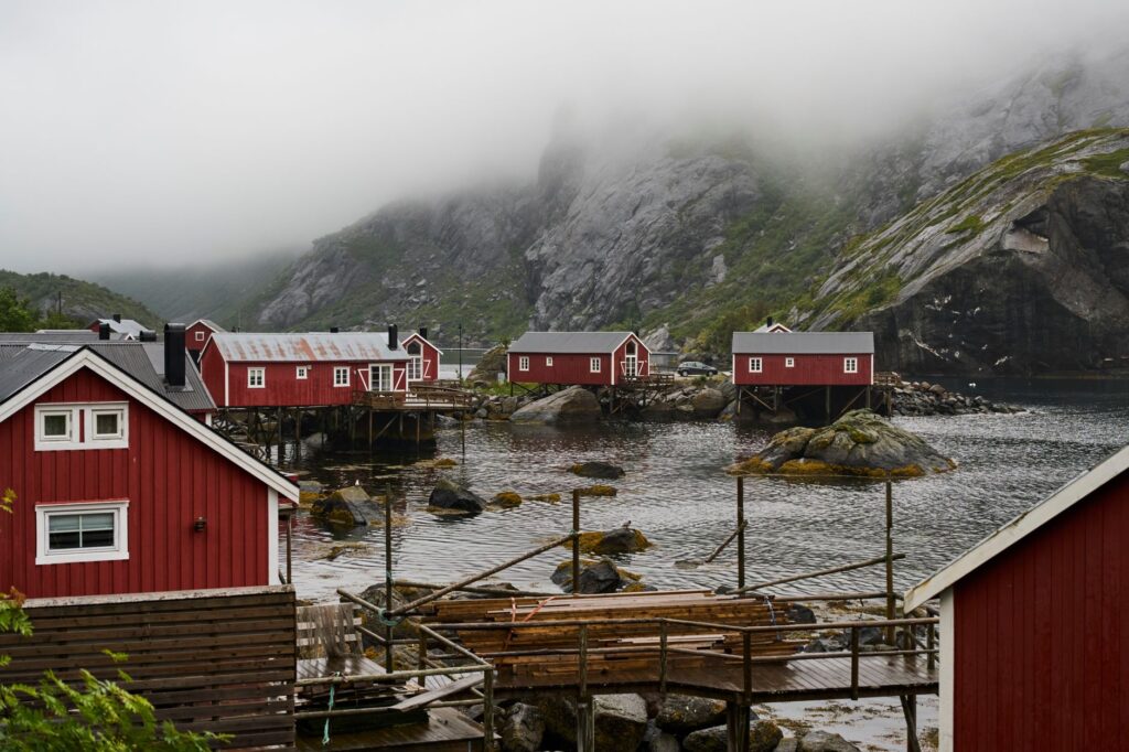
The architectural landscape of Lofoten possesses an unmistakable imprint dominated by two indissoluble elements: rorbuer and hjeller. The former are traditional fishermen’s cabins built on wooden pilings directly over the water. Their origins date back past centuries when temporary fishers from other regions of Norway arrived during winter to participate in the skrei cod season. These structures, traditionally painted with red ochre—a byproduct of local copper mines mixed with fish oil to waterproof the wood—offered shelter to men labouring under extreme conditions.
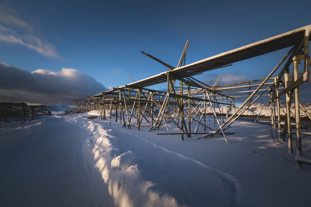
Meanwhile, the hjeller are gigantic wooden pyramidal frameworks erected outdoors along the coast. Their function is as specific as it is vital for the local economy: the natural drying of cod. Subjected to the cold, dry winds of the arctic winter, without using salt or chemical agents, the fish suspended on these racks for months undergoes a dehydration process that concentrates its properties and allows preservation for years. This method, perfected over generations, turns the littoral landscape into a sort of sculptural gallery where utilitarian architecture dialogues directly with the elements.
Inshore Navigation and the Currents of the Vestfjord
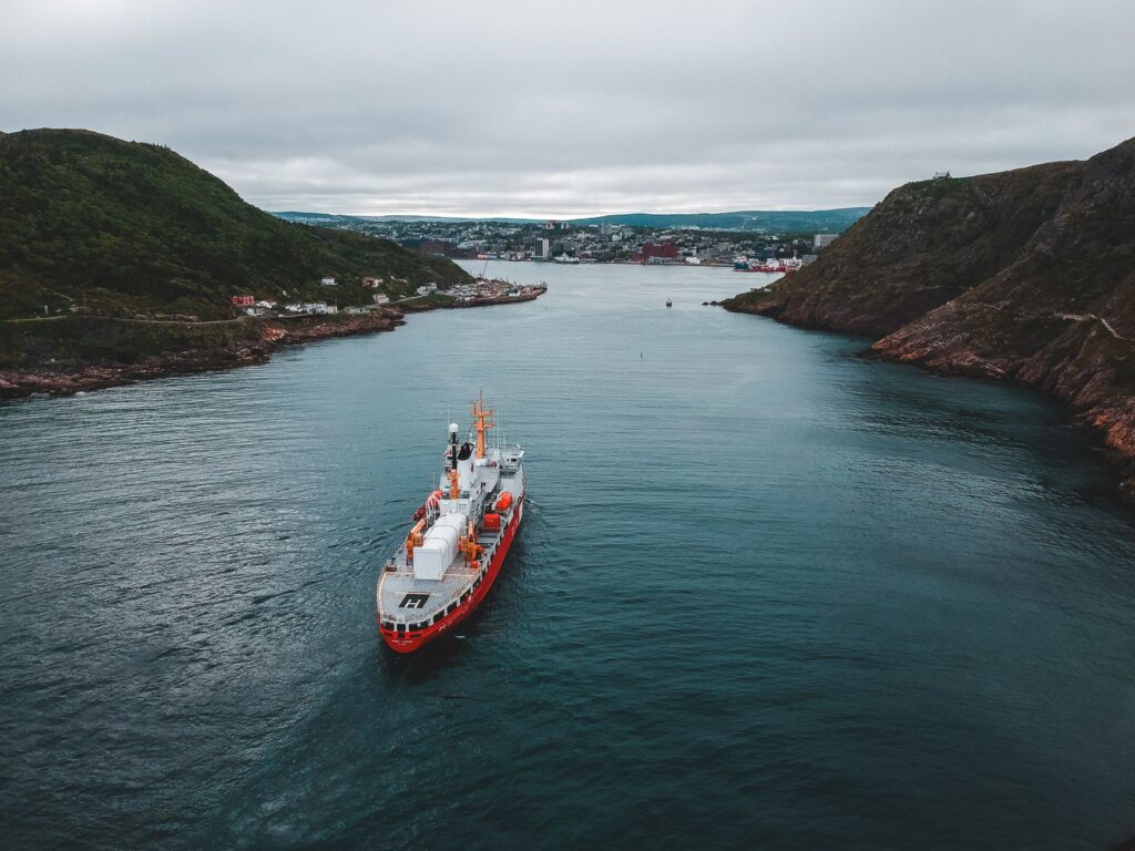
Mastering the waters surrounding the archipelago requires an encyclopedic knowledge of local oceanography. The Vestfjord, the arm of the sea separating Lofoten from the Norwegian mainland, is renowned both for its fishing wealth and the treachery of its currents. Here, the warm waters of the Gulf Current converge with cold flows from the north, creating an ideal habitat for the spawning of the coveted Arctic cod.
Traditional navigation in this environment was carried out aboard nordlandsbåt, wooden vessels with elegant lines and high prows, direct heirs to Viking designs. These craft, propelled by sail and oar, demonstrated exceptional versatility in weathering sudden open-sea storms and maneuvering in narrow inner channels. Today, although fishing fleets have modernized with satellite navigation technology and steel hulls, local skippers continue to pass down from generation to generation the visual reading of tides, the observation of seabird flight, and the interpretation of barometric shifts as irreplaceable survival tools.
The sea in Lofoten is not an element to be contemplated from a distance, but the very ground upon which the life and memory of a people sculpted by wind and ice are built.
The Cycle of Skrei and Insular Economy
The economic and social history of Lofoten revolves around an annual biological event: the migration of skrei, the migratory cod that swims from the Barents Sea to the warm, protected waters of the Lofoten fjords to spawn between January and April. This massive concentration of fish has been the foundation of human subsistence in the region since the Viking Age, when dried fish was already exported to southern Europe through trade routes connecting with Bergen and Hanseatic ports.
The skrei fishery was not merely an extractive activity, but a complex social ritual mobilizing thousands of seasonal fishermen. Organization of labour demanded millimeter precision: from capture in open sea using hand lines and nets set in extreme cold, to gutting on docks and subsequent placement on drying racks. This productive system, based on maximum efficiency and the integral use of every piece—from roe to heads used for broths or exported to African markets—represents one of the earliest documented examples of circular economy in the marine sphere.
Contemporary Transformation: Between Heritage and Mindful Tourism
In recent decades, the archipelago has undergone a profound economic metamorphosis. The progressive decline of fishing quotas and the industrial mechanization of processing plants have forced local communities to diversify income sources. Former rorbuer, once housing generations of fishermen soaked in salt water, have been meticulously restored to welcome travelers from around the world seeking immersion in extreme nature without sacrificing contemporary comfort.
This transition has not been without tensions. The increase in summer tourism poses complex challenges regarding environmental management, infrastructure saturation, and preservation of vernacular landscape. However, local authorities and insular collectives have driven initiatives toward low-impact tourism, promoting sustainable mobility through cycling routes, rigorous protection of seabird habitats, and promotion of zero-kilometer gastronomy based on seafood and small-scale local agricultural holdings capable of resisting the onslaught of mass seasonality.
Practical Guide
How to get there: Main access to the archipelago is through Leknes Airport (LKN) or Svolvær Airport (SVJ) via connecting flights from Oslo via Bodø. Another highly recommended alternative to comprehend the geographic scale of the territory is boarding the ferry linking the mainland city of Bodø with Moskenes, an approximate three-and-a-half-hour journey crossing the Vestfjord.
When to travel: To witness the skrei fishing season and snowy landscapes under winter light, the months of February to April are ideal. If alpine hiking and the midnight sun phenomenon are preferred, the optimal window extends from late May to late August.
Where to stay: It is advisable to overnight in rehabilitated historic rorbuer in villages such as Reine, Nusfjord, or Henningsvær. These lodgings provide direct insight into pile architecture and offer respectful integration with the port environment.
Essential gastronomy: Tasting fresh cod during winter months is indispensable, as is traditional stockfish prepared in various culinary variants in local restaurants adhering to the regional product seal.
Safety recommendations: The climate in Lofoten is extremely variable. Even in summer, hiking trails like the ascent to Reinebringen demand waterproof technical footwear, windproof thermal clothing, and prior consultation of local weather reports to avoid surprises from katabatic winds.
The Final Echo of Boreal Light
When late autumn yields its witness to the polar night, the Lofoten Archipelago reclaims an ancient, solemn silence that permeates every corner of its channels and mountains. In that suspended twilight moment, where the faint lights of fishing villages flicker over the dark water of the fjord, the true dimension of this insular territory is understood. It is not merely an extreme geographical outpost on the map of Europe, but an eloquent testimony to human capacity to inhabit the open elements with dignity, intelligence, and a deep reverence for the unaltered rhythms of the ocean.