
The Kungsleden, historically known as the King’s Trail, represents one of Northern Europe’s most iconic pedestrian traverses. Stretching over four hundred kilometers across the Swedish Lapland, this route connects Abisko in the north with Hemavan in the south, crossing some of the most imposing tundra landscapes, glacial valleys, and desolate plateaus on the continent. Far from being a bucolic stroll, the trail demands a profound understanding of subarctic geography, where the absence of trees across vast sections exposes the hiker to gale-force winds and a climate as unforgiving as it is changeable. Planning an expedition through this natural corridor requires technical rigor, self-sufficiency, and absolute respect for an environment where nature retains its primal rules.
Venturing into the Arctic Circle on foot means accepting that infrastructure, however efficient, remains subordinated to extreme geographical isolation. Along the northern route, considered the most classic section between Abisko and Kvikkjokk, the Swedish Tourist Association (STF) maintains a network of huts and cabins equipped with the strict essentials for overnight stays, featuring wood stoves, bunk beds, and gas, but devoid of contemporary luxuries. This traverse does not offer the comfort of the Alps or the service density of North American trails; here, every trekker must carry their own food, emergency gear, and the mental resilience required to manage prolonged solitude beneath a sky that, depending on the season, barely darkens or remains draped in a bluish twilight.
The Geography of the Arctic Circle: Understanding the Lappish Tundra
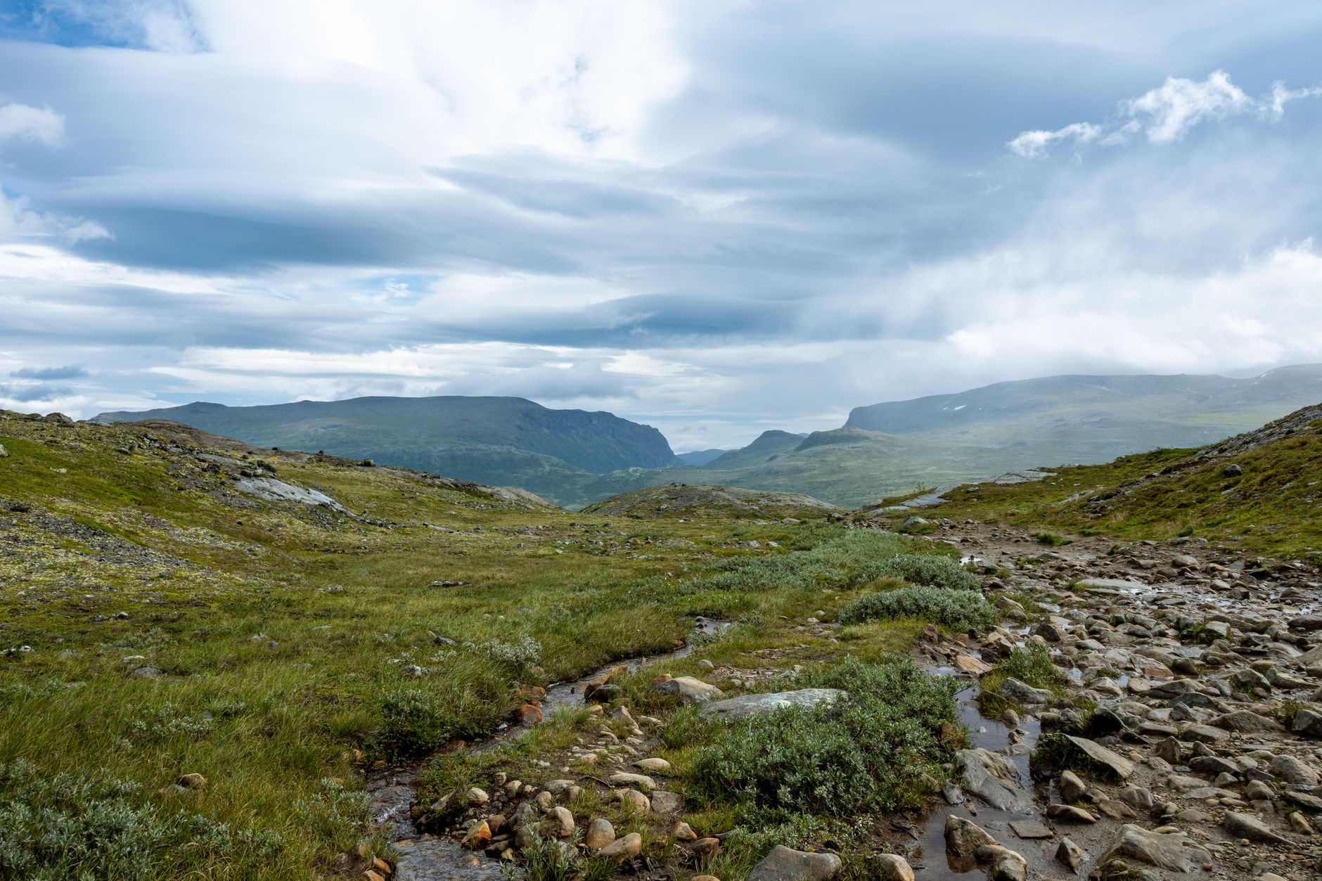
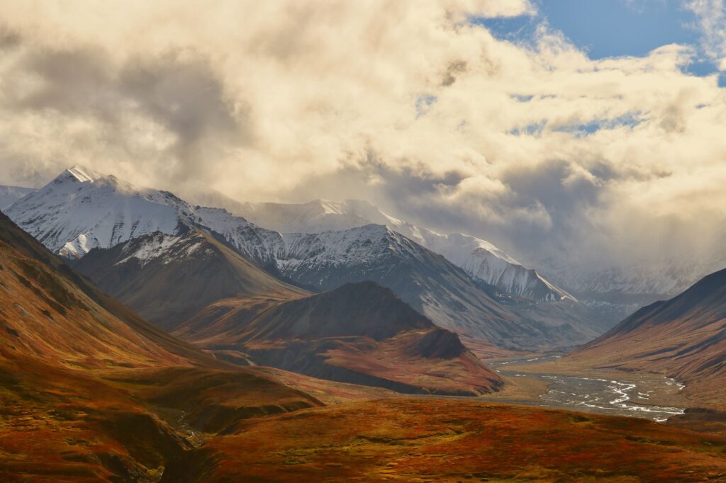
The terrain through which the Kungsleden winds is characterized by a geomorphological alternation ranging from deep canyons carved by ancient glaciers to open, wind-swept plateaus. In the northern sector, the canyon of the Abiskojåkka river welcomes hikers before opening toward the Tjäktja valley, a corridor flanked by rugged peaks where the Kebnekaise massif, Sweden’s highest point at over two thousand meters, dominates the western horizon. The local tectonics have molded a relief where metamorphic rocks and glacial morraines demand high-cut hiking boots with high-traction rubber soles capable of handling both clay mud and wet granite slabs.
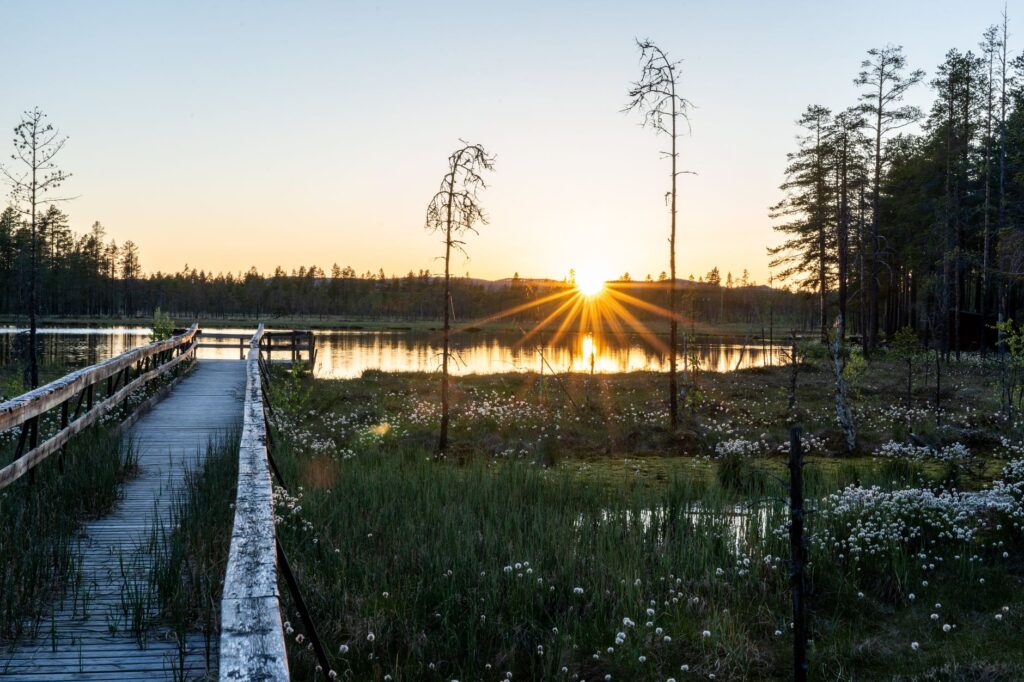
One of the most unique aspects of this geography is the constant presence of enclosed lakes and bogs that necessitate the use of wooden boardwalk systems, locally known as spångar. These structures facilitate transit over fragile, waterlogged soils, but when rain saturates the ground or early ice coats them, they turn into slick surfaces requiring absolute concentration. The transition between valleys sheltered by dwarf birch trees and high tundra plateaus marks a drastic shift in environmental exposure, forcing the expeditionary to continuously adjust their clothing layer system and waterproof shell.
Logistics and Planning: Timelines, Access, and Autonomy
The seasonal window to safely complete the Kungsleden is remarkably brief. It typically extends from late June, when most winter snow has receded and secondary rivers are fordable, to mid-September, when the Arctic autumn floods the tundra with reddish and golden tones, anticipating the first serious snowfalls. Attempting the traverse outside this window means confronting extreme sub-zero temperatures, a lack of sunlight, and the operational closure of the mountain huts and rowing boats necessary to cross certain lakes.
Access to the traditional starting point, the Abisko Mountain Station, is efficiently achieved via the overnight sleeper train operated by the state railway company SJ from Stockholm, a highly recommended logistical option that allows travelers to acclimatize to the country’s rhythm and arrive directly at the trail’s starting arch without renting vehicles. For the return from the southern terminus in Hemavan, connecting buses must be coordinated toward regional airport hubs such as Storuman or Umeå. Food self-sufficiency forms the core of planning: although several STF huts sell basic provisions such as pasta, canned tuna, and Swedish crispbread, stocks are limited and prices reflect the complex logistics of helicopter or snowmobile transport.
River Crossings and the Management of Aquatic Elements
Along the route, glacier-fed rivers do not always feature suspension bridges. In specific sections, such as the crossing of Lake Alesjaure or the Kaitumjåkka river, the trail is interrupted and requires the use of institutional rowing boats. The system stipulated by local tradition is simple yet demands physical effort: if there is only one boat on the shore, one must row across, tie the boat up, and if there are three boats, ensure at least one remains on each side for the following hikers. This communal dynamic requires patience and respect for shared-use rules.
Additionally, wading across minor streams when boardwalks are absent or damaged represents one of the most underestimated technical risks. Frigid water originating directly from lingering snowpatches can cause numbness in the extremities within minutes, reducing stability. It is essential to use trekking poles to form a support tripod, unbuckle backpack hip belts to quickly release the pack in case of a fall, and cross wearing neoprene booties or specific river sandals while keeping primary footwear dry in a waterproof compartment inside the pack.
The true value of a subarctic traverse lies not in the athletic conquest of distance, but in the capacity to attune one’s biological rhythm to the silent immensity of a landscape entirely devoid of human haste.
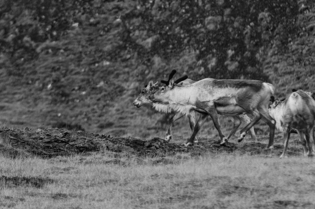
Local fauna adds another layer of interest and caution to the expedition. Although sightings of large mammals such as brown bears or lynx are exceptional due to the animals’ natural shyness, the presence of semi-domesticated reindeer herds, managed by the indigenous Sami communities, is constant. It is crucial to maintain a respectful distance from the animals and scrupulously close all gates of grazing enclosures and cabins to prevent reindeer from seeking shelter or salt indoors.
Wild Camping and the Right of Public Access
Sweden operates under Allemansrätten, the historic right of public access to nature that allows anyone to move freely and camp on uncultivated land. However, inside the national parks crossed by the Kungsleden, such as Abisko National Park or Stora Sjöfallet, specific and more restrictive regulations apply to protect fragile alpine flora. In these protected areas, wild camping is generally restricted to the immediate surroundings of official huts or designated zones where impact on lichen and moss ground cover is minimal.
Pitching a tent on the tundra requires mastering advanced anchoring techniques. On elevated plateaus, crosswinds can easily bend aluminum poles if heavy stones are not used to secure guy lines, as standard tent stakes frequently fail to achieve adequate holding power in stony or moisture-saturated soils. Waste management is equally rigorous: everything brought into the backpack must leave with it. The huts feature waste sorting systems, but along wild camping stretches, leaving organic waste is prohibited, as decomposition in the cold climate is extremely slow.
The Sami community plays a fundamental cultural role within the territory. Their reindeer migration routes, seasonal settlements, and deep worldview are woven into the Kungsleden landscape. The traveler crosses an ancestral territory where every toponym in the Sami language describes with surgical precision the characteristics of the terrain, the presence of pastures, or the shape of a summit, reminding us that this apparent wilderness has been home and sustenance for millennia.
Practical guide
How to get there: SJ overnight sleeper train from Stockholm Central Station to Abisko Turiststation. The journey takes approximately seventeen hours and connects directly to the northern trail head.
Best time to visit: From June 20 to September 10. The first weeks of September offer the advantage of fewer mosquitoes and autumnal colors, though with colder nights and reduced availability of open services.
Accommodation and huts: STF (Svenska Turistföreningen) mountain hut network. They provide bunks with mattresses, blankets, gas, and firewood. Advanced bed reservations are not required for main trail cabins, as no trekker is turned away in an emergency.
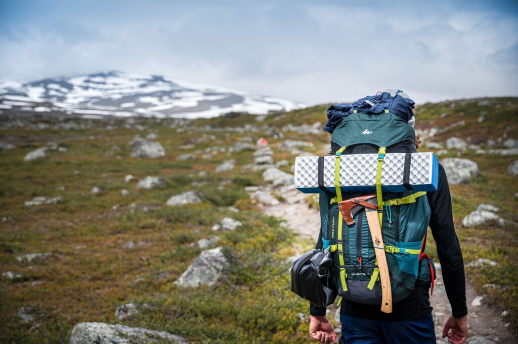
Essential gear: Three-layer waterproof jacket with technical membrane, windproof trousers, high-cut hiking boots, sleeping bag with a comfort rating of at least zero degrees Celsius, tent repair kit, and reliable insect repellent specific for northern wetlands.
Communications: Mobile phone coverage is non-existent across most intermediate stages. Carrying a two-way satellite communication device or a personal locator beacon (PLB) is strongly recommended.
Food and water: It is safe to drink directly from most mountain streams located away from reindeer settlements, though using filters or purification tablets is advised at lower altitudes or near major lakes.
The true test along the Kungsleden is not the distance accumulated in the legs, but the humility with which one accepts the authority of the Arctic climate and the vastness of the Lappish silence.
As the traverse nears its conclusion in the forested southern valleys, the urgency of physical elements gives way to deep introspection. The legs, now accustomed to the constant weight of the backpack and the daily routine of marching over rocks and boardwalks, find an automatic cadence. Continuous effort ceases to be perceived as an obstacle and transforms into a meditative state, where each day narrows down to the essentials: walking, observing subtle shifts of light over glacial lakes, and sharing the warmth of a wood stove at dusk with fellow travelers arriving from every corner of the planet. At the end of the road, the Arctic Circle ceases to be an abstract geographical concept on a map and becomes an indelible memory, marked by absolute respect for the untouched immensity of the north.