
Introduction to the Western Edge
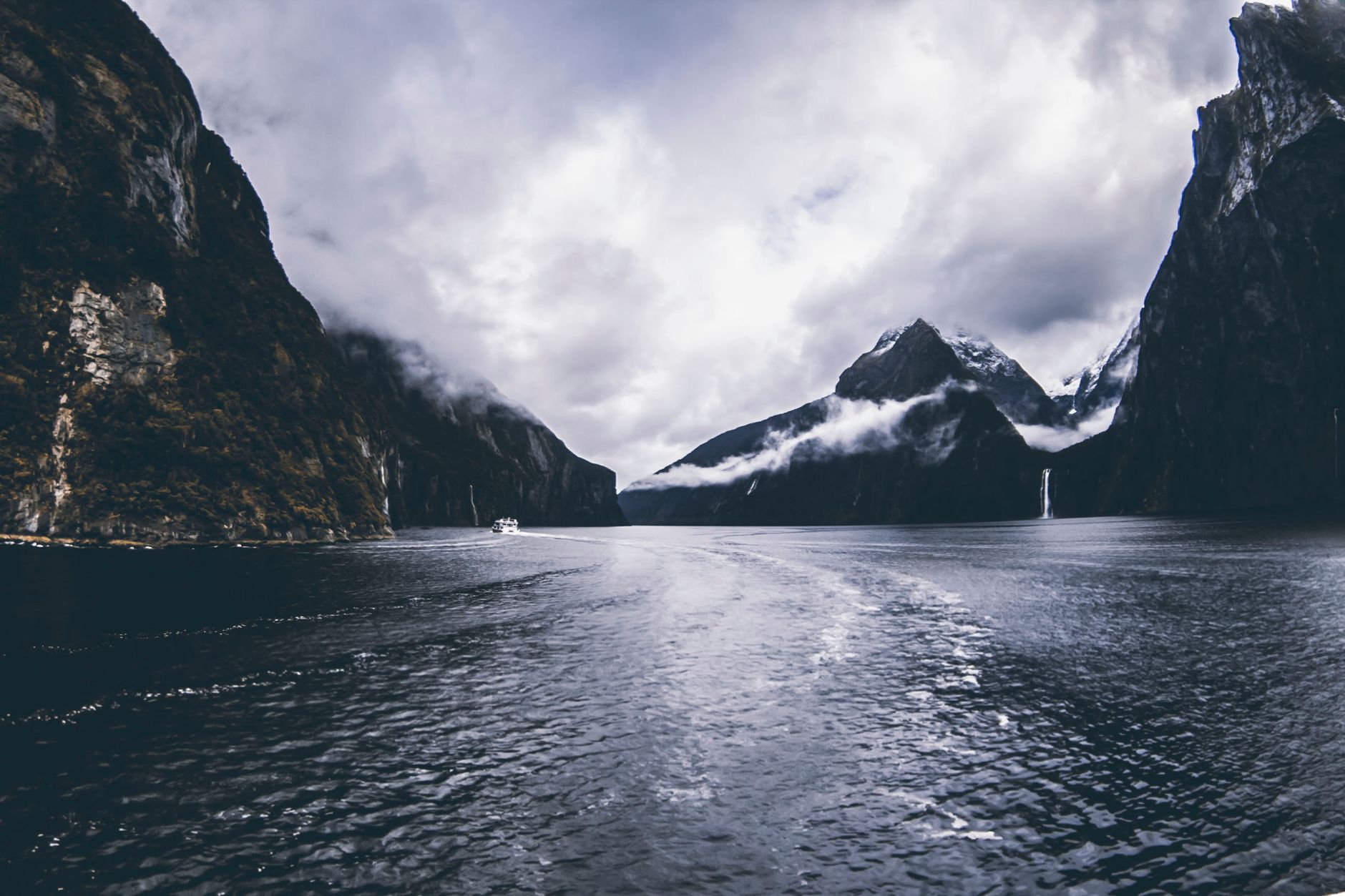
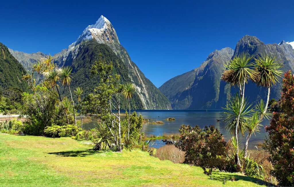
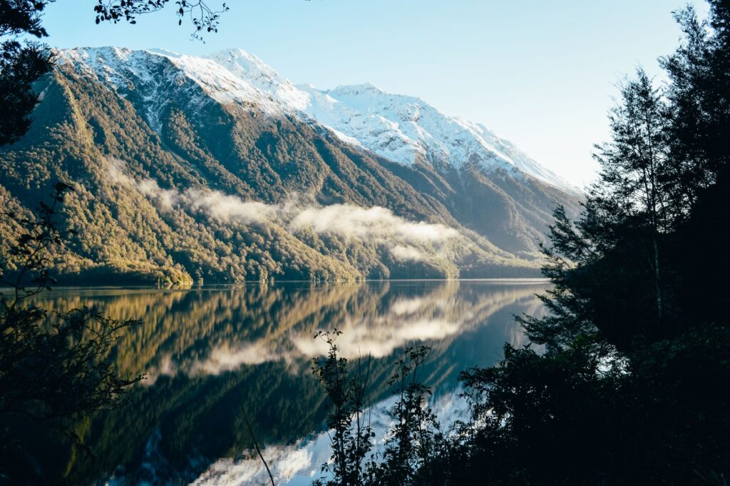
The southwestern extremity of New Zealand’s South Island represents one of the most formidable and unforgiving geographical environments on the planet. Here, the Southern Alps descend abruptly toward the Tasman Sea, carving deep glacial valleys transformed into fjords. This territory, dominated by the imposing presence of Milford Sound—known in the Māori language as Piopiotahi—is not merely a natural sanctuary of vertical walls and ancient waterfalls, but also an intricate laboratory of engineering and transport logistics. The survival of connectivity in this region depends on a delicate balance between human audacity and restraint before an untamable nature.
To understand the magnitude of this intermodal transport system, it is necessary to examine how terrestrial routes carved into living rock, maritime paths defying unpredictable oceanic currents, and air links conditioned by extremely volatile weather converge. This report examines the invisible infrastructure that allows the transit of goods, residents, and travelers in an ecosystem where every kilometer of highway or navigation route is a masterpiece of technical endurance and environmental adaptation.
The Asphalt Backbone: State Highway 94
The only practicable terrestrial access route toward this isolated corner of the globe is State Highway 94, commonly referred to as the Milford Road. Stretching and winding through impossible gorges and temperate rainforests, this thoroughfare represents a monumental milestone in New Zealand road engineering. Formally opened after decades of titanic labor during the mid-twentieth century, the route begins its ascent from the township of Te Anau, meandering through the Eglinton Valley before confronting the most severe alpine obstacles.
The culmination of this land infrastructure is the Homer Tunnel, a 1,219-meter-long bore excavated directly into the solid granite of the continental divide. This single-lane tunnel regulated by smart traffic lights is the indispensable bottleneck for any vehicle attempting to reach the fjord by land. Traffic management at this point requires pinpoint coordination between transport authorities and tourist coach operators, particularly during the summer months, when visitor influx tests the load capacity of the infrastructure.
The geological complexities of the route are constant. Rockfalls and snow avalanches are everyday hazards requiring the permanent presence of specialized maintenance crews. These workers utilize gas cannons and controlled charges to purge unstable slopes before the weight of snow compromises driver safety. The highway is not merely a communication medium; it is a fragile lifeline reinvented every dawn in the face of the relentless erosion of the elements.
The Engineering Milestone: The Permanent Challenge of the Homer Tunnel
The history of the Homer Tunnel stands as testament to human tenacity against alpine hostility. Originally conceived in the 1930s as a public works project during the Great Depression, its construction spanned over two decades due to extreme weather conditions, landslides, and technical difficulties derived from drilling pure igneous rock without modern heavy machinery.
Today, the tunnel operates as an automated alternating-pass system managing thousands of daily transits. Its interior, largely unlined by concrete along its original stretch, exposes the rough texture of the granite, reminding the traveler of the vastness of the mountain mass resting overhead. The ventilation systems and emergency shelters installed nearby reflect continuous evolution toward rigorous international safety standards.
However, reliance on this single terrestrial access exposes the systemic vulnerability of the entire region. Any major seismic event or severe collapse on the slopes flanking the portals of the Homer Tunnel can completely isolate the port settlement of Milford Sound for days, forcing the suspension of land logistics operations and entrusting subsistence exclusively to maritime or air routes.

The Inland Maritime Route: Deep and Protected Water Navigation
Once the traveler or freight carrier overcomes the alpine barrier and reaches the port facilities at Deepwater Basin at the head of the fjord, the transport system mutates in modality. Roads cede the stage to a specialized fleet of surface vessels operating in the dark, stratified waters of Milford Sound, which receive a dense upper layer of fresh water originating from heavy rainfall.
Passenger ferries, tourist catamarans, and light cargo vessels constitute the essential maritime link connecting interior docks with the Tasman Sea. These ships must withstand severe weather conditions, characterized by gusty winds descending from surrounding peaks and unexpected swells at the mouth of the fjord, where open ocean waters clash against vertical cliffs.
Port management at Deepwater Basin is an exercise in environmental precision. Being a protected marine area under the jurisdiction of the Fiordland National Park, emission controls, waste management, and vessel speed regulations are strictly monitored to prevent disturbance to seal colonies, bottlenose dolphins, and the fragile benthic fauna inhabiting the dark underwater abysses of the fjord.
The true measure of connectivity in this southern confine is not calculated in transit speed, but in the capacity to sustain supply and human flow without altering the fragile balance of an ancient ecosystem that poorly tolerates overcrowding.
The Aerial Alternative: Visual Connectivity and Rescue in Unreachable Peaks
When land routes are blocked by snow or landslides, and sea conditions advise against navigation, air transport becomes the sole emergency bridge and a high-end transport medium for specialized tourism. Fixed-wing aircraft and helicopters equipped for high-mountain operations take off regularly from strategically located airstrips in adjacent regions to overfly the imposing topography of the Southern Alps.
Airport infrastructure in the fjord is reduced to an asphalt runway situated in an enclosed valley, where pilots must contend with descending air currents and sudden visibility shifts locally known as katabatic winds. The skill of local aviators is legendary, operating in an environment where error margins are virtually non-existent due to the proximity of impassable rock walls.
Beyond its tourism facet, this aerial fleet plays an irreplaceable sanitary and civil protection role. Medical evacuations from isolated high-mountain shelters or from vessels underway depend exclusively on the response capacity of rescue helicopters, equipped with advanced instrumental flight technology to operate in zero-visibility conditions among the deep abysses of the national park.
The Invisible Logistics: Supply and Waste Management in the Confine
Sustaining daily activity in such a remote enclave demands a complex supply chain operating with Swiss-watch precision. All fuel, fresh food, mechanical spare parts, and equipment necessary for maintaining tourist and port infrastructure must be transported by road across the tortuous layout of State Highway 94 or via authorized barges from larger ports such as Bluff.
Waste management poses one of the greatest logistical and environmental challenges for local authorities and private operators. Given that municipal sanitation infrastructure in the Milford Sound area is limited and strictly regulated to protect the purity of fjord waters, the totality of solid waste and wastewater generated by thousands of daily visitors must be compacted, stored, and evacuated via tanker and cargo trucks to treatment plants located outside national park boundaries.

This bidirectional logistical flow—supplies entering and waste exiting—is planned under strict sustainability guidelines. Freight trucks operate during specific schedules to minimize congestion with passenger buses, demonstrating that the efficiency of the intermodal system relies as much on operational discipline as on the robustness of the vehicles deployed.
Practical guide
Planning a trip or logistical analysis around the Milford Sound transport network requires adhering to a series of rigorous operational guidelines verified by New Zealand authorities.
Terrestrial access and restrictions: State Highway 94 is a demanding alpine route. Carrying tire chains is mandatory during winter and spring months (May to November), and their use may be required by road authorities at any time due to sudden snowfall.
Homer Tunnel management: The tunnel operates with traffic light control. During peak tourist periods, waiting times can reach up to 20 minutes. Consulting official information boards before beginning the ascent from Te Anau is strongly recommended.

Maritime operations: All fjord boat tours must be booked in advance through authorized operators based at Deepwater Basin or via certified agencies in Queenstown and Te Anau.
Environmental regulations: The area is part of Fiordland National Park and the Te Wahipounamu World Heritage site. Disposing of any waste, flying drones without express permission from the Department of Conservation (DOC), or disturbing local wildlife is strictly prohibited.
Digital connectivity: Mobile phone coverage is virtually non-existent along much of the Milford Road and inside the fjord. Downloading offline maps and checking weather and road alerts on the official Waka Kotahi (NZ Transport Agency) portal before setting out is essential.
The Silence of the Fjord and the Traveler’s Memory
When the last passenger catamaran docks at the piers of Deepwater Basin and the headlights of tourist buses disappear winding back along the Homer Tunnel road, Milford Sound recovers its breathtaking ancestral silence. The dark granite walls, bathed by persistent drizzle feeding hundreds of ephemeral waterfalls, reflect the immutability of a landscape challenging the transience of human presence. In this confine where land, water, and air establish a precarious truce, every completed journey is a victory of technical perseverance and a constant reminder of our absolute vulnerability before the untamable grandeur of southern nature.