
Southern Vietnam is not measured in kilometers of asphalt, but in knots of current, tidal shifts, and the profound geometry of freshwater channels. In the Mekong Delta, where the mother river fragments into nine main branches before emptying into the South China Sea, geography imposes a radically amphibious way of life. Here, mobility has never relied on highways or fast lanes, but on the buoyancy of timber, skill in handling the oar, and a millennia-old understanding of a water regime that dictates the rhythm of every dawn.
Traveling across this vast river delta requires abandoning urban haste and embracing a cadence set by the sway of rice barges, markets that emerge before dawn, and the persistent hum of long-tail diesel engines. The transportation infrastructures of this region are not concrete motorways, but a dense network of locks, dredged canals, and floating docks that connect entire provinces without the need to set foot on solid ground. Understanding this system means delving into the logistical and cultural core of a territory where water is simultaneously a communication route, an economic livelihood, and a home.
The Invisible Geography of Minor Branches and Overflow Canals
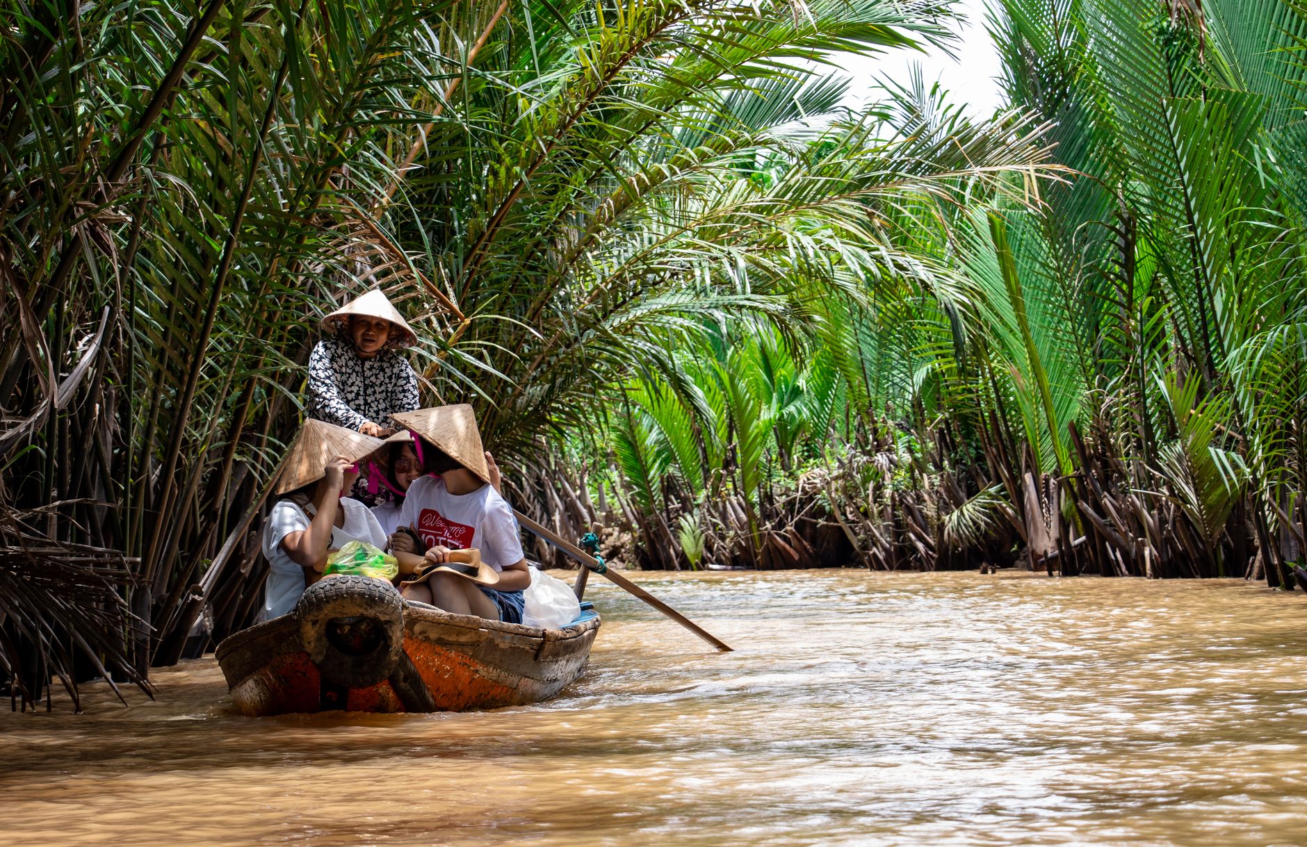
To understand how people and goods move across the delta, one must look beyond the main channels like the Tien Giang or Hau Giang. The true artery of daily life is hidden within thousands of minor canals, known locally as canals and kenhs, excavated over centuries to drain swampy terrain and connect isolated communities. These secondary waterways function as narrow corridors flanked by dense walls of water palms and fruit orchards.
The engineering sustaining this network is both natural and artificial. Periodic dredging is essential to prevent sedimentation that chokes water passages during the dry season, while tidal gates regulate the salinity threatening regional crops. In this environment, small, shallow-draft boats are the only vehicles capable of penetrating riverside hamlets, transporting everything from banana bunches and sacks of coffee to building materials and uniformed schoolchildren.
The Commercial Pulse of Floating Markets at Break of Day
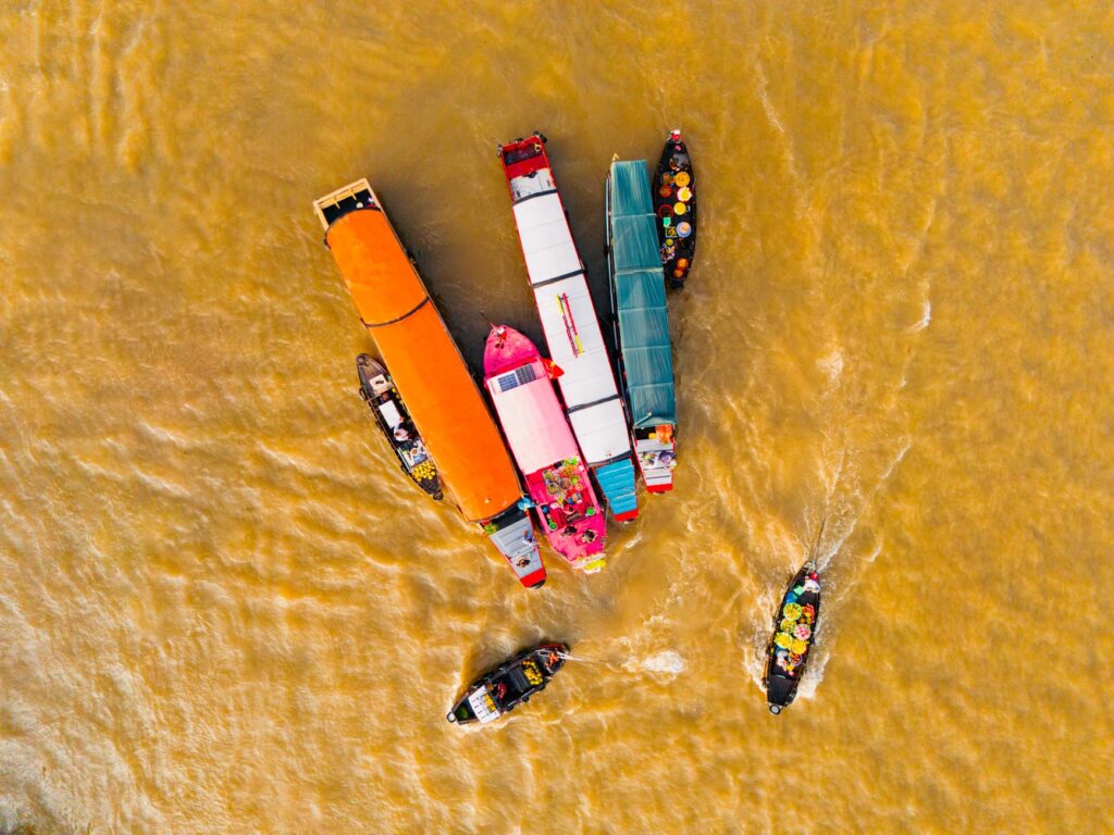
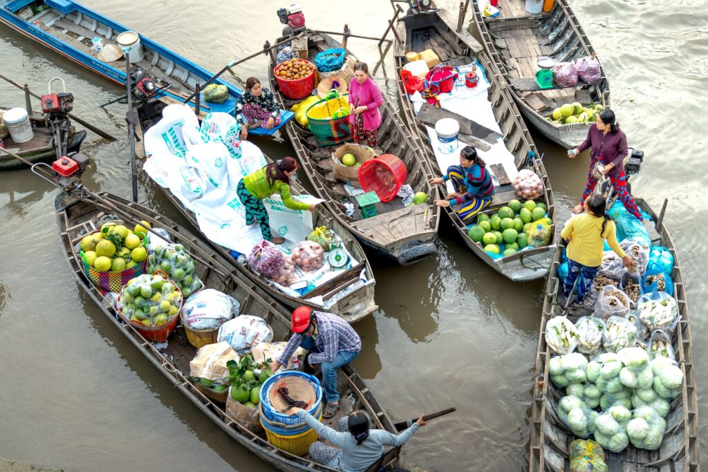
Long before the sun heats the water’s surface, hustle and bustle already dominate the great floating market of Cai Rang, near Can Tho. This commercial node is not a tourist attraction staged for visitors, but a wholesale hub where hundreds of barges crowd to trade goods in bulk. Each vessel advertises its product through an ingenious signaling system: a long bamboo pole planted at the prow from which hangs a sample of the goods for sale—a piece of pineapple, an onion, or a pumpkin—visible from hundreds of meters away.
The logistics of these markets demand millennia-old precision. Large boats transport tons of agricultural produce from distant growing areas, while medium and small sampans act as local distributors, approaching larger vessels to supply riverside shopkeepers and even floating breakfast vendors offering steaming bowls of rice noodle soup amid the morning chop.
Amphibious Architecture and Wooden Rafter Docks
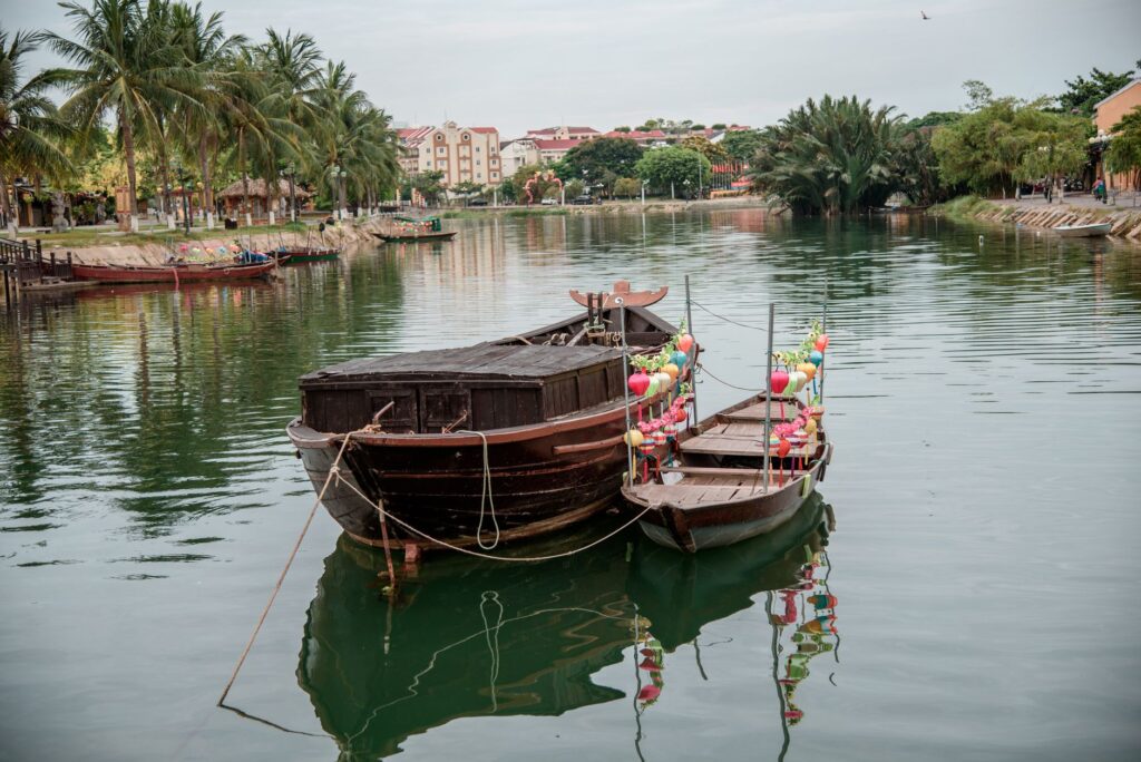
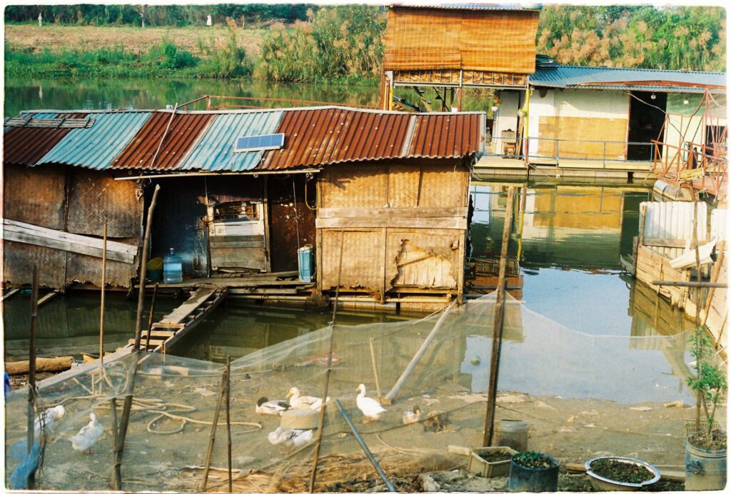
Living by the water in the Mekong Delta has given rise to a unique architectural typology: houses on high stilts and modular floating docks. Due to seasonal fluctuations in water levels, which can vary several meters between flood season and drought, fixed architecture is unfeasible along the riverside strip. Dwellings extend toward the channels via wooden walkways and floating platforms built with empty metal barrels and teak planks.
These improvised docks act as garages, private markets, and boarding points. Each family owns at least one light boat moored at their doorstep, the equivalent of the family car in any Western city. Total reliance on these floating structures means postal delivery services, waste collection, and school transportation operate entirely from the water, weaving a neighborhood network where the street is a dynamic flow.
The Modern Transition: Cable-Stayed Bridges and High-Capacity Ferries
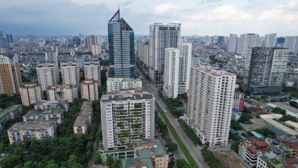
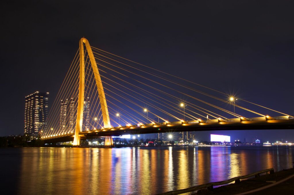
Although water remains the predominant medium, Vietnam’s modernization has introduced profound transformations in the delta’s terrestrial connectivity. The inauguration of major cable-stayed bridges, such as the Can Tho Bridge over the Hau River, has gradually replaced many of the historic vehicle ferries that for decades constituted the sole link between southern provinces and Ho Chi Minh City.
However, integrating these large road infrastructures with the traditional river system has not been automatic. Local authorities face the constant challenge of balancing heavy road freight development with the preservation of river cabotaging routes, vital for communities still lacking paved access. Medium-sized ferries continue to operate with high frequency at secondary crossings, ensuring that the flow of motorcycles and tri-wheelers is not interrupted where the river widens too much.
The Expertise of Freshwater Skippers and the Rowing Tradition
Navigation in the Mekong Delta does not follow modern captaincy manuals, but wisdom passed down through generations. Local skippers know every shifting sandbank, every cross-current, and the unpredictable behavior of water hyacinths that often form floating carpets capable of jamming engine propellers. The mastery of the pole and the stern oar—where the helmsman stands and uses body weight to simultaneously propel and steer the boat—remains an indispensable skill for maneuvering in tight spaces.
Water is not an obstacle to be crossed with a bridge, but the solid ground upon which the entire daily existence of the delta is built.
This seamanship extends to boat-building yards located along the banks of Vinh Long and Sa Dec. Here, artisans continue to build and repair traditional wooden sampanes using ancestral techniques, selecting hardwoods capable of withstanding constant humidity and wood-boring organisms without resorting to aggressive chemical treatments.
Practical guide
How to get there: Can Tho is the delta’s main communication hub and lies about three and a half hours by bus or private car from Ho Chi Minh City via the highway connected by the new river bridges.
When to travel: The dry season, running from December to April, offers the best weather conditions for river navigation, with clear skies and a lower probability of sudden tropical storms.
Local transportation: To explore minor canals and floating markets, it is best to hire traditional sampans directly at local docks in Cai Rang or Phong Dien, agreeing on the route with local boatmen before dawn.
Accommodation: Numerous family homestays exist on river islands like An Binh, where travelers can stay in traditional stilt houses and experience the daily life of fruit farmers up close.
Gastronomy and precautions: It is advisable to drink bottled water and try local river fish specialties at verified restaurants. Floating markets are best visited between 6:00 and 8:00 in the morning to appreciate their peak commercial activity.
The Liquid Silence at Dusk in the Submerged Orchards
When the commercial activity of the large floating markets fades and the sun begins to sink over the delta horizon, the landscape regains a profound stillness. In the most secluded corners of the Phong Dien channels, water ceases to be a bustling transit route and becomes a dark mirror reflecting the heavy bunches of hanging rambutans and longans. Small barges return to their private anchorages, rocking gently to the rhythm of the day’s last tide, while the faint smoke of wood-fired stoves begins to rise among the green thickness of the riverbanks.
In that moment of transition, the true character of southern Vietnam reveals itself in all its quiet magnitude. There are no mechanical strident noises, only the rhythmic splashing of a solitary oar and the steady whisper of water against wooden pilings. The amphibious communities of the Mekong thus demonstrate that human habitability does not require conquering territory with concrete, but maintaining a patient and respectful harmony with the eternal cycles of the current.