
Philadelphia, the most populous city in Pennsylvania and one of the founding metropolises of the United States, rarely appears on hiking lists. Yet within its administrative boundaries lies a trail network that surprises with its scale and variety: the wooded valley of Wissahickon Creek, the banks of the Delaware River, the paths of Fairmount Park, and the tree-covered hills that separate the urban core from the northwestern neighbourhoods. Walking here demands a different kind of preparation than classic mountain hiking: you have to read the Atlantic climate, understand the topography of an enclosed valley, and respect a natural heritage that coexists with the city.
This guide does not promise alpine landscapes or absolute silence. It offers something more useful: understanding what can be hiked in Philadelphia, at what difficulty, in which season, how to arrive without a car, and which habits reduce the impact on a fragile and heavily visited environment.
A hidden valley inside the city
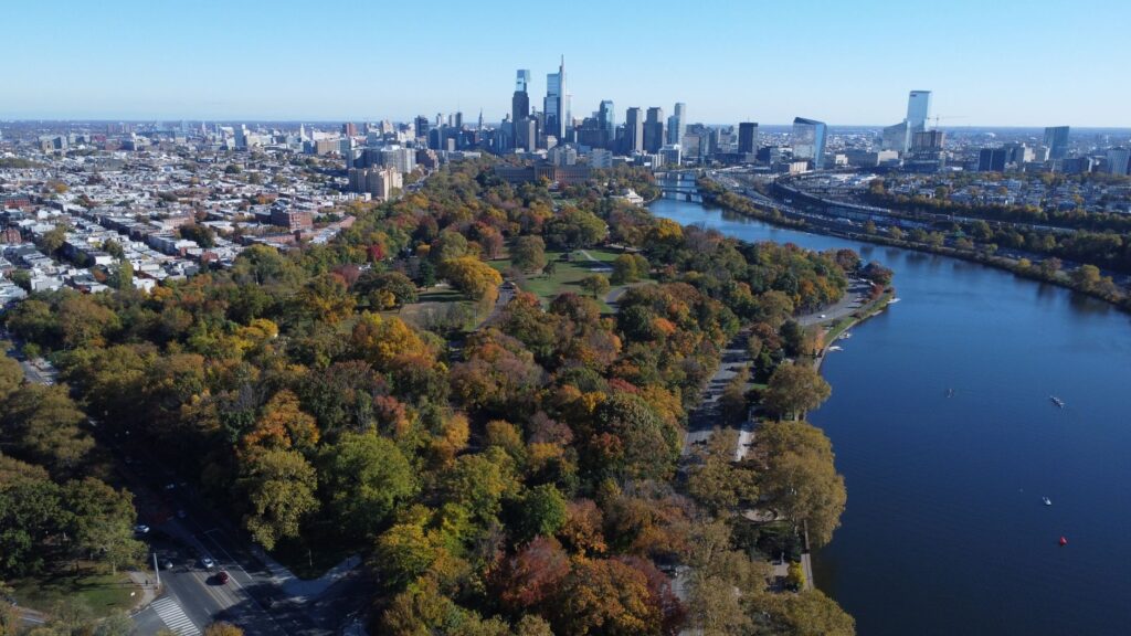
The feature that defines hiking in Philadelphia is Wissahickon Valley Park, a green corridor of more than seven kilometres that follows Wissahickon Creek from the city’s northwestern edge to its mouth on the Schuylkill River. The park is part of Fairmount Park, one of the largest urban park systems in the United States, and its terrain is far from flat: the creek has carved a valley with walls of schist and metamorphic rock that force frequent ups and downs.
That topography explains why many visitors underestimate the area. The main trails, such as the Wissahickon Trail, run partly along old mill roads and partly along dirt tracks full of roots. Cumulative elevation gain on a full route can exceed 200 metres, enough to feel the effort in your legs if you are not used to it.
Real difficulty: what to expect from each section
Not all paths in the valley have the same character. It helps to distinguish three levels:
- Easy: the paved trail along the creek bank from the Valley Green area northwards. Suitable for families, bicycles, and casual walkers, though it can be muddy after rain.
- Moderate: routes climbing to valley viewpoints, such as the trail towards Lovers Leap or the ridges of Andorra. They include sections of rock, roots, and short but steep gradients.
- Demanding: connections linking the valley to the hills of Chestnut Hill or to the Schuylkill River Trail. These require navigation skills, grippy footwear, and more hours of daylight.
Difficulty comes less from elevation than from terrain: wet stone, fallen leaves, and mud are the norm in spring and autumn.
Atlantic climate and seasons: when to walk
Philadelphia has a humid continental climate, with hot, humid summers and cold winters with occasional snowfall. Spring and autumn are the most comfortable seasons for walking, but also the most variable: a morning can dawn at 5 degrees and the afternoon reach 20.
Summer imposes a different logic. Humidity raises the heat index and mosquitoes are abundant near the water. Walking at midday in July or August is a bad idea; start early and carry more water than seems necessary. In winter, ice on the valley’s rocks turns easy sections into slippery surfaces.
In Philadelphia, you do not choose a trail only for its views: you choose it for the hour, the season, and the state of the ground. Preparation begins long before you put on your boots.
Access without a car: public transport and entry points
One advantage of hiking in Philadelphia is that many access points do not require a car. The city’s public transport system, operated by SEPTA, connects the centre with several entry points to the valley and Fairmount Park.
- Valley Green: reachable by buses running up Wissahickon Avenue and nearby streets; it is the most popular starting point and has basic services.
- Lincoln Drive and Forbidden Drive: the park’s main corridor can be reached from several bus stops in the Germantown and Mount Airy neighbourhoods.
- Schuylkill River Trail: connects with regional rail stations and the city centre, allowing linear routes without returning to the starting point.
Planning a linear route and returning by public transport is often a better idea than a long out-and-back on the same path.
Safety: what to know before setting out
Urban hiking carries different risks from high mountain terrain. In Philadelphia, the most common are falls on slippery ground, disorientation in a valley with many junctions, and losing daylight at dusk. Some concrete recommendations:
- Wear footwear with grippy soles and, if the ground is wet, use trekking poles.
- Download an offline map: mobile coverage is patchy at the bottom of the valley.
- Avoid walking alone at dusk on little-used wooded sections.
- Tell someone your itinerary and expected return time.
The city has emergency services, but in an extensive valley the response can take time. Prudence means not needing them.
Heritage: mills, bridges, and industrial memory
The Wissahickon valley is not virgin forest. It was an industrial corridor from the 17th century, when flour mills and sawmills were built using the power of the water. Today, ruins of those structures remain, along with stone bridges and paths that preserve names from that era.
That heritage demands careful walking. Historic structures should not be climbed or altered, and many areas are protected. Walking here is also reading the history of a city that grew while transforming its surroundings.
Minimal impact: unwritten rules of the trail
The proximity of a large city multiplies pressure on the environment. Simple principles of minimal impact therefore apply:
- Stay on marked trails, especially in revegetation areas.
- Leave no waste, not even organic remains that alter local wildlife.
- Keep dogs under control and pick up after them.
- Do not feed wildlife or approach deer, common in the park.
- Respect temporary closures for conservation or tree-fall risk.
The goal is not only to avoid damage: it is to keep the trail passable and pleasant for whoever comes next.
What to bring: equipment suited to an urban valley
You do not need expedition gear, but you do need more than a water bottle. A reasonable list includes:
- Hiking footwear with good grip.
- A light rain jacket, even if the forecast is dry.
- Enough water and some energy food.
- A map or app with downloaded routes.
- A headlamp if the route may run long.
- Sun protection and insect repellent in summer.
The key is adaptability: in Philadelphia the weather changes quickly and the terrain forces improvisation.
Routes beyond the valley: Delaware and Schuylkill
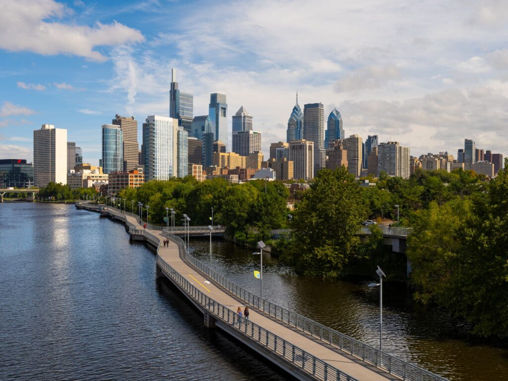
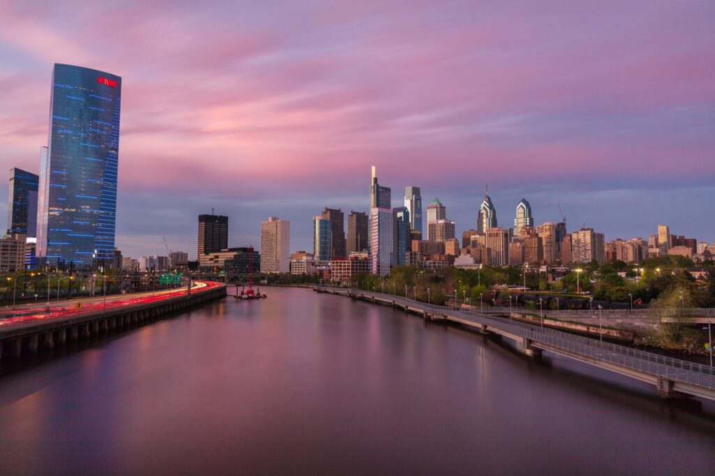
Hiking in Philadelphia does not end at the Wissahickon. The Schuylkill River Trail offers kilometres of continuous riverside path, ideal for long walks and for connecting with other green spaces. On the eastern edge, the banks of the Delaware allow walking with views of the skyline and the bridges crossing to New Jersey.
These routes are flatter and more urban, but also more exposed to sun and wind. They are good options for days with little time or to combine with cultural visits.
Practical guide
Before setting out, check trail conditions and park alerts, which can change due to works, storms, or conservation. The best time to start is early, both for light and for lower crowds. If travelling in spring or autumn, plan for layers and rain protection. In summer, plenty of water and a dawn start. In winter, watch for ice and shaded sections.
For those arriving by plane, Philadelphia International Airport connects to the city centre by regional rail, making it easy to organise a hiking day without renting a car. Staying near the centre or the northwestern neighbourhoods reduces travel and allows you to start the route on foot.
It is not about breaking records, but about walking with judgement: choosing the right section, respecting the environment, and returning with the feeling of having understood a little better a city that can also be explored on foot.
The best trail in Philadelphia is not the longest or the most spectacular: it is the one walked with preparation, respect, and the right light.