
Origins and geography of a Caribbean labyrinth
The Bocas del Toro archipelago, situated on the western edge of the Panamanian Caribbean, represents one of the most complex and fragile marine ecosystems in the Central American isthmus. This insular mosaic, composed of nine main islands, over fifty cays, and thousands of mangrove islets, was formed over millennia by the accumulation of river sediments and the uninterrupted growth of coral reefs. Navigating these waters demands an understanding of a geography shaped by narrow channels, shifting sandbanks, and a constant interaction between continental river runoff and the warm currents of the Caribbean Sea.
The history of navigation in this region is deeply intertwined with the pre-Columbian trade routes of the Ngäbe and Naso peoples, who used dugout canoes hewn from ceiba trunks to traverse the calm lagoons protected by barrier reefs. Centuries later, the arrival of the American banana corporation in the late 19th century radically transformed coastal infrastructure, establishing dredged channels and deep-water ports that today serve as historical waypoints for modern vessel skippers. Far from the mass tourism of other Caribbean enclaves, Bocas del Toro retains an untamed character where the red mangrove acts as the final line of defense against marine erosion.
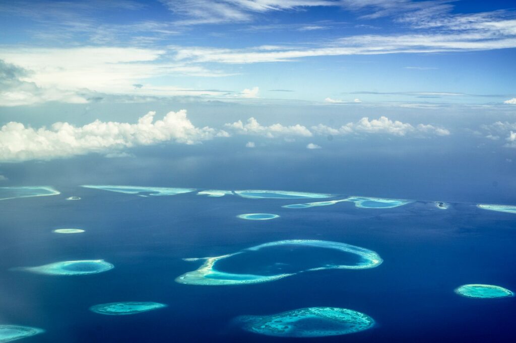
Planning a catamaran traverse through this labyrinth requires stripping the journey of any conventional cruise notions. The stability of a twin-hull vessel is essential to negotiate the shallow depths of Almirante Bay, where draft can drastically decrease within meters if one deviates from buoyed channels. Electronic nautical charts, although precise offshore, must necessarily be complemented by visual water reading: bright turquoise tones denote dangerous fire coral heads, while deep blue hues confirm safe deep-water navigation passages.
The architecture of Caribbean wind and tides
Unlike the Panamanian Pacific, known for its extreme tidal ranges, the Caribbean is characterized by a micro-tidal regime where the difference between high and low tide rarely exceeds forty centimeters. However, this apparent tidal indifference is offset by the complexity of trade winds and summer precipitation. Between December and April, northern winds blow with intermittent force, kicking up short, steep waves in the open channels between Colón Island and Cays Zapatillas, testing the structural endurance of the rigging and the crew’s helm expertise.

During the rainy season, extending from May to November, the critical factor shifts to visibility and massive freshwater runoff originating from the Talamanca mountain range. These river freshets carry logs and organic debris that drift on the surface, becoming a latent hazard for rudder blades and propellers. Experienced skippers know that night navigation in Bocas del Toro is strictly discouraged unless advanced radar systems are utilized and a permanent visual watch is maintained on the bow to spot coral heads and floating timber.
Choosing a catamaran for this expedition addresses a very clear technical equation: the need for efficient sail performance combined with a shallow draft. Featuring hulls that submerge barely seventy centimeters, the vessel can anchor in mangrove shelters inaccessible to deep-keel monohulls. This allows the crew to seek immediate refuge from the sudden formation of tropical squalls—phenomena characterized by intense downward winds capable of dismasting an unprepared boat in a matter of minutes.
Nautical logistics and onshore provisioning
Operational self-sufficiency is the cornerstone upon which any successful traverse through Bocas del Toro rests. Although the town of Bastimentos and the locality of Bocas Town offer marinas with basic services for potable water and electricity, the true essence of the archipelago is experienced in remote anchorages, where support infrastructure is completely nonexistent. This compels meticulous planning for the storage of fuel, gas, and fresh provisions before casting off from the base port.
Freshwater provisioning deserves special mention. Catamaran tanks must be filled exclusively at certified supply points, as local wells on smaller islands exhibit high levels of salinity or organic contamination. Likewise, the management of solid waste and gray or black water must be conducted under a strict zero-discharge code. The archipelago features marine protected areas where Panamanian law severely penalizes the discharge of effluents, prioritizing the health of fragile seagrass ecosystems where the Antillean manatee feeds.
For mechanical and fiberglass repairs, local resources are limited but resourceful. The artisanal shipyards of Colón Island maintain traditional wooden boatbuilding techniques that prove invaluable when dealing with damage to dinghies or wooden bulkheads. Nevertheless, carrying critical spare parts on board—such as water pump impellers, fuel filters, and spare halyards—is an inescapable obligation for any skipper wishing to avoid interrupting their traverse while waiting for logistic shipments from the capital.
Marine ecology: between reefs, mangroves, and manatees
Diving into the waters of Bocas del Toro means stepping into one of the planet’s richest natural laboratories for the study of marine biodiversity. The coral reefs surrounding Coral Cay and Solarte Island harbor hundreds of species of multicolored fish, sponges, and scleractinian corals that form a living barrier against oceanic wave energy. However, rising sea surface temperatures and unregulated tourism development have placed unprecedented pressure on these habitats.
Responsible navigation in the archipelago involves strict compliance with anchoring regulations. Dropping anchor directly over live coral heads is strictly prohibited; skippers must exclusively use the eco-mooring buoys installed by the Ministry of Environment or anchor over white sand bottoms devoid of marine vegetation. Respect for seagrass meadows is vital, as these underwater plants act as nursery grounds for lobsters and snappers while serving as the primary food source for resident manatee populations.
Mangroves, meanwhile, function as the kidneys and lungs of the insular system. Their intricate aerial roots filter terrestrial sediments and protect the coastline from erosion. When approaching these flooded forests in tender boats, it is imperative to turn off outboard motors to avoid collisions with local fauna and reduce acoustic noise that disturbs endangered species such as the bottlenose dolphin, a permanent resident of Dolphin Bay.
Coastal communities and living cultural heritage
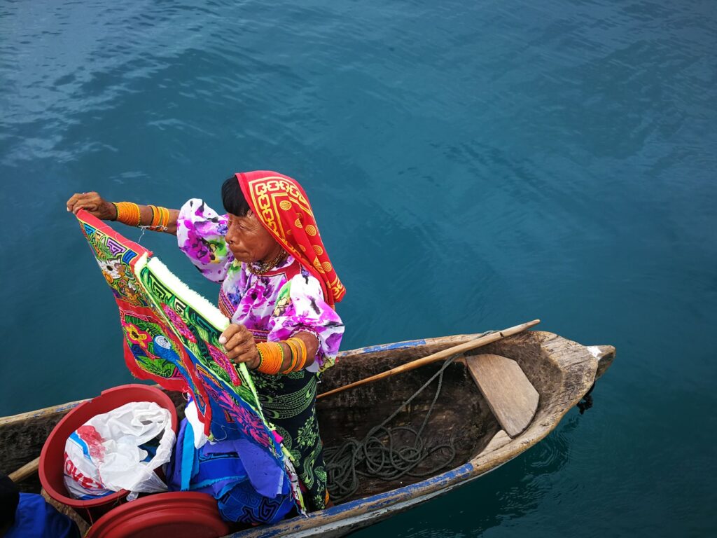
The value of Bocas del Toro lies not only in its impressive natural geography but also in the human fabric that has inhabited these shores for generations. Afro-Caribbean communities, descendants of West Indian immigrants who arrived for railroad construction and banana plantations, coexist in cultural harmony with indigenous Ngäbe populations. This ethnic confluence is reflected in a unique gastronomy based on coconut, fresh fish, plantain, and aromatic condiments such as the local chili pepper.
Visiting coastal settlements such as Salt Creek on Bastimentos Island demands profound respect for community rules and sustainable tourism protocols. Visitors must coordinate their excursions through authorized local guides, ensuring that the economic benefits of tourism flow directly to families in the area. This fosters active conservation of cultural heritage, from traditional basketry woven from palm fibers to ancestral songs and dances that narrate the intimate relationship between humanity and the Caribbean Sea.
The true measure of a sailor is not judged by the calm of the seas they navigate, but by their ability to preserve intact the horizon they leave behind.
Commercial exchange in local floating markets, where fishermen offer their daily catch directly from traditional canoes, constitutes an anthropological experience of incalculable value. Responsible purchasing, avoiding endangered species or non-commercial minimum sizes, is an ethical responsibility that every conscious traveler must assume when anchoring in these waters.
Recommended navigation routes and anchorages
Designing a seven-day itinerary through the archipelago requires alternating coastal sailing days with extended stays in protected anchorages. The classic route begins by setting sail from Bocas Town westward, crossing the Bocas del Toro Channel towards Almirante Bay. This initial stretch allows the crew to familiarize themselves with the catamaran’s response under the combined influence of tidal currents and local winds.
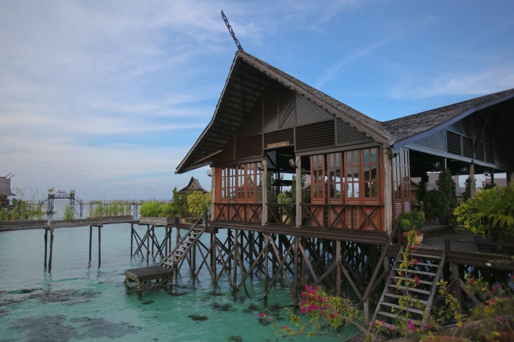
The first strategic anchorage is recommended at Coral Cay, a narrow channel flanked by reefs where waters remain exceptionally calm thanks to the natural protection of Solarte Island and Bastimentos Island. From this point, the crew can engage in snorkeling excursions and explore surrounding mangroves by kayak. Subsequently, the route continues toward the iconic coral formations of Cays Zapatillas, two uninhabited cays surrounded by white sand beaches that form part of Bastimentos Island National Marine Park.
The traverse culminates by circumnavigating Colón Island along its northern coast, exposed directly to the open swell of the Caribbean. This sector requires technical offshore navigation, maintaining a prudent distance from the shore to avoid rocky shoals. The return to the base port is planned by taking advantage of the early morning hours, when trade winds typically show their lowest intensity, ensuring a clean and safe docking maneuver at the marina.
Practical guide
Documentation and entry requirements
Foreign visitors must carry a passport valid for at least six months, a verifiable return ticket, and demonstrable economic solvency. Foreign vessels in transit must process international clearance and cabotage permits through the Panama Maritime Authority (AMP).
Best time for navigation
The period between December and April offers the best sailing days, coinciding with the relative dry season and stable trade winds. September and October record the longest calms, albeit with a higher probability of intense afternoon squalls.

Mandatory technical equipment
It is essential to have a GPS plotter with updated reef cartography, marine radar, dual-band VHF, certified life rafts, and a complete set of spare anchors with high-resistance chain suitable for coral and muddy bottoms.
Environmental regulations and safety
Spearfishing is strictly prohibited in all marine national park zones. The use of approved life jackets is mandatory during all dinghy transfers, alongside strict compliance with speed limits in channels inhabited by manatees.
The eternal pulse of the Caribbean Sea
When the catamaran shuts down its engines at the final anchorage under the shelter of Solarte Island’s mangroves, the silence of the nocturnal Caribbean takes possession of the atmosphere. Only the gentle rhythm of water slapping against the vessel’s hulls and the distant murmur of the outer reef break remind us of the vastness of the ocean surrounding us. In this remote corner of Panama, navigation ceases to be a simple nautical discipline and becomes an exercise in profound communion with nature.
The lessons learned after weeks of dodging shoals, calculating tides, and living alongside coastal communities completely transform the traveler’s perspective. The Bocas del Toro archipelago does not yield its secrets to those who seek the haste of modern tourism, but to those who know how to read the wind’s signals, respect the fragility of corals, and understand that the true luxury of adventure lies in leaving the lightest possible trace upon the face of the sea.
Navigating the channels of Bocas del Toro means learning to decipher the secret heartbeat of an amphibious world where time is measured by the rhythm of the tides.