
Introduction to the Fluvial Labyrinth of the Sahel
In the geographic heart of West Africa, where the vast expanse of the Sahara Desert brushes against the floodplains of Mali, the Niger River departs from its linear course to unfold an intricate network of channels, temporary lakes, and branching streams known as the inner delta. This aquatic ecosystem functions not merely as a sanctuary for migratory biodiversity, but as a vital communication artery where conventional roads yield to a complex amphibious infrastructure. During the months of high water, as floods originating in the highlands of Guinea cascade northward, the landscape undergoes a radical transformation, turning adobe villages into ephemeral islands and forcing riverside communities to rely on a heterogeneous fleet of vessels for survival, commerce, and daily mobility.
Connectivity in this region defies contemporary logistics standards, resting instead on empirical knowledge passed down through generations among boatbuilders, river pilots, and local merchants. Understanding the mechanics of this river corridor requires a close examination of seasonal dynamics, the technical challenges of shallow-water navigation, and the fragile economic balance that keeps a fleet of traditional transport craft afloat amid the surrounding aridity.
The Architecture of Wooden Pirogues and the Mopti Shipyard
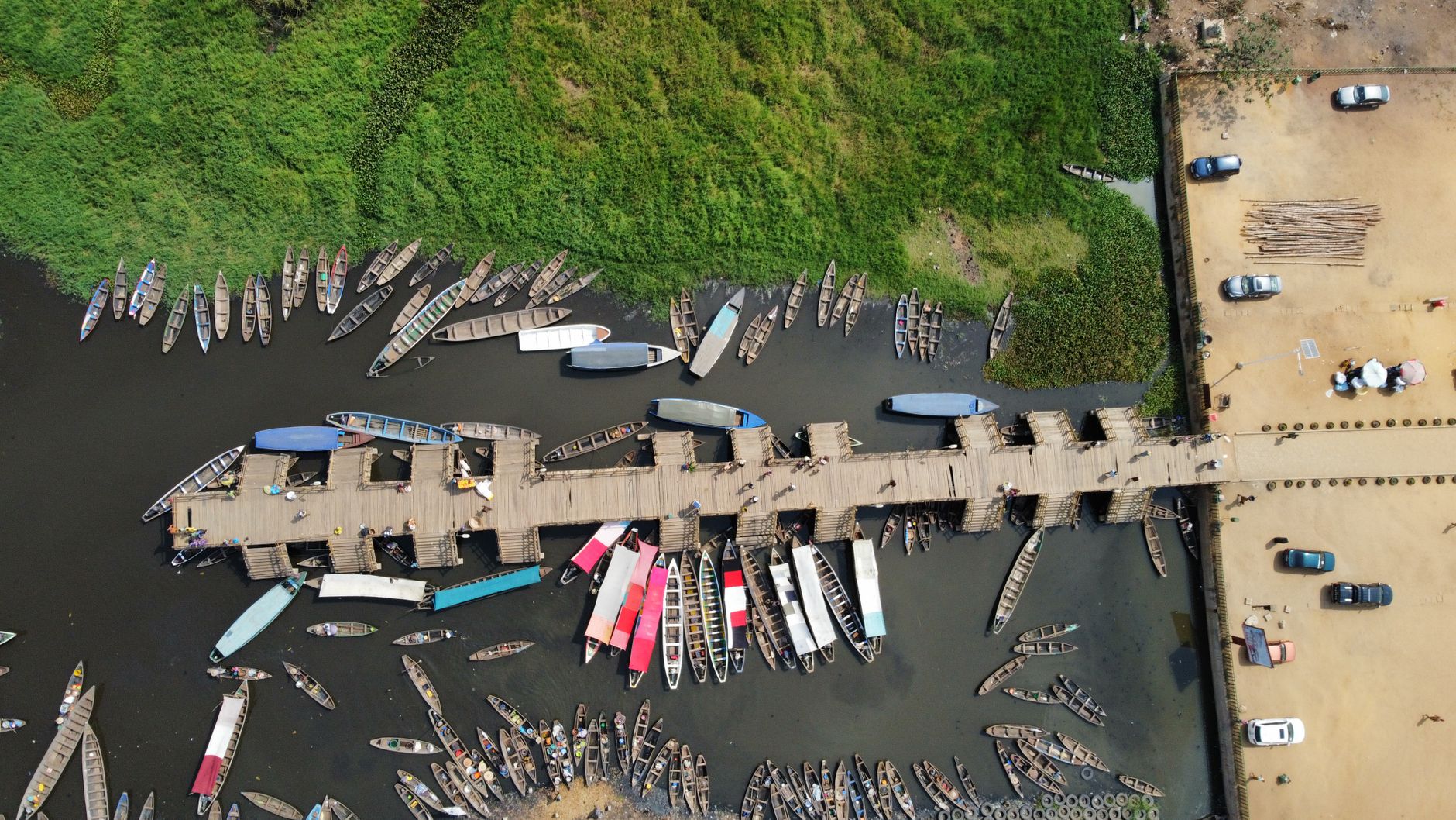
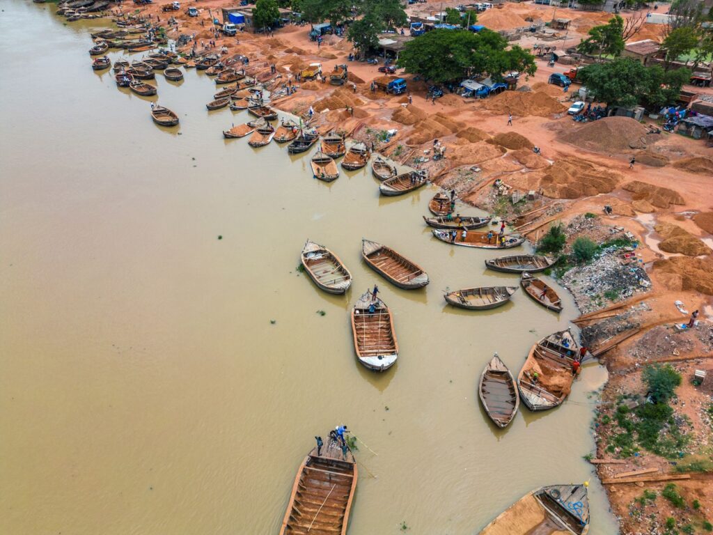
The river port of Mopti, frequently styled the Venice of Mali due to its confluence of the Niger and Bani rivers, serves as the neural epicenter of traditional naval construction in the region. Here, the shipyards set along the muddy banks harbor a millennial tradition of riverside carpentry devoid of blueprints or computer-aided tools, relying entirely on spatial memory and the geometric intuition of master boatbuilders.
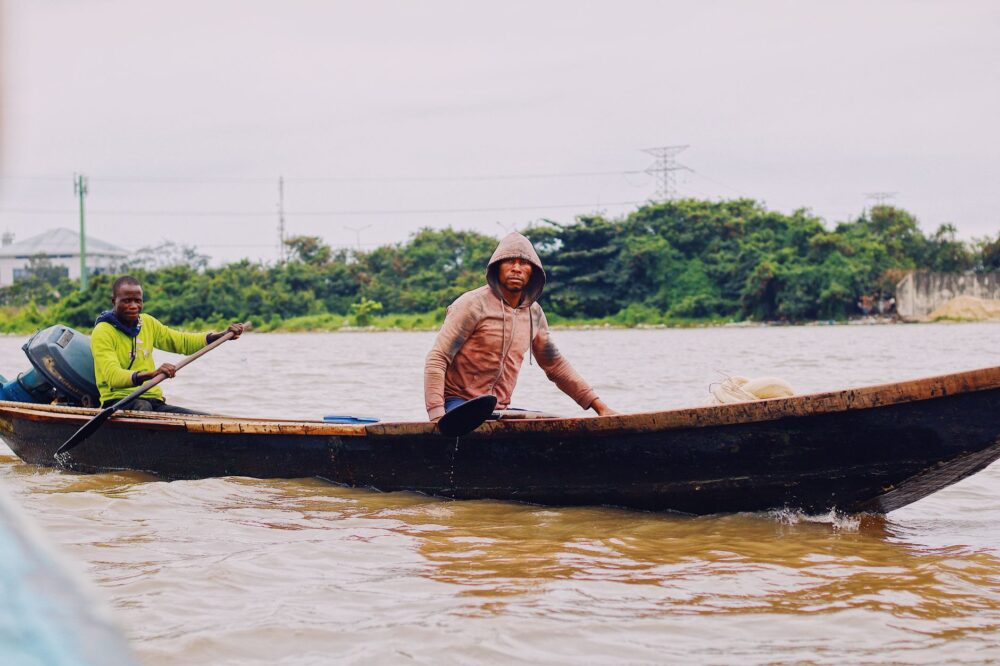
Traditional wooden pirogues, locally known as large canoes or *caiques*, are constructed by assembling planks of cailcedrat or African mahogany using forged iron fasteners and caulking joints sealed with plant fibers and natural resins. This construction methodology endows the hulls with the structural flexibility indispensable for enduring impacts against hidden sandbanks and the shifting pressure of currents during both flood and dry seasons.
Structural Challenges in Riverside Carpentry
Each vessel is designed for specific functions: transporting grain and livestock or carrying passengers across hundreds of kilometers between river markets. Boatbuilders must calculate waterlines and weight distribution with exacting precision to prevent hulls from capsizing under heavy loads of millet sacks, fuel drums, and passengers crammed onto improvised decks.
The port of Mopti is not merely a commercial docking facility; it is a living archive of Sahelian naval technology, where green timber is tamed with adzes and fire to challenge the vastness of the river.
Maintaining these vessels demands regular overhauls at the end of each high-water cycle. Timbers exposed to constant humidity and the alternating scorching sun undergo contraction and expansion processes that compel artisans to replace entire planks and renew tar seals, ensuring the longevity of a fleet that represents the sole viable alternative to impassable savanna tracks.
The Logistics of Large Cabotage Barges
Beyond smaller wooden pirogues, long-distance connectivity toward the northern reaches of the delta—culminating at the desert gates of Timbuktu and Gao—rests upon the shoulders of large metallic and reinforced wooden cabotage barges. These craft operate as true river freighters, capable of carrying tons of essential goods including cement, sugar, salt from the Taoudenni mines, and diverse manufactured products.
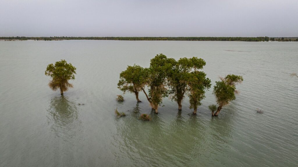
The operation of these barges is subject to strict dependence on the hydrological regime of the Niger River. During the annual flood, known locally as the *crue*, vessels harness rising water levels to navigate main channels safely. However, during the dry season, water levels drop precipitously, confining traffic to narrow channels and forcing captains to execute complex pilotage maneuvers guided exclusively by visual reading of the water surface, sediment color, and sandbar positioning.
Cargo Management and Intermediate Cabotage
Intermediate stops along the northward route structure regional commerce. At each port of call, cargo transfer is executed through a human chain of porters carrying heavy loads from holds to the muddy shore, where auxiliary small boats complete distribution to local markets situated inland within the floodplain.
- Seasonal Coordination: Adjustment of navigation schedules based on hydrological bulletins issued from gauging stations in Koulikoro and Mopti.
- Fuel Logistics: Procuring fuel for outboard motors and auxiliary generators at strategic points along the route.
- Passenger Management: Coexistence of travelers and commercial cargo in confined spaces during journeys that can stretch across multiple weeks.
Shallow-Water Navigation and Pilotage in a Changing Environment
Navigating the inner delta of the Niger demands exceptional technical expertise combining ancestral knowledge of currents with direct meteorological observation. Vessel captains, traditionally belonging to local communities such as the Bozo and Somono, read the river with pinpoint accuracy, identifying submerged reefs, drifting logs, and variations in turbidity that signal the depth of navigable channels.
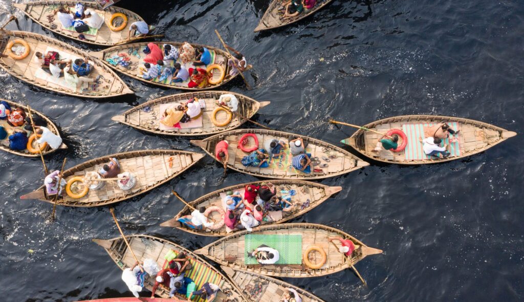
Unlike channeled marine or riverine routes elsewhere in the world, there are no glowing buoys, real-time digital navigation charts, or official waterway markers here. The buoyage system is entirely empirical, relying on natural riverbank markers, distinctive trees, and the accumulated experience of elder helmsmen.
The Impact of Climate Variability on Mobility
In recent decades, progressive rainfall reductions in the upper basin and alterations in flow regimes have shortened the duration of optimal navigation seasons. Consequently, large barges run aground more frequently on shifting sandbanks, interrupting supply chains to northern populations and significantly raising transportation costs for basic commodities.
When the river retreats prematurely, main channels transform into mud traps; the connectivity of the Sahel is then reduced to a fragile network of light pirogues that barely manage to sustain the commercial pulse of the region.
To mitigate these hardships, riparian communities organize community-led manual dredging in critical bottlenecks and establish alternative routes through secondary channels which, though longer and more tortuous, keep communications open when primary arteries become impassable.
The Amphibious Economy of Floating and Riparian Markets
The river transport system extends far beyond the physical movement of passengers and cargo, functioning as a dynamic, moving marketplace. The vessels themselves serve as commercial platforms where harvested floodplain rice, artisanal dried fish, and livestock in transit toward urban consumer markets are actively traded.
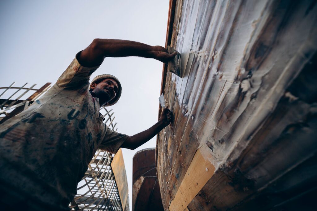
This periodic commercial exchange synchronizes with the arrival of large transport boats, whose appearances at rural docks gather local producers, artisans, and buyers into impromptu fairs lasting precisely as long as the ship remains moored before resuming its journey.
Interdependence Among Agriculture, Fishing, and Transport
The viability of this amphibious system rests upon the complementarity of local economic activities:
- Harvesting floating rice relies on timely floods to ensure grain development before water levels recede excessively.
- Preserving and transporting smoked fish demands rapid connections to southern consumer markets to prevent spoilage under high-temperature climates.
- The seasonal movement of transhumant livestock requires designating specific crossing points where large pirogues are temporarily adapted to board cattle mid-stream.
Practical guide
Planning a journey or logistics study along the central Niger river corridor demands rigorous understanding of local conditions, seasonal constraints, and safety protocols active in the region.

Seasonality and Hydrological Conditions
The optimal season to observe the complete operation of river transport spans the high flood months between September and January, when waters inundate the plain and large barges operate with greater regularity. During the dry season, from March to June, navigation becomes exceptionally complex and slow due to low water levels.
Logistics and Access Points
The primary departure point for entering the inner delta is the city of Mopti, accessible by road from Bamako. From the port of Mopti, regular lines of river transport operate toward key northern enclaves. Consulting local operators and guides familiar with river transport dynamics is essential.
Safety Recommendations and Preparation
- Always verify the technical condition of the vessel and the availability of life jackets before undertaking long-distance journeys.
- Strictly follow the instructions of captains and crew regarding cargo distribution and behavior on deck during passages through strong currents.
- Carry provisions of drinking water and basic first-aid supplies, as support infrastructure at intermediate stops is strictly artisanal and limited.
Epilogue: The Suspended Pulse of the Niger Waters
At dusk, when golden Sahelian light reflects upon the tranquil surfaces of secondary Niger branches, the roar of outboard motors fades, yielding to the rhythmic sound of wooden oars slicing the water. In that suspended moment, the apparent fragility of pirogues and barges reveals its true nature: they are not relics of a superseded past, but the intelligent, resilient response of communities that turned water and mud into their home and their path. As long as the river continues to flow through desert sands, this amphibious civilization will continue writing its history upon wood and current.