
Introduction to Oceanic Connectivity Across Polynesia
In the heart of the vast Pacific Ocean, the Cook Islands archipelago stretches across more than two million square kilometers of open sea. Far from constituting a continuous landmass, this self-governing territory in free association with New Zealand is fragmented into fifteen principal islands divided into two distinct geographic groups: the southern islands, of volcanic origin, fertile soil, and rugged topography; and the northern atolls, flat coral formations rising mere meters above sea level. This geographic dispersion poses one of the most complex logistical challenges in Oceania: how to guarantee human mobility, the supply of essential goods, and social cohesion in an environment where saltwater acts as both bridge and abyss.
Transport management in this scenario does not conform to conventional land-based infrastructure dynamics. Here, the highway is the wake left by outboard motors over turquoise lagoons, and the service station is a concrete wharf exposed to the onslaught of tides and tropical cyclones. The transport authorities in Rarotonga, the principal island where the administrative headquarters and International Airport are concentrated, operate in a constant balancing act between technical modernization and the preservation of ancient insular self-sufficiency. Understanding this system requires unraveling the invisible network connecting southern urban hubs with the remotest corners of the north.
The Aerial Backbone: Bridging Rarotonga and the Southern Islands
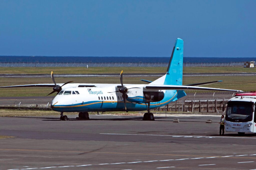
Air traffic represents the indispensable umbilical cord for the administrative, medical, and economic survival of the Cook Islands. From Rarotonga International Airport (RAR), national carrier Air Rarotonga operates a fleet composed primarily of Saab 340 and Embraer Bandeirante turboprop aircraft, specifically designed to operate on short runways, many of them paved with compacted coral or light asphalt. These routes regularly connect southern group islands such as Aitutaki, Atiu, Mitiaro, Mauke, and Mangaia, shortening distances that once required days of navigation under adverse weather conditions.

However, aeronautical operations in these latitudes are dictated by the capricious meteorology of the South Pacific. Pilots face constant crosswinds, a lack of advanced meteorological radar on smaller islands, and limited nighttime lighting on the vast majority of secondary airstrips. This means every morning flight is a real-time evaluation of visibility and runway conditions. The reliability of air transport depends not exclusively on technical engineering, but on expert reading of the horizon and close cooperation between flight crews and local communities, who are responsible for marking runways and clearing local fauna prior to landing.
Maritime Logistics and the Vital Role of Cargo Schooners
While aircraft carry urgency and the human element, ships bear the material life of the archipelago. Multi-purpose cargo schooners sailing from Avatiu Harbor in Rarotonga toward the north and south serve as the true economic lungs of the islands. Vessels like the Lady Moana or similar freighters undertake multi-week voyages, carrying everything from containers of non-perishable food and construction materials to heavy machinery and diesel fuel for local electrical generators.
Unloading operations in atolls such as Penrhyn, Pukapuka, or Rakahanga constitute an exercise in nautical precision. Lacking deep waters or sheltered wharves, large ships must anchor in the open sea outside the coral reef. Cargo transfer is carried out using motorized launches and barges that must negotiate breaking waves and natural reef channels, known locally as passes. This transshipment model requires perfect synchronization with tides and the keen judgment of local captains, who know every underwater current and submerged coral head.
Lagoon Transport and Traditional Outrigger Canoe Navigation
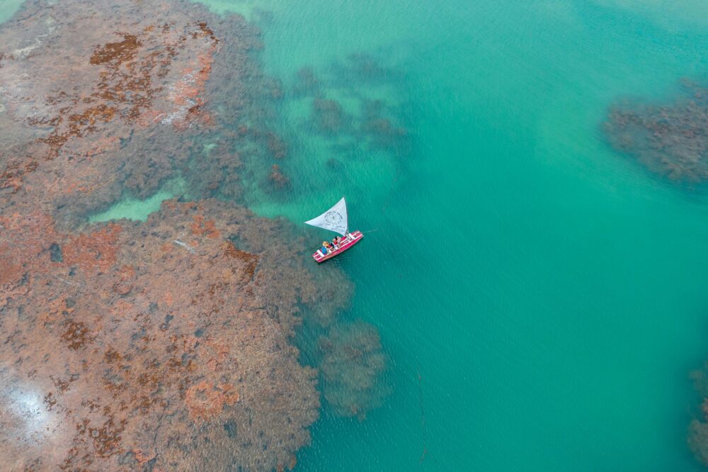
At the micro-insular scale, connectivity shifts from ocean routes to the calm waters of interior lagoons. In atolls like Aitutaki or Manihiki, lightweight boats powered by outboard motors serve as the local equivalent of urban utility vehicles. Fishermen, farmers, and schoolteachers use these craft for daily travel between peripheral islets, locally known as motus, transporting black pearl harvests and schoolchildren alike to central educational hubs.
In parallel, a conscious renaissance in the construction and navigation of traditional outrigger canoes is underway, driven by cultural associations and local navigators. Although gasoline engines dominate the daily transport economy, ancestral techniques of reading stars, seabird behavior, and water coloration remain active. These skills represent not only an invaluable intangible heritage, but an infallible backup system against any disruption in fossil fuel supplies.
Climate Challenges and Adaptation in Port Infrastructure
Global climate change and consequent sea-level rise impose unprecedented pressure on the transport infrastructure of the Cook Islands. Wharves constructed decades ago at low elevations suffer recurrent flooding during spring tides and anomalous wave episodes locally known as tini. Similarly, coastal erosion threatens the stability of several secondary airstrips situated dangerously close to the high-water mark.

Faced with this vulnerability, the Ministry of Infrastructure has initiated a coastal reengineering program. This includes raising port platforms using corrosion-resistant marine materials, constructing eco-designed submerged breakwaters that dissipate wave energy without destroying the coral ecosystem, and implementing smart drainage systems on airstrips. The sustainability of island transport is no longer measured solely in terms of economic profitability, but in its capacity for resilience against the climate crisis.
Transport infrastructure in remote atolls is not a commercial luxury, but the invisible thread preventing depopulation and safeguarding the dignity of communities guarding the ocean.
Engineers overseeing these projects also face the logistical difficulty of importing every bag of cement or ton of steel from New Zealand, exponentially increasing public budgets and demanding meticulous planning to capitalize on seasonal windows of good weather without interrupting basic supplies.
The Economics of Distance and the Traveler’s Experience
For the outside observer or specialized traveler, the Cook Islands transport network reveals the harsh reality of extreme insularity. Inter-island airfares and cargo freight rates reflect the high operating expenses of maintaining aircraft and vessels in such remote zones. There are no massive subsidies or economies of scale found in large continents; every passenger and transported crate bears the true cost of geographic distance.

This fosters a very specific tourism model: low-density, high cultural-value ecotourism, where visitors accept that weather-related delays are an unavoidable part of the Polynesian experience. The rigid punctuality of large international airport hubs yields here to respect for the natural rhythms of sea and wind, transforming patience into the primary credential of any expedition across the archipelago.
Practical guide
Planning Inter-Island Flights: Bookings with Air Rarotonga must be made months in advance, especially during the dry season (May to October). Travel insurance covering weather-related disruptions is essential, as wind or rain cancellations are frequent and can alter itineraries by several days.
Luggage Regulations on Small Aircraft: Flights between Rarotonga and the southern islands operate on light aircraft where space and weight limits are strictly enforced (typically a maximum of 15 to 20 kilograms per passenger, including carry-on). Flexible backpacks are strongly recommended over rigid suitcases.

Cargo Ship Logistics: Travelers planning to journey as passengers on cargo schooners bound for northern atolls (a voyage reserved for experienced travelers with flexible schedules) must secure prior authorizations from port authorities and bring their own provisions of food and potable water.
Digital Connectivity and Communication: In outer islands, cellular coverage and satellite internet managed by Vodafone Cook Islands can be intermittent. Travelers should inform family members or colleagues about potential temporary disconnects during maritime passages.
Emotional Epilogue: The Echo of Arrival Bells
When the twin-engine aircraft’s motor finally cuts out over the coral runway of a remote island like Atiu or Mauke, the silence enveloping the cabin is dense, almost palpable. Having crossed hundreds of miles of infinite blue, the traveler realizes the true magnitude of the Cook Islands lies not in its cartographic scale, but in the resilience of its people. At every wharf where neighbors await the monthly mail boat, or on every airstrip where children wave as the propeller slows, there beats a worldview where transport is never mere mechanical displacement, but the sacred ritual of belonging to the vastness of the world.