
Introduction to Alpine Isolation
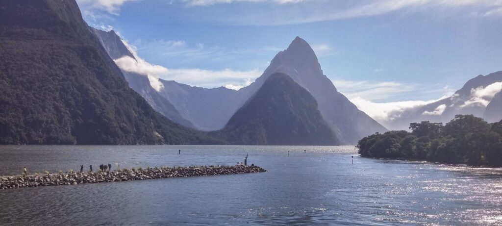
In the southwesternmost corner of New Zealand’s South Island, where the Southern Alps plunge abruptly into the depths of the Tasman Sea, lies one of the most formidable geographical landscapes on the planet: Piopiotahi, internationally known as Milford Sound. This territory of peaks sculpted by ancient glaciers, vertical rock faces exceeding one thousand meters in height, and annual rainfall approaching seven meters represents much more than a postcard destination. It is, above all, an extreme exercise in logistical engineering and a permanent challenge to human connectivity. The fragility of its terrestrial access, the absolute dependence on a single paved route, and the complex choreography of tourist catamarans configure a transportation ecosystem where high alpine terrain, unpredictable meteorology, and rigorous environmental management converge.
For decades, the geographical isolation of Milford Sound protected its pristine biodiversity, allowing endemic species and temperate rainforests to evolve without massive human interference. However, the integration of this remote region into the global circuits of contemporary tourism has radically transformed its circulatory dynamics. Today, thousands of daily visitors travel along a road infrastructure vulnerable to rockfalls and avalanches, while a carefully regulated fleet of vessels navigates the dark waters of the fiord. This report examines with technical rigor the intermodal network that sustains life, commerce, and transit in one of the most isolated and closely monitored confines of Oceania.
The Artery of Asphalt and Rock: State Highway 94
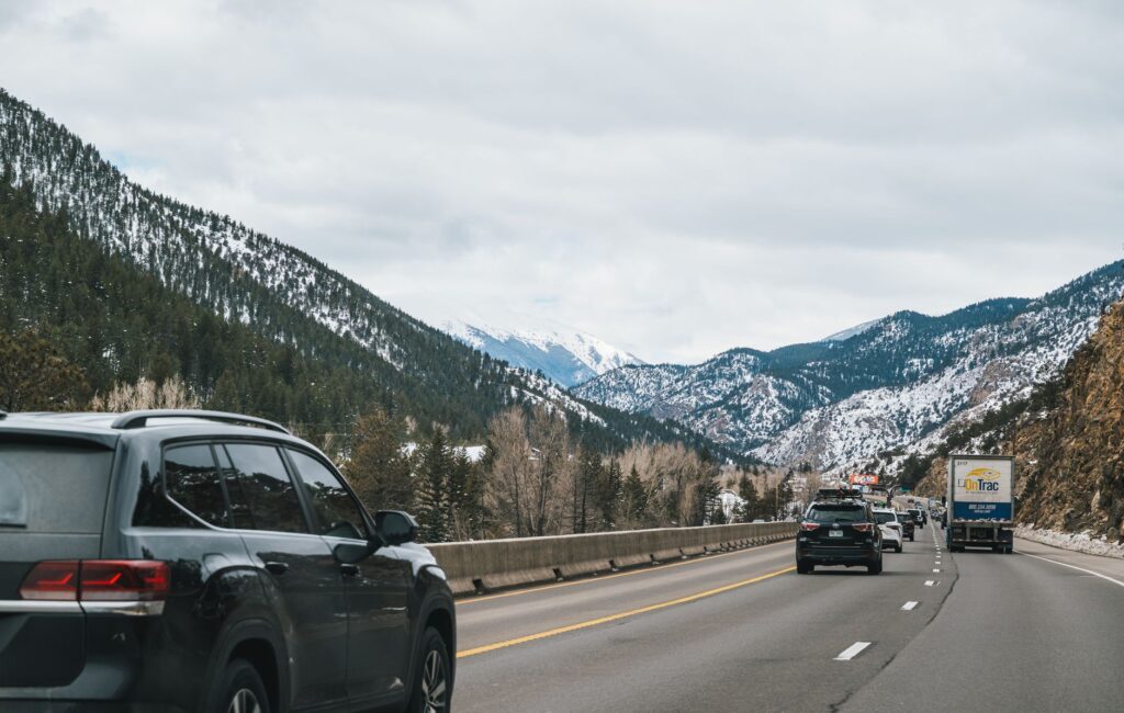
The backbone connecting the outside world with the deep waters of Milford Sound is State Highway 94, commonly referred to as the Milford Road. This route of just over one hundred and twenty kilometers from the township of Te Anau constitutes one of the most ambitious and costly road engineering feats to maintain in the Southern Hemisphere. The engineers who conceived and expanded this route throughout the twentieth century had to face impossible gorges, turbulent rivers, and the constant geological instability of the alpine slopes. Every meter of asphalt won from the mountain is the result of decades of controlled blasting, construction of retaining slopes, and the permanent maintenance of heavy road equipment.
The culminating point of this road journey is the Homer Tunnel, a 1,245-meter bore excavated directly into the granitic rock of the continental divide. Opened in the mid-twentieth century after titanic efforts marked by harsh climatic conditions and geological accidents, the tunnel operates as a controlled bottleneck for traffic. Due to its narrow cross-section, which historically prevented the simultaneous crossing of buses and large vehicles, the management of vehicular flow requires an automated traffic light system and operational control personnel during peak summer hours. The surrounding rock, subjected to daily freeze-thaw cycles, requires constant geotechnical inspections to prevent rockfalls from collapsing this sole land penetration route.
The road to Milford is not a simple transit path; it is a fragile lifeline suspended between the weight of glaciers and the fury of southern elements.
Engineering Against Gravity: Avalanches and Winter Mitigation
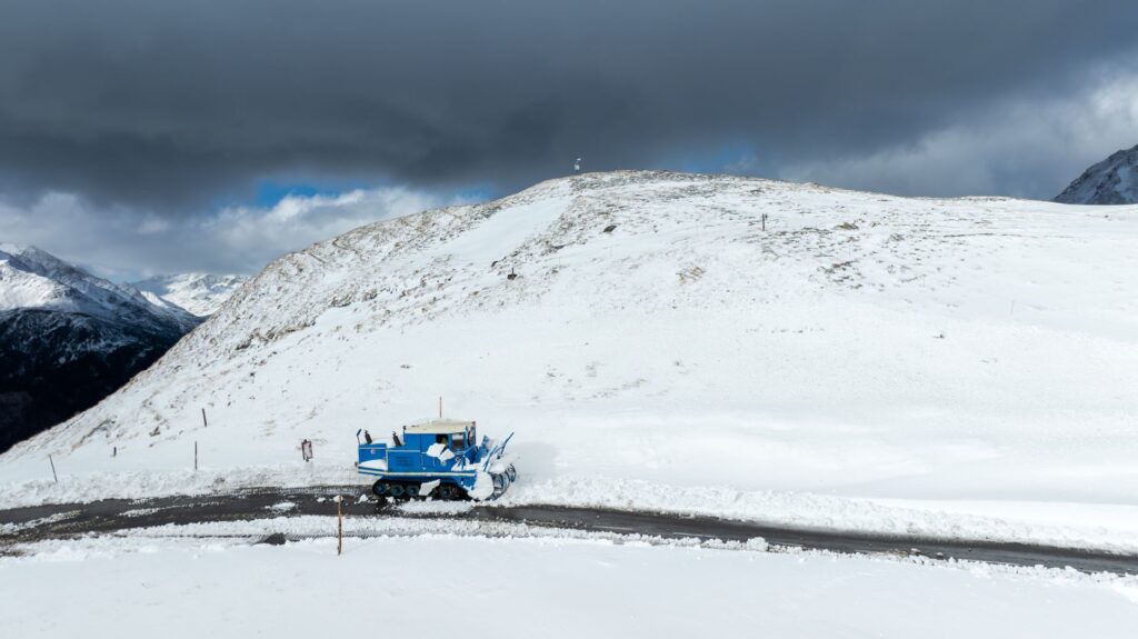
The operability of State Highway 94 faces one of its most formidable enemies every winter: snow avalanches. The heavy snow accumulations on the surrounding peaks, combined with strong winds and sudden thermal fluctuations, turn the slopes above the road into zones of high catastrophic risk. To guarantee the safety of travelers and the continuity of logistical supply to the fiord’s tourist facilities, the New Zealand transport department manages one of the world’s most advanced avalanche control programs, operating in close collaboration with specialized meteorologists and artillery teams.
The mitigation protocol includes satellite monitoring of the snowpack, the installation of automated meteorological stations on inaccessible ridges, and the use of explosive charges deployed via remote systems or helicopters to induce controlled avalanches before they reach the roadway. When conditions exceed established safety thresholds, the closure barriers are activated, and the route remains closed to general traffic for hours or even days. This temporary isolation reminds administrators and tourism operators that alpine nature retains absolute control of the territory, subordinating any economic planning to the whims of the sub-antarctic climate.
The Fleet of the Abyssal Depths: Commercial Navigation in the Fiord
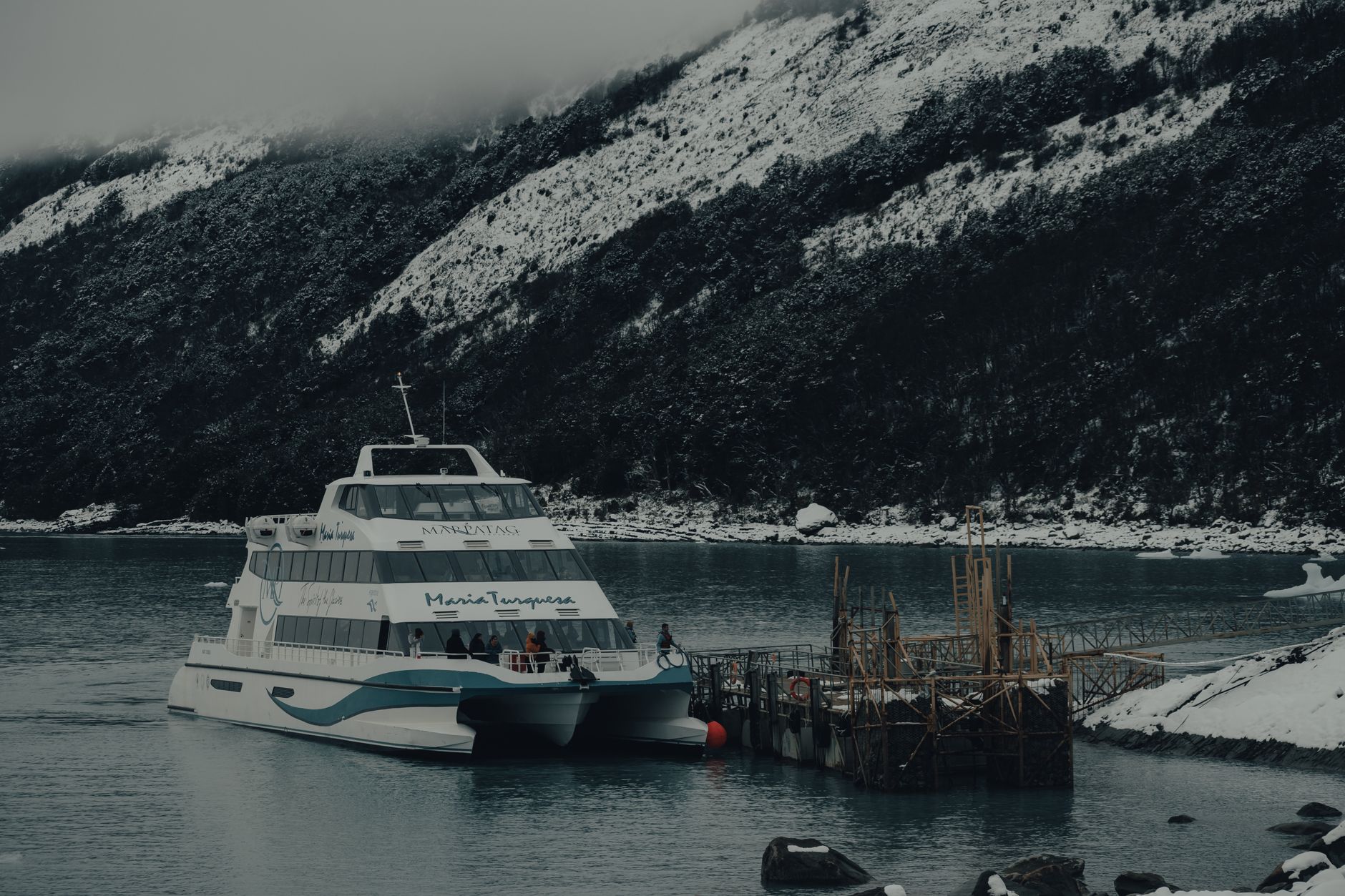
Once the terrestrial obstacle is overcome and the valley floor is reached at Deepwater Basin, the transportation system undergoes a radical metamorphosis: asphalt gives way to saltwater. Milford Sound, which is actually geologically a drowned glacial valley, extends for sixteen kilometers until opening into the Tasman Sea. In this aquatic scenario, a diverse fleet composed of high-speed catamarans, traditional tourist vessels, and small expedition boats sustains the experience of commercial navigation, operating under strict environmental regulations and maritime safety standards.
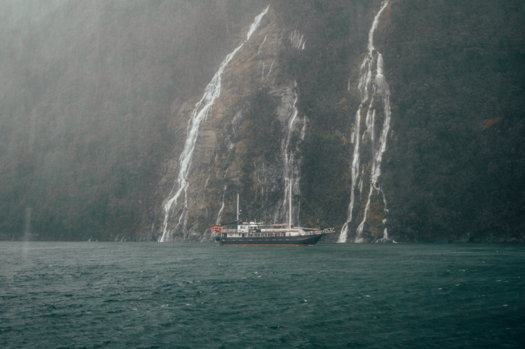
Port management at Deepwater Basin is an exercise in millimeter precision. Despite its name, the facilities suffer from draft limitations and maneuvering space, forcing shipping companies to coordinate their departure times with chronometric exactitude. Captains must also contend with a unique oceanographic feature: a multi-meter surface layer of freshwater, originating from incessant rainfall, sliding over the denser saltwater of the sea. This phenomenon creates particular conditions of reduced visibility, unforeseen surface currents, and a mirror effect that darkens the vertical cliffs, demanding exceptional nautical skill from local crews.
Insular Logistics and Supply Under Extreme Conditions
Maintaining an operational tourist and residential infrastructure in an environment as isolated as Milford Sound implies overcoming colossal logistical challenges of provisioning. Given that the fiord lacks railway connections, high-capacity commercial airports, or regular cargo shipping routes from the main urban centers of the South Island, everything necessary to sustain daily activity must be transported by road via the winding Route 94, facing the restrictions of the Homer Tunnel and bad weather closures.
The supply of fuel, fresh food for floating restaurants, mechanical spare parts for vessels, and the comprehensive management of solid waste and wastewater depend on an extremely disciplined transport chain. Tankers and heavy freight trucks operate in specific time slots, often coordinating to minimize congestion with tourist bus convoys carrying thousands of visitors from Queenstown. Any prolonged interruption in the road due to major landslides forces the activation of emergency protocols, utilizing air transport via cargo helicopters to meet the most urgent needs of resident personnel.
The Green Revolution: Electrification and Sustainable Mobility
Faced with the growing pressure of international tourism and the inescapable need to preserve the ecological purity of Fiordland National Park, the transportation sector in Milford Sound has initiated a deep technological transition toward sustainability. Government authorities, in collaboration with private tourism operators and regional indigenous associations, have promoted strict regulations to reduce the carbon footprint and acoustic impact on the delicate marine ecosystem of the fiord.
In the maritime sphere, fleet renewal has begun to prioritize catamarans powered by hybrid electric battery systems and high-efficiency diesel engines, capable of navigating in absolute silence during the most sensitive stretches along waterfalls and seal colonies. On land, feasibility studies and pilot projects analyze the introduction of long-range electric buses to cover the tourist route from Te Anau, overcoming the technical challenge of steep gradients and cold winter temperatures. These initiatives seek to demonstrate that geographical isolation is not incompatible with the adoption of cutting-edge technologies aimed at environmental conservation.
Practical guide
Trip Planning: Visiting Milford Sound requires rigorous advance booking due to limited local hotel capacity and high seasonal demand. The best time to tour the area spans from the austral summer (December to February), with longer days but heavier congestion, to the autumn months (March to May), when colors contrast with the first snowfalls on the peaks.
Road Access: Driving along State Highway 94 requires experience in alpine routes, vehicles in optimal mechanical condition, and the mandatory carrying of snow chains during the colder months. It is essential to consult traffic status and weather alerts issued by the New Zealand Transport Agency before starting the journey from Te Anau.
Navigation and Bookings: Boat excursions through the fiord must be booked weeks in advance. It is recommended to choose early morning slots to avoid overcrowding and take advantage of the best lighting conditions over the cliffs and the Stirling and Bowen waterfalls.
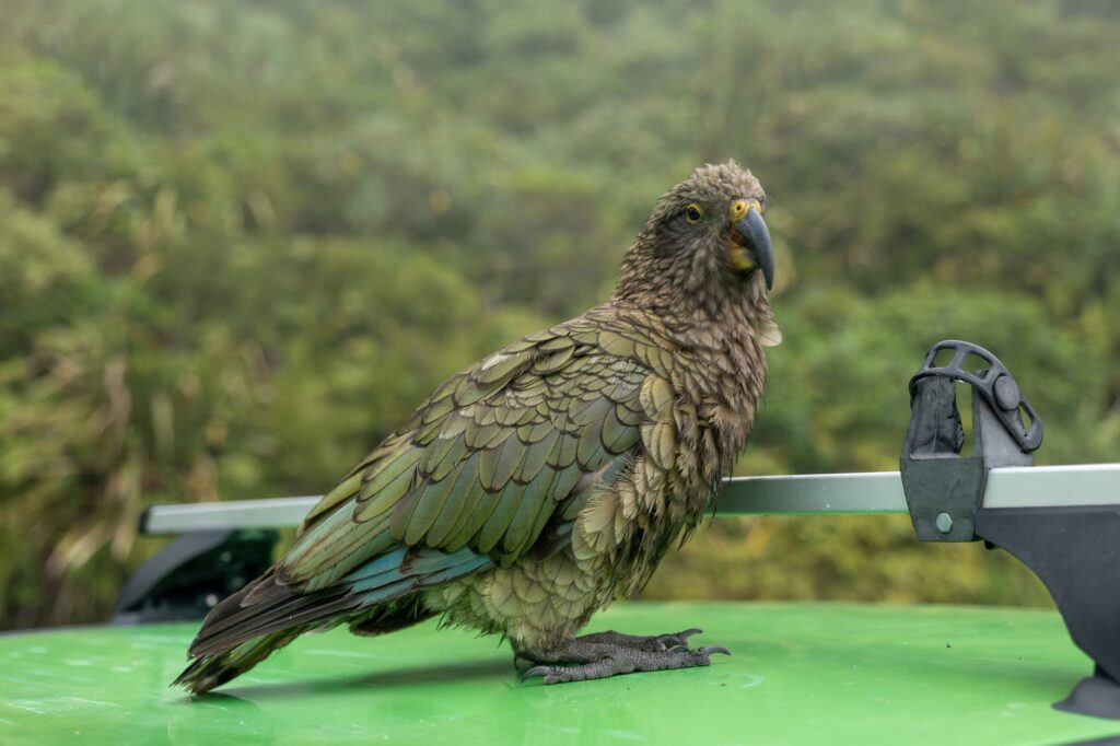
Environmental Regulations: Piopiotahi is part of a protected environment under strict conservation guidelines. Disposing of waste, feeding local wildlife—such as the kea parrots that frequent parking areas—or stepping outside marked trail areas at viewpoints is strictly prohibited.
Epilogue: The Reflection in Dark Waters
When the last catamaran of the day turns off its engines and the reflections of the granitic peaks dissolve on the still surface of the fiord, Milford Sound recovers its millennial silence. In that instant of truce between daytime hustle and the arrival of the sub-antarctic night, the true dimension of the territory reveals itself in all its magnitude. It is not merely a destination point on a global tourism map, but a sanctuary where human perseverance constantly clashes with the rugged immensity of nature. Every bus crossing the Homer Tunnel, every hull plying the deep waters, and every logistical decision adopted in this southern confine represent a delicate balance between the desire to know the world and the supreme duty to protect its inviolable fragility.