
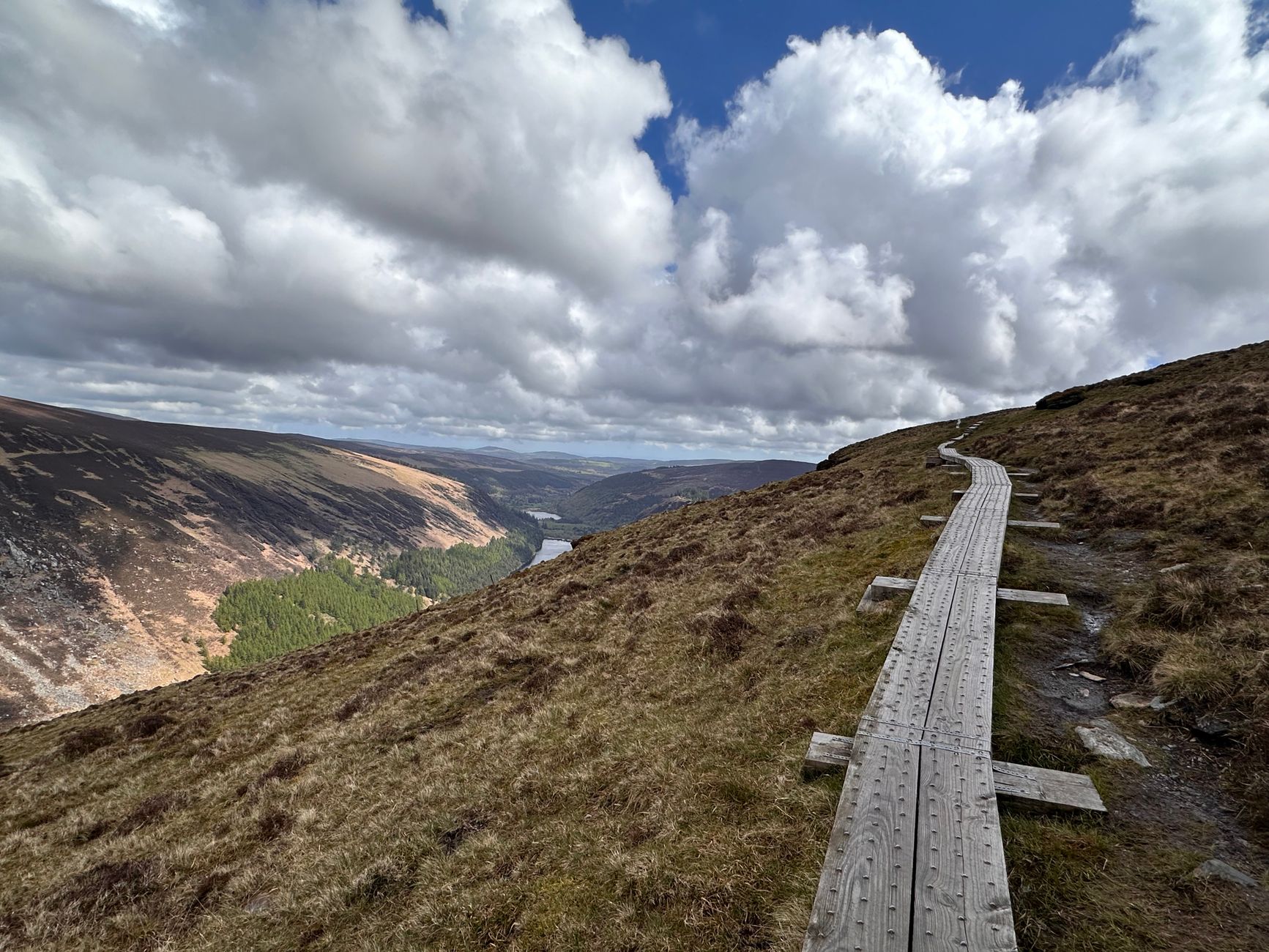

The Emerald Isle hides on its eastern flank a territory where water, granite, and silence shape a landscape of breathtaking melancholy. The Wicklow Way, inaugurated in the early 1980s as the country’s first official long-distance route, crosses the green heart of Ireland from south of Dublin to the remote village of Clonegal. This is no mere country stroll, but a demanding expedition spanning over 129 kilometers that requires profound respect for Atlantic weather, skill over moisture-saturated surfaces, and solid logistical self-sufficiency in stretches where civilization seems to dissolve into low-lying mist.
Approaching this itinerary requires understanding the geological morphology of the Wicklow Mountains, an intrusive granite batholith eroded by millennia of glaciation that has left behind U-shaped valleys, deep corries, and plateaus covered by thick layers of peat. The terrain shifts drastically without warning: from well-maintained forestry tracks among Sitka spruce to waterlogged path segments where footwear sinks deep into black mud. This report examines with technical rigor the keys to planning, traversing, and safely enjoying one of Western Europe’s most iconic pedestrian journeys.
The Hidden Geography of Ireland’s East: Between Granite Peaks and Sacred Valleys
The traditional starting point at Marlay Park in Dublin’s southern suburbs marks an abrupt contrast that intensifies as the trekker ascends toward the initial foothills of the range. The early hills, covered with ferns and native oaks, quickly give way to open moorland dominated by heather and coarse moor grass. The route’s maximum altitude is not extreme—Mullaghcleevaun and Tonelagee hover around the stunted eight-hundred-meter mark—yet northern latitude and direct exposure to Atlantic depressions generate high-mountain weather conditions at surprisingly low elevations.
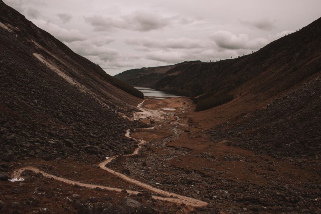
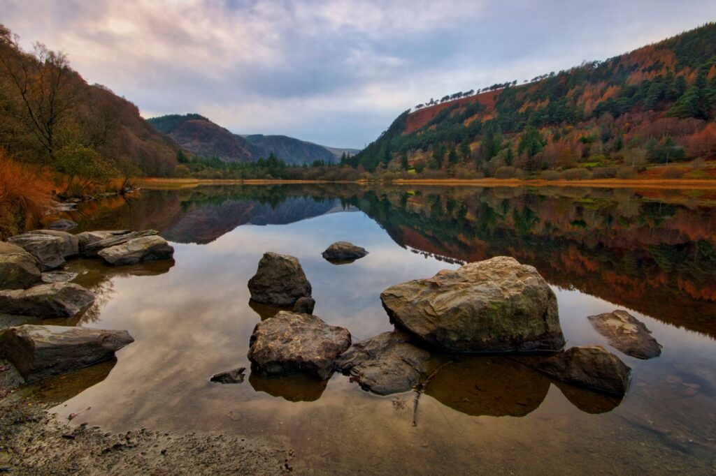
Throughout the early days, the route meanders along slopes where human handiwork is manifested through ancient dry-stone walls and the ruins of nineteenth-century mining settlements. The descent into the Glendalough valley reveals one of insular Christianity’s most important monastic complexes, founded by St. Kevin in the sixth century. Here, the geography turns solemn: two dark lakes, the lower and the upper, nestle at the foot of vertical cliffs where the murmur of waterfalls breaks the sepulchral silence of centuries-old oak forests.
The Emerald Isle’s Climatic Dynamics: Interpreting Atlantic Fronts
Planning a Wicklow Way traverse requires banishing the notion of stable weather. Ireland’s geographical position in the Gulf Stream guarantees mild winters and cool summers, but also extraordinarily high daily variability. In a single day, it is common to walk under radiant sunshine highlighting the intense green of pastures only to be enveloped minutes later by a dense bank of fog—locally known as mist—accompanied by persistent drizzle that chills to the bone.
Dominant southwesterly winds collide head-on with the eastern slopes of the range, causing steady orographic precipitation. Therefore, waterproof protective gear is not an accessory item, but the trekker’s first line of defense. Temperatures rarely reach oppressive extremes in summer, ranging between fifteen and twenty-two degrees Celsius, while nighttime drops can surprise with lows near five degrees, even in July and August. The key to success lies in the three-layer technical principle, completely avoiding cotton fibers that retain body sweat.
Technical Terrain Management: Mastering Peaty Moors and Forestry Tracks
One of the Wicklow Way’s greatest physical challenges lies in the nature of its footing. Much of the high plateau is formed by active and inactive blanket bogs, fragile ecosystems composed of partially decomposed plant matter. Walking across peat requires mindful footing: a misstep off marked paths or away from the wooden duckboards placed by forestry authorities can cause a sudden, knee-deep plunge into acidic, dense mud.
The use of trekking poles with wide baskets is indispensable for probing ground consistency and maintaining balance on muddy descents. Mountaineering boots must feature a high-quality waterproof membrane and firm ankle support to prevent twisting sprains on irregular surfaces covered in roots and loose stones. The constant abrasion of water and mud also tests footwear, making water-repellent treatments vital before embarking on the expedition.
Logistics of Provisioning and Accommodation: Between Traditional B&Bs and Campsites
Unlike remote alpine routes where self-sufficiency with tent and stove is non-negotiable, the Wicklow Way runs close to small rural villages and agricultural settlements. This allows for a lighter marching style for those who prefer indoor lodging in traditional Bed and Breakfasts dotting towns like Roundwood, Laragh, Tinahely, or Glenmalure.

However, accommodation infrastructure is not infinite, and seasonal demand far outstrips available supply, especially between the months of May and September.
Advance booking of overnight stays at least six months ahead is the critical requirement determining the feasibility of an accommodation-based traverse.
For hikers opting for wild camping, it is worth remembering that much of the surrounding land in Ireland is private property, making scrupulous respect for landowners and Coillte forestry park regulations completely non-negotiable.
Safety, Navigation, and Emergency Protocols in the High Moors
Despite lying just a few kilometers from the nation’s capital, the sense of isolation on the Wicklow plateaus can be absolute when visibility drops below five meters. Summer fog easily disorients even experienced mountaineers, turning clear slopes into identical labyrinths.
Carrying detailed physical mapping at a 1:25,000 or 1:50,000 scale published by Ordnance Survey Ireland is mandatory, complemented by a GPS device with spare batteries or waterproof power banks. Official trail markers—a yellow silhouette of a hiker alongside a black arrow and the trail post featuring the walking figure—are highly visible, but in blizzard conditions or low light they can easily be missed. In an emergency, the Dublin and Wicklow Mountain Rescue Team operates in coordination with the Garda Síochána and air support, making a fully charged mobile phone with intermittent valley coverage essential.

Practical guide
How to get there: The official starting point at Marlay Park lies about ten kilometers south of central Dublin. It is easily reached from the capital via the urban bus network (Dublin Bus, routes 16 or 14). For the return from Clonegal, the final village, arranging a private taxi service to the nearest train station in Enniscorthy or using local buses connecting to Dublin or Rosslare is necessary.
Best time to visit: The months between May and September offer the best conditions of prolonged daylight and milder temperatures. June typically stands out for lower crowding and high probability of clear days, though weather unpredictability persists year-round.
Permits and regulations: No paid permits are required to hike the trail, as it mostly runs through rights of way, public forestry tracks, and private land under access agreements. Leave No Trace principles must be strictly followed, closing pasture gates behind you and avoiding open fires in forested areas.

Recommended gear: Broken-in waterproof hiking boots, 30 to 40-liter backpack with rain cover, breathable and waterproof three-layer system (Gore-Tex or equivalent), telescoping poles, first-aid kit, emergency blanket, headlamp with spare batteries, high-calorie trail rations, and water for long stretches without reliable potable sources.
Recommended accommodations: In Laragh and Glendalough, historic establishments like The Glendalough Hotel stand out. In intermediate stages, family-run B&Bs managed by local residents offer the authentic warmth of Irish hospitality, including full traditional breakfasts and luggage transfer services via authorized local agencies.
Visual Epilogue: The Golden Silence of the Bogs at Dusk
When the day’s march draws to a close and the final rays of sunlight pierce the high cloud layer over the slopes of Clonegal, the Wicklow Way landscape undergoes a chromatic metamorphosis of profound emotional intensity. The emerald green of the valleys merges with the ochre, copper, and violet tones of blooming heather, while stream water reflects a glowing sky announcing the arrival of the Atlantic night. In that instant of absolute stillness, devoid of mechanical noise and embraced by the cool breeze of the moors, the trekker understands that the true reward of the journey lies not in the distance conquered, but in the intimate communion achieved with Ireland’s austere and magnetic nature.


