At the confluence where the Tigris and Euphrates surrender to the embrace of the Persian Gulf, a landscape emerges that defies the logic of the surrounding desert. The Mesopotamian Marshes, or Al-Ahwar, are not merely home to one of the planet’s oldest civilizations, but the stage for a unique transport system that has survived wars, forced drainage, and the relentless march of modernity. Here, connectivity is not measured in kilometers of asphalt, but in the depth of the channels and the resilience of the reed fibers.
This liquid ecosystem, declared a UNESCO World Heritage site, currently faces a historic crossroads. While local inhabitants, the Ma’dan or Marsh Arabs, continue to navigate their iconic bitumen-coated canoes, just a few kilometers away, the Grand Faw Port is rising. This contrast defines the region’s intermodal reality: a constant struggle between preserving millennial routes and the ambition to turn Iraq into the new logistical axis between Asia and Europe through the ambitious Development Road project.
The Rebirth of Water in Southern Iraq
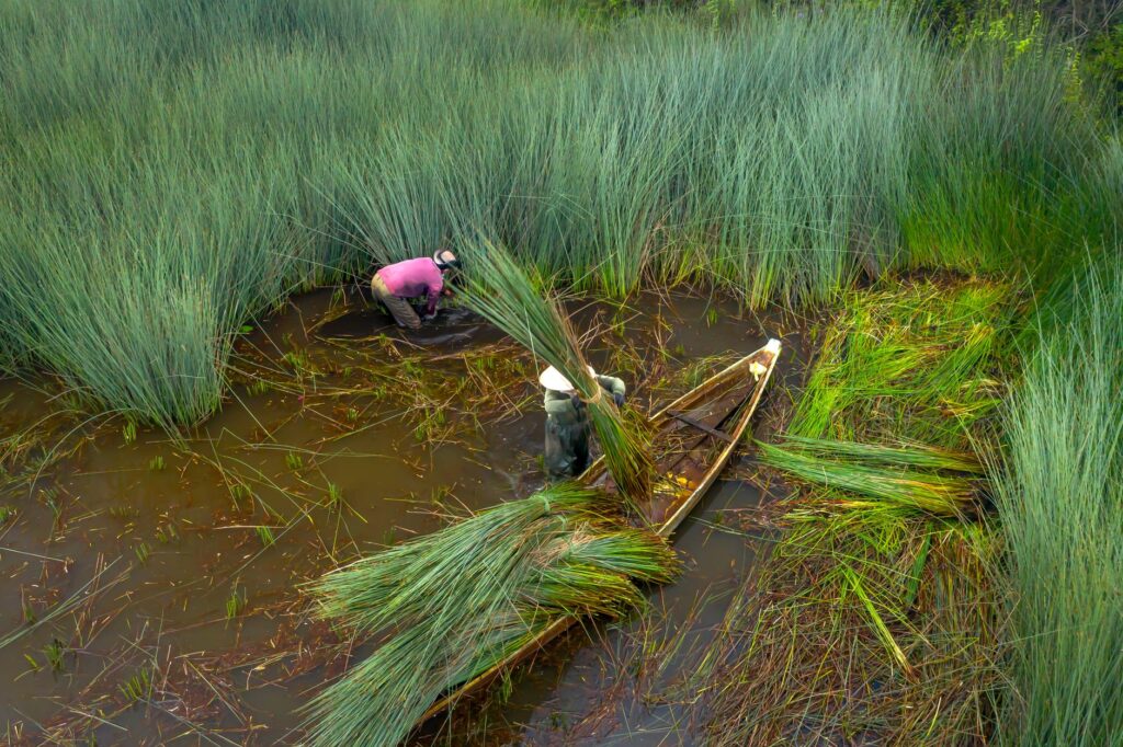
The history of transport in the marshes is, above all, a story of resilience. Following the massive drainage of the 1990s, which reduced this wetland to less than 10% of its original size, the fall of the regime in 2003 allowed local communities to dismantle the dikes and return the water to its course. However, the restoration of the ecosystem brought the challenge of rebuilding a transport network that had been wiped off the map. Today, the channels are once again the primary arteries for the trade of buffalo, milk, and fish.
Navigating these waters is no simple task. The system is extremely sensitive to water levels, which depend on dams in Turkey and Iran and seasonal rainfall. During periods of drought, the channels become impassable, isolating entire communities that rely exclusively on their boats to access basic services in cities like Chibayish or Al-Qurnah. This fragility underscores the importance of water management that understands water not just as a biological resource, but as essential transport infrastructure.

“The marshes are not merely an ecosystem; they are the liquid memory of humanity, where transport is still governed by the rhythm of the reeds.”
Intermodal transport here begins at the packed-earth quay. Goods arrive in light trucks from Basra and are manually transferred to canoes. There are no cranes or mechanized docks in the heart of Al-Ahwar; only human strength and the skill of navigators who know every bend of the hidden channels among the giant reeds. It is a last-mile system that has remained unchanged for five millennia.
The Mashoof: Ancient Bitumen Engineering
The centerpiece of this network is the mashoof. This slender canoe, with its high prow and black bitumen coating, is a masterpiece of vernacular engineering. Its design allows it to glide through waters barely thirty centimeters deep, dodging dense vegetation that would stop any conventional outboard motor. The construction of a mashoof follows Sumerian techniques, using local wood and a waterproofing layer of natural pitch, which is abundant in the region.
Different types of mashoof exist according to their function. The tarada is the longest and fastest version, historically used by sheikhs to travel between villages, while the belem is wider and more stable, ideal for carrying heavy cargo like fodder for water buffalo. Despite the introduction of gasoline engines in recent years, traditional paddling remains indispensable in the densest parts of the marsh, where engine noise scares away wildlife and propellers get tangled in roots.

The Transition Toward Motorization
The arrival of two-stroke engines has transformed the local economy, allowing fishermen to reach more distant markets in less time. However, this modernization has brought new problems: noise pollution and fuel spills threaten the biodiversity of a protected area. Furthermore, maintaining these engines in a logistically difficult area creates a technological dependency that clashes with the traditional autonomy of the Ma’dan.
The Shatt al-Arab Artery: Logistics Between Borders
South of the marshes, the landscape changes drastically as it meets the Shatt al-Arab, the river formed by the confluence of the Tigris and Euphrates. This is Iraq’s most important waterway and its only direct outlet to the sea. Here, transport ceases to be artisanal and becomes a matter of geopolitics and large-scale operations. Coastal vessels and tankers share the channel with border patrol boats in an area that has been historically contested with neighboring Iran.
Basra, known as the Venice of the East, is the central node of this network. Its internal canals, though currently suffering from severe pollution and lack of maintenance, were once the heart of an aquatic urban transport system. Basra’s connectivity with the rest of the country relies on a railway infrastructure dating back to the British era, which is being renovated to handle the flow of goods expected with the opening of new ports.
- Umm Qasr Port: Currently the main port of entry for goods and humanitarian aid in the south.
- Khor Al-Zubair Terminal: Specialized in petroleum products and crude oil exports.
- Navigation Channel: Constantly dredged to allow access for deep-draft vessels.
The Grand Faw Port and the Dry Canal Dream
The region’s most ambitious project is undoubtedly the Grand Faw Port. Located at the southern tip of the Al Faw peninsula, this megaport aspires to be one of the largest in the world. Its construction includes the world’s longest breakwater, a 14.5-kilometer structure protecting the basins from Gulf currents. The goal is clear: to capture maritime traffic currently heading to other regional ports and offer a land-based alternative to the Mediterranean.
This project is the cornerstone of the so-called Development Road, a 1,200-kilometer intermodal corridor that will connect Al Faw with the Turkish border through a network of high-speed railways and modern highways. It is estimated that this «Dry Canal» could reduce transit time between Asia and Europe by several days compared to the Suez Canal, positioning Iraq as a key player in global trade.
“The Dry Canal project aims not just to move containers, but to redefine Iraq’s role as the inevitable bridge between East and West.”
However, integrating this megaproject with the fragile environment of the marshes is a technical and ethical challenge. Projected routes must avoid fragmenting the wetlands, requiring the construction of large-scale viaducts and bridges that do not alter the natural flow of water. Modern engineering is forced to dialogue with a hydrography that does not forgive planning errors.
Environmental Challenges: Transport in the Face of Drought
The greatest enemy of connectivity in southern Iraq is not a lack of investment, but climate change and transboundary water management. The salinization of the Shatt al-Arab, caused by the decrease in freshwater flow and the advance of the salt wedge from the Gulf, is destroying palm grove ecosystems and hindering navigation. Sediments accumulate faster than dredgers can work, reducing the draft of the main channels.
In the marshes, recurring drought forces inhabitants to migrate with their animals and boats to deeper areas, breaking traditional settlement patterns. Transport then becomes a tool for survival; canoes no longer just carry fish, but freshwater tanks to supply families who refuse to leave their floating homes. Intermodality manifests here dramatically: water tankers travel as far as the mud allows to transfer water to the mashoofs.

Intermodality of Survival: From Canoe to Truck
For the traveler or analyst, understanding southern Iraq requires observing the transfer points. At the edges of the marsh, where the asphalt ends, spontaneous markets form that function as logistical hubs. Here, buffalo milk collected at dawn in the heart of the wetland is transported by canoe to a meeting point, where it is loaded onto refrigerated trucks that will take it to the markets of Nasiriyah or Basra.
This system, while efficient on a local scale, lacks a robust cold chain and adequate storage infrastructure. Improving these intermodal nodes is fundamental for the region’s economic development. It is not just about building large ports, but about creating local docks that facilitate loading and unloading without destroying the environment, allowing marsh products to reach international markets with the added value of their artisanal origin.
Social Impact of the New Iraqi Silk Road
The transformation of transport infrastructure has a direct impact on the social structure of southern tribes. The construction of the Development Road promises thousands of jobs but also threatens to displace communities that have lived in isolation for centuries. The challenge for the Iraqi government is to ensure that this new connectivity is inclusive and does not become a mere transit corridor for foreign goods.

Education and technical training in logistics and port management are essential for the local population to be the protagonists of this change. In Basra, the university is already adapting its programs to prepare the next generation of engineers and managers who will operate the Grand Faw Port. Connectivity, therefore, is not just physical, but also intellectual and economic.
Practical guide
Traveling to southern Iraq and exploring its transport network requires meticulous planning and deep respect for local customs. It is not a destination for mass tourism, but for the traveler seeking to understand the complexity of a region in the midst of transformation.
- Access: Basra International Airport (BSR) is the main gateway, with direct connections from Dubai, Istanbul, and Baghdad.
- Visas: Iraq offers a Visa on Arrival for citizens of the EU, USA, and other countries at its main airports. It is recommended to check current regulations before traveling.
- Local Transport: To move between cities, shared or private taxis are the most common option. For the marshes, it is essential to hire a local guide in Chibayish who can facilitate the rental of a mashoof.
- Recommended Time: From November to March. During summer, temperatures easily exceed 50°C (122°F), making navigation extremely harsh and dangerous.
- Security: While the situation has significantly improved, one should travel with authorized guides and stay informed about embassy recommendations.
The Echo of Water in the Desert
As evening falls in the Central Hammar marshes, the silence is only broken by the rhythmic splash of the oar against the water and the distant hum of an engine. It is a moment of melancholy beauty, where the past and the future seem to coexist in a fragile truce. The mashoof gliding through the reeds is the same one seen by the scribes of Ur, but the horizon it seeks is no longer that of a Sumerian city-state, but of an Iraq trying to navigate toward global stability.
The true connectivity of Mesopotamia lies not in the concrete of its new ports nor in the steel of its railways, but in the ability of its people to maintain their link with the water. As long as a single bitumen canoe continues to ply these channels, the thread of history will remain intact. The challenge is to ensure that progress does not drown the whisper of the reeds, and that the Grand Faw Port is a bridge to the world, but also a shield for the land that gives it its name.