
Navigation Among Mangroves and Reefs in the Panamanian Caribbean
The Bocas del Toro archipelago, situated at the westernmost tip of the Panamanian Caribbean, represents one of the most complex and fascinating settings for shallow-draft catamaran navigation. Unlike open oceanic routes where the primary variable is wave height, this insular labyrinth demands a millimeter-by-subtle-millimeter reading of shallow channels, living coral formations, and mangrove systems that act as natural barriers. The nautical journey through these waters is not a simple exercise in coastal displacement, but a technical immersion into a hyper-diverse marine ecosystem where traditional cartography must be obligatorily complemented by the direct visual observation of shifting water color tones.
For the contemporary navigator seeking to understand the true scale of this territory, the adventure begins long before hoisting the mainsail. It involves unraveling the dynamics of trade winds descending from the Talamanca mountain range and colliding unpredictably with the warm air masses of the Caribbean Sea. This phenomenon generates local microclimates, sudden squalls, and tidal currents that can transform a peaceful anchorage into a test of seamanship skills in a matter of minutes. Choosing a multihull vessel, preferably a shallow-draft catamaran, becomes the determining factor for accessing the most secluded nooks of cays and islets where deep-keeled monohulls are irremediably excluded.
The Dynamic Geography of the Archipelago and Its Hidden Channels
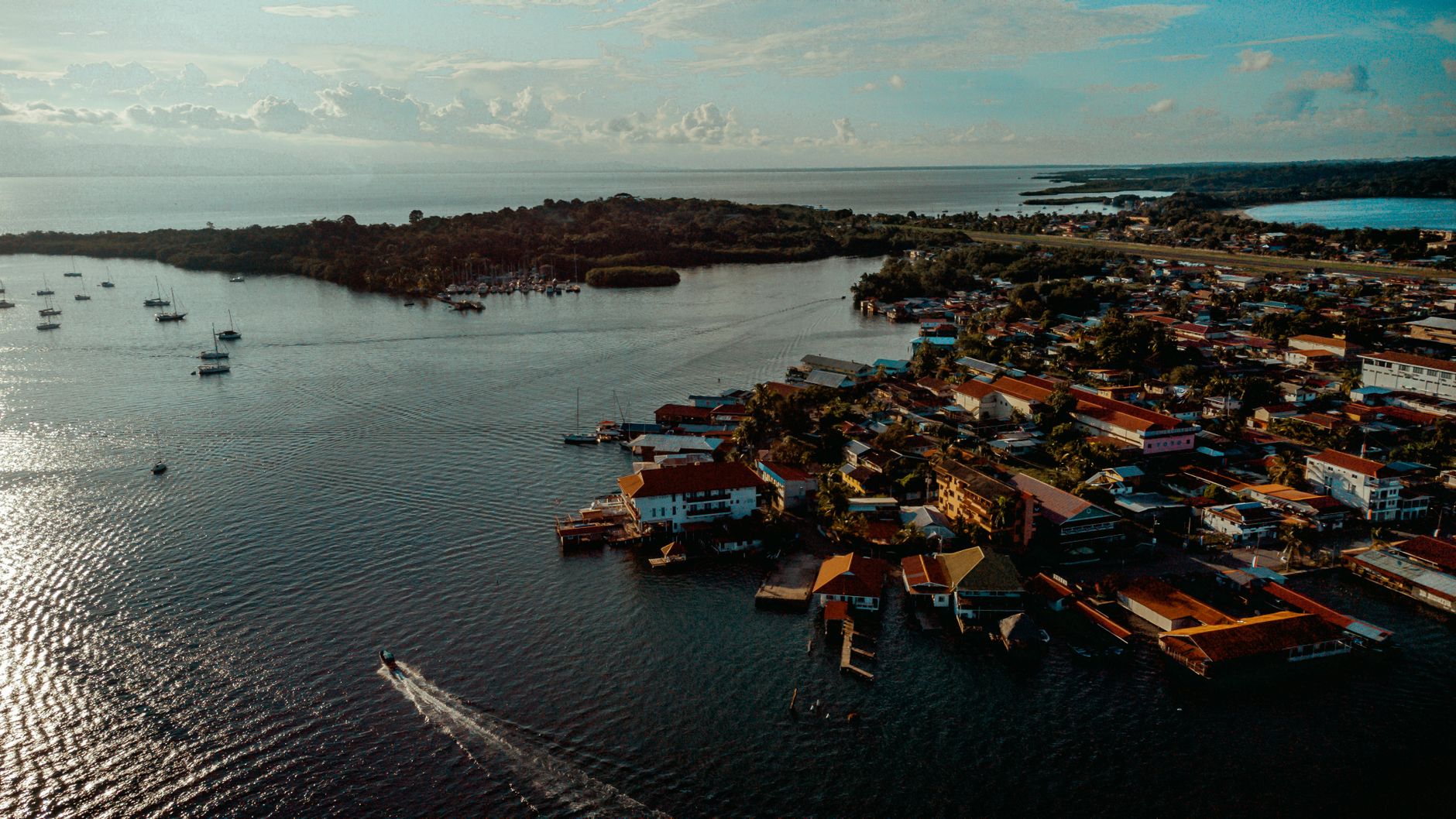
The physical heart of Bocas del Toro is composed of a complex network of main islands—such as Colón, Bastimentos, Solarte, and Carenero—surrounded by dozens of smaller cays and constantly evolving sandbars. The geomorphology of the area is dominated by fluvial sediments carried by powerful rivers like the Changuinola and Teribe, which empty into the Chiriquí Lagoon and seasonally alter salinity and underwater visibility. This interaction between fresh and salt water creates labyrinthine channels whose depth can oscillate drastically over just a few meters, forcing the skipper to maintain a permanent visual watch from the bow or the elevated steering station.
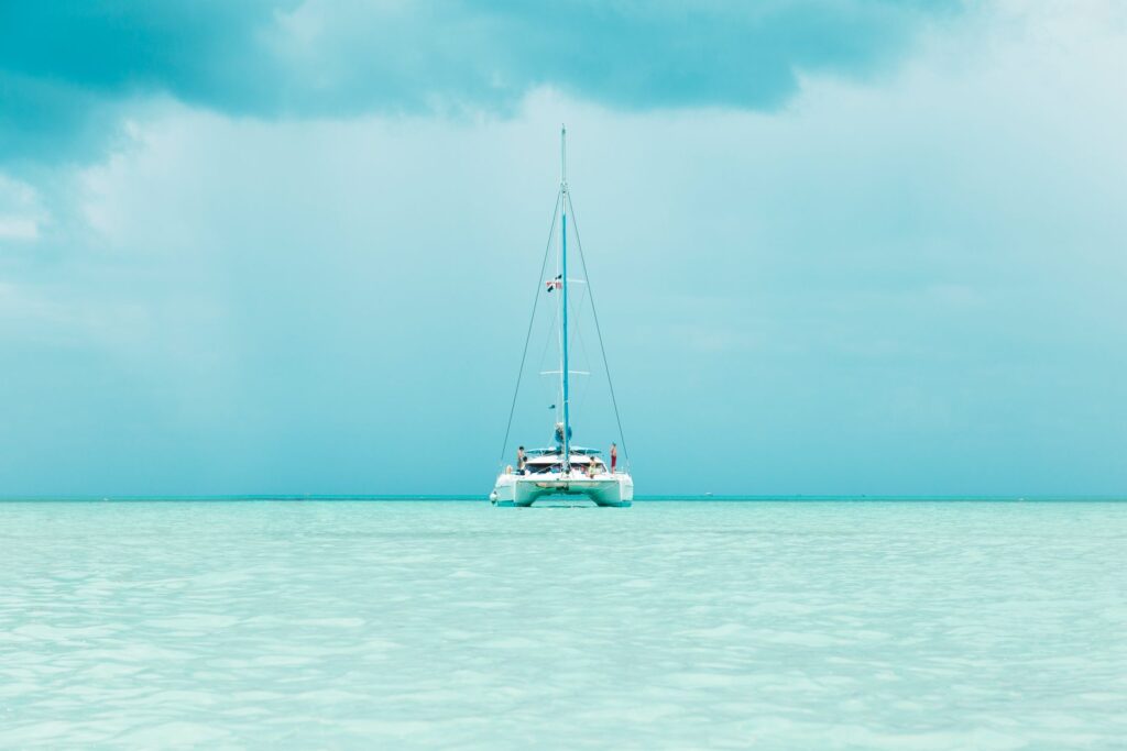
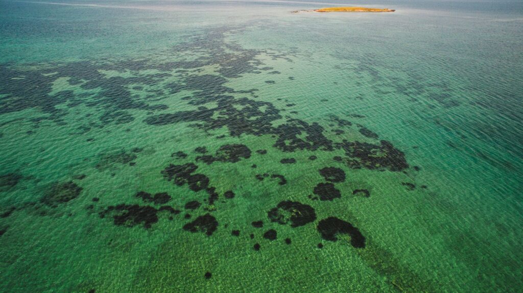
Navigating the Pastores channel or venturing into Almirante Bay requires mastering the use of global positioning systems combined with updated bathymetric charts and, above all, a heavy dose of navigational intuition. The patch reef formations, while of dazzling beauty, represent a latent danger for rudders and centerboards. The fringing reefs protecting the northern coast of Isla Bastimentos bear the direct brunt of oceanic swells, whereas the interior channels offer calm waters yet are riddled with red mangrove mazes that act as genuine vegetative traps for anchor rodes if swing radiuses are not carefully calculated.
True mastery of Bocas del Toro lies not in the speed of the traverse, but in the capacity to read the colors of the seafloor before the coral reef dictates its own sentence.
Meteorological Planning and Wind Regimes on the Northern Coast
Understanding the meteorological behavior of the Bocas del Toro province requires discarding the preconception that the Caribbean operates under a uniform regime of sunshine and constant breeze. While the nominal dry season spans from December to April, cold fronts originating in North America—locally known as turbonadas—can descend abruptly, bringing torrential rains and gusty winds exceeding thirty knots. During these episodes, exposed anchorages like Bluefield Bay become uninhabitable, forcing crews to seek sheltered refuge behind the mangroves of the Chiriquí Lagoon.
Conversely, the rainy season, stretching from May to November, is characterized by morning calms followed by high-intensity, short-duration afternoon thunderstorms. Planning navigation legs must be structured around early-morning windows, capitalizing on the early hours when the wind remains stable and the water surface permits clear identification of shallow shoals. Energy management on board via solar panels and wind generators also suffers during periods of persistent cloud cover, demanding a rigorous audit of electrical consumption for navigation and refrigeration systems.
Shallow-Water Anchoring Logistics and Autonomy Management
Anchoring a catamaran in a coral and muddy environment like Bocas del Toro poses specific technical challenges that differ markedly from anchoring in pure sand bottoms. Rocna or Spade-style anchors, combined with an adequate ratio of chain to synthetic rode, are essential to guarantee purchase in the seagrass beds and clayey mud that predominate in protected zones. It is fundamental to avoid the indiscriminate dropping of anchors onto live coral heads, not only for ethical reasons of environmental conservation, but because coral offers extremely precarious holding power that can yield under a sudden tidal shift.
Freshwater autonomy and provisioning constitute another critical pillar of the expedition. Although the town of Isla Colón possesses commercial infrastructure for restocking fresh provisions and fuel, venturing toward the remote cays of the southern Chiriquí Lagoon means going without outside assistance for weeks. Reverse osmosis watermaker systems on board are highly recommended, though their operation must be closely supervised due to the high concentration of suspended organic sediments in tropical waters. Likewise, the management of grey and black water demands rigorous use of holding tanks to preserve the pristine quality of waters inhabited by bottlenose dolphins and manatees.
Vernacular Architecture and Stilt Settlements Over the Sea
The cultural landscape of Bocas del Toro is deeply tied to its amphibious architecture, a historical legacy of Afro-Caribbean and Indigenous Ngäbe communities that have lived above the water for generations. The traditional brightly painted wooden houses, raised on rot-resistant mangrove stilts, are not merely housing solutions, but a masterful adaptation to an environment where the boundary between solid land and sea is diffuse. From the perspective of the navigator dropping anchor off communities like Old Bank in Bastimentos or the riverside settlements of Almirante Bay, this architecture offers a visual lesson in harmonious coexistence with the aquatic medium.
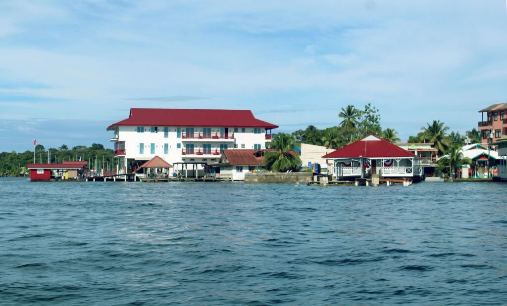
These floating and stilt structures are designed to allow the free flow of tides and minimize the impact of seasonal flooding. Interacting with these communities brings an indispensable human dimension to the nautical traverse. Far from the conventional tourist routes of large resorts, anchorages near these settlements offer insight into the socioeconomic complexities of a region that has seen artisanal subsistence fishing coexist with the pressures of international adventure tourism and the historical banana industry.
Marine Biodiversity and Coral Reef Conservation
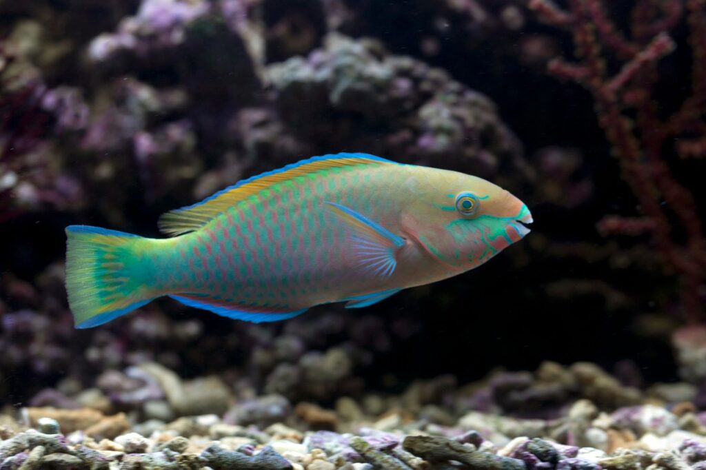
Diving into the waters surrounding the archipelago reveals a marine ecosystem of extraordinary richness yet extreme fragility. The coral reefs of Bocas del Toro form part of the Mesoamerican Biological Corridor and harbor a biodiversity that includes sponges, gorgonians, eagle rays, and a vast array of reef fish. Nevertheless, rising sea surface temperatures and anthropogenic pressure have subjected these reefs to severe stress in recent decades, triggering recurrent episodes of coral bleaching and the degradation of surrounding mangrove forests.
For expeditioners and navigators, rigorous adherence to protected area regulations, such as the Isla Bastimentos National Marine Park, is an inescapable obligation. Dragging anchors in coral zones is strictly prohibited, as is the collection of marine species or the use of chemical sunscreens containing oxybenzone, substances lethal to coral larvae. Responsible navigation also entails maintaining reduced speeds in channels frequented by manatees and dolphins, minimizing acoustic impact and the risk of collisions with vessels.
Practical guide
Best Time for Navigation: Although navigable year-round, the period between February and April offers the most stable wind conditions and lowest rainfall, ideal for anchoring off remote cays.
Recommended Vessel: Catamaran with a draft under one meter fifty centimeters, equipped with twin diesel engines, high-capacity solar panels, and updated cartographic navigation systems.
Documentation and Permits: National and international clearance managed through the Panama Maritime Authority (AMP) and payment of anchorage fees in protected areas managed by the Ministry of Environment (MiAmbiente).
Key Provisioning: Full load of fuel and potable water in Isla Colón before launching the route toward the Chiriquí Lagoon; acquisition of basic spare parts for bilge pumps and anchoring systems.
Safety Equipment: Certified life raft, long-range VHF radio, satellite phone or inReach emergency communication device, and backup anchoring system with high-strength synthetic rode.
The Silence of the Anchor in the Mangrove Twilight
When the sun begins to dip over the Caribbean horizon, staining the sky in deep ochre and violet tones, activity on the catamaran fades until reduced to the gentle rhythm of water slapping against the hulls. It is at this precise moment, with the anchor firmly set in the protected mud of a mangrove estuary on Isla Solarte, that the true essence of the traverse reveals itself in its full magnitude. There is no longer the roar of engines or the urgency of reaching the next waypoint; there remains only the silent contemplation of a marine ecosystem surviving in precarious balance between the untamed force of the open ocean and the fragile calm of its interior labyrinths, reminding us that the most transformative journey is the one that forces us to stop and listen to nature’s deep breath.