
In the northernmost reaches of Australia’s Northern Territory, the South Alligator River basin forms one of the most complex and dynamic alluvial systems on Earth. Shaped by the unyielding rhythm of tropical monsoons, this vast landscape undergoes a radical annual metamorphosis: transitioning from sun-cracked, arid ground into an inland sea dominated by submerged forests of Melaleuca leucadendra, seasonal floodplains, and oxygenated water bodies locally known as billabongs.
Understanding Kakadu requires moving past conventional seasonal concepts and adopting the intricate meteorological taxonomy of the Indigenous Bininj and Mungguy traditional owners, who recognize six distinct climatic cycles. Between the torrential fury of Gudjewg and the severe drying of Gurrung, the wildlife of the Top End has evolved profound physiological and behavioral adaptations, turning this Biosphere Reserve into an active living laboratory for studying trophic resilience amid global change.
The hydrological pulse of the Top End: Monsoonal dynamics
The landscape architecture of Kakadu is fundamentally fluid, sustained by the freshwater surge cascading down from the sandstone escarpment of the Arnhem Land plateau. During the wet season, rainfall frequently exceeds fifteen hundred millimeters, inundating thousands of square kilometers of alluvial plains. This process redefines biological connectivity between permanent river channels and peripheral feeding grounds, distributing organic nutrients and sedimentary detritus across the entire basin.
Subsurface hydrology is equally crucial. Shallow aquifers absorb the first rains of Gungmeleng, replenishing porous substrates before surface runoff triggers widespread plant germination. This continuous oscillation between aquatic abundance and dry season scarcity exerts intense evolutionary pressure, favoring species capable of hydrological nomadism or metabolic dormancy.

Benthic ecology and floodplain vegetation mosaics
The botanical diversity of these floodplains relies on sharp ecological and hydrological zonation. In the deeper waters of permanent billabongs, macrophyte species such as the giant water lily (Nymphaea gigantea) and the sacred lotus (Nelumbo nucifera) anchor in nitrogen-rich muds. Their broad leaves shadow the water surface, moderating water temperatures and creating critical microhabitats for aquatic invertebrates and juvenile fish.
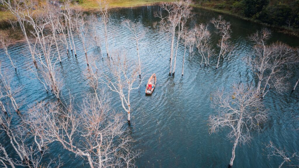
Along terrestrial buffer zones, paperbark forests (Melaleuca leucadendra and Melaleuca viridiflora) form biological shields that stabilize riverbanks against high-velocity flood flows. Equipped with adventitious root systems adapted to prolonged soil anoxia, these trees filter suspended sediments, maintaining clarity in secondary feeder streams.
«The resilience of Kakadu lies in its fluidity: boundaries between water and dry ground are drawn not on maps, but by the volume of each monsoonal downpour.»
Avian demographics: Aggregations of waterfowl and shorebirds
As the dry season shrinks open water, avian biodiversity concentrates dramatically around remaining permanent billabongs. Kakadu shelters over one-third of all Australian bird species, highlighted by massive aggregations of the magpie goose (Anseranas semipalmata), a taxonomically unique species serving as a key bioindicator for watershed health.

During Gurrung, hundreds of thousands of magpie geese gather at sites like Mamukala to feed on the tubers of the water chestnut (Eleocharis dulcis). Using specialized bills, the geese turn over benthic sediments, facilitating nutrient cycling and opening patches in dense vegetation that benefit dozens of migratory shorebird species arriving along the East Asian-Australasian Flyway.
Trophic structure of Kakadu wetlands
- Primary consumers: Magpie geese, whistling ducks, and herbivorous fish feeding on aquatic macrophytes.
- Intermediate predators: White-necked herons, black-necked storks (jabiru), and royal spoonbills preying on amphibians and crustaceans.
- Apex predator: Estuarine crocodiles controlling large fish populations and introduced mammals.
The apex predator: Biology of the estuarine crocodile
The indisputable apex predator of Kakadu’s freshwater and estuarine food webs is the saltwater crocodile (Crocodylus porosus). Reaching lengths exceeding five meters and weights over a ton, this archosaurian reptile acts as both an ecological regulator and a geomorphic force, clearing movement channels between estuarine zones and inland billabongs.
The physiology of Crocodylus porosus features highly efficient lingual salt glands, allowing individuals to navigate seamlessly between brackish estuaries and freshwater ecosystems. Their predatory presence regulates populations of large freshwater species like Barramundi (Lates calcarifer), preventing overgrazing on smaller forage fish and maintaining structural diversity within aquatic communities.
Ancestral fire regimes: Indigenous land management and savanna ecology
Far from an untouched wilderness in the Western sense, Kakadu is an anthropogenic landscape shaped by tens of thousands of years of deliberate fire management by Bininj and Mungguy traditional owners. Fire is understood not as a destructive force, but as an essential environmental tool for land renewal during seasonal shifts.

By executing low-intensity patchy burns (cool fires) early in the dry season, Indigenous rangers clear dead fuel loads without damaging the forest canopy or disturbing nesting bird species. This proactive burning prevents cataclysmic late-season wildfires, protecting fire-sensitive monsoon rainforest patches and encouraging fresh green shoots for agile wallabies and other native mammals.
Invasive species threats and coastal salinization pressures
Kakadu’s delicate ecotones face growing pressures from introduced species and climate disruption. Historically, introduced feral Asian water buffalo (Bubalus bubalis) trampled natural levees separating saltwater estuaries from freshwater floodplains, driving saltwater intrusion into freshwater frog breeding sites and sensitive paperbark stands.
Simultaneously, invasive weed species such as Mimosa pigra and Para grass (Urochloa mutica) form dense monocultures that choke native vegetation and degrade traditional foraging grounds for waterfowl. Joint management teams deploy biological control agents and hydrological restoration structures to combat these biological invasions.
«Water management is not about mastering the flood, but about protecting the invisible barriers that stop the ocean from swallowing the sweetness of the savanna.»
Fluvial corridors and sea-level rise resilience
Rising sea levels and extreme weather events present novel threats to low-lying Top End ecosystems. Because vast expanses of Kakadu’s floodplains sit only meters above sea level, storm surges linked to intense monsoonal cyclones risk turning freshwater marshes into hypersaline flats.
Conservation scientists continuously monitor salinity gradients along the South Alligator River. Hydrogeological models indicate that over the coming decades, freshwater habitats may migrate further inland, requiring strict protection of contiguous ecological corridors to facilitate species displacement.
Practical guide
Access and regional logistics
Kakadu National Park is located roughly three hours by road east of Darwin along the Arnhem Highway. Visitors must purchase an official park pass online prior to entry. Given the park’s vast scale (nearly 20,000 square kilometers), a four-wheel-drive (4WD) vehicle is highly recommended for accessing unpaved tracks leading to remote waterfalls and wetlands.
Seasonal timing and climate planning
Accessibility changes dramatically depending on the monsoonal calendar:
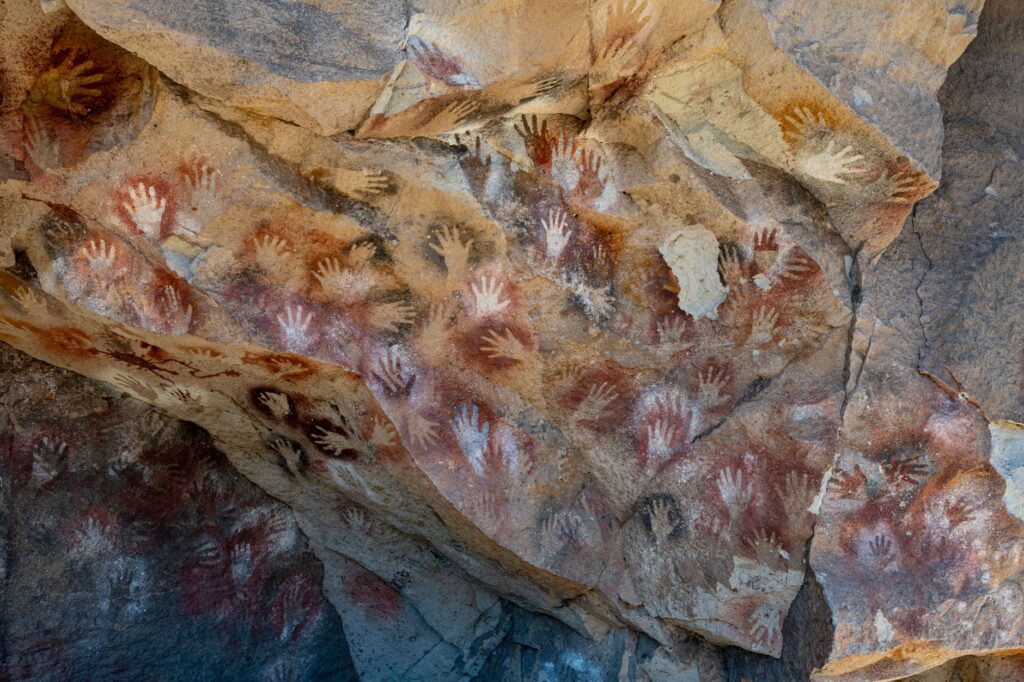
- Dry Season (May to October): Ideal for wildlife viewing and road access to walking trails, billabongs, and rock art galleries at Ubirr and Burrungkuy (Nourlangie).
- Wet Season (November to April): Heavy flooding closes many unpaved roads. However, scenic flights offer breathtaking aerial views of overflowing waterfalls like Jim Jim and Twin Falls.
Crocodile safety and environmental hazards
Crocodylus porosus is present in all Kakadu waterways, including rivers, billabongs, and coastal estuaries. Swimming is strictly prohibited except in designated safe areas explicitly managed by park authorities. Always maintain a minimum distance of five meters from the water’s edge and camp at least fifty meters away from riverbanks.
Visual epilogue: Twilight at Mamukala and the billabong vigil
As dusk settles over the Mamukala observation hide, the tropical sun drops below a horizon lined with paperbark trees. Golden light illuminates thousands of beating wings as magpie geese return to their roosts, while the dark contour of a saltwater crocodile cuts silently across the amber reflection of the water.
In this quiet moment, Kakadu reveals its wild essence—not as a static landscape locked in time, but as a living, breathing ecosystem where water, fire, and ancient cultural wisdom remain inextricably linked.