
The Jandía peninsula, situated at the southernmost tip of Fuerteventura, presents itself to the contemporary traveler as a territory of extreme dualities. Separated from the rest of the island by the isthmus of La Pared—a narrow strip barely five kilometers wide where the Atlantic Ocean and the Saharan sands appear to merge—this region has historically depended on connectivity that is as fragile as it is resilient. Far from the massive asphalt circuits dominating the tourist north, Jandía has preserved its own logic of movement, dictated by volcanic topography, the constant force of the trade winds, and a geographical isolation that has shaped both the lives of its inhabitants and the few travelers daring to venture onto its jable tracks.
Analyzing mobility in this arid territory requires understanding the evolution of its land infrastructure. For centuries, crossing toward the southern part of the island meant navigating bridle paths and vast seas of sand where conventional vehicles inevitably became trapped. It was not until the second half of the twentieth century that pressure from the tourism industry and the need to supply traditional fishing settlements drove the opening of the first stable roadways. Today, the FV-2 highway acts as the backbone of the eastern coast, connecting consolidated urban centers with tourist enclaves, while western arteries continue to rely on dirt tracks that demand absolute respect for the natural environment and unique driving expertise.
The Genesis of Jable Tracks and Rustic Engineering
The term jable, used in the Canary Islands to designate wind-transported organic sand, defines the very nature of Jandía’s western routes. Traveling toward Cofete beach or the Punta de Jandía lighthouse is not a simple exercise in displacement, but rather a lesson in engineering adaptation to a shifting terrain. The roadways winding through the Jandía Natural Park lack the paved surface of major island highways; instead, they rest on a foundation of compacted volcanic rock constantly eroded and buried by aeolian sediments. Periodic maintenance, carried out with heavy machinery by the Island Council, ensures that isolation is not absolute, yet the intrinsic nature of the terrain imposes a natural speed limit preserving the territory’s unhurried pace.

This technical precariousness responds to a conscious conservation decision. Completely paving these routes would mean irreversibly altering the habitats of endemic species and the fragile dune ecosystems descending from the mountain massif to the breaking waves. Consequently, local institutions have historically opted for a corrective rather than a transformative maintenance model. Road signs warning against driving off authorized tracks serve as visual testimony to strict regulations balancing the right to transit with the environmental protection of one of Macaronesia’s most pristine landscapes.
Sheltered Ports and Traditional Cabotage on the Atlantic Coast
If the land offers a challenging transit, the sea has traditionally represented the only truly reliable communication route for Jandía’s coastal communities. Ports like Morro Jable—today transformed into a dynamic hub combining artisanal fishing fleets with high-speed ferries connecting to Gran Canaria—have deep roots in a modest cabotage tradition. Before modern roads arrived, small boats and skiffs transported not only fresh fish caught in the rich fishing grounds of the Saharan shelf, but also the provisions, construction materials, and mail necessary for the survival of local herders and fishermen.
Current port infrastructure results from successive expansions intended to absorb both commercial traffic and the surge in nautical excursions and passenger transport. However, in the small coves and inlets scattered along the western coast, such as the bay of Cofete, maritime activity still depends on the skill of local skippers who understand the whims of Atlantic currents and the ferocity of western gales. Navigation in these waters brooks no improvisation; the absence of large breakwaters on the windward coast turns every approach into an exercise of respect toward an ocean imposing its own rules.
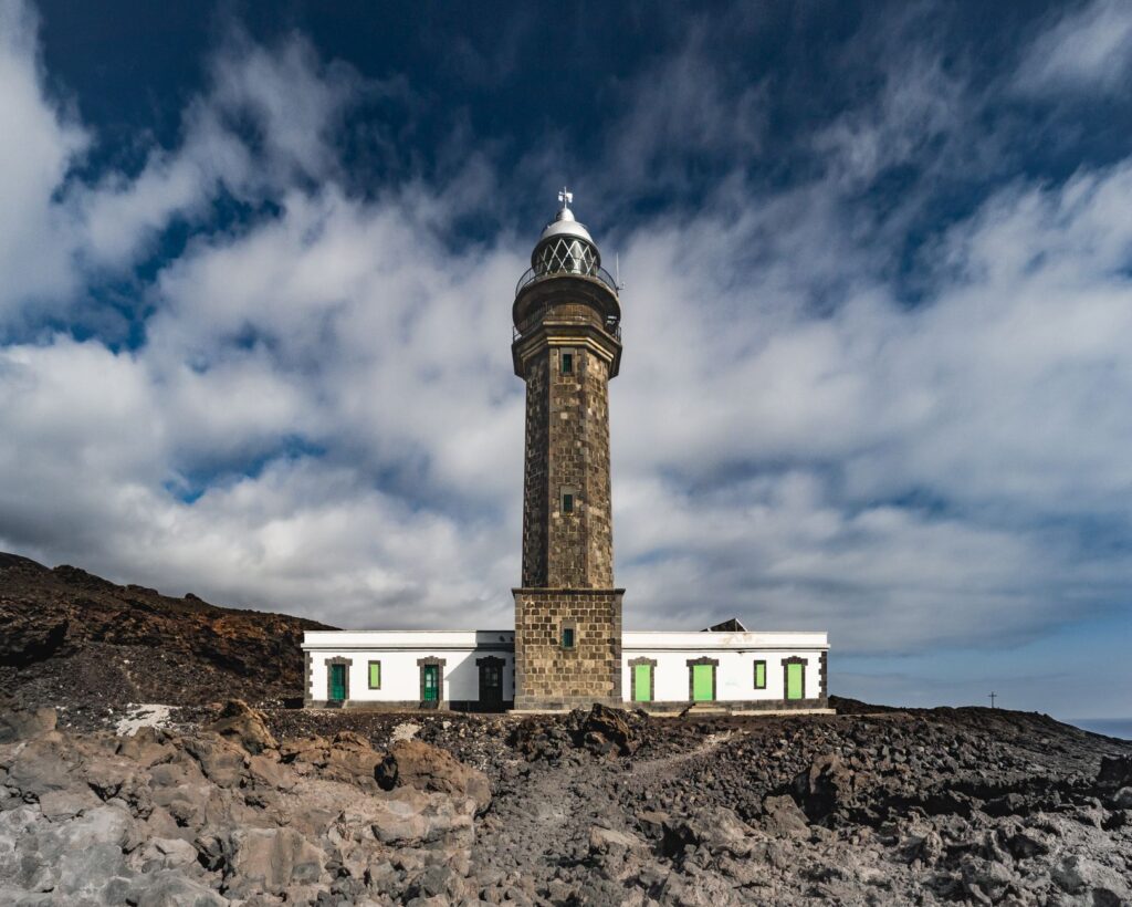
The Architecture of Isolation: The Punta de Jandía Lighthouse as a Geographic Landmark
At the westernmost tip of the peninsula, where solid land abruptly ends before oceanic immensity, stands the Punta de Jandía lighthouse. Built in the second half of the nineteenth century under the direction of engineer Juan de León and Castillo, this building is not merely a navigational aid infrastructure, but the ultimate symbol of extreme connectivity. For decades, the lighthouse keepers inhabiting this enclave lived in near-total isolation, communicating with Morro Jable through arduous camelback journeys or support barges when sea conditions allowed.
The arrival of electricity and subsequent automation transformed working conditions without reducing the symbolic weight of the site. Today, the road leading to its facilities is one of the most traveled routes for visitors seeking to understand Fuerteventura’s true territorial scale. The architectural structure of solid volcanic masonry withstands the onslaught of salinity and hurricane-force winds, reminding us that survival in Jandía has always depended on the sturdiness of its buildings and its people’s ability to endure at the margins of island geography.
Isolation is not a deficiency in Jandía, but a visual discipline forcing travelers to shed haste and attune themselves to the geological rhythm of the territory.
The network of historic paths descending from mountain ridges to hidden windward coves completes the map of traditional mobility. Trodden for centuries by goat herders seeking seasonal pasture generated by summit mists, these trails constitute a network of long-distance routes allowing an unparalleled pedestrian approach. Managing these paths demands a delicate balance between promoting nature tourism and preserving ethnographic heritage, preventing mass tourism from eroding fragile volcanic soils and disrupting the secular tranquility of abandoned hamlets dotting the route.
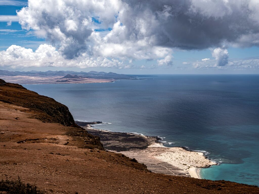
Demographic Pressure and Strain on Water Resources
Connectivity in Jandía cannot be analyzed separately from the demographic and ecological tensions experienced by Fuerteventura as a whole. The exponential growth of the floating population linked to the tourism sector has drastically increased demand for basic resources, especially potable water and energy. Pumping pipelines and electrical transmission networks crossing the isthmus of La Pared southward are true invisible lifelines ensuring supply to hotel complexes and residential areas. Any technical incident in these infrastructure systems immediately translates into a supply crisis testing the resilience of the insular model.
Given this vulnerability, public administrations and local managers have begun prioritizing energy self-sufficiency and water optimization projects, committing to high-efficiency desalination plants and landscape-integrated wind farms. Nevertheless, the primary challenge remains road traffic management during peak season months. The occasional collapse of parking facilities at iconic beaches like Sotavento or Las Gaviotas has sparked intense debate over implementing shuttle public transport systems to reduce the ecological footprint of private vehicles on fragile protected sandbanks.
Practical guide
Planning a trip to the Jandía peninsula requires understanding the climatic and logistical particularities of a territory where nature dictates timelines and access conditions.
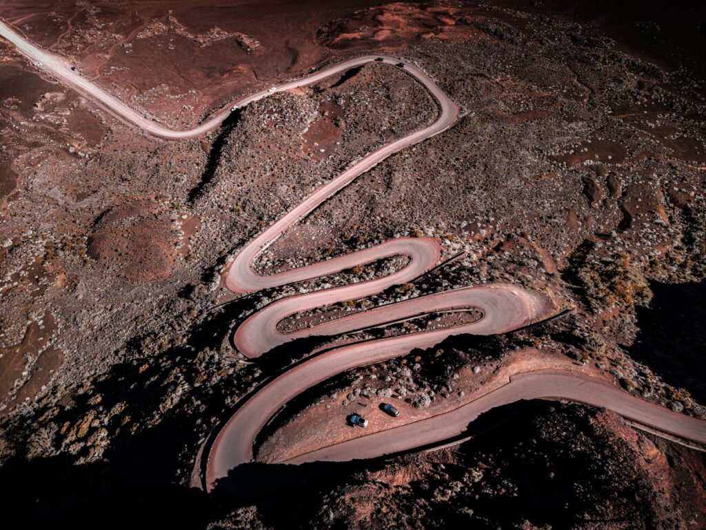
How to get there: The main entry point to Fuerteventura is El Matorral Airport, located in Puerto del Rosario. From there, the FV-1 highway and subsequently the FV-2 road connect the capital to Morro Jable in approximately an hour and a half by rental car.
Internal transport: To explore main towns and eastern beaches, conventional cars are suitable. However, to access the western coast and enclaves like Cofete or Punta de Jandía, renting an SUV or four-wheel-drive vehicle is highly recommended, verifying beforehand that rental insurance covers dirt track driving.
Accommodation: Hotel and apartment options are concentrated mostly in Morro Jable and Jandía Playa. Authorized rural houses also exist within the municipality of Pájara, ideal for those seeking absolute disconnection.

Safety and regulations: Driving outside authorized paths within the Jandía Natural Park is strictly prohibited. Fines for damaging the dune environment or protected flora are substantial. Furthermore, caution must be exercised when swimming on the west coast due to strong currents and unpredictable waves.
Best time to visit: Spring months (April to June) and autumn (September to November) offer pleasant temperatures and lower tourist influx, allowing visitors to enjoy trails and beaches with greater tranquility compared to summer peaks in August.
The true measure of a journey through Jandía is found when turning off a vehicle’s engine facing the sea of Cofete and listening to the silence broken only by the murmur of waves.
The peninsula’s final horizon, where the imposing silhouette of the mountain massif merges with white Atlantic foam, synthesizes the essence of a territory refusing complete domestication. Traversing its final dirt kilometers or contemplating the trimmed silhouette of its historic lighthouses, visitors realize Jandía’s true wealth lies not in the artificial comfort of its resorts, but in the tenacious persistence of an indomitable landscape still beating to the unhurried rhythm of its tides and ancient winds.