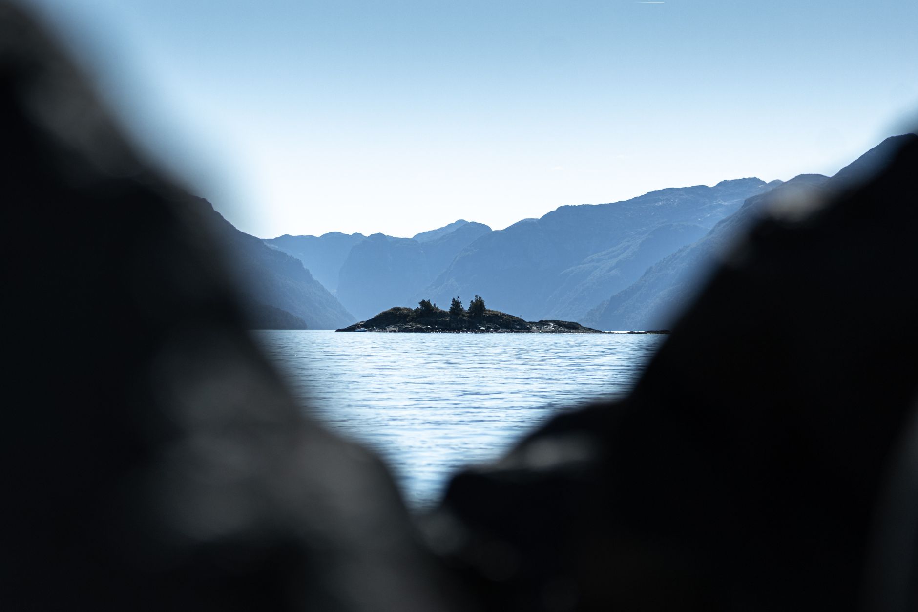

Navigating the Inside Passage is far more than a scenic coastal transit; it is a profound immersion into one of the most complex and biologically dense maritime labyrinths on Earth. This route, winding over 1,000 miles from Olympia, Washington, to Skagway, Alaska, demands a level of technical discipline that transcends conventional sailing. Here, the mariner faces a fragmented geography where mountains plunge vertically into the Pacific, creating channels that are deep yet narrow, where tides do not merely rise and fall but flow with the violence of torrential rivers. It is a realm of persistent mists, colossal drifting logs, and an absolute solitude that tests the autonomy of any vessel.
An expedition through these waters requires a deep understanding of North Pacific meteorology and a logistical planning capability that leaves no room for error. Unlike blue-water ocean crossings where open space is a sailor’s greatest ally, in the Inside Passage, the danger lies in the constant proximity of the coast and the unpredictability of local microclimates. Every mile gained is a negotiation between the desire to explore the pristine beauty of the Great Bear Rainforest and the imperative need to find secure shelter before the southeast winds shut down any window of safe passage. In this report, we break down the critical pillars for undertaking this journey with scientific rigor and environmental respect.
The Pacific Labyrinth: Geography and Challenges of the North Coast
The geomorphological configuration of the Inside Passage is the result of millennia of glacial erosion that has sculpted an intricate network of fjords, islands, and channels. For the navigator, this translates into precision sailing where nautical charts must be consulted with near-obsessive frequency. Water depth can exceed 1,300 feet in the center of a channel only to reduce to submerged rocks within a few meters of lateral distance. This extreme verticality makes anchoring maneuvers exceptionally difficult, often requiring the stern-tie technique—securing the vessel’s stern to a sturdy tree on shore to prevent swinging in steeply sloped bottom conditions.
The weather is dominated by the Aleutian Low pressure system, which sends successive fronts laden with moisture. Rain is not a meteorological event here; it is a constant condition that defines the ecosystem. This persistent humidity not only affects visibility but also demands extremely reliable onboard heating and dehumidification systems. Energy management becomes critical when solar panels prove inefficient under perpetually overcast skies, forcing a reliance on hydro-generators or very conservative battery management.
Navigating the Inside Passage is an exercise in humility before a geography that ignores human presence; here, time is not marked by the clock, but by the pulse of the currents.
Another constant risk factor is the presence of deadheads: cedar or fir logs floating vertically, barely visible above the surface, capable of piercing a fiberglass hull or destroying a propeller in seconds. Visual watch must be uninterrupted, limiting safe navigation hours to daylight, especially in the narrower reaches of British Columbia where forest debris accumulation is highest following storms.
Tidal Dynamics: Crossing the Critical Narrows
The technical heart of the traverse lies in managing the tidal rapids. At points like Seymour Narrows or the Yuculta Rapids, the water is forced through such narrow openings that currents can reach speeds of 15 knots. For a recreational vessel cruising at 7 or 8 knots, attempting to cross these points at the wrong time is physically impossible and extremely dangerous. Planning must revolve around slack water—that brief interval of calm when the tide changes direction.

Navigating these narrows requires the use of specific current tables and a precise calculation of arrival times. A 20-minute error can mean encountering massive whirlpools and standing waves that can compromise rudder stability. Johnstone Strait, famous for its opposing winds clashing with favorable currents, creates what locals call «seas of confusion,» where waves become short, steep, and highly aggressive for vessels under 50 feet.
Supply Logistics on the Last Frontier
As one ascends northward, human settlements become scarce, and the distances between fuel and water supply points stretch significantly. Ports like Prince Rupert or Ketchikan serve as vital replenishment nodes, but between them lie hundreds of miles of uninhabited coastline. Food and fuel autonomy must be calculated with a 30% margin, anticipating delays due to adverse weather that can hold a vessel in a remote cove for days.
Waste management is another pillar of logistics. In such a fragile and protected ecosystem, any discharge is strictly prohibited. This means the vessel must be equipped with large-capacity holding tanks and greywater treatment systems. Furthermore, solid waste must be compacted and stored in a way that does not attract local wildlife, particularly in high-density bear areas where scent can turn a boat into a target of dangerous curiosity during shore excursions.
The Great Bear Rainforest: Safety Protocols and Wildlife
Entering the waters of Central British Columbia is stepping into the territory of the Spirit Bear (Kermode bear) and the coastal wolf. Interaction with wildlife is inevitable and must be managed with strict protocols. When going ashore for hikes or securing lines, the use of bear spray and constant communication through noise are mandatory. Bears in this region rely on salmon and intertidal zones, making beaches high-activity areas where humans are the intruders.
In the water, the presence of humpback whales and orcas is constant. Canadian and U.S. regulations are very strict regarding approach distances. Northern resident and transient orcas use these channels as migratory highways. The navigator must be able to identify blows on the horizon and reduce speed immediately, not only for legal compliance but to avoid catastrophic collisions, which have been on the rise over the last decade due to increased maritime traffic.
Technology and Navigation: The Critical Use of Radar and AIS
In an environment where fog can reduce visibility to less than 150 feet in minutes, radar ceases to be an accessory and becomes the captain’s primary eye. Interpreting radar signals in narrow channels is complex due to echoes from rocky walls, requiring significant experience. The Automatic Identification System (AIS) is equally vital, not just to see the large Alaska Marine Highway ferries, but to be seen by them in narrow passages where maneuvering room is non-existent.
Despite digital technology, exclusive reliance on GPS is a tactical error. Atmospheric interference and mountain shadowing can generate positioning errors. Therefore, dead reckoning and visual recognition of lighthouses and daymarks remain fundamental skills. The use of forward-looking sonar is highly recommended for detecting uncharted rocks or sediment deposits at the mouths of glacial rivers.
Technology provides security, but maritime intuition, forged in observing water color and foam direction, is what truly saves ships in the Inside Passage.
Expedition Psychology and Living in Confined Spaces
The human factor is often the weakest link in long-duration voyages through hostile climates. The Inside Passage can feel claustrophobic; incessant rain forces the crew inside the cabin for extended periods. Managing stress derived from technical navigation and lack of sunlight requires a cohesive crew with clearly defined roles. Decision fatigue—the mental exhaustion of constant current, weather, and hazard assessment—must be mitigated with scheduled breaks in protected coves.
Digital disconnection is almost total in large sections of the route. Without cellular coverage, communication depends on long-range VHF radios and satellite communicators. This lack of outside contact reinforces the sense of expedition but also requires the crew to have advanced first-aid knowledge, as medical evacuation can take hours or even days depending on flying conditions for rescue seaplanes.
Practical guide
- Optimal Season: Late May to early September. June offers the longest daylight hours, essential for debris watch.
- Vessel Requirements: Reinforced hull, redundant propulsion or critical spare parts kit (pumps, belts, filters), and an independent diesel heating system.
- Documentation: Customs clearance between Canada and the U.S. (Alaska) is mandatory. The CBP Roam app is recommended to expedite the process at designated ports of entry.
- Safety Gear: Serviced liferaft, immersion suits due to low water temperatures, and an EPIRB with integrated GPS.
- Navigation: Updated charts from the Canadian Hydrographic Service and NOAA. Do not rely solely on tablet apps without dedicated plotter backups.
- Supply Management: Prince Rupert is the last major provisioning point before crossing into Alaska. Take the opportunity to top off water and fuel tanks.
The Legacy of Cold Water: A Final Reflection
Upon reaching the glacier latitudes of Southeast Alaska, such as Tracy Arm or Resurrection Bay, the navigator realizes that the Inside Passage is not a destination, but a process of learning. The journey transforms one’s perception of time and effort. The silence of a fjord at dawn, broken only by the crackle of calving ice or the blow of a whale, more than compensates for the tense nights in the narrows and the days of endless rain.
Sailing these waters is a privilege that carries the responsibility of acting as guardians of one of the world’s last wild strongholds. The voyage ends, but the discipline acquired and the deep connection to the rhythm of the tides remain. It is, ultimately, a journey toward the essence of nautical self-sufficiency, where every decision counts and where nature, in its purest and most brutal state, always has the final word.