
Alto Douro, Portugal: A Landscape Travelled Between Schist Terraces and River
The Alto Douro in Portugal is not a backdrop for photographs. It is a living territory where the Douro River and its tributaries —Varosa, Corgo, Távora, Torto and Pinhão— shape a relief of extreme slopes that has been modelled over centuries by vine cultivation. UNESCO inscribed this region as a World Heritage Site in 2001 under cultural criteria, recognising a landscape that reflects the technical, social and economic evolution of European viticulture.
Travelling through it responsibly means understanding that this is not a theme park but a working agricultural mosaic: terraces, quintas, casais, chapels, roads and villages that still function as a complex machine. This report proposes an unhurried approach, with practical information to prepare the visit and keys to interpret what you see.
A landscape built on schist
The Douro Valley cuts through mountains that shelter the region from Atlantic winds. That relative isolation has allowed vine cultivation to develop here for approximately two thousand years. The dominant stone is schist, a brittle material that has forced the creation of retaining structures to prevent fertile soil from sliding downhill.
The earliest documented terraces, pre-dating phylloxera, were the so-called socalcos: narrow, irregular dry-stone walls supporting one or two rows of vines. They required continuous maintenance and defined the valley’s silhouette for centuries. In the late 19th and early 20th centuries, after the vineyard was rebuilt, wider and slightly sloping terraces appeared, with monumental walls that modified the landscape and improved sun exposure.
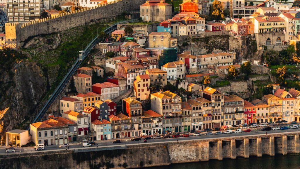
The Alto Douro landscape is a collective work by anonymous artists: generations of winegrowers who adapted the vine to extreme conditions without losing soil fertility.
Today different planting methods coexist. Some plots maintain historic walls; others have adopted more mechanisable forms. This diversity is part of the site’s value and also one of its conservation challenges.
What it means to travel through an active cultural landscape
Unlike other heritage destinations, the Alto Douro is not visited by contemplation alone. You travel through it, walk it, sail it and observe how the estates work. The quintas —farm complexes with a main house, wineries and outbuildings— are visual and functional landmarks. The casais, small family holdings, complete a social mosaic that remains inhabited.
The responsible traveller must accept that they are moving through a productive territory. Roads are narrow and winding; rural tracks may be in agricultural use; and private properties are not public spaces. The best way to explore is with patience, suitable footwear and an attitude of respect towards those who live and work there.
This working dimension is precisely what makes the Alto Douro different from a museum. The landscape is not preserved in a fixed state: it evolves with each planting season, each repair of a wall, each decision about which variety to grow. Understanding this helps visitors interpret what they see not as a static picture but as an ongoing process. The terraces you admire are maintained by people whose daily work is the very thing that keeps the heritage alive.
The river as a guiding axis
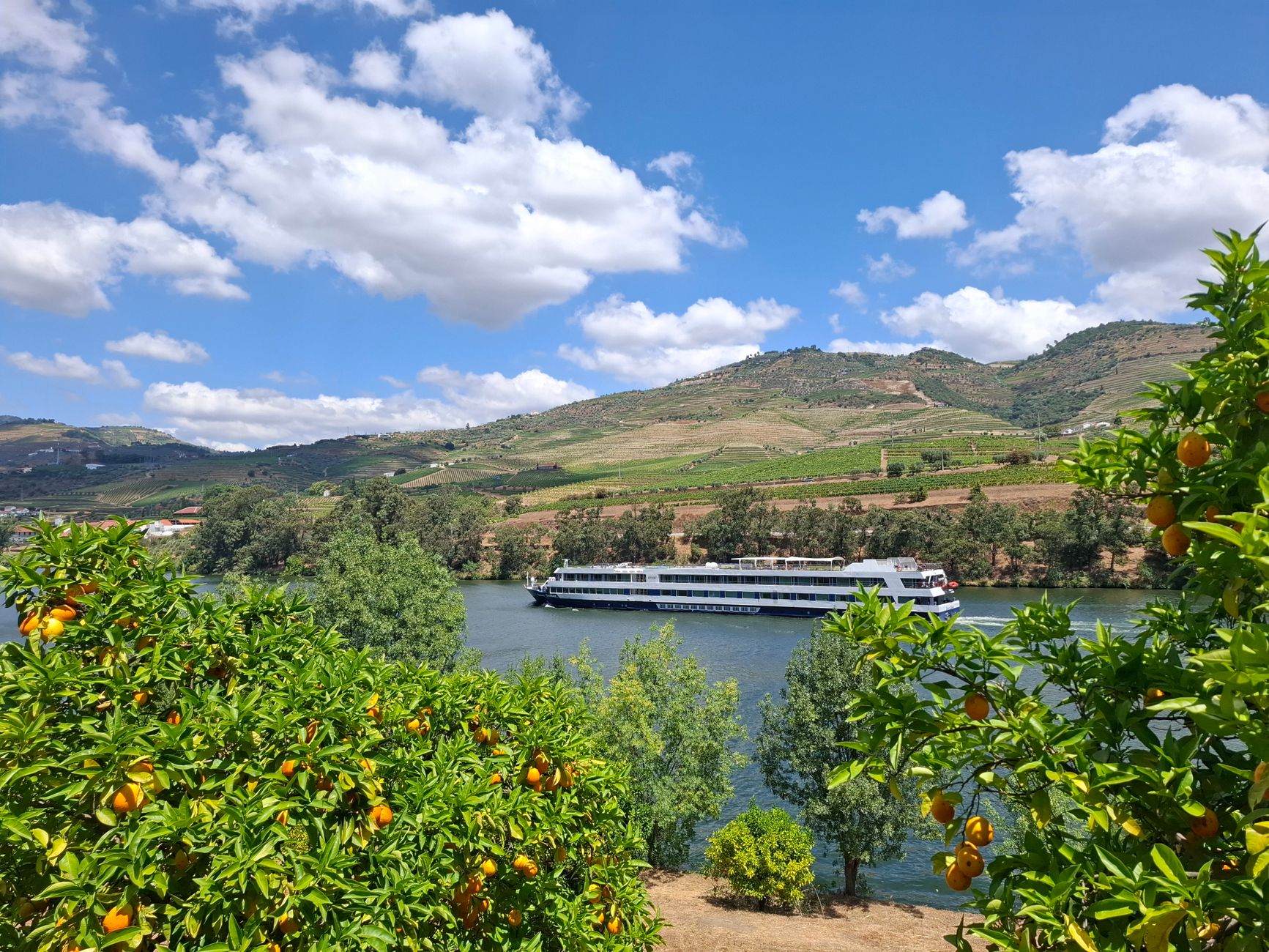
The Douro acts as the valley’s backbone. Its tributaries descend deeply between slopes, creating corridors that often follow old paths. Along the lower banks, orange groves appear, sometimes walled, along with remains of channels and water catchments that once supplied the crops.
Sailing the river offers a different perspective: it reveals the continuity of the terraces, the location of villages halfway up the slopes and the scale of the walls. It also helps explain why river transport was historically important for shipping wine. Today, however, visits must be planned in advance and operators chosen who respect environmental and safety regulations.
The river also marks the rhythm of the valley. Its width and flow change with the seasons, and the views from its banks shift accordingly. For those who prefer to stay on land, roads often run parallel to the water at different elevations, offering successive vantage points. Each bend reveals a new arrangement of terraces, quintas and settlements, reminding the traveller that the landscape is never seen in full from a single spot.
Villages, chapels and vernacular architecture
Alto Douro settlements are usually located at mid-height, protected from floods and the excessive heat of the valley floor. Many retain whitewashed houses, tiled roofs and narrow streets adapted to the topography. Community life is organised around parish churches, sometimes of 18th-century origin.
Scattered across the landscape are small chapels, some on high ground and others next to manor houses. They are not decorative elements: they form part of the territory’s historic structure and should be observed with respect, avoiding unauthorised access or behaviour that disturbs the peace of the place.
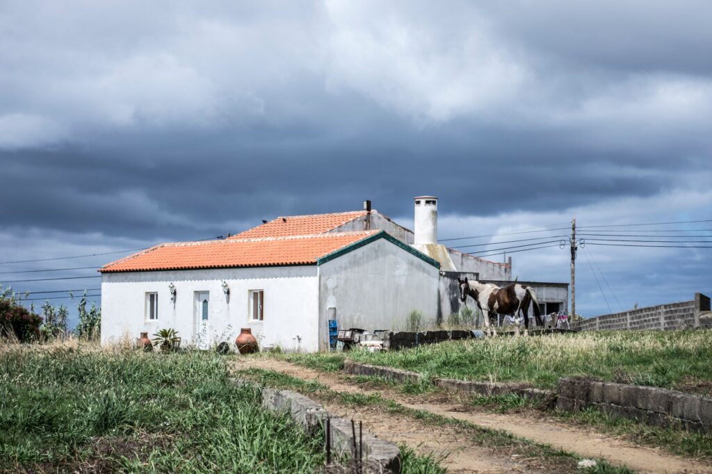
The architecture here is shaped by available materials and climate. Schist appears in walls and foundations; whitewash helps reflect heat; and the compact layout of villages provides shade and shelter. These are practical responses to a demanding environment, and they contribute to the visual identity of the region. Walking through these settlements, one senses that the built heritage and the agricultural landscape are inseparable parts of the same system.
Seasonality rules
The valley changes radically throughout the year. Spring covers the slopes in green and activates vine work. Summer imposes intense heat and long days. Autumn concentrates the harvest and transforms the landscape into a palette of ochres and reds. Winter, more austere, reveals the structure of walls and terraces more clearly.
For those who want to walk, the intermediate seasons are usually kinder. For those who want to understand the production cycle, the harvest is a key moment, although it means greater crowds and the need to book well in advance. In any case, it is advisable to check road conditions and weather forecasts before setting out.
Light also changes dramatically with the seasons and the time of day. Early mornings and late afternoons tend to offer softer illumination and clearer views, while midday sun can flatten the relief. Photographers and walkers alike benefit from planning around these variations, which also affect temperature and comfort on the slopes.
Accessibility and trip preparation
The Alto Douro is not an especially easy destination for people with reduced mobility. Slopes, uneven ground and the lack of pavements in many sections make movement difficult. Some quintas and tourist facilities have adapted specific areas, but universal accessibility is not guaranteed across the territory.
Preparing the trip involves consulting each visit’s conditions in advance, checking whether adapted transport is available and choosing accommodation that provides clear information. It is also advisable to carry water, sun protection and footwear with good grip. Signage can be irregular outside the main routes.
Travelling through the Alto Douro requires accepting its rhythms: distances that look short on the map stretch out on mountain roads and constant bends.
It is equally important to plan for limited services in some areas. Fuel stations, shops and medical facilities may be sparse away from larger towns, so stocking up and informing someone of your route is a sensible precaution. Mobile coverage can also vary, and carrying a physical map or offline navigation tool is recommended for those venturing onto secondary roads.
Gastronomy and local products
Vines are the dominant crop, but not the only one. Olive oil, almonds, citrus fruits and garden produce complement the local economy. The region’s cuisine tends to be hearty and seasonal: meats, cured sausages, legumes and river fish have traditionally formed part of the diet.
Port wine is the most internationally known product, with a quality defined and regulated since 1756. But the region also produces table wines that deserve attention. Visiting a winery should not be limited to tasting: understanding the process, the grape varieties and the field work helps to appreciate the landscape you are travelling through.
Markets and small producers can offer a more direct connection to the territory. Seasonal fruits, local cheeses and preserves reflect the agricultural calendar and provide insight into how the landscape is used beyond the vineyards. Engaging with these products respectfully —buying directly where possible, avoiding waste— is another way of supporting the communities that maintain the region.
Practical guide
- When to go: spring and autumn offer milder temperatures and good visibility. Summer can be very hot; winter is cold but bright.
- Getting around: a car is practical for exploring the valley, but roads are narrow. River routes and some rail services connect specific points; check current timetables and frequencies.
- What to bring: hiking footwear, water, sun protection, layered clothing and a power bank for your phone.
- Bookings: accommodation, winery visits and river experiences usually require advance booking, especially in high season.
- Accessibility: check case by case. Do not assume all spaces are accessible.
- Respect: do not enter private property without permission, do not leave waste and keep noise down in villages and viewpoints.
A closing thought to look slowly
At the end of the journey, what remains is not only the image of the terraces. It is the memory of a territory that has managed to adapt without destroying its foundation. The Alto Douro remains a productive, inhabited and fragile landscape. Travelling through it with care is the best way to help it stay that way.