
Introduction to the Lacustrine Pulse of Ghana
The largest freshwater reservoir on the planet contained by an artificial dam is not merely a geographical accident or a monumental feat of hydraulic engineering; it is, above all, a vital artery that defines the destiny of thousands of people. In the heart of West Africa, Lake Volta stretches like an inland sea across a surface area exceeding eight thousand square kilometers, fragmenting Ghana’s geography into a mosaic of peninsulas, depopulated islands, and riverine communities cut off by land. Far from the hustle and bustle of Accra or the commercial dynamism of Kumasi, this aquatic colossus imposes its own cadence, governed by the rhythmic grip of Harmattan winds, seasonal water level fluctuations, and a complex intermodal network where mid-twentieth-century technology converges with the ancestral skill of boatbuilders.
Understanding mobility on Lake Volta requires delving into a transportation ecosystem where the formality of public administration coexists with the urgency of subsistence trade. Along its shores, heavy freight barges share space with dugout canoes hand-carved from silk-cotton trunks, while state-operated ferries run by the Volta Lake Transport Company (VLTC) attempt to stitch together the kilometer-wide gaps between banks lacking bridges. This report examines the infrastructure, logistical challenges, and human pulse that make connectivity possible in one of the most fascinating and complex fluvial settings on the African continent.
Hydraulic Genesis and Territorial Fracture
The modern history of Lake Volta is inextricably linked to the construction of the Akosombo Dam in 1965, a pharaonic project designed to supply hydroelectric power to the burgeoning aluminum industry and national development of newly emancipated Ghana. However, the damming of the Volta River and its main tributaries—the Black Volta, White Volta, and Oti Rivers—displaced more than eighty thousand residents and submerged hundreds of settlements. Simultaneously, the water completely reconfigured the country’s physical map, turning vast expanses of farmland and overland trade routes into an impassable aquatic labyrinth.
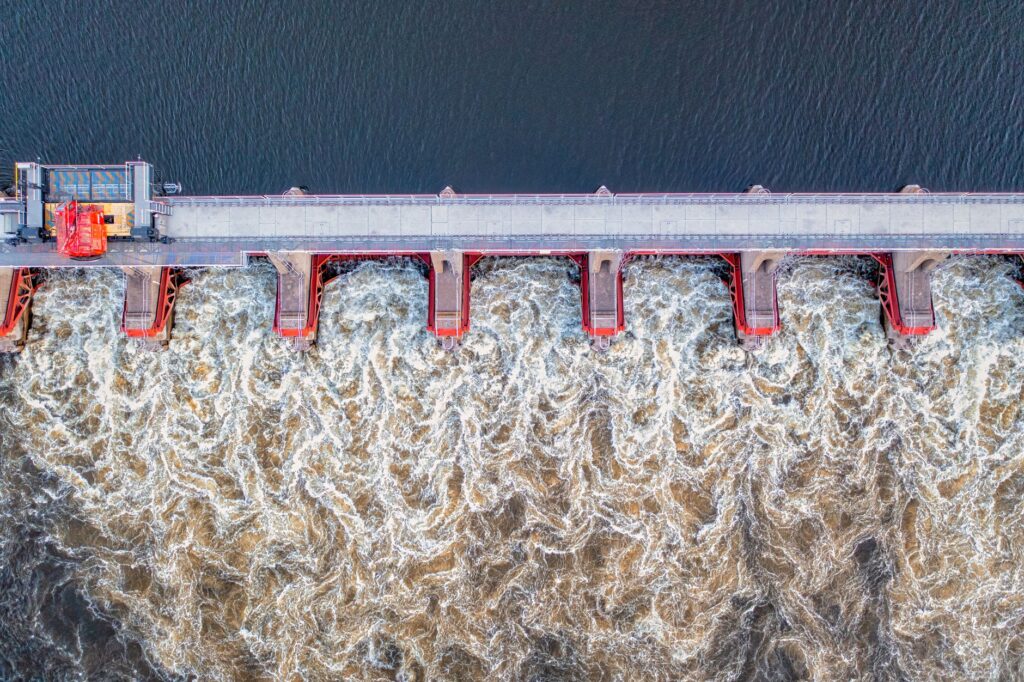
The sudden appearance of this body of water isolated the northern regions from the industrial and port-focused south. Roads that once directly connected the eastern corridor with the west were severed, forcing a lengthy detour around the lake’s western limits or total dependence on surface navigation. This territorial fracture prompted the belated creation of a ferry system and landing stages which, through budgetary and technological ups and downs, became the sole lifeline for transporting passengers, livestock, and agricultural goods to southern consumer markets.
The Backbone of the VLTC: Heavy Logistics and State Ferries
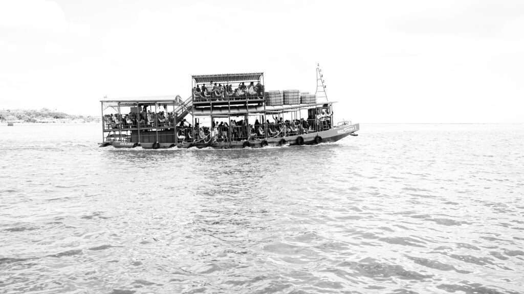
At the operational hub of Akosombo and at strategic points such as Yapei, Yeji, and Kpandu Torkor, port activity takes on an industrial character. The Volta Lake Transport Company operates a fleet of tugboats and large steel barges designed to carry fuel, cement, and tons of yams, maize, and cassava from the agricultural north to southern distribution centers. These floating colossi, many of them with decades of continuous service, undergo rigorous maintenance under adverse weather conditions, where freshwater corrosion and the proliferation of aquatic weeds present a constant technical challenge for naval engineers.
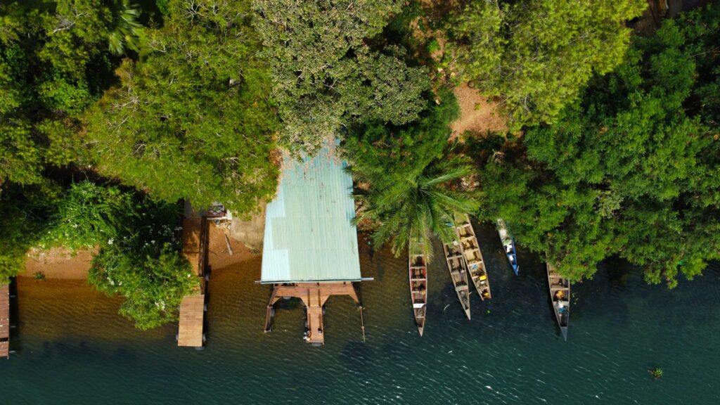
Nevertheless, the backbone of the passenger and vehicle ferry system faces extreme operational pressure. Access ramps at the terminals, mostly built over half a century ago, suffer the ravages of seasonal variations in water levels. During the flood season, facilities are partially flooded, while during periods of severe drought, accumulated silt forces restrictions on the draft of the ferries. This climatic vulnerability exposes the fragility of a logistics chain that does not always benefit from the investment in dredging and technological modernization necessary to guarantee uninterrupted service.
The Amphibious Economy: Cabotage Trade and Floating Markets
Beyond the formalized trade routes operated by large barges, Lake Volta sustains a vibrant ecosystem of artisanal cabotage. Hundreds of motorized canoes and locally built wooden vessels operate as water buses, connecting weekly markets that exist solely thanks to the proximity of water. In enclaves like Yeji—considered the most chaotic and dynamic intermodal node in the basin—the unloading of goods is a practiced choreography of physical strength, where local porters haul sacks of grain and crates of smoked fish from the boats to the muddy shore.
This informal trade is not without risks. The lack of precise records regarding cargo weight, a scarcity of life jackets, and overcrowding on vessels during market days have historically turned certain stretches of the lake into scenes of serious navigation accidents. In recent years, Ghanaian maritime authorities have intensified inspection campaigns and mandatory registration of traditional boats, seeking to balance the indispensable freedom of movement of riverine communities with minimum standards of human safety in inland navigation.
Intermodal Infrastructure: The Challenge of Lake Terminals
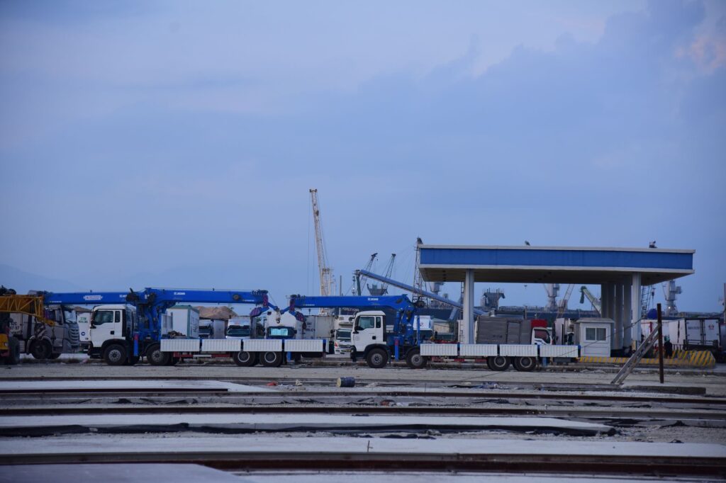
Intermodality on Lake Volta is defined by constant friction between land and river transport. Roads leading to the main lake terminals are usually unpaved dirt tracks that become impassable during the rainy season, creating monumental bottlenecks at ferry terminals. A livestock truck coming from the northern savannahs may spend days stranded at the Yeji landing stage waiting for its turn to cross toward the Brong-Ahafo or Ashanti regions due to space limitations and the rotation schedule of available vessels.
To mitigate these logistical imbalances, the Ghanaian government and international cooperation agencies have promoted wharf rehabilitation projects and the construction of new reinforced concrete ramps at key points such as Dambai and Yeji. However, the integration of the road network with lake routes remains incomplete. The absence of modern cold-storage systems at ports and a lack of adequate nighttime navigation aids limit operations strictly to daylight hours, drastically reducing the overall efficiency of a transport corridor that aspires to drive regional integration in West Africa.
The calm surface of Lake Volta conceals an implacable logistical machinery where industrial steel and artisanal wood compete to trace routes across a liquid map that changes shape with every season.
The Invisible Geography of Islands and Isolated Settlements
If the impact of the lake is visible at its major ports, its true human dimension is experienced in the hundreds of small islands and riverine communities completely lacking land connections. In these insular enclaves, daily life is subordinated to the movements of the ferryman. Children attending secondary school, the sick requiring urgent medical attention, and farmers transporting their harvests depend entirely on small boats powered by outboard motors or, in more modest cases, hand-carved oars.
This absolute dependence on aquatic mobility generates deep isolation dynamics when weather conditions deteriorate. Sudden storms, characterized by local gale-force winds known in the region as tornado squalls, turn lake crossings into a hazardous undertaking. Under these circumstances, island communities are temporarily cut off from the mainland, demonstrating that territorial sovereignty on Lake Volta is not a matter of political borders, but of navigation capacity and resilience against natural elements.
Practical guide
Planning a journey or documentary expedition along Lake Volta requires rigor, patience, and a deep respect for local schedules. Unlike conventional tourist routes, the transportation infrastructure in this region prioritizes commercial functionality over traveler comfort.

- Main Access Points: The most important intermodal nodes to connect with the ferry network are Akosombo in the south, Kpandu Torkor on the eastern shore, and Yeji in the north-central zone.
- Documentation and Planning: It is essential to check the operational status of VLTC ferries in advance, as periodic mechanical maintenance and water level fluctuations frequently alter published schedules.
- Navigation Safety: Avoid boarding artisanal canoes that lack visible buoyancy aids or display obvious signs of passenger and cargo overload.
- Weather Conditions: The best time of year to document or travel the lake system is the dry season, between November and March, when land access tracks to the landing stages are in optimal condition for transit.
- Accommodation and Services: Formal hotel infrastructure is extremely scarce outside Akosombo and provincial urban centers like Hohoe or Techiman; travelers are advised to be logistically self-sufficient regarding water and provisions.
Silence Over the Water: Dusk in the Labyrinth of Akosombo
When the sun begins to set over the horizon of Lake Volta, the metallic roar of heavy diesel barge engines gives way to an almost ceremonial silence. At the Akosombo Dam, the calm water reflects the final golden glimmers of the day, illuminating the ghostly silhouettes of centuries-old tree trunks still emerging from the surface as silent witnesses to a submerged forest. On the shores, fishermen mend their nets in the faint glow of lanterns, while the last wooden boats return with their quiet cargo from the day’s labor.
This sunset not only marks the end of work in the world’s largest artificial reservoir, but also encapsulates the complex contradiction of a landscape forged by human hands. Here, modern engineering and fluvial tradition converge in a fragile yet tenacious balance, where every crossing serves as a reminder that the true measure of development in West Africa lies not solely in the scale of its grand infrastructure, but in the enduring capacity of its people to master the water and turn it into home.