At six in the morning, when dense mountain mist still wraps the pine forests of the Sierra Tarahumara and freezing temperatures grip the high plateau, a distant train whistle pierces the cold northern Mexican air. This is no ordinary passenger service; it marks the start of one of the twentieth century’s most extraordinary civil engineering accomplishments: the Chihuahua al Pacífico Railroad, universally known as El Chepe. Stretching across more than six hundred kilometers of rugged terrain, this steel lifeline cuts through titanic gorges, linking the arid expanse of Chihuahua with the subtropical lowlands of Sinaloa and unveiling a world where time operates on an entirely different scale.
The Copper Canyon (Barrancas del Cobre) is not a single chasm, but a vast network of six major canyons carved over millions of years by ancestral rivers draining into the Sea of Cortez. Four times larger in area and significantly deeper in several sections than Arizona’s Grand Canyon—plunging vertically past 1,800 meters—this majestic geological formation provides the backdrop to an enduring cultural tapestry anchored by the Rarámuri people, whose light footsteps have traced these towering rims for centuries.
Impossible Engineering Across the Sierra Madre Occidental
First envisioned in the late nineteenth century as a strategic freight corridor linking the American Midwest with the Pacific Ocean, the construction of the railway required nearly nine decades of intermittent labor, financial crises, and seemingly insurmountable topographical hurdles. Mexican and foreign engineers were confronted with an imposing volcanic mountain range that resisted every effort of human containment. The completed line, officially inaugurated in 1961, required the excavation of eighty-six tunnels and the erection of thirty-seven steel bridges slung across dizzying voids.
Among the most remarkable engineering feats along the route is the Descanso Tunnel and the famous Encinillas loop, where the rail line completes a full 360-degree spiral over itself to gain or shed elevation within an extremely tight footprint without exceeding standard traction gradients. Watching the heavy carriages cross the Chinipas Bridge, suspended more than one hundred meters above the riverbed, underscores the scale and sheer daring of a railroad built against immense physical odds.
Creel: Pine Forests and the Gateway to the High Sierra
Perched at an elevation exceeding 2,300 meters, the mountain town of Creel serves as the northern staging post for high-sierra exploration. Once a rugged timber outpost, it has evolved into a base for hikers and backcountry expeditions, retaining a frontier character where the scent of burning pine fills the alpine air and historic sawmills stand alongside indigenous craft cooperatives.
Just outside the town center, the terrain breaks into strange geological shapes sculpted by millennia of wind and water runoff. The Valleys of the Frogs, Mushrooms, and Monks display dramatic limestone and volcanic tuff monoliths standing like stone sentinels among the pines. Nearby, Lake Arareko mirrors deep blue skies against untouched woodlands, while the nearby Rarámuri community of San Ignacio de Arareko preserves seventeenth-century adobe chapels that reflect the enduring spiritual synthesis forged during the Jesuit missionary era.
The Geological Labyrinth: Scales Beyond Human Measure
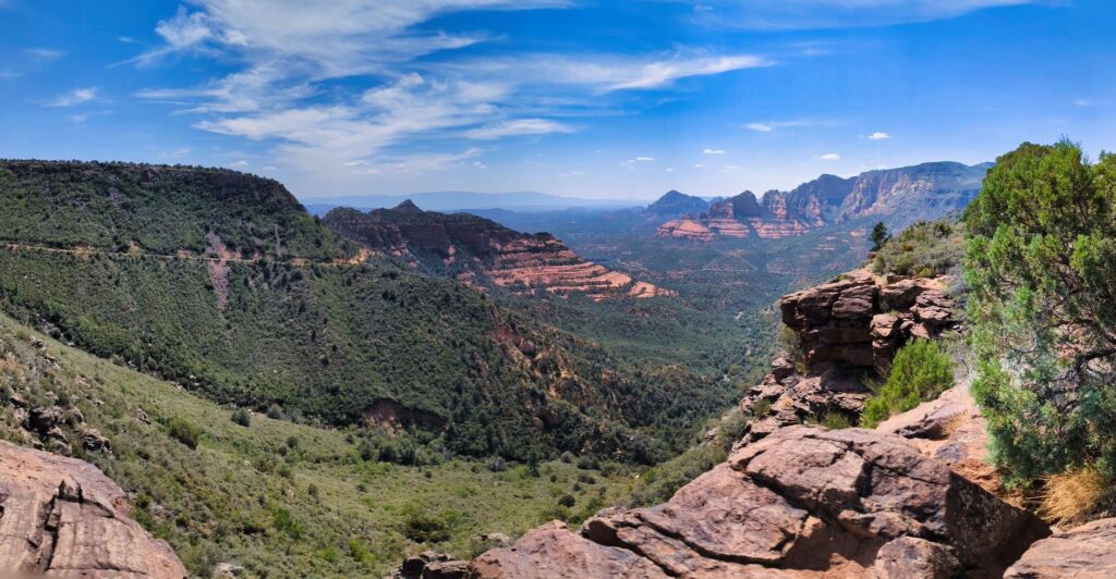
As the train heads southwest, alpine woodland gradually gives way to dramatic vertical fault lines. While named collectively after the copper-green hues of the Urique Canyon walls, the system includes the Sinforosa, Batopilas, Candameña, Huapoca, and Chínipas canyons. Candameña is home to Mexico’s two highest waterfalls: Piedra Volada, which drops 453 meters during the wet season, and Basaseachi, plunging 246 meters down a sheer vertical basalt precipice year-round.
The most striking ecological feature of the Copper Canyon is its extreme vertical climate layering. While the upper rims experience alpine weather, with freezing nights and regular winter snowfalls between December and February, the canyon floors foster a sheltered subtropical microclimate where citrus orchards, mangoes, and wild river vegetation thrive. Descending into the abyss on foot or horseback is literally an expedition through multiple distinct bioclimatic zones in a single afternoon.
Divisadero: A Front-Row Seat to the Abyssal Edge
Divisadero station is the scenic climax of the rail line. Here, the tracks run along the precipitous edge of the gorge, allowing passengers to gaze directly into the dramatic confluence of three major canyons: Urique, Tararecua, and del Cobre. The sweeping view from the Piedra Volada lookout challenges normal spatial perception; horizontal rock strata expose millions of years of volcanic history in layered hues of ochre, copper, and charcoal.
Nearby, the Parque de Aventura Barrancas del Cobre has introduced aerial infrastructure to the canyon rim. Its cable car—one of the world’s longest unsupported aerial tramways—glides over a three-kilometer span without intermediate towers, while an extensive network of ziplines traverses the canyon mouths at breathtaking speeds. Yet, despite these engineering marvels, the true majesty of Divisadero remains the profound, uninterrupted silence that settles over the canyons as evening falls.
«The Sierra Tarahumara is not merely a physical frontier of stone and steel; it is a sacred geological sanctuary where wind and rock safeguard an unbreakable human spirit».
The Rarámuri: Running Culture and Ancestral Resilience
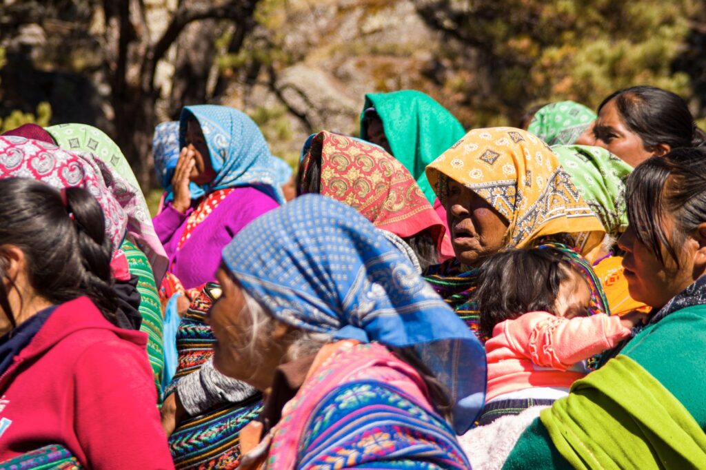
No comprehensive portrait of the Copper Canyon is complete without its indigenous guardians: the Rarámuri, commonly referred to as Tarahumara, a name translating to ‘those who walk well’ or ‘the light-footed runners’. Having survived centuries of colonial and cultural pressure by seeking refuge in the most remote pockets of the canyons, they are internationally renowned for their endurance, running ultra-distances across steep terrain wearing only tire-tread sandals known as *huaraches*.
For the Rarámuri, long-distance running is not an athletic pursuit, but a sacred communal ritual, an expression of spiritual endurance, and an everyday means of transport across roadless wilderness. Their society is organized around small, dispersed family homesteads (*rancherías*), often utilizing natural rock shelters or simple stone dwellings. Respecting their cultural privacy, traditions, and community sovereignty is essential for any responsible traveler venturing through their ancestral lands.
Descending to Bahuichivo and the Hidden Valley of Cerocahui
Beyond Bahuichivo station, the train begins a rapid descent toward the Pacific watershed. From Bahuichivo, a winding mountain road leads to Cerocahui, a quiet valley founded in 1680 by Jesuit missionary Juan María de Salvatierra. Surrounded by high-altitude vineyards, apple orchards, and mixed pine-oak forests, the village features one of the sierra’s finest preserved colonial mission churches.
Cerocahui is also the jumping-off point for the journey to the Cerro del Gallego viewpoint. From this vantage point above 2,100 meters, the ground falls away precipitously into the depths of Urique Canyon. Far below, the historic mining settlement of Urique appears as a tiny grid of rooftops beside a winding river, a full 1,800 meters beneath the lookout. The narrow dirt road down to the canyon floor ranks among the most exhilarating and demanding mountain drives in North America.
Chepe Express vs. Chepe Regional: Operational Logistics
The modernization of the northern Mexican rail corridor has produced two distinct train services running along the same scenic track, each catering to different travel styles and logistical needs:
- Chepe Express: A luxury, tourism-oriented train operating between Creel (Chihuahua) and Los Mochis (Sinaloa), stopping only at Divisadero and Bahuichivo. It offers First, Executive, and Tourist classes, featuring an open-air observation terrace car, cocktail bars, and an upscale dining carriage serving regional cuisine developed by prominent Mexican chefs. Departures operate on scheduled days of the week.
- Chepe Regional: The historic, multi-stop passenger service connecting Chihuahua City to Los Mochis with over fifteen rural station stops. It remains a vital transportation lifeline for remote canyon communities and indigenous families, reaching villages inaccessible by paved highway. While more utilitarian and budget-friendly, ticket procurement requires direct planning at regional station counters.
Smart itineraries often involve combining both trains, booking multi-night stopovers in Creel, Divisadero, and Cerocahui to explore the side valleys without rushing through the landscape in a single tiring journey.
Colonial Finale in El Fuerte, Sinaloa
Emerging from the jagged foothills of the Sierra Madre, the train crosses long bridges over the widening rivers of the coastal plain. The pine forests disappear entirely, replaced by organ pipe cactus, agricultural fields, and tropical palm trees. The colonial town of El Fuerte welcomes travelers at the western end of the mountain crossing.
Established in 1564 as a fortified Spanish outpost to protect settlers and Jesuit expeditions, El Fuerte showcases classic colonial architecture, complete with stone arcades, cobblestone streets, and manicured town plazas. A gentle boat trip along the Fuerte River reveals rich riparian birdlife and access to ancient indigenous petroglyphs at Cerro de la Máscara, providing an archaeological counterpoint to the geological drama experienced up in the high sierra.
Practical Planning: Seasons, Logistics, and High Altitudes
Exploring the Copper Canyon requires thoughtful preparation to navigate wide swings in temperature, rugged terrain, and limited rural infrastructure. Keep these essential considerations in mind:
- Best Travel Windows: September through November brings pleasant weather, lush green canyon walls, and full waterfalls immediately following the summer rainy season. Winter (December to February) brings crisp mountain air and occasional snow across the high rims, while spring (March to May) offers dry days and clear visibility.
- Altitude Awareness: Key stations sit between 2,200 and 2,400 meters above sea level. Travelers should acclimatize by staying hydrated, pacing physical exertion, and moderating alcohol intake during the first forty-eight hours. Temperature shifts between the high rim and the canyon floor can easily exceed 15°C (30°F) during the same afternoon.
- Advance Ticketing: Seats on the Chepe Express sell out weeks in advance during peak periods such as Easter, mid-summer, and the Christmas holidays. Train seats and boutique canyon-edge hotels should ideally be booked two to three months ahead of departure.
- Gear Essentials: Pack sturdy hiking boots with aggressive grip for loose gravel trails, modular layered clothing (windbreaker, fleece, thermal base layers), high-SPF sun protection, and sufficient cash in Mexican Pesos, as banking machines and card terminals are virtually nonexistent outside major hubs.
Stepping down from the carriage onto the coastal plains of Sinaloa, one realizes that El Chepe is far more than a scenic train ride. It stands as one of the world’s most defiant triumphs of railway engineering over impossible topography, preserving a living link between ancient indigenous worlds and the vast landscapes of northern Mexico.