
Territory, Elevation, and Horizons in the Balqa Highlands
Located within the Balqa Governorate in the heart of Jordan, the town of Mahis rises to an average elevation of approximately 839 meters above sea level. This highland enclave has no direct access to the open sea, yet its relationship with water has historically defined its landscape, its agricultural economy, and the daily rhythm of its residents. The approximate coordinates of 31°59′ north latitude and 35°46′ east longitude place the settlement in a transitional zone where breezes from the surrounding valleys moderate a climate characterized by warm summers and mild winters.
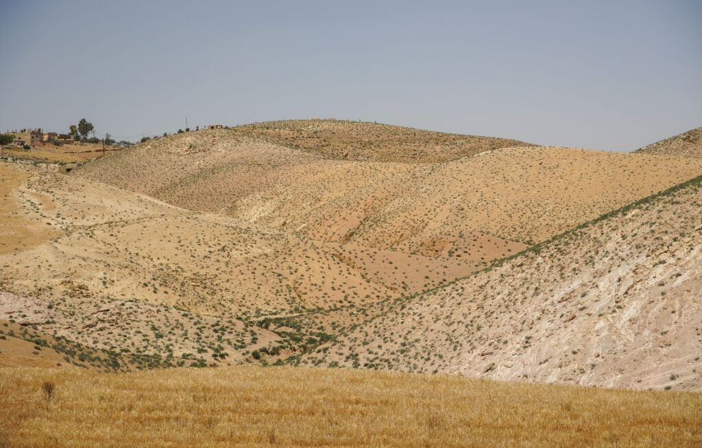
The topographic analysis of the region reveals a rugged relief of hills sculpted by millennia of erosion and the steady action of underground springs. These hydrological outcrops have allowed the development of traditional orchards of pomegranates, olives, and fig trees, creating a green mosaic that contrasts sharply with the surrounding aridity of the Jordanian steppe. Understanding the territory requires observing how groundwater emerges at strategic points along the slope, feeding small seasonal streams that descend toward the Jordan Valley.
The layout of human settlements in Mahis responds directly to the availability of these water resources. Unlike the large desert metropolises, this population center of just over seventeen thousand residents is structured around agricultural terraces where community water management has been a constant for generations. The methodical observation of the terrain highlights the interplay between limestone bedrock, local aquifers, and ancestral slope-farming techniques.
Seasonal Climatology and Meteorological Variability
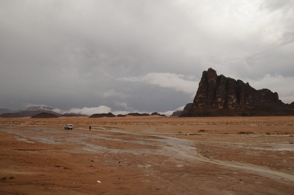
The climate regime of Mahis is governed by continental Mediterranean patterns. Winters typically record cool temperatures with concentrated precipitation episodes occurring between November and March. These seasonal rains are fundamental for recharging local aquifers and maintaining the water table that nourishes the area’s springs. During this period, dense cloud cover and westerly winds can significantly reduce visibility across the hilltop ridges.

In contrast, the summer months are characterized by marked environmental dryness and high daytime temperatures, though the elevation of nearly 840 meters provides notable thermal relief during nighttime hours. This daily thermal oscillation requires travelers and residents alike to rigorously plan for hydration and sun exposure. Ultraviolet radiation at these elevated latitudes is intense, necessitating adequate protection during outdoor activities.
Local winds play an essential regulatory role in dispersing haze and moderating heat during summer afternoons. Studying the region’s meteorology entails recognizing that sudden atmospheric pressure changes in the eastern Mediterranean can trigger unexpected gusts in ridge areas, a factor that must be considered when planning walking excursions along the rural paths connecting Mahis with neighboring communities.
Agrarian Culture and Traditional Water Management
The cultural identity of Mahis is rooted in a robust agricultural tradition that has successfully adapted to the structural water scarcity of the Middle East region. Dry-stone retaining terraces built along the hillsides not only prevent fertile soil erosion but also optimize rainwater infiltration into lower strata. This landscape architecture constitutes tangible evidence of vernacular engineering developed to harness every available drop.
Rainfed crops coexist with traditional irrigated plots supplied by local springs, such as the one historically renowned in the area for its steady flow. Autumn olive harvesting and summer fruit gathering mark the community’s social calendar, establishing a direct link between natural cycles and the local economy. This agricultural heritage is kept alive through generational turnover and respect for practices inherited from elders.
Community management of irrigation channels reflects a profound understanding of the ecological limits of the environment. Customary water distribution rules have historically ensured equitable access to the resource among various orchard owners, preventing the overexploitation of underground aquifers during periods of lower rainfall.
Safety, Regulations, and Expedition Preparation
Exploring the surroundings of Mahis requires logistical preparation appropriate to the mountainous and semi-arid terrain of Balqa. Although crime rates are low and local hospitality is a deeply ingrained cultural norm, safety in the natural environment depends on individual prudence and strict compliance with private property and environmental conservation regulations. Rural roads and bridle paths can present slippery sections following winter rains.
Responsible exploration of traditional landscapes requires understanding that every trail and every orchard is the result of centuries of human adaptation to a fragile environment.
It is essential to carry grip-soled footwear, sufficient water provisions, and offline navigation systems, as mobile phone coverage can fluctuate in deeper hollows and valleys. Likewise, checking local weather bulletins before embarking on any long hike along the hilltop ridges is strongly advised, especially during transitional seasonal months.
Local authorities and community organizations promote low-emission tourism focused on low-impact hiking. This entails leaving no trace, avoiding campfires in unauthorized areas, and respecting local crops. Preserving native flora, primarily composed of maquis shrubland and drought-resistant herbaceous species, is vital for maintaining the stability of the clayey slopes.
Historical Heritage and Community Fabric
The urban fabric of Mahis combines traditional limestone dwellings with contemporary constructions that tier up the hillsides. This growth has largely respected the historical communication routes connecting the settlement to the commercial roads of the Jordan Valley and the country’s capital, Amman. Proximity to larger urban centers has not diluted the singular identity of this agrarian community.
Local festivities and gatherings around public squares reflect the cohesion of a population that values its historical roots. Studying toponymic records and local oral history allows researchers to reconstruct how the populating of these hills has always been conditioned by the stability of water sources and the fertility of alluvial soils accumulated in minor depressions.
The social fabric acts as the primary custodian of the region’s intangible heritage. Through the oral transmission of agricultural techniques, traditional recipes, and community norms, Mahis preserves a collective memory that enriches the experience of any visitor interested in the most authentic facet of the Jordanian highlands.
Ecosystem Protection and Local Sustainability
The ecological balance in Mahis faces challenges stemming from global climate change and demographic pressure on water resources. The conservation of native vegetation cover is the first line of defense against desertification and biodiversity loss in this sector of the Balqa Governorate. Various local initiatives seek to protect habitats for resident and migratory birds that use the green corridors of the valleys as resting zones.
Solid waste management and pollution prevention in seasonal streambeds are critical areas where municipal authorities and citizen groups are focusing their efforts. Keeping springs clean ensures not only public health but also the survival of minor aquatic flora and fauna adapted to these interior microclimates.
The future of sustainability in the area relies on consolidating a model where respectful tourism activity contributes economically to the conservation of natural and agrarian heritage without altering the daily lives of permanent residents.
Practical guide
How to get there: The main access to Mahis is by road from Amman, located a few kilometers to the east, using private vehicles or shared service taxis in a journey ranging from thirty to forty minutes depending on traffic.
When to go: Spring months (March to May) offer mild temperatures and an optimal landscape with blooming fields, while autumn (September to November) is ideal for enjoying agricultural harvests and stable weather.
What to pack: Layered clothing to adapt to thermal oscillation between day and night, sturdy footwear for walking on uneven terrain, broad-spectrum sunscreen, and reusable water bottles to minimize plastic use.
Local rules: Respect the privacy of private agricultural properties, ask for permission before photographing individuals, and strictly follow local guide instructions in restricted access areas designated for conservation reasons.
Visual Reflection and Closing in the Balqa Hills
At dusk, when golden light bathes the olive terraces and stone walls of Mahis, the landscape of the Jordanian highlands acquires a dimension of profound serenity. The silhouettes of the hills stand out against a sky shifting from ochre to violet, reminding us that the beauty of this territory lies in its subtle balance between the hardness of the stone and the persistence of water. It is in this moment that the true essence of the region reveals itself without artifice, inviting silent contemplation and enduring respect for an environment shaped by centuries of human endeavor.