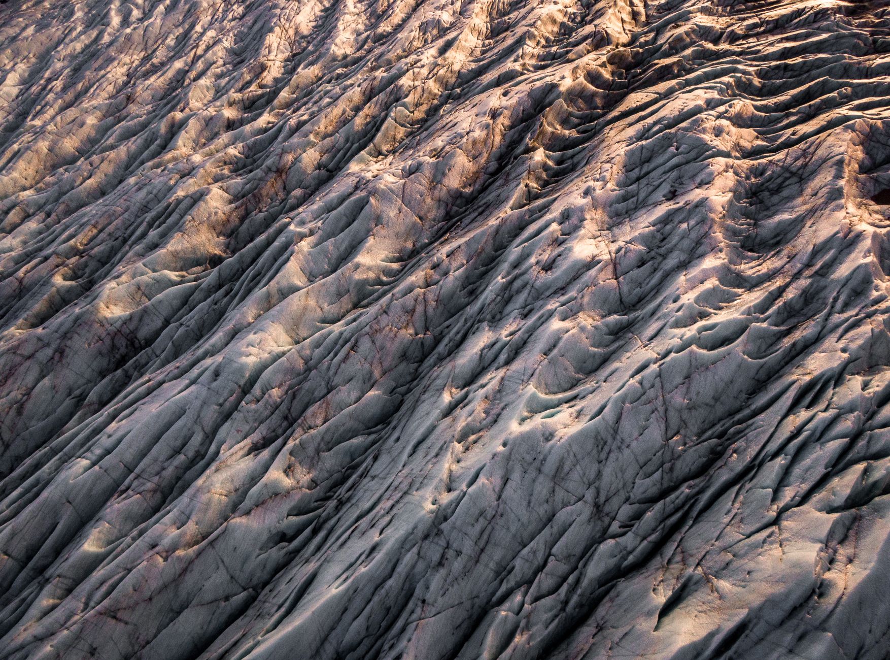

In southeast Iceland, the Vatnajökull ice cap covers more than 780,000 hectares and rests on a framework of volcanoes, fissures, and rivers that never stop moving. The national park bearing its name, inscribed on the UNESCO World Heritage List in 2019, spans over 1,400,000 hectares, nearly 14% of Iceland’s territory. This is not a landscape to contemplate from afar: it is a working system.
Anyone arriving in search of a stable postcard has chosen the wrong destination. The ground underfoot may have been reshaped by a sudden glacial flood, a jökulhlaup, only decades ago. Reading that territory is the real exercise of this expedition: learning to interpret the signals that ice and magma leave on the rock.
A territory that behaves like an open laboratory
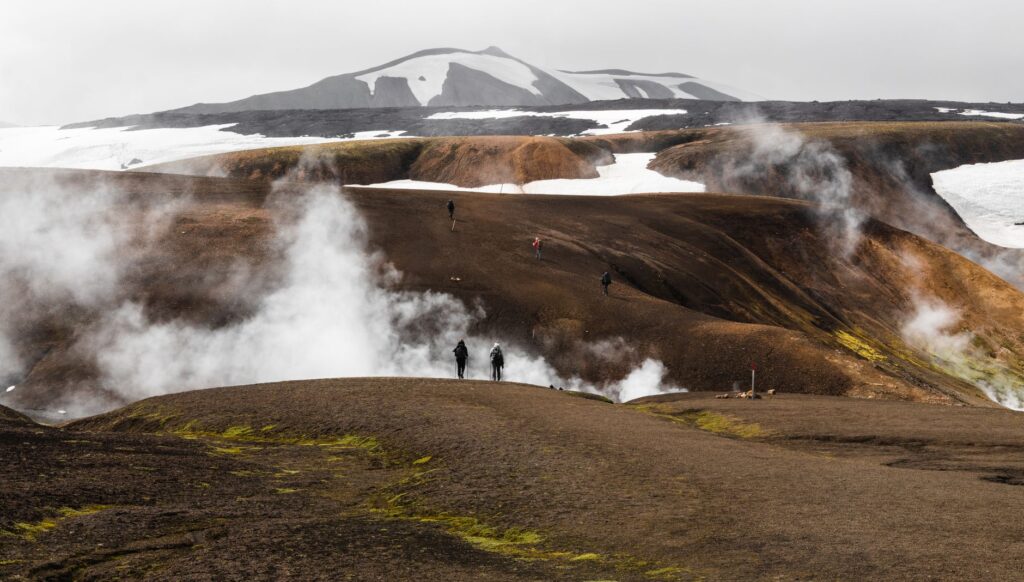
Vatnajökull is not just ice. Beneath its surface lie ten central volcanoes, eight of them subglacial, and two of the most active in Iceland. The interaction between magma and the ice cap produces phenomena rarely observable elsewhere on the planet: eruptions that melt ice from within, sudden floods that carry sediment, and the formation of sand plains, the sandur, that stretch north and south of the glacier.
The Mid-Atlantic Ridge, the boundary between tectonic plates that crosses Iceland, separates here by about 19 millimetres per year. That slow but constant movement explains why the landscape never fully stabilises. Canyons evolve rapidly, rivers change course, and subglacial lakes grow or drain according to the rhythm of eruptions and melting.
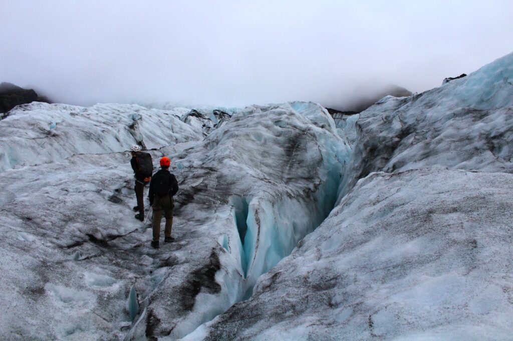
Vatnajökull is not visited like a monument: it is observed like a process. Each season leaves a different version of the same place.
What you can see without stepping on the ice
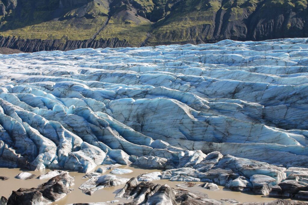
No technical expedition is required to begin understanding this landscape. In the southern part of the park, outlet glaciers such as Svínafellsjökull or Fjallsjökull descend to accessible elevations, allowing visitors to observe from marked viewpoints the ice tongue, the moraines, and the proglacial lakes. The Ring Road skirts several of these points and offers frequent stops.
The National Park Visitor Centre at Skaftafell serves as a starting point for trails of varying difficulty. There, the geology of the area is explained, along with the cycles of ice advance and retreat and the fauna inhabiting subglacial ecosystems. It is a good place to understand, before walking, what you are looking at.
The trails of Skaftafell
Routes such as the one leading to Svartifoss, the waterfall surrounded by basalt columns, or the paths toward viewpoints over the glacier, allow a gradual approach to the landscape without technical equipment. Signage is clear and distances are designed for visitors with different levels of experience.
Daily life beside the ice
In the towns of the southeast, such as Höfn í Hornafirði, the relationship with the glacier is not abstract. Fishing, tourism, and greenhouse farming coexist with an environment that imposes its own rhythms. Roads can close due to wind or floods, and planning any activity depends on weather reports consulted several times a day.
Local residents have learned to read the behaviour of the glacier and glacial rivers as part of their routine. They know when to avoid certain channels, how to interpret the colour of the water, or why some tracks are only passable at certain times of year. That practical coexistence with an unstable landscape is, perhaps, the most valuable lesson for the traveller.
Technical activities: always with local operators
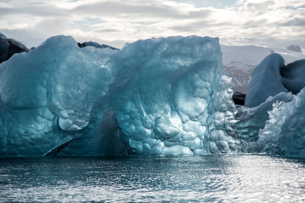
Walking on the ice, entering ice caves, or navigating among icebergs in the Jökulsárlón lagoon are activities that require certified guides and adequate equipment. Conditions change rapidly: a cave that was safe one week can become unstable, and a trail on the glacier can be cut by a new crevasse.
For this reason, the recommendation is always to hire licensed operators, check that they provide helmets, crampons, and harnesses when the activity requires them, and respect indications regarding schedules and small groups. The park has specific regulations to govern these activities and protect both visitors and the environment.
What to ask before booking
- Whether the activity includes a certified guide and technical equipment.
- What the maximum group size is.
- What cancellation policies apply if the weather worsens.
- Whether small groups are used in sensitive areas.
Water as the architect of the landscape
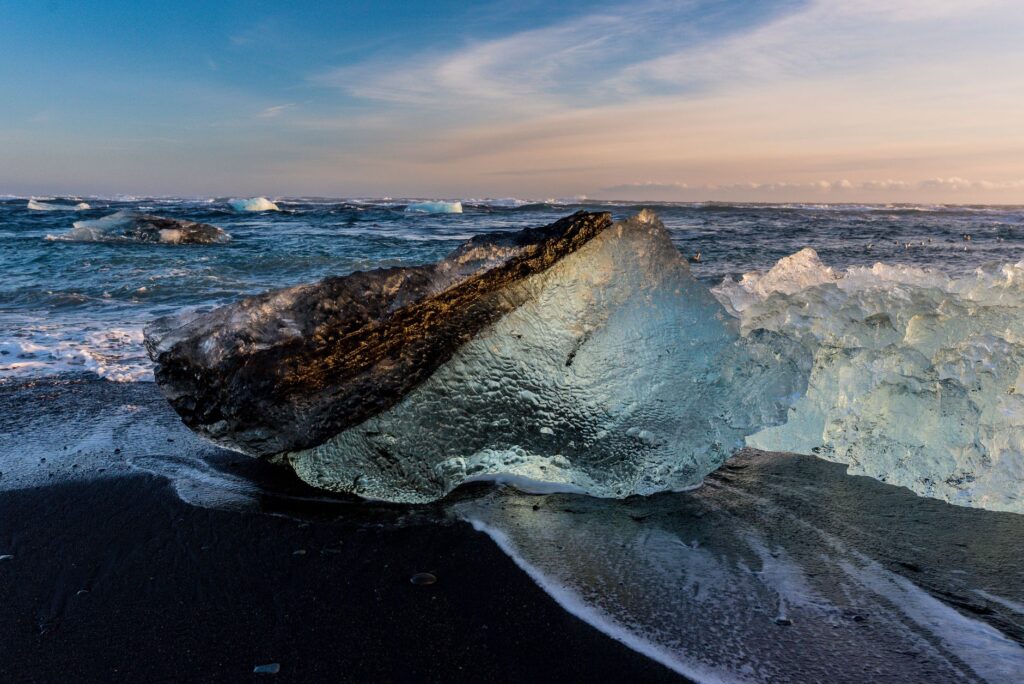
The glacial rivers born in Vatnajökull carry fine sediments that give the water its characteristic milky grey tone. Upon reaching the sea, those sediments settle and form dark beaches, such as those at Diamond Beach, where ice blocks carried by the current strand on the black sand.
That contrast between transparent ice and dark basalt is one of the most recognisable images of southeast Iceland, but it is also a warning: waves and currents on these beaches are dangerous, and local authorities insist on not approaching the water or climbing on the ice blocks.
The Vatnajökull landscape cannot be understood without water: it is the agent that sculpts, transports, and reorganises everything that ice and fire produce.
A natural archive of climate change
The ice cap reached its greatest extent at the end of the 18th century and has been retreating steadily since then. In recent decades, that retreat has accelerated, and scientists use Vatnajökull as one of the main natural laboratories for studying the effects of global warming on glaciers and the landforms they leave exposed.
Moraines, proglacial lakes, and newly exposed valleys function as time markers. Observing them allows us to understand not only what the glacier was like decades ago but also where the landscape may evolve in the future. That scientific dimension coexists with the visitor’s experience, often finding themselves before a territory in visible transformation.
Fauna that survived the ice age
In the volcanic zones of the park lives an endemic groundwater fauna that managed to survive the glacial period. These are organisms adapted to extreme conditions, whose study provides clues about how life persists in hostile environments, both on Earth and potentially on other bodies in the solar system.
Getting around the region
The Ring Road connects the main access points to the park and allows the trip to be organised in stages. The settlements with the most complete services are in Höfn í Hornafirði, to the east, and near Skaftafell, to the west. Between them, distances are considerable and services are scarce, so it is advisable to plan refuelling and provisions.
Public transport is limited in this area, and many bus routes operate only in summer. Renting a vehicle suited to road conditions, with leeway for weather changes, is the most flexible option for those who want to explore the park independently.
Practical guide
Before travelling, consult the official Vatnajökull National Park website and the weather and road alerts published by Icelandic authorities. Conditions can change within hours, especially in winter, when days are very short and wind gusts are intense.
- Best season: summer offers more daylight and access to more trails; winter allows ice cave visits but requires a guide and specific equipment.
- Equipment: waterproof and warm clothing, mountain footwear, and wind protection, even in summer.
- Safety: never walk on the ice without a certified guide; respect signs and closed areas.
- Accommodation: book in advance during high season, as local supply is limited.
- Environmental respect: leave no waste, stay on marked trails, and keep distance from wildlife.
A gaze that accepts the provisional
At the end of the journey, what remains is not a fixed image of the glacier but an awareness that this landscape is in motion. Vatnajökull teaches you to look differently: to notice the crevasses, the colour of the water, the shape of the moraines, the traces the ice leaves as it retreats.
That reading of the territory, done with patience and with the help of those who live there, transforms the visit into something more than a scenic route. It is a way of understanding that there are places where nature is not a backdrop but a continuous process that invites us to observe with humility and act with care.