Silence in Te Wahipounamu is not the absence of sound but a dense presence that envelops every corner. In the southwest of New Zealand’s South Island, fjords carve their way between mountains that drop sheer into dark, still water. Here, the largest expanse of temperate rainforest in the Southern Hemisphere covers entire valleys, and the oldest trees are more than eight hundred years old. This territory, designated a UNESCO World Heritage site, is not a theme park or a film set: it is a functioning ecosystem, a natural laboratory where evolution continues to write its pages at a pace humans can barely perceive.
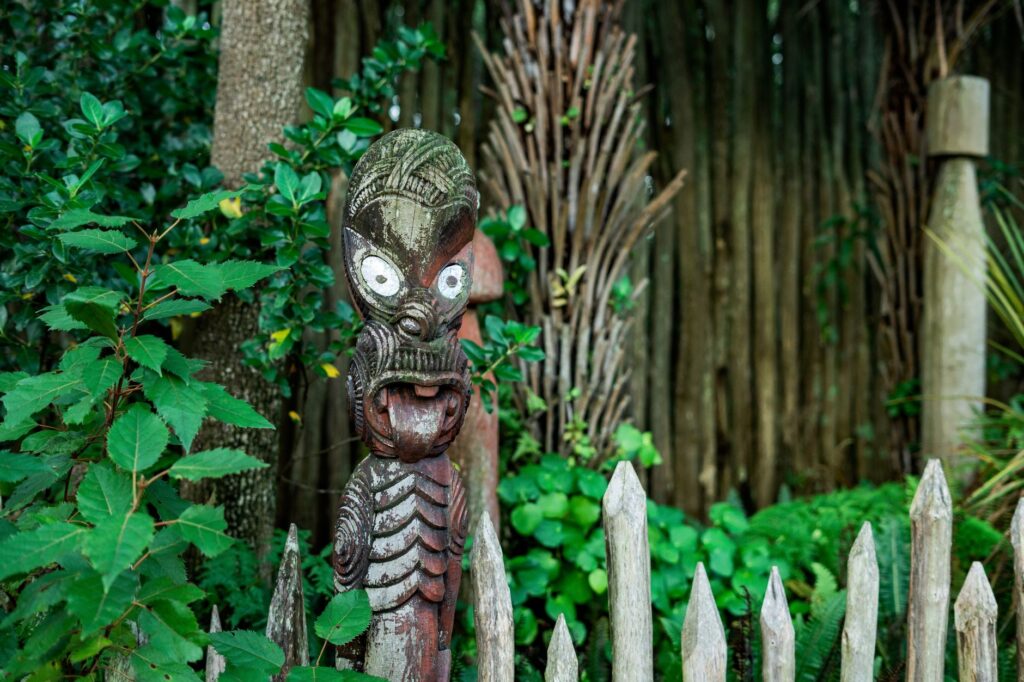
Te Wahipounamu means «the place of greenstone» in Māori, a reference to pounamu, the nephrite that for centuries was a sacred resource and a mark of prestige for the southern iwi. Today, the name designates a collection of national parks, reserves, and protected areas totalling 2.6 million hectares, nearly ten percent of New Zealand’s landmass. But reducing it to a figure would be a mistake: what makes this place exceptional is its status as a living archive of Gondwana, the supercontinent that fragmented millions of years ago and from which New Zealand separated before mammals appeared. That absence of land predators allowed birds and plants to evolve in near-total isolation, shaping a world unlike any other.
A landscape carved by ice and time
The geology of Te Wahipounamu is a story of colossal forces. The Alpine Fault, which divides the region, marks the contact zone between the Indo-Australian and Pacific tectonic plates. Their collision raised the Southern Alps, a range that reaches nearly four thousand metres in altitude just thirty kilometres from the sea. That proximity between mountain and ocean explains the violence of the landscape: rivers plunging in waterfalls, U-shaped valleys gouged by glaciers, and a coastline indented by fifteen fjords that cut inland like fingers of stone and water.
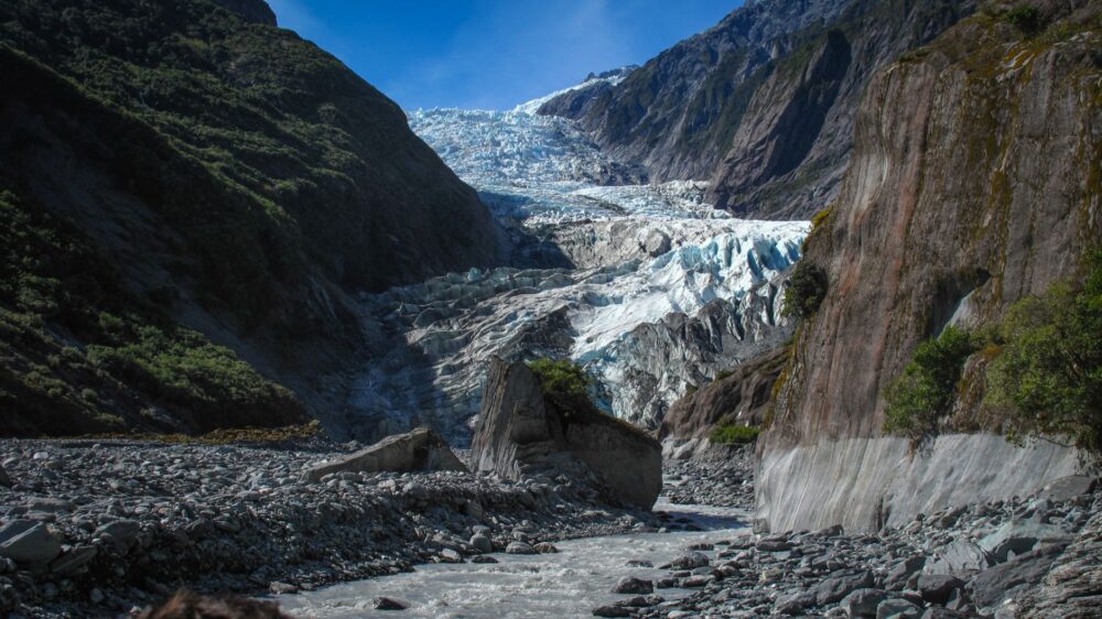
Successive glaciations left their mark on every corner. The Franz Josef and Fox glaciers descend into temperate rainforest, a phenomenon rare in the world. On the Waitutu coast, a sequence of thirteen forested marine terraces has been uplifted more than a thousand metres over the past million years, offering a unique chronological record of the interaction between sea, land, and vegetation. These processes are not relics of the past: they remain active, albeit on a timescale that defies human impatience.
«The combination of geological and climatic processes, together with a unique biota displaying evolutionary adaptation across extreme gradients, gives Te Wahipounamu its exceptional natural characteristics,» notes the UNESCO assessment.
The result is a landscape that is not merely viewed but read. Every cliff, every moraine, every glacial lake tells a story of slow, powerful transformation. And amid that immensity, life finds its way with surprising strategies.
The forest that never stopped being Gondwana
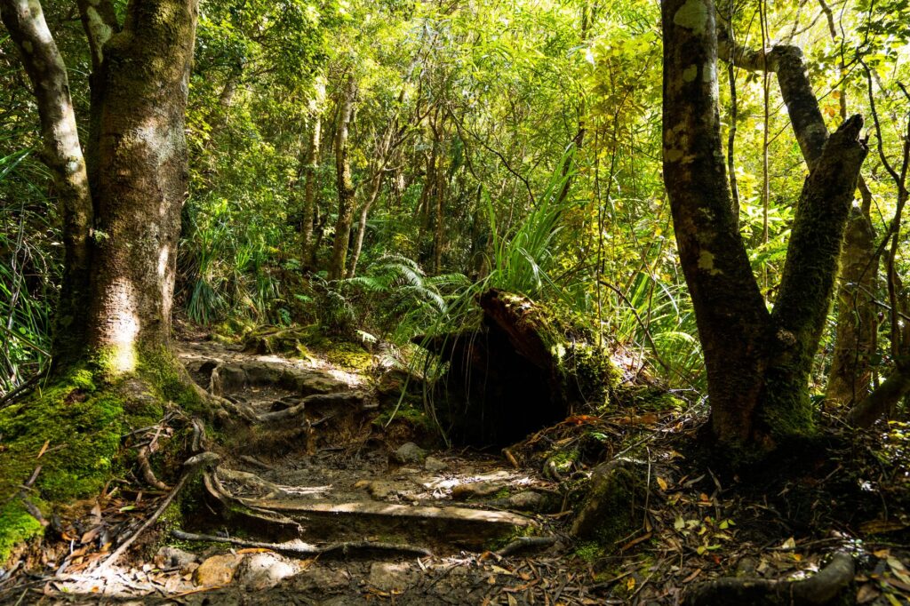
Two-thirds of Te Wahipounamu is covered by southern beech and podocarp forests. Some of these trees, such as the rimu, reach fifty metres in height and exceed eight hundred years in age. These are not just any forests: they are the most intact representatives of the flora that dominated Gondwana before the continents drifted apart. Walking among them is walking through an ecosystem that has persisted for millions of years, untouched by the transformations that swept other regions of the planet.
The diversity of podocarps is remarkable. From the towering rimu to the pygmy pine, the world’s smallest conifer, the forest displays a variety that reflects its long evolutionary history. Plant succession after glacial retreat is another process scientists study here: as ice withdraws, new surfaces are exposed and colonised by plants that, over time, give way to more complex communities. It is a natural laboratory where one can observe how life reclaims territory.
A refuge for flightless birds
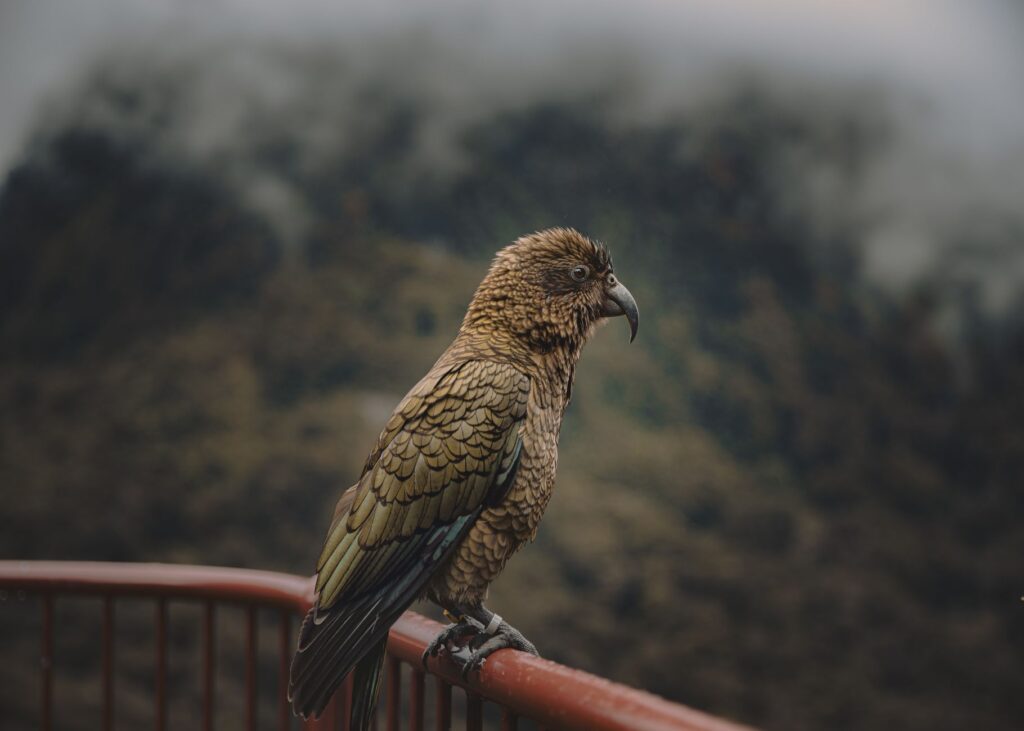
The fauna of Te Wahipounamu is as singular as its flora. The kea, the world’s only alpine parrot, lives here, an intelligent and curious bird adapted to harsh mountain conditions. The takahe also inhabits these forests, a large flightless bird once thought extinct and now surviving thanks to intensive conservation programmes. The South Island brown kiwi and the rowi, the rarest kiwi in the world, find their last refuge in these woods.
The absence of native land mammals made birds the dominant vertebrates in New Zealand. Many lost the ability to fly, as they did not need to escape terrestrial predators. That evolutionary advantage became a vulnerability when humans introduced rats, stoats, and other mammals. Today, the conservation of these species depends on constant efforts: traps, fences, captive breeding programmes, and transfers to predator-free islands. It is a silent battle fought every day in the remotest corners of the park.
«The property contains the entire wild population of the takahe, the South Island brown kiwi, and the rowi, as well as the only significant remaining populations of mohua and kaka,» the UNESCO report on the site’s values states.
Fiordland: where the mountains meet the sea
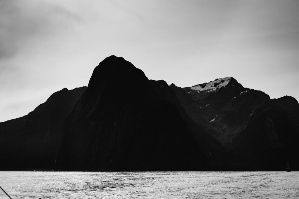
Fiordland, at the far southwest, is perhaps the most dramatic expression of Te Wahipounamu. Its fifteen fjords, carved by glaciers and later invaded by the sea, create a labyrinth of water and rock that has inspired navigators and naturalists for generations. The best known is Milford Sound, with Mitre Peak rising almost seventeen hundred metres above sea level. But beyond the iconic viewpoints, Fiordland is a territory of overwhelming vastness, where the human footprint is minimal and nature sets the rules.
The indented, steep coastline harbours marine ecosystems of great richness. The fjords function as estuaries where freshwater from rivers mixes with saltwater, creating layers of different density that allow species adapted to very specific conditions to exist. In the depths, corals and sponges form communities that have barely been explored. The interaction between land and sea is constant, and any alteration in one affects the other.
The Māori legacy and greenstone
Before the arrival of Europeans, the southern Māori, the Ngāi Tahu, travelled these territories in search of pounamu, the nephrite they used to make tools, weapons, and ceremonial ornaments. Greenstone was a valuable resource, and the routes to the western deposits became strategically important trails. These paths, known as the greenstone trails, crossed mountains and rivers, and some sections can still be walked today.
The relationship of Ngāi Tahu with the territory was not merely extractive: it involved deep ecological knowledge and a system of sustainable management. Māori regulated hunting and fishing and maintained resting areas for birds. That connection is recognised in the current management of the park, where the Department of Conservation works in partnership with the Ngāi Tahu iwi, incorporating their vision and authority over the land. It is a co-management model that acknowledges ancestral rights and traditional knowledge.

Conservation: a task of precision
The protection of Te Wahipounamu is not a settled matter. Invasive species, especially introduced mammals, remain the greatest threat. Deer, goats, stoats, and rats disrupt ecosystems, compete with native birds, and destroy vegetation. The Department of Conservation runs control programmes, but the scale of the territory makes the task difficult. Science and technology combine with fieldwork: traps, toxins, fences, and constant monitoring.
Climate change adds a layer of uncertainty. The region’s glaciers have retreated in recent decades, and scientists are studying how this process will affect freshwater ecosystems and the species that depend on them. The loss of glacial mass alters river flow, water temperature, and habitat availability. There are no easy answers, but ongoing research is the only way to anticipate scenarios and design adaptation strategies.
Tourism, in turn, poses a dilemma. Millions of visitors arrive each year drawn by the beauty of the place, and that influx generates revenue that funds conservation. But it also puts pressure on fragile ecosystems. Management seeks a balance: controlled access, well-defined trails, awareness campaigns, and limits on carrying capacity at the most sensitive sites. The key is for visitors to understand that they are not in an amusement park but in a sanctuary that demands respect.
Beyond the fjords: mountains, lakes, and glaciers
Te Wahipounamu does not end at Fiordland. To the north, Mount Aspiring National Park protects a territory of snow-capped peaks, glacial valleys, and turquoise lakes. Mount Aspiring, known as Tititea in Māori, rises as a perfect pyramid and is a challenge for experienced mountaineers. The valleys around it, such as Matukituki, offer hiking routes that combine alpine landscapes with beech forests.
Further north, Aoraki/Mount Cook National Park is home to New Zealand’s highest peak, at 3,724 metres. Although Mount Cook was not part of the original core of Te Wahipounamu, its inclusion in the World Heritage site broadens the representation of alpine and glacial ecosystems. The Tasman Glacier, one of the country’s longest, descends from the slopes of Aoraki and offers a spectacle of ice, snow, and rock that attracts visitors from around the world.
On the west coast, the Franz Josef and Fox glaciers are two of the few in the world that descend into temperate rainforest. Their proximity to the road and visitor centres makes them accessible but also places them under significant tourist pressure. Scenic flights, guided ice walks, and viewing platforms allow people to contemplate them, but they also generate impacts that must be managed carefully.
The southern lakes: mirrors of water and mountain
The great glacial lakes of the southeast, such as Te Anau, Manapouri, Wakatipu, and Wanaka, are another gateway to Te Wahipounamu. Their deep, cold waters reflect the mountains around them, creating landscapes of deceptive serenity. Towns and tourist centres have developed on their shores, serving as bases for exploring the region. But beyond the infrastructure, these lakes are complex ecosystems, home to waterfowl and native fish, and their health depends on the management of the catchments that feed them.
Lake Te Anau, New Zealand’s second largest, is the gateway to Fiordland. From here, excursions depart for Milford Sound and Doubtful Sound, as well as trails that penetrate the heart of the park. Lake Manapouri, with its intense blue waters, is the starting point for visiting Doubtful Sound, a more remote and less crowded fjord than Milford. The underground Manapouri hydroelectric power station, built in the 1960s and 1970s, was the subject of one of the country’s first environmental battles, and its history reflects the tension between development and conservation.
Practical guide
Planning a visit to Te Wahipounamu requires considering the scale of the territory and the weather conditions. The region is accessible year-round, but the weather can change rapidly, especially in Fiordland, where rain is frequent. It is advisable to bring waterproof clothing, suitable footwear, and be prepared for variable temperatures.
- Getting there: Queenstown and Christchurch international airports connect with domestic flights to Te Anau, Invercargill, and other centres. From there, you can rent a vehicle or use tourist transport services. The road to Milford Sound is scenic but requires attention, especially in winter.
- Accommodation: Options range from Department of Conservation (DOC) campsites to luxury lodges. In high season, booking well in advance is essential, especially in Milford Sound and Te Anau.
- Activities: Hiking is the main way to explore the park. The Milford Track, Routeburn Track, and Kepler Track are among the best known and require advance booking. Boat trips through the fjords, scenic flights, and glacier visits are also available.
- Conservation: Before entering the park, it is worth learning about conservation rules. Do not feed wildlife, do not introduce species, and do not leave the trails. All rubbish must be carried out. The goal is to keep the impact minimal.
- Safety: The region is remote and emergency services may take time to arrive. It is advisable to carry a personal locator beacon (PLB), inform someone of your itinerary, and check the weather forecast before setting out.
The best time to visit depends on your interests. The austral summer (December to February) offers longer days and milder temperatures but also more visitors. Spring and autumn are quieter and the landscapes take on different tones. Winter is for those seeking snow and alpine activities, although some access routes may close.
A journey that demands humility
Te Wahipounamu is not a destination to be consumed in haste. It is a place that invites you to pause, observe, and listen. The immensity of the landscape, the antiquity of the forests, and the fragility of its endemic species force a reflection on the role of humans in nature. Here, conservation is not an option but an urgent necessity. Every visitor who understands this becomes an ally, not a threat.
At the end of the day, when the sun sets over the fjords and the mountains stand out against a burning sky, one understands that this place does not belong to those who visit it. It is a loan that the Earth makes to future generations. The greenstone, the deep water, and the ancient forest will remain here, silent witnesses to a time that surpasses us. And perhaps that is the most valuable lesson Te Wahipounamu has to offer: that there are places that must remain, above all, untouched.