
The Arctic Circle is not merely a line drawn on navigation charts, but a threshold where the laws of physics and geography impose their own unforgiving rules on human mobility. At the northwestern tip of Norway, the Lofoten archipelago unfolds as a wall of granitic peaks emerging from the dark waters of the Norwegian Sea, defying any conventional attempt at territorial integration. For centuries, the sole communication channel between these islands, fragmented by deep fjords and violent ocean currents, was the strength of oars and the courage of fishermen aboard their traditional wooden boats, known as nordlandsbåt. Today, the picturesque image of fishing villages suspended on wooden stilts contrasts with a hyper-modern civil engineering network, consisting of monumental suspension bridges and subsea tunnels winding dozens of meters beneath the seabed. However, this apparent conquest of nature conceals a profound structural vulnerability, where hurricane-force winter winds and snow avalanches can sever in a matter of minutes the fragile supply chain feeding entire communities.
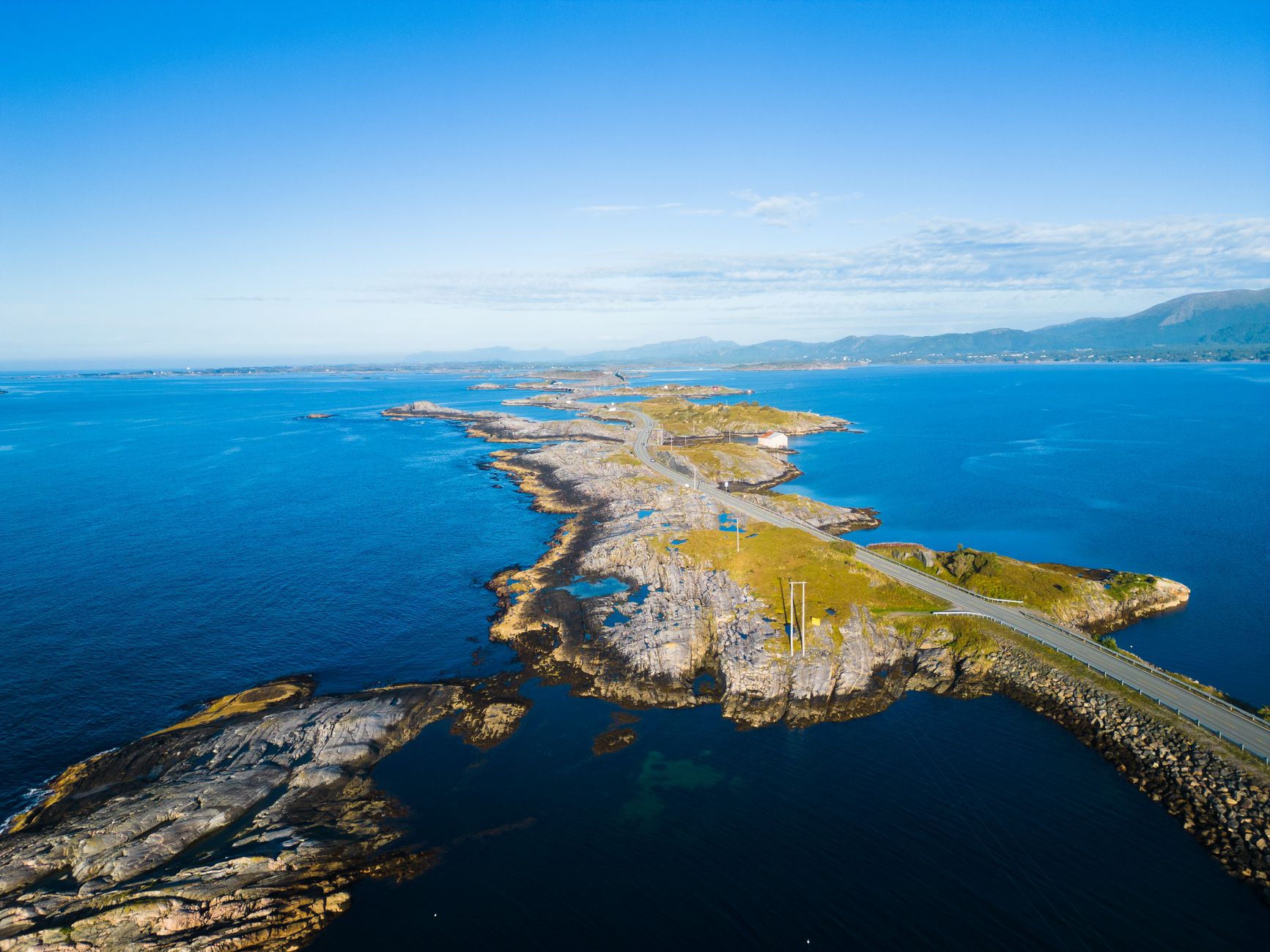
Understanding the transport architecture of Lofoten requires abandoning the comfort of continental highways to immerse oneself in an intermodal ecosystem where every movement depends on the millimetric synchrony between asphalt, tides, and scheduled ferry timetables. The E10 highway, officially named King Olaf’s Road, acts as the terrestrial backbone stitching the islands together from the mainland locality of Fiskebøl to the remote settlement of Å at the southern tip. Nonetheless, this asphalt umbilical cord is not a continuous, homogeneous route, but a winding path that forces drivers and freight operators to contend with single-lane sections, rock-carved pull-offs, and gorges where the margin for error is measured in centimeters. Throughout this report, we will examine how the surge of summer mass tourism clashes head-on with the logistical needs of the local fishing industry and the daily lives of permanent residents, testing the resilience of an infrastructure system originally conceived for a radically different demographic and climatic reality.
The E10 Backbone: Road Engineering on the Edge of Abysses
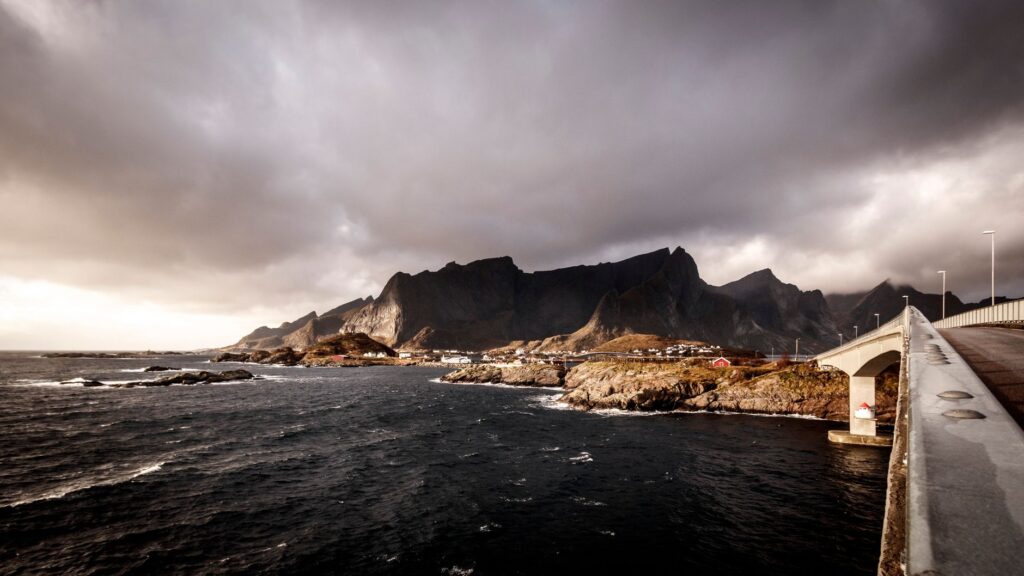
The construction of the E10 highway across the Lofoten archipelago represented one of the greatest civil engineering challenges in Scandinavian modern history. Completed along its main alignment in the late 20th century with the opening of the inter-island project known as Lofotensfastheten, this route eliminated historical dependence on ferries to link the major islands of Austvågøy, Gimsøy, Vestvågøy, and Flakstadøy. Norwegian engineers had to design unprecedented structural solutions to bypass marine straits where tidal currents reach speeds comparable to a mountain river. The result is a dizzying succession of arch and prestressed beam bridges, such as the imposing Raftsund Bridge and the Gimsøystraumen Bridge, rising above the waters with a slender profile calculated to withstand wind pressures exceeding one hundred and fifty kilometers per hour.
Yet the visual spectacle of these infrastructures masks a complex and costly operational reality in terms of ongoing maintenance. Constant marine salinity, combined with extreme freeze-thaw cycles during the long months of the polar night, rapidly corrodes steel anchorages and pavement expansion joints. The road maintenance crews of northern Norway’s public roads administration (Statens vegvesen) operate under a permanent surveillance regime, mobilizing heavy machinery equipped with thermal blades and brine-spreading systems that must act preventively before blizzards blind the approaches to the tunnels. These tunnels, many of which were blasted through living rock without concrete linings in their early sections, function today as veritable ice traps if interior drainage systems become clogged due to sudden slush accumulation, forcing the temporary closure of road arteries vital for the supply of fuel and fresh food.
The Maritime Pulse: The Silent Resilience of Fjord Ferries
Despite the unstoppable advance of the road and tunnel network, Lofoten’s transport system would immediately collapse without the constant presence of scheduled ferries and high-speed coastal vessels. While the E10 absorbs heavy traffic and the main flow of private vehicles, secondary maritime routes remain the only viable lifeline for peripheral islands and for stretches where submarine topography has precluded the drilling of safe tunnels. Local shipping companies operate fleets of double-ended ferries capable of simultaneously embarking dozens of passenger cars, refrigerated trucks loaded with fresh cod, and local passengers who brave the Arctic swells on a daily basis.
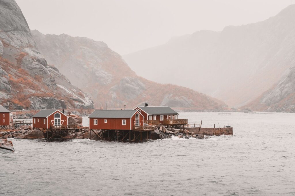
The operation of these ferries is dictated by a rigorous choreography where maritime weather has the final say. Storms originating in the Norwegian Sea generate high waves that transform docking piers into high-tech risk zones, forcing captains to maneuver with azimuth propulsion and assisted positioning systems to fit ramps onto platforms battered by salty foam. For residents of smaller islands such as Værøy and Røst, situated far south of the archipelago’s main body, the weekly ferry is not a simple tourist alternative, but the sanitary and commercial umbilical cord ensuring the demographic survival of communities that would otherwise remain completely isolated during the severest winter storms.
The Geopolitics of Seasonality: Mass Tourism Versus Fishing Logistics
In recent years, Lofoten’s transport model has been subjected to unprecedented tension due to the exponential growth of international mass tourism, driven by digital promotion campaigns that have transformed the archipelago into one of the most coveted photographic destinations on the planet. During the summer months, the narrow lane of the E10 and scenic parking lots alongside iconic beaches such as Haukland or Kvalvika experience congestion levels that overwhelm the carrying capacity of local infrastructure. Large motorhomes, rental cars driven by travelers unfamiliar with narrow roads, and intrepid cyclists share limited road space, generating constant hazardous situations and blocking the passage of freight trucks supplying the local fishing industry.
This conflict of interests between the tourism economy and traditional productive sectors sparks intense debate among island municipalities over the need to implement congestion charges, vehicular access restrictions in areas of high ecological value, and tighter regulation of seasonal public transport. Local fishermen, whose core economic activity continues to revolve around the export of dried cod stock (skrei), frequently report that summer overcrowding paralyzes logistical operations in the ports of Reine and Svolvær, where maneuvering space for landing fresh fish is millimetrically tight. The regional administration thus faces the complex dilemma of preserving the authenticity and operational viability of a fragile territory without strangling the primary source of economic income for its permanent residents.

The true infrastructure of Lofoten does not lie in the reinforced concrete of its bridges or the steel of its ferries, but in the everyday adaptive capacity of its people facing a natural environment that never negotiates its own rules.
The Invisible Air Network: Short Runways and Emergency Connectivity
When boreal storms paralyze the road network and suspend ferry navigation due to hurricane-force winds and extreme ground swells, the Lofoten archipelago falls back on its ultimate defensive line of connectivity: short-takeoff-and-landing (STOL) regional aviation. Strategically distributed at key points across the island territory are the airports of Svolvær (Helle), Leknes, and the more distant island of Røst—facilities specifically designed to operate turboprop aircraft capable of handling exceptionally short runways battered by severe turbulence generated by nearby mountain peaks.
These air terminals do not cater to mass commercial aviation standards, but rather to an essential public service subsidized by the Norwegian state to guarantee the territorial cohesion of peripheral regions. Aboard planes operated by regional airlines travel not only business travelers and lagging tourists, but also medical specialists on emergency missions, patients requiring hospital treatments on the mainland, and critical biological samples that cannot wait for snow-blocked roads to reopen. The technical expertise of pilots operating on these coastal runways is legendary in international civil aviation, as they must calculate with millimetric precision the lateral drift caused by katabatic winds descending sharply from mountain summits toward runways situated almost at sea level.
Practical guide
Planning a trip or field study across Lofoten’s transport infrastructure requires methodological rigor far exceeding that demanded in conventional tourist destinations. Essential guidelines drawn from official operational sources and verified logistic data are detailed below:
Weather and Road Monitoring: Permanently consult official platforms of the Norwegian public administration (vegvesen.no/trafikk) and storm warning bulletins from the Meteorological Institute (yr.no) before embarking on any road journey.
Advance Ferry Booking: Although high-frequency routes exist, ferries connecting the mainland (Skutvik or Bodø) with the archipelago operate with limited quotas for heavy vehicles and motorhomes; digital booking months in advance is indispensable.
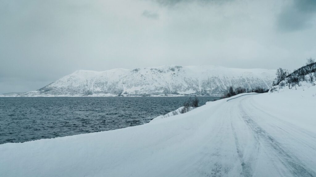
Winter Driving in Extreme Conditions: If traveling between October and April, it is mandatory to use properly studded winter tires (piggdekk) and maintain absolute familiarity with black ice driving techniques.
Aerial Backup Alternatives: In case of red weather alerts closing road and maritime passage, maintain direct contact with your regional airline to readjust connecting flights from the airports of Bodø, Leknes, or Svolvær.
The imposing silence descending over the Lofoten islands as polar night twilight falls reveals the true dimension of their geographical isolation. Beyond the technological display of suspension bridges and the millimetric efficiency of ferries, this archipelago continues to belong by right to the indomitable realm of the Arctic Ocean, reminding us that human connectivity at the ends of the earth is always a fragile, temporary achievement deeply conditioned by respect for natural elements.