
The horizon over the Minch strait expands like a sheet of polished lead under the pale North Atlantic sky. From the deck of the ferry leaving the mainland shelter of Ullapool, the rugged coast of Scotland gradually dissolves into a delicate gradient of greys and cold blues. The journey toward the archipelago of the Outer Hebrides is not a mere geographical transfer; it is a ritual voyage across one of Europe’s most demanding maritime passages, where the steady cadence of island vessels sustains the supplies, culture, and isolation of communities carved by salt-laden winds.
As the ship navigates the deep currents of the strait, the stone spine of the Isle of Lewis and Harris emerges from the ocean like a massive ridge of Precambrian gneiss. Here, where the mainland gives way to the relentless assault of Atlantic storms, inshore seamanship and coastal navigation have governed human survival for millennia. Traversed by working ferries and local fishing boats alike, these waters demand an accurate reading of nautical charts, deep-water channels, and the unpredictable arrival of northern mists.
2>The Minch Strait and Maritime Links of the North Atlantic
The Minch is a profound marine trench separating the Scottish Highlands from the outer island chain. Reaching depths well over one hundred and fifty meters in several stretches, this body of water acts as a natural funnel for Atlantic depressions sweeping in from the west. Historically, crossing the Minch required exceptional seamanship handed down orally across generations; today, modern roll-on/roll-off ferries preserve the lifeline of the islands using sophisticated stabilization systems and high-definition radar arrays.
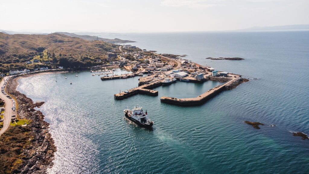
The regular crossing between the mainland port and Stornoway represents a triumph of contemporary island logistics. These vessels do not simply transport travelers and private vehicles; they guarantee an unbroken flow of fresh provisions, heavy fuel, and vital raw materials. During the dark winter months, when Beaufort force eight gales hammer the hull from port to starboard, captains must evaluate tidal windows with razor-sharp precision to dock safely against narrow concrete breakwaters.
Lewisian Gneiss and the Architecture of Island Isolation
The physical character of the Outer Hebrides is dictated by Lewisian gneiss, among the oldest metamorphic rocks on Earth, dating back over three billion years. This exceptionally hard geological bedrock has fundamentally shaped human settlement patterns and vernacular architecture across the islands. The absence of native timber drove ancestral builders to erect dwellings with immensely thick drystone walls, engineered to deflect gale-force winds and retain internal hearth heat.
These historic structures, known as blackhouses, featured low-profile thatched roofs secured with woven netting and heavy stone weights to prevent violent gusts from tearing the thatch away. The interior layout was strictly functional: a central living space with a continuous peat fire whose dense smoke permeated the roof, waterproofing the straw against relentless rain. While most blackhouses now serve as preserved ethnographic sites, their stone-shelter logic endures in modern coastal building design.
«Architecture across the archipelago does not attempt to dominate the landscape; it embeds itself into the fissures of metamorphic rock to endure the ocean’s fury.»
Seamanship on the Atlantic Edge: Navigating the Sound of Harris
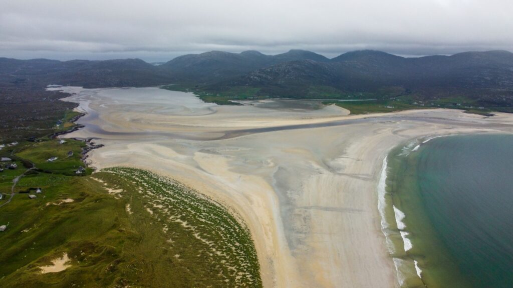
If crossing the Minch demands raw engine power and structural hull stability, navigating between the archipelago’s inner islands requires exquisite knowledge of the seafloor topography. The stretch separating the northern moorlands of Lewis from the rugged hills of Harris, along with the treacherous Sound of Harris leading to the southern islands, forms an intricate labyrinth of shallow reefs, uninhabited islets, and shifting sandbars. Navigating these channels demands strict adherence to lighted beacons and starboard buoys.
Captains of passenger ferries and local shellfish boats operate in constant negotiation with the tidal regime. In the Sound of Harris, low tide exposes vast granite reefs and shallow sandbanks where cross-currents can easily reach six knots. The expertise of local mariners allows them to thread these narrow passages even when sudden sea fogs reduce visibility down to a few ship lengths.
Woven by Wind and Smoke: The Heritage of Harris Tweed
Inland, across moorlands shaped by ancient glaciers and deep peat bogs, the wind carries the rhythmic, metallic clatter of foot-pedal looms. Official Harris Tweed remains the only fabric in the world protected by a dedicated Act of Parliament, which mandates that the cloth must be handwoven by islanders at their homes in the Outer Hebrides using pure virgin wool that has been dyed and spun locally.
The production cycle is an extraordinary masterclass in historical ecology and handcraft precision:
- Raw wool is dyed prior to spinning, traditionally utilizing pigments harvested from local lichens, heather, and peat roots.
- Craftspeople spin the yarn to a variable density that endows the fabric with unmatched thermal resistance against damp Atlantic winds.
- Weaving is executed on mechanical pedal looms without electric power, requiring continuous physical rhythm and absolute precision in herringbone or check patterns.
- Every finished length of cloth undergoes rigorous official inspection before receiving the iconic orb and cross stamp of authenticity.
This cottage industry provides decentralized economic resilience across small rural townships while preserving a specialized craft vocabulary that links the texture of every garment directly to the surrounding mineral terrain.
Archaeology in the Mist: Callanish Standing Stones and Celtic Memory
On the western coast of Lewis, atop a gentle ridge overlooking the sea inlet of Loch Roag, stands the megalithic complex of Callanish. Erected over four thousand five hundred years ago, this cross-shaped alignment of Lewisian gneiss megaliths predates the construction of Stonehenge. The monoliths, with their weathered surfaces sculpted by millennia of wind and rain, encircle a central stone circle and chambered tomb.

The astronomical alignment of Callanish reflects deep observational knowledge of solar and lunar cycles by prehistoric northern communities. During specific celestial alignments, the moon appears to skim the distant mountain ridge to project long shadows straight through the avenue of stones into the heart of the circle. The interplay between massive stone monoliths, low grazing light, and drifting clouds creates an atmosphere of austere grandeur where the silence is broken only by calling sea birds.
Inshore Pantry: Stornoway Smokehouses and Coastal Harvests
The intimate bond between the Hebrides and the sea finds direct expression in its culinary heritage, where fish preservation through salting and peat smoke has long been a pillar of survival. The harbour town of Stornoway, the administrative capital of the Outer Hebrides, remains home to historic smokehouses that preserve curing methods perfected during the nineteenth century.
Atlantic salmon and sea-caught herring from cold coastal waters are hand-filleted and cured with coarse sea salt before being suspended in oak chimney chambers fed with smoldering dried peat. This slow cold-smoking process, lasting up to twenty-four hours under closely monitored temperatures, imparts a firm texture and an unmistakable earthy aroma to the fish. Local traditional kitchens pair these smoked delicacies with potatoes cultivated in soils enriched with harvested bladderwrack kelp.
Preserving Gaelic: The Living Voice of a Resilient Archipelago
Beyond transportation infrastructure and megalithic sites, the core sanctuary of Outer Hebridean identity lies in the living continuity of the Scottish Gaelic language. Unlike mainland regions where Gaelic experienced sharp historical decline, the archipelago remains a vibrant stronghold where the language is spoken daily across homes, harbors, and community centers.
«Hearing Gaelic spoken during harbor maneuvers or inside weaving workshops confirms that island memory resides in a living, ancient cadence.»
The Gaelic language possesses a extraordinarily rich vocabulary for describing nuances of coastal topography, sea states, and shifting weather patterns. Precise terms denote the exact shape of a wave cresting against granite cliffs or the peculiar quality of light breaking through sea mist. This linguistic precision mirrors a refined adaptation to the North Atlantic environment, where language functions as both a navigational compass and a vessel for cultural memory.
Practical guide
Getting there and maritime ferry routes
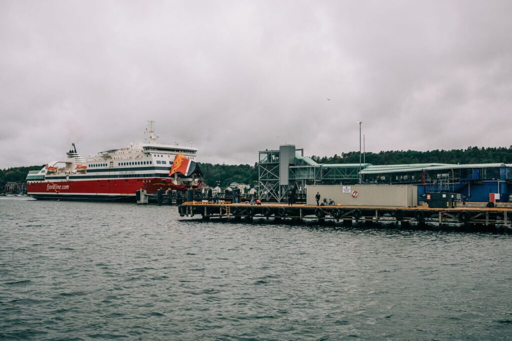
Mainland access to the Isle of Lewis and Harris is primarily provided by Caledonian MacBrayne (CalMac) passenger and vehicle ferries. The primary vehicle route departs from Ullapool on the Scottish mainland, arriving at Stornoway harbour after a vessel crossing of approximately two hours and thirty minutes. An alternative southern sea route connects Uig on the Isle of Skye to Tarbert in Harris. Advance reservations for vehicles are imperative, particularly between May and September.
Island transport and navigation logic
Although Lewis and Harris form a single landmass, driving distances can be deceptively long due to winding single-track roads fitted with designated passing places. Visitors should rent a suitable vehicle or consult local bus schedules carefully, keeping in mind that public transportation routes run on reduced timetables during weekends and local holidays.

Recommended gear and weather preparation
The Atlantic climate of the Outer Hebrides is notoriously unpredictable and demands high-quality outdoor gear year-round. Dress in technical layers topped with a fully waterproof and windproof shell jacket featuring high water-column protection. Sturdy hiking boots with breathable waterproof membranes, warm wool socks, and light gloves are essential. UV-blocking sunglasses are also recommended due to intense water reflection.
Observing local customs
Island townships maintain deep respect for traditional Sunday observances. On Sundays, the vast majority of commercial businesses, fuel stations, and local shops remain closed, particularly across Lewis. Travelers should plan vehicle refueling and grocery purchasing in advance to respect the quiet Sabbath rhythm of the communities.
The Final Light at Butt of Lewis
At the northernmost tip of Lewis, the dramatic promontory of Butt of Lewis thrusts into the Atlantic Ocean like a massive prow of dark granite, topped by a red-brick lighthouse engineered by David Stevenson in 1862. Here, sheer vertical cliffs endure the unbridled force of Atlantic swells that have traveled thousands of nautical miles across open sea. Perpetual salt winds shape the stunted turf of coastal machair and carry a fine marine spray that coats the air in a translucent sheen.
At dusk, as storm clouds part briefly to reveal the golden setting sun, the lighthouse beacon begins its steady, rhythmic sweeping pattern across the dark expanse of water. It is a scene of profound clarity: human engineering standing resolute against the overwhelming power of the elements. At this northern frontier, the ferry journey reveals its ultimate purpose—proving that these islands are not remote outposts, but enduring sanctuaries of stone, sea, and maritime dignity.