
Introduction to the Marine Labyrinth of Marlborough
At the northernmost tip of New Zealand’s South Island, the terrain does not slope gently toward the sea; it plunges. The valleys carved during the Pleistocene by the advance and retreat of titanic glaciers were gradually swallowed by the waters of the Pacific, giving rise to an intricate network of channels, inlets, and forested peninsulas known as the Marlborough Sounds. Far from the conventional tourist circuit that prioritizes the volcanic peaks of the North Island or the wetter fjords of Fiordland, this region offers a fascinating case study on the coexistence between contemporary maritime engineering, inshore aquaculture, and timber architecture adapted to the capricious rhythm of the tide.
Approaching Marlborough requires understanding that water here is not an obstacle to be overcome, but the only true artery of communication. Roads wind with difficulty across mountain ridges, but daily life—from the supply of mussel farms to the displacement of local residents—depends on a complex network of boats and hardwood jetties. This report explores how the ice-sculpted topography has conditioned the construction of coastal retreats, the design of navigation routes, and the preservation of a marine ecosystem where silence is only broken by the occasional breath of bottlenose dolphins and the creak of hulls against pontoons.
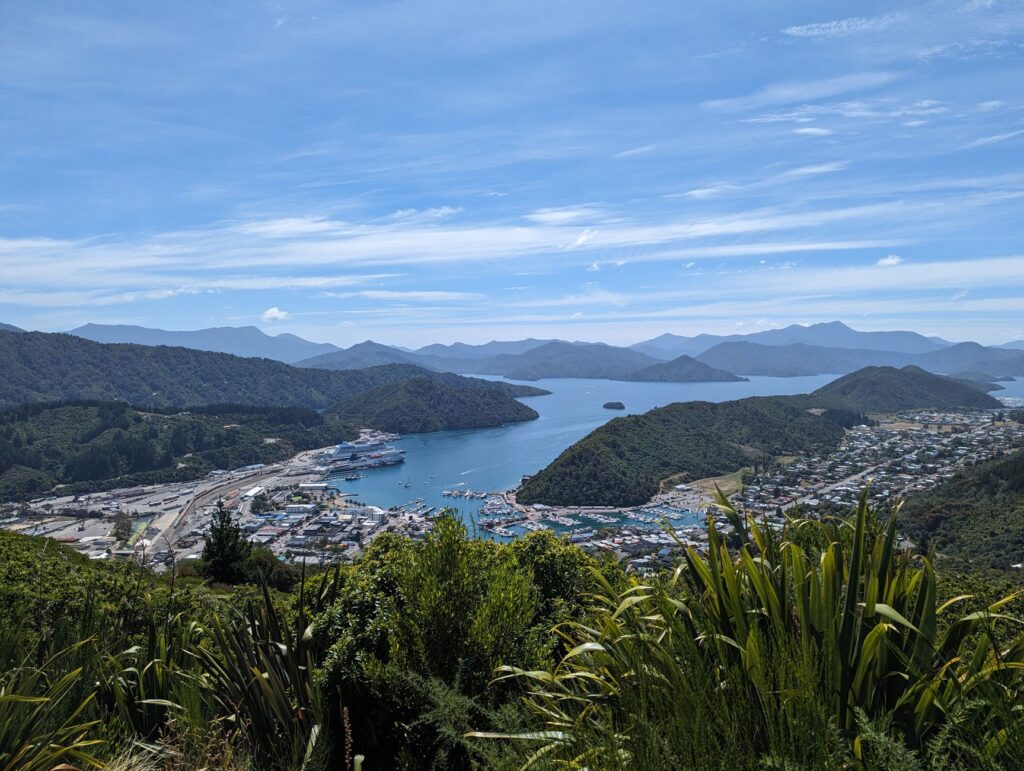
The Geography Sculpted by Ice and Sea
The genesis of the Marlborough fjords responds to a geological process unique in Oceania. Unlike classic Norwegian fjords, carved exclusively by glaciers emptying directly into open sea, the Marlborough channels—primarily Queen Charlotte, Pelorus, and Kenepuru—are actually a system of submerged river valleys. This tectonic subsidence created more than fifteen hundred kilometers of jagged coastline, where hills blanketed in native beech and fern forests drop sheer into deep, sheltered waters.
Navigation through these waters requires millimeter precision. The currents flowing between the channels act as invisible rivers, accelerating their course in narrow passages known locally as narrows. Tidal patterns, influenced by underwater topography, generate variations of up to four meters that test the skill of inshore vessel skippers. Over centuries, the Māori of the Ngāti Kuia iwi navigated these routes in waka (canoes) carved from totara, recognizing in each inlet a sacred refuge against the gales of the Cook Strait.
Floating Architecture and Canal Sheds
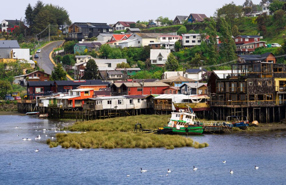
Human intervention in this marine landscape is characterized by marked material discretion. The scarcity of flat ground on the slopes has driven the development of a very specific architectural typology: pile-supported sheds and dwellings anchored directly to floating pontoons. These structures, built primarily from treated radiata pine and local totara, defy saltwater corrosion through a modular design that absorbs the constant movement of tides without compromising structural stability.
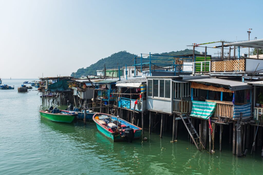
These coastal shelters are not merely summer residences, but essential operational stations for managing marine farms. Their design prioritizes cross-ventilation and rainwater harvesting, given that many of these inlets lack connections to municipal utility grids. Large eaves protect windows from the intense solar radiation of the southern summer, while galvanized sheet metal roofs channel every drop toward underground cisterns excavated into the schist rock. This vernacular architecture demonstrates how human habitation can integrate into a protected environment without drastically altering the skyline.
The Water Route: Inshore Navigation and Transport
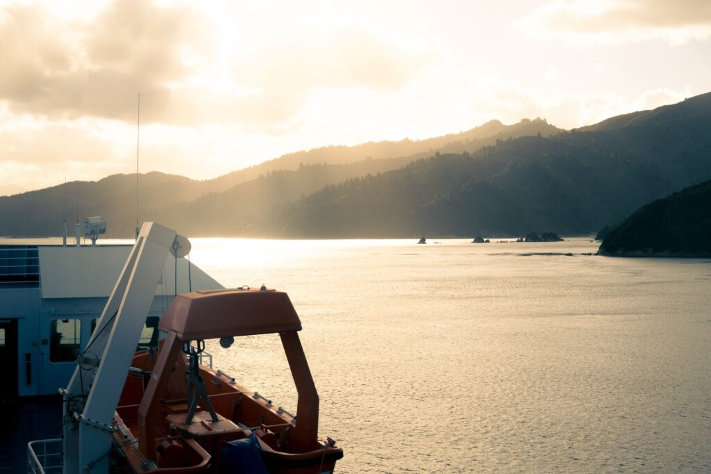
The pulse of the Marlborough fjords beats to the rhythm of ferries and mail boats connecting Picton with isolated settlements such as Ship Cove and Te Mahia. This navigation line, operational for over a century, constitutes a vital artery transporting travelers, provisions, construction materials, and correspondence. Aboard these shallow-draft vessels, the journey becomes a lesson in living cartography, where captains must navigate shifting sandbanks and floating timber debris washed down by seasonal floods.
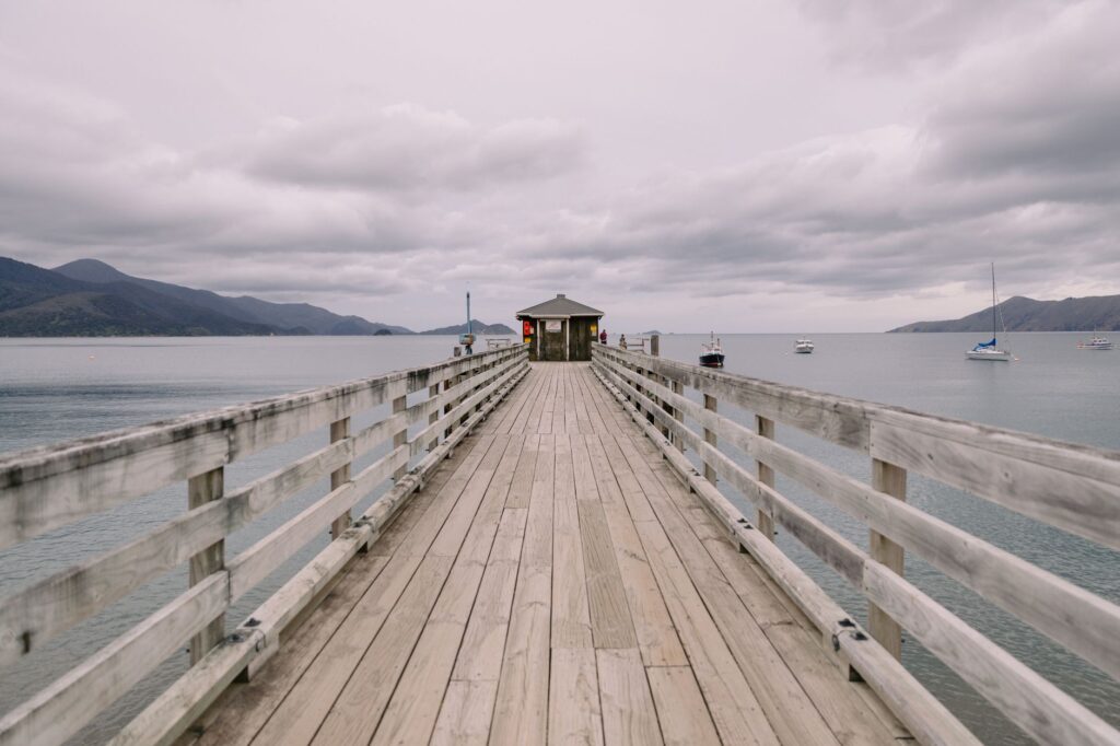
Port infrastructure is minimalist. Instead of large concrete basins, piers consist of timber platforms suspended on piles driven into the seabed. This lightweight construction minimizes impact on benthic habitats, allowing sponges and bivalves to thrive undisturbed beneath the structures. For travelers traversing the region, utilizing this inshore maritime transport system offers an unparalleled perspective of forested cliffs, revealing hidden coves inaccessible by land and former whaling stations now converted into nature reserves.
Sustainable Aquaculture and the Tide Economy
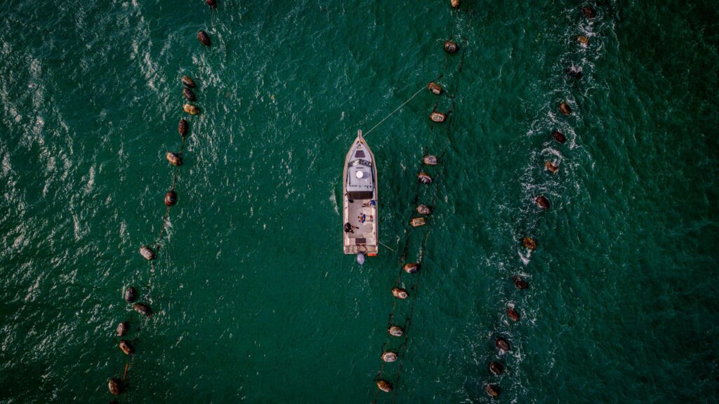
Beneath the calm surface of the Marlborough channels unfolds one of the most heavily regulated and technologically advanced economic activities in the Southern Hemisphere: the cultivation of the green-lipped mussel (*Perna canaliculus*). Endemic to New Zealand, this bivalve finds optimal conditions for growth in the nutrient-rich, sheltered waters of the fjords. The floating cultivation lines, discreetly marked with buoys in authorized inlets, form a geometric grid that merges with the deep blue tone of the water.
Marlborough’s production model has evolved from traditional wild harvesting to precision aquaculture based on satellite monitoring of water temperature and phytoplankton density. Environmental regulations prohibit the overloading of marine spaces, compelling producers to rotate cultivation zones to allow seabed recovery. This symbiosis between commercial activity and ecological conservation positions the region as a global benchmark for exploiting marine resources without compromising coastal biodiversity.
The Living Heritage of the Queen Charlotte Track
Running parallel to the channels is one of Oceania’s most celebrated hiking routes: the Queen Charlotte Track. Spanning seventy-one kilometers, this historic trail connects Ship Cove with Anakiwa, winding through ridges covered in centuries-old podocarps and descending to golden sand beaches. Unlike high-alpine routes, the trail’s design allows hikers to combine trekking with maritime luggage transport, making it easy to stay in small eco-lodges situated in intermediate bays.
The route’s cultural value lies in its ability to intertwine Polynesian seafaring history, the arrival of early British explorers—such as Captain James Cook, who anchored at Ship Cove on multiple occasions—and modern forest conservation. Informational panels along the trail detail the traditional use of medicinal plants by the Māori, such as horopito and kawakawa, reminding visitors that this landscape has been inhabited and cared for for at least eight centuries.
Practical Guide
Planning a journey through the Marlborough fjords requires understanding the logistical particularities of a territory where water is the central axis. Below are the essential guidelines for a rigorous and environmentally respectful visit.
- Getting There: The main gateway to the region is Picton, connected to Wellington via daily ferry services crossing the Cook Strait in approximately three and a half hours. Blenheim Airport (BHE), located twenty-five minutes away by road, receives regular flights from Auckland and Christchurch.
- Local Transport: Moving between inlets requires utilizing local ferry services (such as Beachcomber Cruises or Couper’s Mail Boat) or hiring authorized water taxis. There are no roads connecting the entirety of the northern Queen Charlotte Sound coastline.
- Accommodation: Lodging consists of eco-friendly lodges integrated into the landscape, Department of Conservation (DOC) timber huts, and small boutique hotels in Picton and Havelock. Advance booking months ahead is mandatory during the southern summer (December to February).
- Climate and Gear: The climate is temperate but highly variable. Waterproof layers, trekking shoes with high traction, and broad-spectrum sunscreen are strongly recommended, as UV intensity at this latitude is notably high.
- Environmental Regulations: Discharging waste into the sea or lighting fires outside designated areas is strictly prohibited. Trekkers must adhere strictly to Leave No Trace principles across all natural reserves.
Epilogue: The Final Reflection in Deep Waters
As the sun declines over the western reaches of Pelorus Sound, the abrupt profiles of the hills merge into an inked shadow that impregnates the sea’s surface. In that instant of absolute stillness, when local fishing boats return to their moorings and the wind ceases entirely, the Marlborough fjords reveal their deepest truth. This is neither a mere theatrical landform nor a destination engineered for accelerated tourist consumption, but a fragile equilibrium between the relentless force of the ocean and the modest endurance of those who have learned to inhabit its shores with respect and silence.