
Along the winding shores of the Mundaka estuary, nestled in the heart of the Urdaibai Biosphere Reserve, mobility is no longer measured by the speed at which private vehicles choke narrow coastal roads. Instead, it is defined by the silent precision with which a newly integrated transport network restores prominence to the water and the pedestrian. For decades, this Vizayan enclave endured the summer pressure of thousands of cars striving to reach its beaches and viewpoints, straining fragile marsh ecosystems and altering local community dynamics. Today, an ambitious plan coordinated by the Urdaibai Board and riverside municipalities redefines regional commuting through a strategy that combines electric river ferries, elevated boardwalks on pilings, and the optimization of narrow-gauge rail services.
This paradigm shift stems not from bureaucratic imposition, but from an urgent ecological necessity and the mobilization of marine scientists, civil engineers, and local fishermen who heeded the warnings of environmental decline. The central thesis of this transformation is clear: true sustainability in highly sensitive estuarine environments does not lie in building new asphalt infrastructure to absorb more traffic, but in discouraging private car use through multimodal public transport alternatives that respect tidal cycles and migratory bird populations. Throughout this report, we examine how solid-state battery technology applied to inland navigation and the recovery of old mining rail routes are redrawing the mobility map of the Bay of Biscay.
The Geomorphodynamic Pulse of Urdaibai and Its Historical Access Points
To understand the magnitude of the logistical challenge in the Mundaka estuary, one must examine its complex morphology. Sculpted by the combined action of the Oka River and Cantabrian Sea currents, the marshland forms a wetland of international importance where protected bird species such as the Eurasian spoonbill and the osprey thrive. Historically, communications between the two banks of the estuary—with towns like Mundaka, Busturia, and Sukarrieta on one side, and Forua and Gautegiz Arteaga on the other—relied on lengthy road detours or inefficient combustion-engine boats. The sustained rise in mass tourism pushed the carrying capacity of these roads to the limit, generating chronic congestion that harmed residents’ quality of life and estuarine habitat integrity.

Faced with this diagnosis, local institutions ruled out any widening of regional roads. Instead, they opted for a model of surgical intervention in the landscape, prioritizing intermodality. The restoration of historic docks and their adaptation for electric ferry docking has stitched the two shores of the estuary together in minutes, eliminating thousands of daily car trips. The naval engineers behind the project designed hydrodynamically optimized catamaran hulls to minimize wake generation, thereby protecting marsh slopes from artificial wave erosion. This technical solution proves that innovation can serve conservation without sacrificing operational efficiency.
The Railway Backbone: Modernization of Euskotren in the Oka Basin
The foundational pillar of this new mobility strategy is the railway. The Euskotren line connecting Bilbao and Bermeo as it passes through the Biosphere Reserve has undergone a profound, comprehensive overhaul. This is not merely an improvement in service frequencies, but a complete redesign of the travel experience tailored for residents and visitors alike. Stations have been redesigned to function as genuine multimodal hubs, where travelers can step off the train and immediately access a network of shared electric bicycles or information points for river navigation routes.
Current trains incorporate regenerative braking systems that return energy to the grid during frequent descents and stops along the rugged terrain of the Bizkaia region. Furthermore, specific spaces for bicycle transport have been expanded, ensuring that cycle tourism becomes a viable alternative to private vehicles for touring the estuary’s perimeter. Data provided by transport operators indicate a steady thirty-five percent increase in annual weekend usership, demonstrating strong citizen support for these traffic-reduction measures.
True connectivity in a protected natural space is not measured by the speed at which an engine crosses the landscape, but by the subtlety with which the traveler integrates into its silences and tides.
This railway integration is complemented by the elimination of dangerous level crossings and the landscape integration of the tracks using native vegetation screens that reduce noise pollution. Local ecologists continuously monitor the impact of vibrations on bird colonies near the marshes, ensuring railway operations meet the strictest standards of European environmental legislation. Collaboration between transport operators and biologists has become a pioneering management model along the Cantabrian coast.

Soft Engineering: Floating Walkways and Cycle Paths on Former Rail Traces
Designing the non-motorized road network posed one of the greatest engineering challenges in the Mundaka estuary. To connect urban centers without fragmenting the marsh ecosystem, large concrete structures were avoided. Instead, designers utilized articulated floating walkways and pathways on heat-treated timber piles that flexibly adapt to tidal swings, which can exceed four meters between high and low tide. These walkways allow walkers and cyclists to immerse themselves visually in the heart of the wetland without altering the soil or interfering with natural flood channels.
The main route connects to the greenway network built along the trace of the old mining railroad that once hauled iron ore from the Forua deposits to the estuary loading docks. Reclaiming this disused infrastructure has transformed an industrial liability into a premier tourist asset. Pavement surfaces were constructed using local aggregate mixes and permeable resins that prevent surface runoff and soil erosion toward the estuary. Along the route, interpretive panels designed in collaboration with marine research centers explain the geological and ecological importance of the marsh, turning every journey into an environmental education experience.
Zero-Emission Nautical Transport: Solar Catamarans in the Estuary
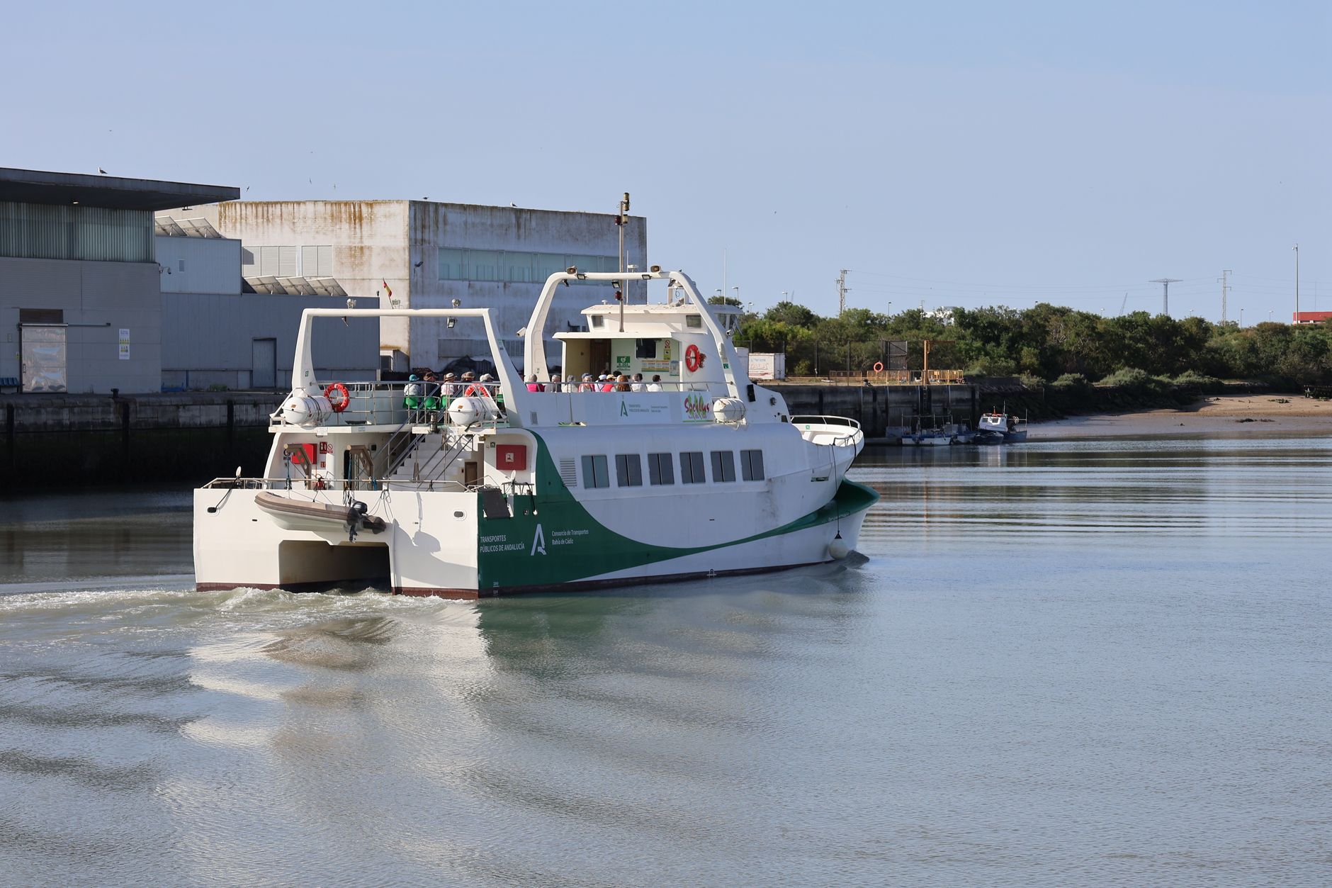
Water, which for decades acted as a barrier or a transport route polluted by traditional recreational craft, has become the most innovative axis of mobility in Urdaibai. The fleet of ferries operating between Mundaka and the opposite shore consists entirely of catamarans powered by electric motors running on lithium batteries and solar panels integrated into their roofs. These vessels operate with virtually imperceptible noise levels, preventing any acoustic disturbance to marine life and the populations of waterbirds that use the estuary as a resting and feeding ground.

The scheduling of these ferries is synchronized via digital applications with train timetables and regional bus lines, ensuring seamless transfers and reducing wait times to under ten minutes. Captains trained in sustainable navigation regulate their speeds according to currents and bird densities on the water, applying respectful navigation protocols praised by international environmental organizations. This fluvial system not only moves people but redefines the visitor’s visual and cultural relationship with the estuarine landscape.
Flow Regulation and Participatory Governance in Riverside Municipalities
The transformation of transport in the Mundaka estuary is not limited to mechanical and nautical infrastructure; it rests upon a complex framework of participatory governance. The municipalities of Mundaka, Bermeo, Sukarrieta, and Busturia, alongside the Basque Government and local fishermen’s guilds, form a management committee tasked with monitoring the territory’s tourism carrying capacity in real time. Using people and vehicle-counting sensors located at access points to key viewpoints and beaches, the system automatically triggers alerts when recommended saturation thresholds are exceeded.
When this occurs, digital mobility platforms activate recommended detours to peripheral parking lots, automatically stepping up shuttle bus frequencies and commuter trains. This open-data-driven management absorbs peak visitor numbers during summer weekends without overwhelming local infrastructure or degrading the traveler experience. Residents, organized in neighborhood forums, actively participate in the annual evaluation of the plan, ensuring that local mobility needs always take priority over tourist traffic.
The success of sustainable mobility is not measured by the amount of accumulated technology, but by a community’s capacity to collectively decide how it wishes to inhabit and protect its environment.
The economic impact of these measures has also been rigorously analyzed. Far from diminishing commercial activity in riverside towns, restricting vehicular traffic and prioritizing pedestrians has increased visitor length of stay in historic centers and local markets. Local shopkeepers confirm that the tourist profile has shifted: a more respectful traveler interested in local gastronomy, cultural heritage, and environmental interpretation, generating more stable and widely distributed economic returns throughout the year.
Practical guide
How to get there: Accessing the Urdaibai region is recommended via the Euskotren line from Bilbao (Zazpikaleak/Casco Viejo Station) to Mundaka, Busturia, or Forua stops, avoiding private vehicles due to strict parking restrictions in coastal centers.
Internal transport: The zero-emission fluvial transport network operates continuously between Mundaka and the right bank of the estuary 365 days a year, synchronized with commuter trains and Bizkaibus regional bus lines.
Cycling mobility: Electric bicycle rentals are available at the main train stations along the Oka line. Travelers are advised to use exclusively the designated greenway and wooden marsh boardwalks to prevent erosion on protected slopes.

Environmental regulations: Anchoring private boats in the estuary’s ecological exclusion zones and accessing beaches via unauthorized paths during migratory bird nesting periods is strictly prohibited.
Best time to visit: Spring and autumn offer optimal conditions for enjoying the estuarine landscape with lower visitor density, facilitating birdwatching and the smooth use of sustainable transport infrastructure.
At the end of the journey, as the sun begins to sink over the calm waters of the Mundaka estuary, casting golden hues on the silhouettes of shipyards and marshes, the true triumph of this mobility model reveals itself in all its sensory dimensions. Sitting on one of the reclaimed wooden benches on the Busturia dock, the traveler senses the contrast between the commotion that once drowned out this corner of the Cantabrian Sea and its current serene harmony. Accelerating engines and impatient horns are no longer heard; the landscape is dominated by the rhythmic murmur of the tide striking walkway pilings and the faint whisper of an electric catamaran gliding effortlessly across the water’s surface. It is empirical proof that when transport is designed with absolute respect for a territory’s ecological limits, it ceases to be a source of friction and becomes the thread that reconciles humanity with the fragile beauty of its natural surroundings.